![](/images/other/stat-length.png)
![Excursión Senderismo La Thuile - Jour 4 - Refuge Deffeyes - Planaval via Col de Planaval - Photo](https://media.geolcdn.com/t/1900/400/ext.pjpeg?maxdim=2&url=https%3A%2F%2Fstatic1.geolcdn.com%2Fsiteimages%2Fupload%2Ffiles%2F1553511878bg_sport_marche.png)
Jour 4 - Refuge Deffeyes - Planaval via Col de Planaval
i20
Usuario
![Longitud](/images/other/stat-length.png)
![Altitud máxima](https://static1.geolcdn.com/siteimages/upload/files/1508320355ic_sort_altitude_max_24dp.png)
![Desnivel positivo](https://static1.geolcdn.com/siteimages/upload/files/1508320355ic_sort_den_pos_24dp.png)
![Km-Effort](/images/other/stat-length.png)
![Altitud mínima](https://static1.geolcdn.com/siteimages/upload/files/1508320355ic_sort_altitude_min_24dp.png)
![Desnivel negativo](https://static1.geolcdn.com/siteimages/upload/files/1508320355ic_sort_den_neg_24dp.png)
![Boucle](https://static1.geolcdn.com/siteimages/upload/files/16400158638029165_repeat_loop_refresh_sync_direction_icon.png)
![Senderismo](https://static1.geolcdn.com/sitytour/trail-icons/101.png)
5h20
Dificultad : Muy difícil
![Escanee este código QR para abrir la excursión en la aplicación SityTrail](https://capi.geolives.com/qq0zvz2zws4bq2lad0pu/sitytour/trails/3756750/qr.png?size=200)
Aplicación GPS de excursión GRATIS
A propósito
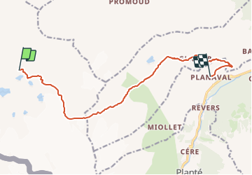
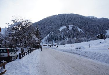
Ruta Senderismo de 12,8 km a descubrir en Valle de Aosta, Desconocido, La Thuile. Esta ruta ha sido propuesta por i20.
Descripción
Meilleure carte = L'Escursionista #3 (rouge)
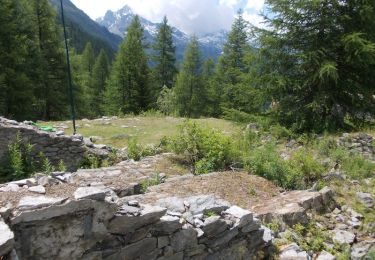
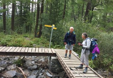
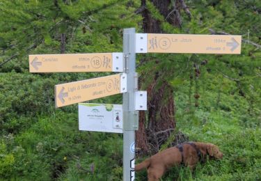
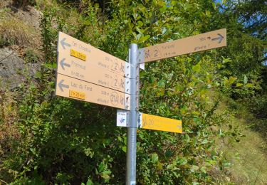
Du refuge de Deffeyes, prendre le chemin #16 en direction du col de Planaval. Au col, continuer dans le pierrier et retomber sur le chemin #21.
Suivre le torrent du fond. Descendre tout en bas sur le chemin /2\ (21) (21A) jusqu'à chavonnette, puis prendre la route jusqu'à Planaval.
Localización
Comentarios
Excursiones cerca
![Excursión A pie La Thuile - Alta Via n. 2 della Valle d'Aosta - Tappa 4 - Photo](https://media.geolcdn.com/t/375/260/d0d9b39f-0875-4fe1-8e1d-ef35e0e56836.jpeg&format=jpg&maxdim=2)
![A pie A pie](https://static1.geolcdn.com/sitytour/trail-icons/100.png)
A pie
![](/images/other/stat-length.png)
![](https://static1.geolcdn.com/siteimages/upload/files/16400158638029165_repeat_loop_refresh_sync_direction_icon.png)
![Excursión A pie La Thuile - Alta Via n. 2 della Valle d'Aosta - Tappa 3 - Photo](https://media.geolcdn.com/t/375/260/fb52a141-2ccc-4477-a43a-2492c5ab0bf5.jpeg&format=jpg&maxdim=2)
![A pie A pie](https://static1.geolcdn.com/sitytour/trail-icons/100.png)
A pie
![](/images/other/stat-length.png)
![](https://static1.geolcdn.com/siteimages/upload/files/16400158638029165_repeat_loop_refresh_sync_direction_icon.png)
![Excursión A pie La Thuile - (SI F06) La Thuile - Rifugio Elisabetta - Photo](https://media.geolcdn.com/t/375/260/e61d6606-e987-432b-8d7d-37c89c2af308.jpeg&format=jpg&maxdim=2)
![A pie A pie](https://static1.geolcdn.com/sitytour/trail-icons/100.png)
A pie
![](/images/other/stat-length.png)
![](https://static1.geolcdn.com/siteimages/upload/files/16400158638029165_repeat_loop_refresh_sync_direction_icon.png)
![Excursión A pie La Thuile - (SI F05) Rifugio Deffeyes - La Thuile - Photo](https://media.geolcdn.com/t/375/260/6810ad33-742c-42ff-b0fc-3847896fc1fc.jpeg&format=jpg&maxdim=2)
![A pie A pie](https://static1.geolcdn.com/sitytour/trail-icons/100.png)
A pie
![](/images/other/stat-length.png)
![](https://static1.geolcdn.com/siteimages/upload/files/16400158638029165_repeat_loop_refresh_sync_direction_icon.png)
![Excursión A pie Morgex - Itinerario 16 Col San Carlo Colle Della Croce - Photo](https://media.geolcdn.com/t/375/260/c22e5ac9-457f-4754-8c34-80abe211a3ca.jpeg&format=jpg&maxdim=2)
![A pie A pie](https://static1.geolcdn.com/sitytour/trail-icons/100.png)
A pie
![](/images/other/stat-length.png)
![](https://static1.geolcdn.com/siteimages/upload/files/16400158638029165_repeat_loop_refresh_sync_direction_icon.png)
![Excursión Senderismo La Thuile - Le glacier ruitor - Photo](https://media.geolcdn.com/t/375/260/3272fa93-a495-4a31-82ad-ac319dcbe57e.jpg&format=jpg&maxdim=2)
![Senderismo Senderismo](https://static1.geolcdn.com/sitytour/trail-icons/101.png)
Senderismo
![](/images/other/stat-length.png)
![](https://static1.geolcdn.com/siteimages/upload/files/16400158638029165_repeat_loop_refresh_sync_direction_icon.png)
![Excursión Senderismo La Thuile - Cascade du Ruitor La Thuile - Photo](https://media.geolcdn.com/t/375/260/4d59db96-5c6b-4760-ae9d-eadc3701016b.jpg&format=jpg&maxdim=2)
![Senderismo Senderismo](https://static1.geolcdn.com/sitytour/trail-icons/101.png)
Senderismo
![](/images/other/stat-length.png)
![](https://static1.geolcdn.com/siteimages/upload/files/16400158638029165_repeat_loop_refresh_sync_direction_icon.png)
![Excursión Senderismo La Thuile - laghi Di bellacomba - Photo](https://media.geolcdn.com/t/375/260/8199b550-cd97-4e8d-9c1e-c9fb77446f4c.jpg&format=jpg&maxdim=2)
![Senderismo Senderismo](https://static1.geolcdn.com/sitytour/trail-icons/101.png)
Senderismo
![](/images/other/stat-length.png)
![](https://static1.geolcdn.com/siteimages/upload/files/16400158638029165_repeat_loop_refresh_sync_direction_icon.png)
![Excursión Senderismo La Thuile - Étape 4 - Refuge Deffeyes - Planaval - Photo](https://media.geolcdn.com/t/375/260/389ad9bc-ba8e-4a24-970e-282b6b89313b.jpg&format=jpg&maxdim=2)
![Senderismo Senderismo](https://static1.geolcdn.com/sitytour/trail-icons/101.png)
Senderismo
![](/images/other/stat-length.png)
![](https://static1.geolcdn.com/siteimages/upload/files/16400158638029165_repeat_loop_refresh_sync_direction_icon.png)