![](/images/other/stat-length.png)
![Excursión Senderismo Champagney - Canal souterrain de la Haute-Saône - Photo](https://media.geolcdn.com/t/1900/400/04c8dd3d-861a-49bc-aa06-88e783162bdc.jpg&format=pjpeg&maxdim=2)
Canal souterrain de la Haute-Saône
Bart2015
Usuario
![Longitud](/images/other/stat-length.png)
![Altitud máxima](https://static1.geolcdn.com/siteimages/upload/files/1508320355ic_sort_altitude_max_24dp.png)
![Desnivel positivo](https://static1.geolcdn.com/siteimages/upload/files/1508320355ic_sort_den_pos_24dp.png)
![Km-Effort](/images/other/stat-length.png)
![Altitud mínima](https://static1.geolcdn.com/siteimages/upload/files/1508320355ic_sort_altitude_min_24dp.png)
![Desnivel negativo](https://static1.geolcdn.com/siteimages/upload/files/1508320355ic_sort_den_neg_24dp.png)
![Boucle](https://static1.geolcdn.com/siteimages/upload/files/16400158638029165_repeat_loop_refresh_sync_direction_icon.png)
![Senderismo](https://static1.geolcdn.com/sitytour/trail-icons/101.png)
3h03
Dificultad : Difícil
![Escanee este código QR para abrir la excursión en la aplicación SityTrail](https://capi.geolives.com/qq0zvz2zws4bq2lad0pu/sitytour/trails/3756280/qr.png?size=200)
Aplicación GPS de excursión GRATIS
A propósito
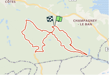
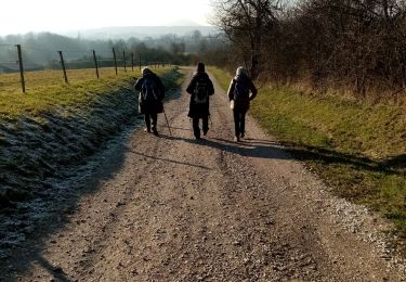
Ruta Senderismo de 10,1 km a descubrir en Borgoña-Franco Condado, Alto Saona, Champagney. Esta ruta ha sido propuesta por Bart2015.
Descripción
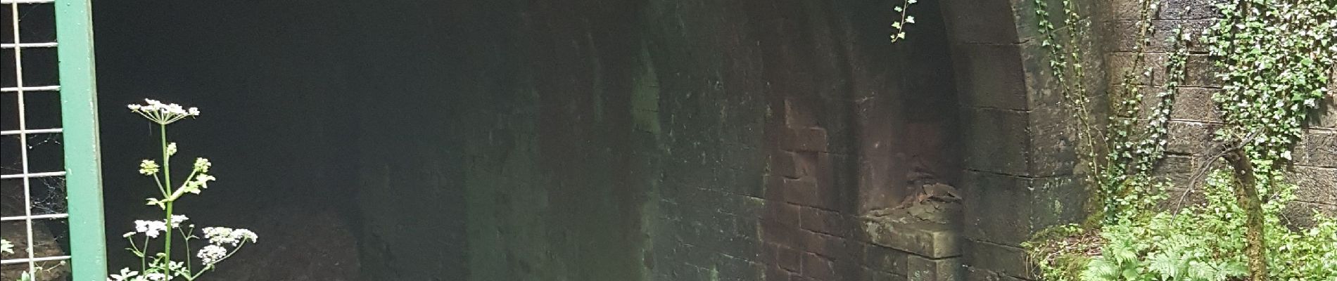
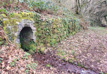
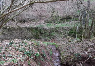
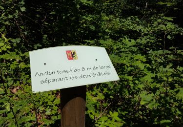
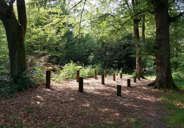
Cette randonnée longe le canal souterrain de la Haute-Saône qui devait relier le canal du Rhône au Rhin à la Saône. Projet démarré en 1884 pour s'arrêter en 1909 sans atteindre l'objectif fixé (28,6 km réalisés sur les 85 km prévus). Elle permet de voir les extrémités du tunnel.
Bonne rando ...
Localización
Comentarios
Excursiones cerca
![Excursión Senderismo Ronchamp - le tour par la chapelle Ronchamp - Photo](https://media.geolcdn.com/t/375/260/ext.jpg?maxdim=2&url=https%3A%2F%2Fservices.sitytrail.com%2FGeolivesWS%2FDownloadMedia.ashx%3FTrailID%3D200144%26Media%3D20130623170833.jpeg)
![Senderismo Senderismo](https://static1.geolcdn.com/sitytour/trail-icons/101.png)
Senderismo
![](/images/other/stat-length.png)
![](https://static1.geolcdn.com/siteimages/upload/files/16400158638029165_repeat_loop_refresh_sync_direction_icon.png)
![Excursión Senderismo Ronchamp - Ronchamp - Chapelle ND du Haut - sentier de l'Etançon (puits de mines) - Photo](https://media.geolcdn.com/t/375/260/17f2d8a4-0385-46eb-a4ac-833c4b43d439.jpg&format=jpg&maxdim=2)
![Senderismo Senderismo](https://static1.geolcdn.com/sitytour/trail-icons/101.png)
Senderismo
![](/images/other/stat-length.png)
![](https://static1.geolcdn.com/siteimages/upload/files/16400158638029165_repeat_loop_refresh_sync_direction_icon.png)
![Excursión Senderismo Frahier-et-Chatebier - frahier - Photo](https://media.geolcdn.com/t/375/260/95f0d94d-e209-4293-8856-d410c2620589.jpg&format=jpg&maxdim=2)
![Senderismo Senderismo](https://static1.geolcdn.com/sitytour/trail-icons/101.png)
Senderismo
![](/images/other/stat-length.png)
![](https://static1.geolcdn.com/siteimages/upload/files/16400158638029165_repeat_loop_refresh_sync_direction_icon.png)
![Excursión Senderismo Champagney - Champagney - canal de la Haute-Saône - tunnel - Photo](https://media.geolcdn.com/t/375/260/53752e24-7a78-44c3-b746-8236e26bab64.jpg&format=jpg&maxdim=2)
![Senderismo Senderismo](https://static1.geolcdn.com/sitytour/trail-icons/101.png)
Senderismo
![](/images/other/stat-length.png)
![](https://static1.geolcdn.com/siteimages/upload/files/16400158638029165_repeat_loop_refresh_sync_direction_icon.png)
![Excursión Senderismo Champagney - Grotte prisonniers allemands - château Etobon - Etobon - Photo](https://media.geolcdn.com/t/375/260/f76125a8-85be-43f8-b3b5-d887afc7fd40.jpg&format=jpg&maxdim=2)
![Senderismo Senderismo](https://static1.geolcdn.com/sitytour/trail-icons/101.png)
Senderismo
![](/images/other/stat-length.png)
![](https://static1.geolcdn.com/siteimages/upload/files/16400158638029165_repeat_loop_refresh_sync_direction_icon.png)
![Excursión Senderismo Étobon - Etobon - Photo](https://media.geolcdn.com/t/375/260/ext.jpg?maxdim=2&url=https%3A%2F%2Fstatic1.geolcdn.com%2Fsiteimages%2Fupload%2Ffiles%2F1553511878bg_sport_marche.png)
![Senderismo Senderismo](https://static1.geolcdn.com/sitytour/trail-icons/101.png)
Senderismo
![](/images/other/stat-length.png)
![](https://static1.geolcdn.com/siteimages/upload/files/16400158638029165_repeat_loop_refresh_sync_direction_icon.png)
![Excursión Senderismo Champagney - parcours sportif des Épaisses à Champagney - Photo](https://media.geolcdn.com/t/375/260/5ea0a359-1d7e-46eb-81bb-44044f5bf7c9.jpg&format=jpg&maxdim=2)
![Senderismo Senderismo](https://static1.geolcdn.com/sitytour/trail-icons/101.png)
Senderismo
![](/images/other/stat-length.png)
![](https://static1.geolcdn.com/siteimages/upload/files/16400158638029165_repeat_loop_refresh_sync_direction_icon.png)
![Excursión Bici de montaña Ronchamp - rando VTT club lure, ronchamp la filature, le plainet - Photo](https://media.geolcdn.com/t/375/260/74582360-9399-4bb9-bd36-d524b524a244.jpg&format=jpg&maxdim=2)
![Bici de montaña Bici de montaña](https://static1.geolcdn.com/sitytour/trail-icons/202.png)
Bici de montaña
![](/images/other/stat-length.png)
![](https://static1.geolcdn.com/siteimages/upload/files/16400158638029165_repeat_loop_refresh_sync_direction_icon.png)
![Excursión Bici de montaña Ronchamp - Filature de ronchamp, bassin de champagney - Photo](https://media.geolcdn.com/t/375/260/0fb0814e-f221-4c85-810a-089a0332e1ac.jpg&format=jpg&maxdim=2)
![Bici de montaña Bici de montaña](https://static1.geolcdn.com/sitytour/trail-icons/202.png)
Bici de montaña
![](/images/other/stat-length.png)
![](https://static1.geolcdn.com/siteimages/upload/files/16400158638029165_repeat_loop_refresh_sync_direction_icon.png)