


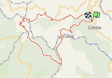


16 km | 29 km-effort


Usuario


Aplicación GPS de excursión GRATIS
 SityTrail
IGN / Institutos geográficos
SityTrail World
El mundo es suyo
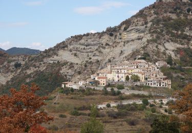
Ruta Senderismo de 12,8 km a descubrir en Provenza-Alpes-Costa Azul, Alpes Marítimos, Gilette. Esta ruta ha sido propuesta por PVERTICAL.
prévoir suffisamment d'eau (pas de source)
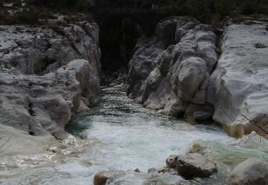
02 points d'eau pour se rafraichir ou se baigner (pont de cerise et la Clave)
A pie

Senderismo

Senderismo

A pie

A pie
A pie

Senderismo

Senderismo

Senderismo