![](/images/other/stat-length.png)
![Excursión Senderismo Viroflay - Chaville Velizy - Photo](https://media.geolcdn.com/t/1900/400/ext.pjpeg?maxdim=2&url=https%3A%2F%2Fstatic1.geolcdn.com%2Fsiteimages%2Fupload%2Ffiles%2F1553511878bg_sport_marche.png)
Chaville Velizy
JacquesMARQUET
Usuario
![Longitud](/images/other/stat-length.png)
Longitud
10,4 km
![Altitud máxima](https://static1.geolcdn.com/siteimages/upload/files/1508320355ic_sort_altitude_max_24dp.png)
Altitud máxima
186 m
![Desnivel positivo](https://static1.geolcdn.com/siteimages/upload/files/1508320355ic_sort_den_pos_24dp.png)
Desnivel positivo
212 m
![Km-Effort](/images/other/stat-length.png)
Km-Effort
13,3 km
![Altitud mínima](https://static1.geolcdn.com/siteimages/upload/files/1508320355ic_sort_altitude_min_24dp.png)
Altitud mínima
97 m
![Desnivel negativo](https://static1.geolcdn.com/siteimages/upload/files/1508320355ic_sort_den_neg_24dp.png)
Desnivel negativo
212 m
![Boucle](https://static1.geolcdn.com/siteimages/upload/files/16400158638029165_repeat_loop_refresh_sync_direction_icon.png)
Boucle
Sí
Fecha de creación :
2023-07-20 10:00:29.626
Última modificación :
2023-07-20 13:39:10.506
![Senderismo](https://static1.geolcdn.com/sitytour/trail-icons/101.png)
3h28
Dificultad : Difícil
![Escanee este código QR para abrir la excursión en la aplicación SityTrail](https://capi.geolives.com/qq0zvz2zws4bq2lad0pu/sitytour/trails/3741092/qr.png?size=200)
Aplicación GPS de excursión GRATIS
A propósito
Ruta Senderismo de 10,4 km a descubrir en Isla de Francia, Yvelines, Viroflay. Esta ruta ha sido propuesta por JacquesMARQUET.
Descripción
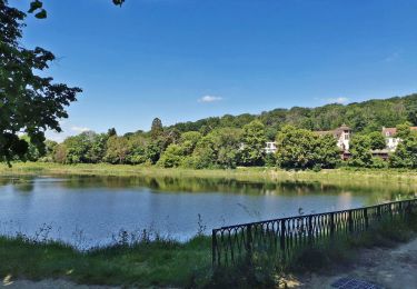
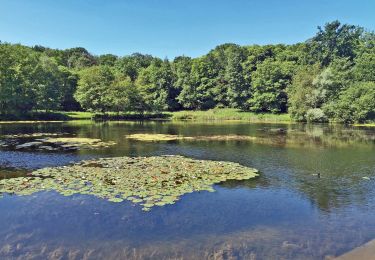
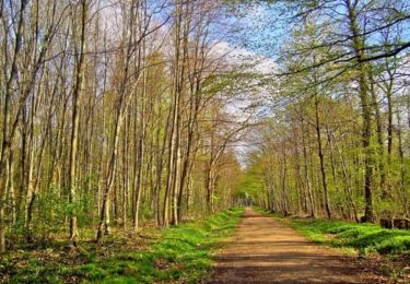
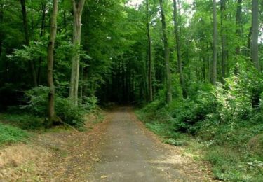
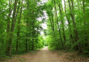
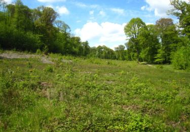
Parcours dans les bois de la forêt de Meudon, très rafraîchissant en été, avec quelques dénivelés sympathique.
Localización
País:
France
Región :
Isla de Francia
Departamento/provincia :
Yvelines
Municipio :
Viroflay
Localidad:
Unknown
Salida:(Dec)
Salida:(UTM)
440102 ; 5405526 (31U) N.
Comentarios
Excursiones cerca
![Excursión Senderismo Chaville - Le Sentier des 7 étangs - Photo](https://media.geolcdn.com/t/375/260/ext.jpg?maxdim=2&url=https%3A%2F%2Fservices.sitytrail.com%2FGeolivesWS%2FDownloadMedia.ashx%3FTrailID%3D110203%26Media%3D5435_1.jpg)
![Senderismo Senderismo](https://static1.geolcdn.com/sitytour/trail-icons/101.png)
Le Sentier des 7 étangs
Senderismo
Difícil
(5)
Chaville,
Isla de Francia,
Altos del Sena,
France
![](/images/other/stat-length.png)
23 km | 31 km-effort
5h 0min
![](https://static1.geolcdn.com/siteimages/upload/files/16400158638029165_repeat_loop_refresh_sync_direction_icon.png)
Sí
![Excursión Senderismo Chaville - GRP CV-IDF 20R Chaville à Vaucresson - Photo](https://media.geolcdn.com/t/375/260/ee9d0d3a-696b-449f-af8b-f1928f5c8b40.jpg&format=jpg&maxdim=2)
![Senderismo Senderismo](https://static1.geolcdn.com/sitytour/trail-icons/101.png)
GRP CV-IDF 20R Chaville à Vaucresson
Senderismo
Medio
(1)
Chaville,
Isla de Francia,
Altos del Sena,
France
![](/images/other/stat-length.png)
8,2 km | 11,1 km-effort
2h 30min
![](https://static1.geolcdn.com/siteimages/upload/files/16400158638029165_repeat_loop_refresh_sync_direction_icon.png)
No
![Excursión Senderismo Jouy-en-Josas - GRP CV-IDF 2023 - Photo](https://media.geolcdn.com/t/375/260/0b37f40c-1685-409c-9ec1-27f69abf4580.jpg&format=jpg&maxdim=2)
![Senderismo Senderismo](https://static1.geolcdn.com/sitytour/trail-icons/101.png)
GRP CV-IDF 2023
Senderismo
Difícil
(1)
Jouy-en-Josas,
Isla de Francia,
Yvelines,
France
![](/images/other/stat-length.png)
11,2 km | 14,5 km-effort
3h 17min
![](https://static1.geolcdn.com/siteimages/upload/files/16400158638029165_repeat_loop_refresh_sync_direction_icon.png)
No
![Excursión Senderismo Verrières-le-Buisson - Sur les sentiers de découverte du Bois de Verrières - Photo](https://media.geolcdn.com/t/375/260/ext.jpg?maxdim=2&url=https%3A%2F%2Fservices.sitytrail.com%2FGeolivesWS%2FDownloadMedia.ashx%3FTrailID%3D110232%26Media%3D5500_1.jpg)
![Senderismo Senderismo](https://static1.geolcdn.com/sitytour/trail-icons/101.png)
Sur les sentiers de découverte du Bois de Verrières
Senderismo
Medio
(2)
Verrières-le-Buisson,
Isla de Francia,
Essonne,
France
![](/images/other/stat-length.png)
22 km | 27 km-effort
4h 40min
![](https://static1.geolcdn.com/siteimages/upload/files/16400158638029165_repeat_loop_refresh_sync_direction_icon.png)
Sí
![Excursión Senderismo Viroflay - Les 3 Forêts; Meudon, Fausses Reposes et Versailles - Photo](https://media.geolcdn.com/t/375/260/ext.jpg?maxdim=2&url=https%3A%2F%2Fservices.sitytrail.com%2FGeolivesWS%2FDownloadMedia.ashx%3FTrailID%3D110157%26Media%3D5357_1.jpg)
![Senderismo Senderismo](https://static1.geolcdn.com/sitytour/trail-icons/101.png)
Les 3 Forêts; Meudon, Fausses Reposes et Versailles
Senderismo
Difícil
(2)
Viroflay,
Isla de Francia,
Yvelines,
France
![](/images/other/stat-length.png)
25 km | 32 km-effort
5h 19min
![](https://static1.geolcdn.com/siteimages/upload/files/16400158638029165_repeat_loop_refresh_sync_direction_icon.png)
Sí
![Excursión Senderismo Chaville - Sentier des deux Forêts - Meudon et Verrières - Photo](https://media.geolcdn.com/t/375/260/ext.jpg?maxdim=2&url=https%3A%2F%2Fservices.sitytrail.com%2FGeolivesWS%2FDownloadMedia.ashx%3FTrailID%3D110156%26Media%3D5356_1.jpg)
![Senderismo Senderismo](https://static1.geolcdn.com/sitytour/trail-icons/101.png)
Sentier des deux Forêts - Meudon et Verrières
Senderismo
Difícil
(2)
Chaville,
Isla de Francia,
Altos del Sena,
France
![](/images/other/stat-length.png)
23 km | 29 km-effort
5h 0min
![](https://static1.geolcdn.com/siteimages/upload/files/16400158638029165_repeat_loop_refresh_sync_direction_icon.png)
Sí
![Excursión Senderismo Buc - Le Tour de Satory - Photo](https://media.geolcdn.com/t/375/260/ext.jpg?maxdim=2&url=https%3A%2F%2Fservices.sitytrail.com%2FGeolivesWS%2FDownloadMedia.ashx%3FTrailID%3D110070%26Media%3D5206_1.jpg)
![Senderismo Senderismo](https://static1.geolcdn.com/sitytour/trail-icons/101.png)
Le Tour de Satory
Senderismo
Difícil
(2)
Buc,
Isla de Francia,
Yvelines,
France
![](/images/other/stat-length.png)
23 km | 28 km-effort
4h 49min
![](https://static1.geolcdn.com/siteimages/upload/files/16400158638029165_repeat_loop_refresh_sync_direction_icon.png)
Sí
![Excursión Senderismo Boulogne-Billancourt - Parc de St Cloud et forêt de Fausses Reposes - Photo](https://media.geolcdn.com/t/375/260/ext.jpg?maxdim=2&url=https%3A%2F%2Fservices.sitytrail.com%2FGeolivesWS%2FDownloadMedia.ashx%3FTrailID%3D106613%26Media%3D11213_2.jpg)
![Senderismo Senderismo](https://static1.geolcdn.com/sitytour/trail-icons/101.png)
Parc de St Cloud et forêt de Fausses Reposes
Senderismo
Medio
(1)
Boulogne-Billancourt,
Isla de Francia,
Altos del Sena,
France
![](/images/other/stat-length.png)
18,2 km | 23 km-effort
4h 30min
![](https://static1.geolcdn.com/siteimages/upload/files/16400158638029165_repeat_loop_refresh_sync_direction_icon.png)
No
![Excursión A pie Boulogne-Billancourt - Boulogne - Marne la Coquette - Ville d'Avray - Meudon - Photo](https://media.geolcdn.com/t/375/260/fed6b7bc-76e0-4d10-9619-38a76fb662e3.jpg&format=jpg&maxdim=2)
![A pie A pie](https://static1.geolcdn.com/sitytour/trail-icons/100.png)
Boulogne - Marne la Coquette - Ville d'Avray - Meudon
A pie
Difícil
Boulogne-Billancourt,
Isla de Francia,
Altos del Sena,
France
![](/images/other/stat-length.png)
29 km | 36 km-effort
8h 9min
![](https://static1.geolcdn.com/siteimages/upload/files/16400158638029165_repeat_loop_refresh_sync_direction_icon.png)
No