![](/images/other/stat-length.png)
![Excursión Senderismo Saint-Laurent-en-Gâtines - Saint-Laurent-en-Gatines - Photo](https://media.geolcdn.com/t/1900/400/3bcc51bc-dce3-484e-8c68-f9b9dd3f130d.jpg&format=pjpeg&maxdim=2)
Saint-Laurent-en-Gatines
guydu41
Usuario
![Longitud](/images/other/stat-length.png)
![Altitud máxima](https://static1.geolcdn.com/siteimages/upload/files/1508320355ic_sort_altitude_max_24dp.png)
![Desnivel positivo](https://static1.geolcdn.com/siteimages/upload/files/1508320355ic_sort_den_pos_24dp.png)
![Km-Effort](/images/other/stat-length.png)
![Altitud mínima](https://static1.geolcdn.com/siteimages/upload/files/1508320355ic_sort_altitude_min_24dp.png)
![Desnivel negativo](https://static1.geolcdn.com/siteimages/upload/files/1508320355ic_sort_den_neg_24dp.png)
![Boucle](https://static1.geolcdn.com/siteimages/upload/files/16400158638029165_repeat_loop_refresh_sync_direction_icon.png)
![Senderismo](https://static1.geolcdn.com/sitytour/trail-icons/101.png)
3h23
Dificultad : Difícil
![Escanee este código QR para abrir la excursión en la aplicación SityTrail](https://capi.geolives.com/qq0zvz2zws4bq2lad0pu/sitytour/trails/3739706/qr.png?size=200)
Aplicación GPS de excursión GRATIS
A propósito
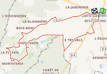
Ruta Senderismo de 13,1 km a descubrir en Centro, Indre y Loira, Saint-Laurent-en-Gâtines. Esta ruta ha sido propuesta por guydu41.
Descripción
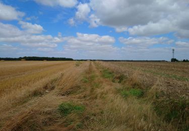
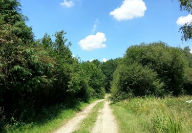
Parcours qui suit globalement un circuit "balisé bleu" à travers champs et bois.
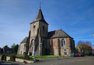
Note : Un tout petit crochet permet d'aller voir la petite chapelle Saint-Roch située dans un bois privé.
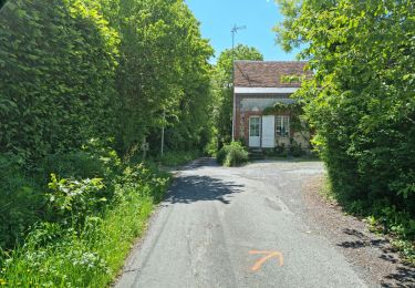
Passage assez long sur une petite route goudronnée en pleine campagne.
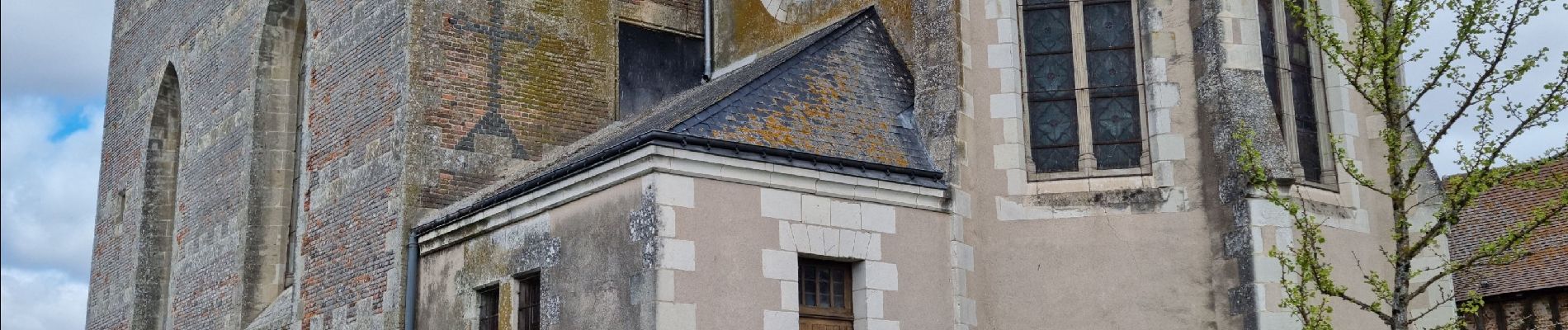
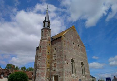
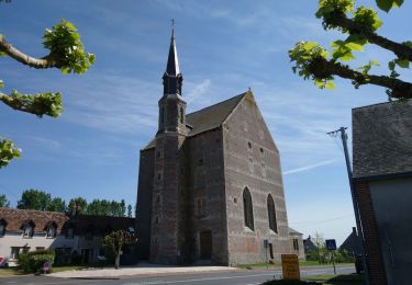
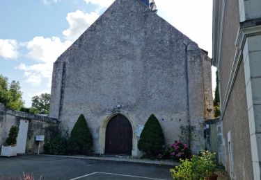
En toute fin de parcours, détour vers l'étonnante église Saint-Laurent.
Localización
Comentarios
Excursiones cerca
![Excursión Senderismo Saint-Laurent-en-Gâtines - Saint-Laurent-en-Gâtines - variante du PR Chemin de Chenusson - 10.2km 90m 2h25 - 2023 07 30 - Photo](https://media.geolcdn.com/t/375/260/9480277e-5582-454b-ba7d-ba1780556f7f.jpg&format=jpg&maxdim=2)
![Senderismo Senderismo](https://static1.geolcdn.com/sitytour/trail-icons/101.png)
Senderismo
![](/images/other/stat-length.png)
![](https://static1.geolcdn.com/siteimages/upload/files/16400158638029165_repeat_loop_refresh_sync_direction_icon.png)
![Excursión Senderismo La Ferrière - la Ferrière - le Moulin à Vent à Saint-Laurent-en-Gâtines - 14.9km 115m 3h20 (30mn) - 2023 07 30 - Photo](https://media.geolcdn.com/t/375/260/d3c77c4c-8983-42fc-ab09-ce988903c800.jpg&format=jpg&maxdim=2)
![Senderismo Senderismo](https://static1.geolcdn.com/sitytour/trail-icons/101.png)
Senderismo
![](/images/other/stat-length.png)
![](https://static1.geolcdn.com/siteimages/upload/files/16400158638029165_repeat_loop_refresh_sync_direction_icon.png)
![Excursión Senderismo Saint-Laurent-en-Gâtines - Saint-Laurent-en-Gâtines - Circuit jaune avec variante le Sentier - 18.7km 120m 4h30 - 2022 05 01 - Photo](https://media.geolcdn.com/t/375/260/8fa477e2-239d-46b3-938e-82d894cde1c1.jpg&format=jpg&maxdim=2)
![Senderismo Senderismo](https://static1.geolcdn.com/sitytour/trail-icons/101.png)
Senderismo
![](/images/other/stat-length.png)
![](https://static1.geolcdn.com/siteimages/upload/files/16400158638029165_repeat_loop_refresh_sync_direction_icon.png)
![Excursión Senderismo Nouzilly - Nouzilly - Circuit des Orchidées - 22.4km 375m 5h10 - 2022 04 10 - Photo](https://media.geolcdn.com/t/375/260/f369628d-ef19-453f-82e0-3cfc95192175.jpg&format=jpg&maxdim=2)
![Senderismo Senderismo](https://static1.geolcdn.com/sitytour/trail-icons/101.png)
Senderismo
![](/images/other/stat-length.png)
![](https://static1.geolcdn.com/siteimages/upload/files/16400158638029165_repeat_loop_refresh_sync_direction_icon.png)
![Excursión Senderismo Crotelles - Crotelles - PR avec variante - 21.4km 285m 4h35 (30mn) - 2021 03 20 - Photo](https://media.geolcdn.com/t/375/260/bceaf6e3-80b3-4324-91c6-ae12af2bbf7f.jpg&format=jpg&maxdim=2)
![Senderismo Senderismo](https://static1.geolcdn.com/sitytour/trail-icons/101.png)
Senderismo
![](/images/other/stat-length.png)
![](https://static1.geolcdn.com/siteimages/upload/files/16400158638029165_repeat_loop_refresh_sync_direction_icon.png)
![Excursión Senderismo Monthodon - Monthodon - et Le Sentier - 26.7km 230m 6h00 - 2018 07 15 - public - Photo](https://media.geolcdn.com/t/375/260/ext.jpg?maxdim=2&url=https%3A%2F%2Fservices.sitytrail.com%2FGeolivesWS%2FDownloadMedia.ashx%3FTrailID%3D1004638%26Media%3Dfix__20180715141736.jpg)
![Senderismo Senderismo](https://static1.geolcdn.com/sitytour/trail-icons/101.png)
Senderismo
![](/images/other/stat-length.png)
![](https://static1.geolcdn.com/siteimages/upload/files/16400158638029165_repeat_loop_refresh_sync_direction_icon.png)
![Excursión Senderismo La Ferrière - La Ferrière - Photo](https://media.geolcdn.com/t/375/260/2b9da9c8-3be2-44f6-92a4-c42159cd8b74.jpg&format=jpg&maxdim=2)
![Senderismo Senderismo](https://static1.geolcdn.com/sitytour/trail-icons/101.png)
Senderismo
![](/images/other/stat-length.png)
![](https://static1.geolcdn.com/siteimages/upload/files/16400158638029165_repeat_loop_refresh_sync_direction_icon.png)
![Excursión Senderismo Monthodon - Monthodon Le Sentier - Photo](https://media.geolcdn.com/t/375/260/86376099-ac84-49f8-82e1-db4414073e78.jpg&format=jpg&maxdim=2)
![Senderismo Senderismo](https://static1.geolcdn.com/sitytour/trail-icons/101.png)
Senderismo
![](/images/other/stat-length.png)
![](https://static1.geolcdn.com/siteimages/upload/files/16400158638029165_repeat_loop_refresh_sync_direction_icon.png)
![Excursión Senderismo Crotelles - Crotelles-19-11 - Photo](https://media.geolcdn.com/t/375/260/ext.jpg?maxdim=2&url=https%3A%2F%2Fstatic1.geolcdn.com%2Fsiteimages%2Fupload%2Ffiles%2F1553511878bg_sport_marche.png)
![Senderismo Senderismo](https://static1.geolcdn.com/sitytour/trail-icons/101.png)
Senderismo
![](/images/other/stat-length.png)
![](https://static1.geolcdn.com/siteimages/upload/files/16400158638029165_repeat_loop_refresh_sync_direction_icon.png)