


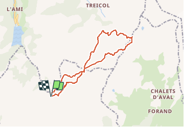

13,6 km | 26 km-effort


Usuario


Aplicación GPS de excursión GRATIS
 SityTrail
IGN / Institutos geográficos
SityTrail World
El mundo es suyo
Ruta Senderismo de 15,6 km a descubrir en Auvergne-Rhône-Alpes, Saboya, Aime-la-Plagne. Esta ruta ha sido propuesta por morganee.
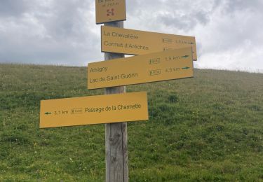
Très belle rando, qq passages techniques nécessitant d'avoir le pied sur (col du coin et passe au pied de la Pierra Menta). À faire par temps sec.

Senderismo

Senderismo

Esquí de fondo

Senderismo

Senderismo

Raquetas de nieve

Senderismo

Senderismo
Senderismo