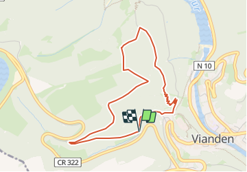
![](/images/other/stat-length.png)
![Excursión Senderismo Vianden - Vianden : Télésiège & Château - Photo](https://media.geolcdn.com/t/1900/400/d79592ef-5b36-4bc2-ad1d-709da52cc00f.jpg&format=pjpeg&maxdim=2)
Vianden : Télésiège & Château
mumu.larandonneuse
Usuario GUIDE
![Longitud](/images/other/stat-length.png)
![Altitud máxima](https://static1.geolcdn.com/siteimages/upload/files/1508320355ic_sort_altitude_max_24dp.png)
![Desnivel positivo](https://static1.geolcdn.com/siteimages/upload/files/1508320355ic_sort_den_pos_24dp.png)
![Km-Effort](/images/other/stat-length.png)
![Altitud mínima](https://static1.geolcdn.com/siteimages/upload/files/1508320355ic_sort_altitude_min_24dp.png)
![Desnivel negativo](https://static1.geolcdn.com/siteimages/upload/files/1508320355ic_sort_den_neg_24dp.png)
![Boucle](https://static1.geolcdn.com/siteimages/upload/files/16400158638029165_repeat_loop_refresh_sync_direction_icon.png)
![Senderismo](https://static1.geolcdn.com/sitytour/trail-icons/101.png)
1h28
Dificultad : Medio
![Escanee este código QR para abrir la excursión en la aplicación SityTrail](https://capi.geolives.com/qq0zvz2zws4bq2lad0pu/sitytour/trails/3738916/qr.png?size=200)
Aplicación GPS de excursión GRATIS
A propósito
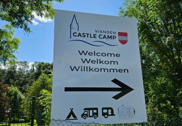
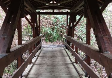
Ruta Senderismo de 4 km a descubrir en Desconocido, Canton Vianden, Vianden. Esta ruta ha sido propuesta por mumu.larandonneuse.
Descripción
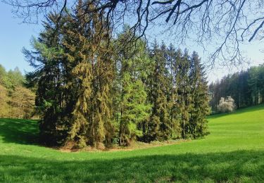
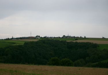
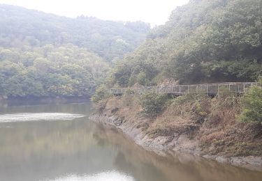
Un parcours boisé passant au sommet du télésiège (à 440 m) d'où il y a une vue époustouflante en panoramique sur la ville, le château et le barrage.
Possibilité d'une pause au restaurant.
Le retour emprunte un joli sentier au bord de la montagne.
A combiner avec la visite du château à l'arrivée.
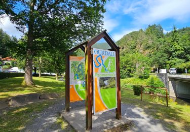
www.vianden.lu
📌 & 🅿️ du château, max 5h00 pour 4 euros.
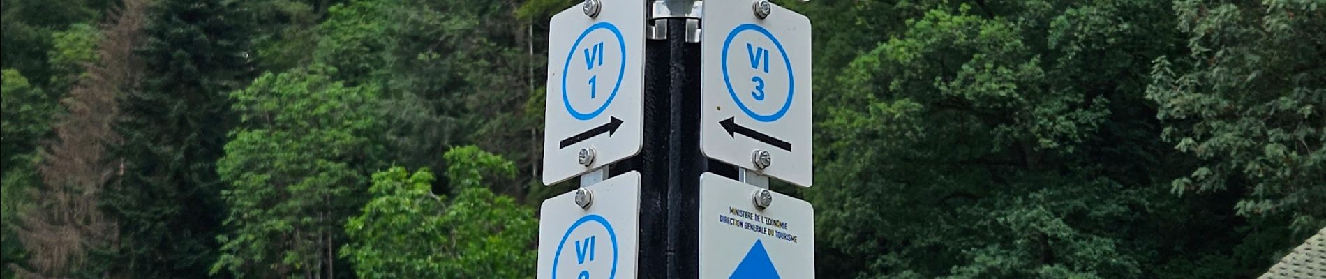
Localización
Comentarios
Excursiones cerca
![Excursión Senderismo Vianden - 2023-06-19_15h21m20_eislek-pad-vianden-1 - Photo](https://media.geolcdn.com/t/375/260/33ae7762-fc23-4c7a-b8ae-83734bad05ea.jpg&format=jpg&maxdim=2)
![Senderismo Senderismo](https://static1.geolcdn.com/sitytour/trail-icons/101.png)
Senderismo
![](/images/other/stat-length.png)
![](https://static1.geolcdn.com/siteimages/upload/files/16400158638029165_repeat_loop_refresh_sync_direction_icon.png)
![Excursión Senderismo Vianden - Itinérant Luxembourg Jour 7: Vianden -Ettelbruck - Photo](https://media.geolcdn.com/t/375/260/928dee80-2005-4eae-8761-66de6a052544.jpg&format=jpg&maxdim=2)
![Senderismo Senderismo](https://static1.geolcdn.com/sitytour/trail-icons/101.png)
Senderismo
![](/images/other/stat-length.png)
![](https://static1.geolcdn.com/siteimages/upload/files/16400158638029165_repeat_loop_refresh_sync_direction_icon.png)
![Excursión Senderismo Vianden - Itinérant Luxembourg Jour 6 : Boucle autour de Vianden - Photo](https://media.geolcdn.com/t/375/260/5b9141dd-6e04-4494-b5cf-8eec4ef7e8b3.jpg&format=jpg&maxdim=2)
![Senderismo Senderismo](https://static1.geolcdn.com/sitytour/trail-icons/101.png)
Senderismo
![](/images/other/stat-length.png)
![](https://static1.geolcdn.com/siteimages/upload/files/16400158638029165_repeat_loop_refresh_sync_direction_icon.png)
![Excursión Senderismo Tandel - 2024-07-11_16h37m44_local-hiking-trail-ta-2 - Photo](https://media.geolcdn.com/t/375/260/8c005037-a9f4-4acb-88bc-4e713f695a2c.jpg&format=jpg&maxdim=2)
![Senderismo Senderismo](https://static1.geolcdn.com/sitytour/trail-icons/101.png)
Senderismo
![](/images/other/stat-length.png)
![](https://static1.geolcdn.com/siteimages/upload/files/16400158638029165_repeat_loop_refresh_sync_direction_icon.png)
![Excursión A pie Vianden - Autopedestre Bettel - Photo](https://media.geolcdn.com/t/375/260/02b2f00a-75a6-48f2-b6f0-c11bc4a34d36.jpeg&format=jpg&maxdim=2)
![A pie A pie](https://static1.geolcdn.com/sitytour/trail-icons/100.png)
A pie
![](/images/other/stat-length.png)
![](https://static1.geolcdn.com/siteimages/upload/files/16400158638029165_repeat_loop_refresh_sync_direction_icon.png)
![Excursión A pie Tandel - Autopedestre Brandenbourg - Photo](https://media.geolcdn.com/t/375/260/f773c6ce-1e62-48fa-9c88-bf2c6a499187.jpeg&format=jpg&maxdim=2)
![A pie A pie](https://static1.geolcdn.com/sitytour/trail-icons/100.png)
A pie
![](/images/other/stat-length.png)
![](https://static1.geolcdn.com/siteimages/upload/files/16400158638029165_repeat_loop_refresh_sync_direction_icon.png)
![Excursión A pie Bettendorf - Promenade du Souvenir - Photo](https://media.geolcdn.com/t/375/260/eb9361c9-b7f4-45db-943a-ed4ec49958c8.jpeg&format=jpg&maxdim=2)
![A pie A pie](https://static1.geolcdn.com/sitytour/trail-icons/100.png)
A pie
![](/images/other/stat-length.png)
![](https://static1.geolcdn.com/siteimages/upload/files/16400158638029165_repeat_loop_refresh_sync_direction_icon.png)
![Excursión Senderismo Vianden - Les panoramas de Vianden - Photo](https://media.geolcdn.com/t/375/260/eea14bf8-62f0-4367-9ed4-8f55cee74d56.jpg&format=jpg&maxdim=2)
![Senderismo Senderismo](https://static1.geolcdn.com/sitytour/trail-icons/101.png)
Senderismo
![](/images/other/stat-length.png)
![](https://static1.geolcdn.com/siteimages/upload/files/16400158638029165_repeat_loop_refresh_sync_direction_icon.png)
![Excursión Senderismo Vianden - vianden . stolzemmbour - Photo](https://media.geolcdn.com/t/375/260/04cc6bc0-b9f3-4b97-a33c-e613e3b69f69.jpg&format=jpg&maxdim=2)
![Senderismo Senderismo](https://static1.geolcdn.com/sitytour/trail-icons/101.png)
Senderismo
![](/images/other/stat-length.png)
![](https://static1.geolcdn.com/siteimages/upload/files/16400158638029165_repeat_loop_refresh_sync_direction_icon.png)
Courte mais hard ! Faite avec Luna 🐕