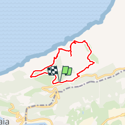
![](/images/other/stat-length.png)
![Excursión Senderismo Pasajes - Mitxitxola Mendia litoral 1 - Photo](https://media.geolcdn.com/t/1900/400/ext.pjpeg?maxdim=2&url=https%3A%2F%2Fservices.sitytrail.com%2FGeolivesWS%2FDownloadMedia.ashx%3FTrailID%3D372366%26Media%3Db0c1c584-5ef0-44b2-8745-fe8cc649fe0a.jpg)
Mitxitxola Mendia litoral 1
DECHAMPD
Usuario
![Longitud](/images/other/stat-length.png)
![Altitud máxima](https://static1.geolcdn.com/siteimages/upload/files/1508320355ic_sort_altitude_max_24dp.png)
![Desnivel positivo](https://static1.geolcdn.com/siteimages/upload/files/1508320355ic_sort_den_pos_24dp.png)
![Km-Effort](/images/other/stat-length.png)
![Altitud mínima](https://static1.geolcdn.com/siteimages/upload/files/1508320355ic_sort_altitude_min_24dp.png)
![Desnivel negativo](https://static1.geolcdn.com/siteimages/upload/files/1508320355ic_sort_den_neg_24dp.png)
![Boucle](https://static1.geolcdn.com/siteimages/upload/files/16400158638029165_repeat_loop_refresh_sync_direction_icon.png)
![Senderismo](https://static1.geolcdn.com/sitytour/trail-icons/101.png)
2h40
Dificultad : Difícil
![Escanee este código QR para abrir la excursión en la aplicación SityTrail](https://capi.geolives.com/qq0zvz2zws4bq2lad0pu/sitytour/trails/372366/qr.png?size=200)
Aplicación GPS de excursión GRATIS
A propósito
Ruta Senderismo de 7,1 km a descubrir en País Vasco, Guipúzcoa, Pasajes. Esta ruta ha sido propuesta por DECHAMPD.
Descripción
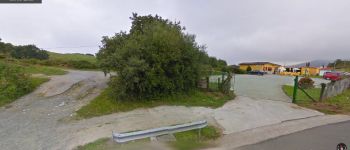
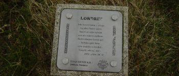
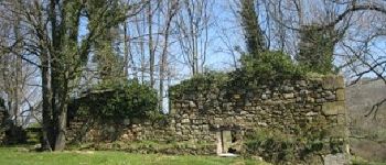
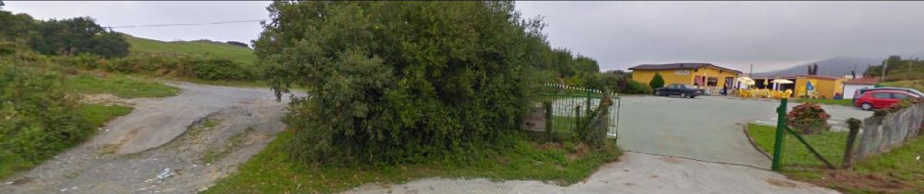
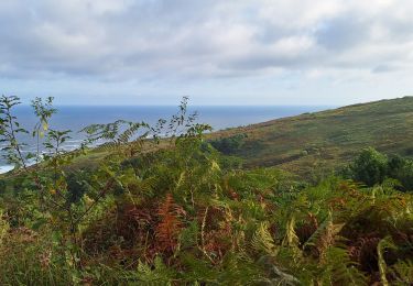
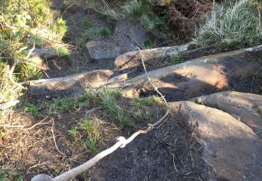
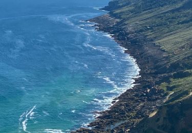
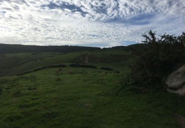
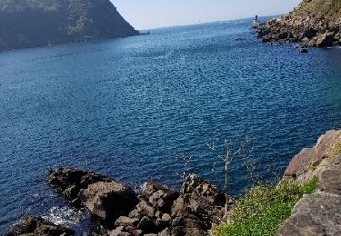
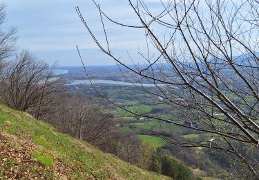
départ Parking Merendero resto, Kabite, Londres, contour de Mitxintxola Mendia par GR (rouge blanc, puis sentier à droite 260m (blanc blanc), Buenos Aires 240m, descente dans la vallée de Inalurreta, montée vers Maturreta, descente vers vallée Sagatxa, Kostaundi,remontée vers Zunbitondo 210m, descente vers Inalurreta et Merendero. La montagne Mitxitxola n'est pas plus qu'un appendice de Jaizkibel dans son versant Pasaitarra, dans ce lieu vert il y avait une série de hameaux, aujourd'hui abandonnés et semi-démolis avec des noms très pittoresques comme Londres, Buenos Aires à cotés les spectaculaires falaises de Grankanto avec caid
Puntos de interés
Localización
Comentarios
Excursiones cerca
![Excursión Senderismo Fuenterrabía - Pasaia les vallées des couleurs - Photo](https://media.geolcdn.com/t/375/260/57f480d6-c56c-4ebd-ac8e-5bd675485a93.jpg&format=jpg&maxdim=2)
![Senderismo Senderismo](https://static1.geolcdn.com/sitytour/trail-icons/101.png)
Senderismo
![](/images/other/stat-length.png)
![](https://static1.geolcdn.com/siteimages/upload/files/16400158638029165_repeat_loop_refresh_sync_direction_icon.png)
![Excursión Senderismo Pasajes - Pasaia Donibane - Photo](https://media.geolcdn.com/t/375/260/0553a38d-8a0d-4fa0-800e-ecb893adf7b5.jpg&format=jpg&maxdim=2)
![Senderismo Senderismo](https://static1.geolcdn.com/sitytour/trail-icons/101.png)
Senderismo
![](/images/other/stat-length.png)
![](https://static1.geolcdn.com/siteimages/upload/files/16400158638029165_repeat_loop_refresh_sync_direction_icon.png)
![Senderismo Senderismo](https://static1.geolcdn.com/sitytour/trail-icons/101.png)
Senderismo
![](/images/other/stat-length.png)
![](https://static1.geolcdn.com/siteimages/upload/files/16400158638029165_repeat_loop_refresh_sync_direction_icon.png)
![Excursión Senderismo Pasajes - Littoral du Jaizkibel I - Photo](https://media.geolcdn.com/t/375/260/c0b73d7c-a983-4f61-bb9e-e7eb6af85a90.jpeg&format=jpg&maxdim=2)
![Senderismo Senderismo](https://static1.geolcdn.com/sitytour/trail-icons/101.png)
Senderismo
![](/images/other/stat-length.png)
![](https://static1.geolcdn.com/siteimages/upload/files/16400158638029165_repeat_loop_refresh_sync_direction_icon.png)
![Excursión Senderismo Pasajes - Piemont du Jaizkibel Pays Basque Espagne - Photo](https://media.geolcdn.com/t/375/260/fd334848-f3d2-471b-86a8-42eac21c68f8.jpg&format=jpg&maxdim=2)
![Senderismo Senderismo](https://static1.geolcdn.com/sitytour/trail-icons/101.png)
Senderismo
![](/images/other/stat-length.png)
![](https://static1.geolcdn.com/siteimages/upload/files/16400158638029165_repeat_loop_refresh_sync_direction_icon.png)
![Excursión Senderismo Pasajes - le batier à la sauce Basque du phiphidechagny - Photo](https://media.geolcdn.com/t/375/260/ext.jpg?maxdim=2&url=https%3A%2F%2Fservices.sitytrail.com%2FGeolivesWS%2FDownloadMedia.ashx%3FTrailID%3D1134598%26Media%3Dfix__20190413165921.jpg)
![Senderismo Senderismo](https://static1.geolcdn.com/sitytour/trail-icons/101.png)
Senderismo
![](/images/other/stat-length.png)
![](https://static1.geolcdn.com/siteimages/upload/files/16400158638029165_repeat_loop_refresh_sync_direction_icon.png)
![Excursión Senderismo Pasajes - le batier à la sauce Basque du phiphidechagny - Photo](https://media.geolcdn.com/t/375/260/ext.jpg?maxdim=2&url=https%3A%2F%2Fservices.sitytrail.com%2FGeolivesWS%2FDownloadMedia.ashx%3FTrailID%3D1134504%26Media%3Dfix__20190413165921.jpg)
![Senderismo Senderismo](https://static1.geolcdn.com/sitytour/trail-icons/101.png)
Senderismo
![](/images/other/stat-length.png)
![](https://static1.geolcdn.com/siteimages/upload/files/16400158638029165_repeat_loop_refresh_sync_direction_icon.png)
![Excursión Senderismo Lezo - Raizkibel depuis Irun avec topo - Photo](https://media.geolcdn.com/t/375/260/7d9a8293-19e8-4036-a96a-024e46e1c78c.jpg&format=jpg&maxdim=2)
![Senderismo Senderismo](https://static1.geolcdn.com/sitytour/trail-icons/101.png)
Senderismo
![](/images/other/stat-length.png)
![](https://static1.geolcdn.com/siteimages/upload/files/16400158638029165_repeat_loop_refresh_sync_direction_icon.png)