![](/images/other/stat-length.png)
![Excursión Senderismo Goumois - GTJ - Photo](https://media.geolcdn.com/t/1900/400/ext.pjpeg?maxdim=2&url=https%3A%2F%2Fstatic1.geolcdn.com%2Fsiteimages%2Fupload%2Ffiles%2F1553511878bg_sport_marche.png)
GTJ
famiski
Usuario
![Longitud](/images/other/stat-length.png)
Longitud
16,9 km
![Altitud máxima](https://static1.geolcdn.com/siteimages/upload/files/1508320355ic_sort_altitude_max_24dp.png)
Altitud máxima
977 m
![Desnivel positivo](https://static1.geolcdn.com/siteimages/upload/files/1508320355ic_sort_den_pos_24dp.png)
Desnivel positivo
782 m
![Km-Effort](/images/other/stat-length.png)
Km-Effort
26 km
![Altitud mínima](https://static1.geolcdn.com/siteimages/upload/files/1508320355ic_sort_altitude_min_24dp.png)
Altitud mínima
494 m
![Desnivel negativo](https://static1.geolcdn.com/siteimages/upload/files/1508320355ic_sort_den_neg_24dp.png)
Desnivel negativo
489 m
![Boucle](https://static1.geolcdn.com/siteimages/upload/files/16400158638029165_repeat_loop_refresh_sync_direction_icon.png)
Boucle
No
Fecha de creación :
2023-07-03 08:43:25.91
Última modificación :
2024-09-04 06:52:13.703
![Senderismo](https://static1.geolcdn.com/sitytour/trail-icons/101.png)
5h58
Dificultad : Muy difícil
![Escanee este código QR para abrir la excursión en la aplicación SityTrail](https://capi.geolives.com/qq0zvz2zws4bq2lad0pu/sitytour/trails/3721721/qr.png?size=200)
Aplicación GPS de excursión GRATIS
A propósito
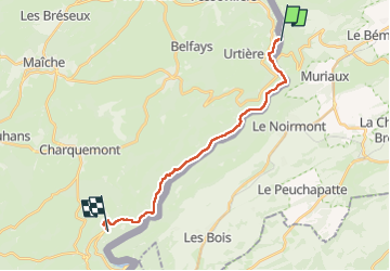
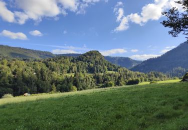
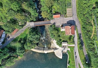
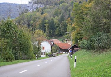
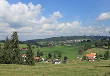
Ruta Senderismo de 16,9 km a descubrir en Borgoña-Franco Condado, Doubs, Goumois. Esta ruta ha sido propuesta por famiski.
Descripción
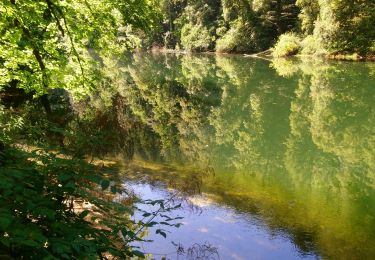
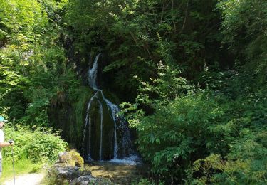
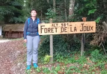
GTJ jusqu'à La Charbonnière du Haut . Je n'ai pas pris la déviation par le bas qui évite le passage bloqué aux échelles de la mort . Le reste de la randonnée est improvisation.
Localización
País:
France
Región :
Borgoña-Franco Condado
Departamento/provincia :
Doubs
Municipio :
Goumois
Localidad:
Unknown
Salida:(Dec)
Salida:(UTM)
344986 ; 5236282 (32T) N.
Comentarios
Excursiones cerca
![Excursión Senderismo Goumois - Circuit du barrage de la Goule - Photo](https://media.geolcdn.com/t/375/260/5b0019e2-a604-4bd2-9c4a-c096b01f1b2e.jpg&format=jpg&maxdim=2)
![Senderismo Senderismo](https://static1.geolcdn.com/sitytour/trail-icons/101.png)
Circuit du barrage de la Goule
Senderismo
Medio
Goumois,
Borgoña-Franco Condado,
Doubs,
France
![](/images/other/stat-length.png)
13,8 km | 18,8 km-effort
3h 36min
![](https://static1.geolcdn.com/siteimages/upload/files/16400158638029165_repeat_loop_refresh_sync_direction_icon.png)
Sí
![Excursión A pie Le Noirmont - La Goule - fixme - Photo](https://media.geolcdn.com/t/375/260/26c9f498-14fd-470d-95fd-f93787b84ec0.jpeg&format=jpg&maxdim=2)
![A pie A pie](https://static1.geolcdn.com/sitytour/trail-icons/100.png)
La Goule - fixme
A pie
Fácil
Le Noirmont,
Jura,
District des Franches-Montagnes,
Switzerland
![](/images/other/stat-length.png)
3,4 km | 4,5 km-effort
1h 0min
![](https://static1.geolcdn.com/siteimages/upload/files/16400158638029165_repeat_loop_refresh_sync_direction_icon.png)
No
![Excursión A pie Le Noirmont - La Goule - fixme - Photo](https://media.geolcdn.com/t/375/260/26c9f498-14fd-470d-95fd-f93787b84ec0.jpeg&format=jpg&maxdim=2)
![A pie A pie](https://static1.geolcdn.com/sitytour/trail-icons/100.png)
La Goule - fixme
A pie
Fácil
Le Noirmont,
Jura,
District des Franches-Montagnes,
Switzerland
![](/images/other/stat-length.png)
3,9 km | 8,2 km-effort
1h 51min
![](https://static1.geolcdn.com/siteimages/upload/files/16400158638029165_repeat_loop_refresh_sync_direction_icon.png)
No
![Excursión A pie Muriaux - Muriaux - Goumois - Photo](https://media.geolcdn.com/t/375/260/39340727-7fad-44c3-aed8-14f4632db308.jpeg&format=jpg&maxdim=2)
![A pie A pie](https://static1.geolcdn.com/sitytour/trail-icons/100.png)
Muriaux - Goumois
A pie
Fácil
Muriaux,
Jura,
District des Franches-Montagnes,
Switzerland
![](/images/other/stat-length.png)
4 km | 6,7 km-effort
1h 31min
![](https://static1.geolcdn.com/siteimages/upload/files/16400158638029165_repeat_loop_refresh_sync_direction_icon.png)
No
![Senderismo Senderismo](https://static1.geolcdn.com/sitytour/trail-icons/101.png)
Les Sommêtres
Senderismo
Medio
Goumois,
Borgoña-Franco Condado,
Doubs,
France
![](/images/other/stat-length.png)
24 km | 37 km-effort
7h 54min
![](https://static1.geolcdn.com/siteimages/upload/files/16400158638029165_repeat_loop_refresh_sync_direction_icon.png)
No
![Excursión Senderismo Charmauvillers - Goumois randonnée La Goule - Photo](https://media.geolcdn.com/t/375/260/21b4c51b-c2b4-4e0c-a0c1-612025391c50.jpg&format=jpg&maxdim=2)
![Senderismo Senderismo](https://static1.geolcdn.com/sitytour/trail-icons/101.png)
Goumois randonnée La Goule
Senderismo
Medio
Charmauvillers,
Borgoña-Franco Condado,
Doubs,
France
![](/images/other/stat-length.png)
19,6 km | 35 km-effort
3h 5min
![](https://static1.geolcdn.com/siteimages/upload/files/16400158638029165_repeat_loop_refresh_sync_direction_icon.png)
No
![Excursión A pie Saignelégier - Moulin Jeannottat-Les Pommerats - Photo](https://media.geolcdn.com/t/375/260/ext.jpg?maxdim=2&url=https%3A%2F%2Fstatic1.geolcdn.com%2Fsiteimages%2Fupload%2Ffiles%2F1545311037marcheuse_200dpi.jpg)
![A pie A pie](https://static1.geolcdn.com/sitytour/trail-icons/100.png)
Moulin Jeannottat-Les Pommerats
A pie
Fácil
Saignelégier,
Jura,
District des Franches-Montagnes,
Switzerland
![](/images/other/stat-length.png)
4,3 km | 8,5 km-effort
1h 55min
![](https://static1.geolcdn.com/siteimages/upload/files/16400158638029165_repeat_loop_refresh_sync_direction_icon.png)
No
![Excursión Senderismo Goumois - Goumois - Photo](https://media.geolcdn.com/t/375/260/d0f49200-6ae5-4a6b-8236-c2c6eaab60f6.jpg&format=jpg&maxdim=2)
![Senderismo Senderismo](https://static1.geolcdn.com/sitytour/trail-icons/101.png)
Goumois
Senderismo
Fácil
Goumois,
Borgoña-Franco Condado,
Doubs,
France
![](/images/other/stat-length.png)
13,6 km | 19,4 km-effort
5h 42min
![](https://static1.geolcdn.com/siteimages/upload/files/16400158638029165_repeat_loop_refresh_sync_direction_icon.png)
Sí
![Excursión Senderismo Fessevillers - Étape 4 : Fessevillers à Bief d'Etoz - Photo](https://media.geolcdn.com/t/375/260/277dd886-30bb-40a5-b26e-59eee8200701.jpg&format=jpg&maxdim=2)
![Senderismo Senderismo](https://static1.geolcdn.com/sitytour/trail-icons/101.png)
Étape 4 : Fessevillers à Bief d'Etoz
Senderismo
Medio
Fessevillers,
Borgoña-Franco Condado,
Doubs,
France
![](/images/other/stat-length.png)
15 km | 21 km-effort
5h 14min
![](https://static1.geolcdn.com/siteimages/upload/files/16400158638029165_repeat_loop_refresh_sync_direction_icon.png)
No