![](/images/other/stat-length.png)
![Excursión Senderismo Saint-Étienne-de-Tinée - De Roya au Col de Blainon, baisse herisson - Photo](https://media.geolcdn.com/t/1900/400/f3ff390a-3102-4c2f-baae-0abdbac6b210.jpg&format=pjpeg&maxdim=2)
De Roya au Col de Blainon, baisse herisson
GrouGary
Usuario
![Longitud](/images/other/stat-length.png)
![Altitud máxima](https://static1.geolcdn.com/siteimages/upload/files/1508320355ic_sort_altitude_max_24dp.png)
![Desnivel positivo](https://static1.geolcdn.com/siteimages/upload/files/1508320355ic_sort_den_pos_24dp.png)
![Km-Effort](/images/other/stat-length.png)
![Altitud mínima](https://static1.geolcdn.com/siteimages/upload/files/1508320355ic_sort_altitude_min_24dp.png)
![Desnivel negativo](https://static1.geolcdn.com/siteimages/upload/files/1508320355ic_sort_den_neg_24dp.png)
![Boucle](https://static1.geolcdn.com/siteimages/upload/files/16400158638029165_repeat_loop_refresh_sync_direction_icon.png)
![Senderismo](https://static1.geolcdn.com/sitytour/trail-icons/101.png)
4h04
Dificultad : Medio
![Escanee este código QR para abrir la excursión en la aplicación SityTrail](https://capi.geolives.com/qq0zvz2zws4bq2lad0pu/sitytour/trails/3721251/qr.png?size=200)
Aplicación GPS de excursión GRATIS
A propósito
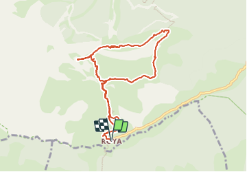
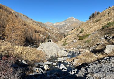
Ruta Senderismo de 10,4 km a descubrir en Provenza-Alpes-Costa Azul, Alpes Marítimos, Saint-Étienne-de-Tinée. Esta ruta ha sido propuesta por GrouGary.
Descripción
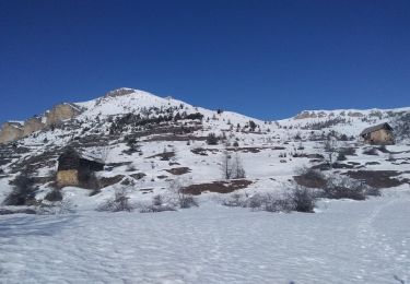
Boucle à faire au printemps ou automne, pour éviter chaleur été.
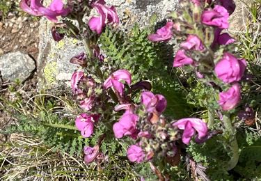
GR 5 pour découvrir les alpages et granges dont certaines sont encore habitées l'été pour la surveillance des moutons.
2 gros élevages de moutons, enfermés en journée par clôture, au lieu de pâturer (curieux) ... et chiens non hargneux.
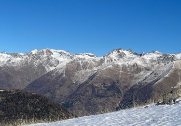
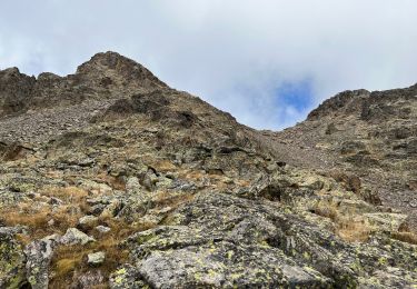
Retour après la Baisse du hérisson par ancien sentier peu visible jusqu'au Pt 1999 sur IGN puis descendre direct dans la pente herbeuse/églantiers, sans cairn (sauf 1 gros cairn à mi parcours), en visant les vieilles granges. Retour sur GR5 à Roya.
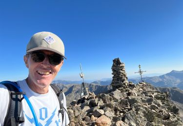
"Ma vieille école" est un gite d'étape ouvert à Roya de mai à septembre avec d'excellents cakes citron et orange
Localización
Comentarios
Excursiones cerca
![Excursión Senderismo Saint-Étienne-de-Tinée - Réel Roya Col de Crousette Stèle Valette Petit Mounier et Mounier - Photo](https://media.geolcdn.com/t/375/260/b5c86927-6c55-4c7f-afae-58ada10c53b3.jpg&format=jpg&maxdim=2)
![Senderismo Senderismo](https://static1.geolcdn.com/sitytour/trail-icons/101.png)
Senderismo
![](/images/other/stat-length.png)
![](https://static1.geolcdn.com/siteimages/upload/files/16400158638029165_repeat_loop_refresh_sync_direction_icon.png)
![Excursión A pie Saint-Étienne-de-Tinée - Cime de la Bercha - Photo](https://media.geolcdn.com/t/375/260/06e4d46f-e317-406d-bd2c-01041e541c38.jpeg&format=jpg&maxdim=2)
![A pie A pie](https://static1.geolcdn.com/sitytour/trail-icons/100.png)
A pie
![](/images/other/stat-length.png)
![](https://static1.geolcdn.com/siteimages/upload/files/16400158638029165_repeat_loop_refresh_sync_direction_icon.png)
![Excursión Esquí de fondo Saint-Étienne-de-Tinée - Mont Triboulet et Mont Rion - Photo](https://media.geolcdn.com/t/375/260/628b9303-05b3-4c82-bf08-aa61a07e7015.jpg&format=jpg&maxdim=2)
![Esquí de fondo Esquí de fondo](https://static1.geolcdn.com/sitytour/trail-icons/503.png)
Esquí de fondo
![](/images/other/stat-length.png)
![](https://static1.geolcdn.com/siteimages/upload/files/16400158638029165_repeat_loop_refresh_sync_direction_icon.png)
![Excursión Esquí de fondo Saint-Étienne-de-Tinée - Las Donnas et baisse du Colombier - Photo](https://media.geolcdn.com/t/375/260/0cedeff1-332d-460c-af06-a42d22a26fa2.jpg&format=jpg&maxdim=2)
![Esquí de fondo Esquí de fondo](https://static1.geolcdn.com/sitytour/trail-icons/503.png)
Esquí de fondo
![](/images/other/stat-length.png)
![](https://static1.geolcdn.com/siteimages/upload/files/16400158638029165_repeat_loop_refresh_sync_direction_icon.png)
![Excursión Raquetas de nieve Saint-Étienne-de-Tinée - Cabane Vieille - Photo](https://media.geolcdn.com/t/375/260/d08ad509-8448-4a00-bc95-11334e53fd24.jpg&format=jpg&maxdim=2)
![Raquetas de nieve Raquetas de nieve](https://static1.geolcdn.com/sitytour/trail-icons/504.png)
Raquetas de nieve
![](/images/other/stat-length.png)
![](https://static1.geolcdn.com/siteimages/upload/files/16400158638029165_repeat_loop_refresh_sync_direction_icon.png)
![Excursión Senderismo Saint-Étienne-de-Tinée - Le Mounier - Photo](https://media.geolcdn.com/t/375/260/6d3039c6-e5bd-4a5c-b5ca-417ffa1a190a.jpg&format=jpg&maxdim=2)
![Senderismo Senderismo](https://static1.geolcdn.com/sitytour/trail-icons/101.png)
Senderismo
![](/images/other/stat-length.png)
![](https://static1.geolcdn.com/siteimages/upload/files/16400158638029165_repeat_loop_refresh_sync_direction_icon.png)
![Excursión Senderismo Saint-Étienne-de-Tinée - Le Corborant - Photo](https://media.geolcdn.com/t/375/260/4e6a72e4-8dfa-499a-bed5-882b283528e3.jpeg&format=jpg&maxdim=2)
![Senderismo Senderismo](https://static1.geolcdn.com/sitytour/trail-icons/101.png)
Senderismo
![](/images/other/stat-length.png)
![](https://static1.geolcdn.com/siteimages/upload/files/16400158638029165_repeat_loop_refresh_sync_direction_icon.png)
![Excursión sport Saint-Étienne-de-Tinée - Tête de l autaret Lagos colla longa - Photo](https://media.geolcdn.com/t/375/260/0f54380f-0cc0-41e9-83d3-976012bf1985.jpg&format=jpg&maxdim=2)
sport
![](/images/other/stat-length.png)
![](https://static1.geolcdn.com/siteimages/upload/files/16400158638029165_repeat_loop_refresh_sync_direction_icon.png)
![Excursión Senderismo Saint-Étienne-de-Tinée - Pas du Corborant - Photo](https://media.geolcdn.com/t/375/260/1437e916-f1b9-46ba-a4bd-95ebbd78d5eb.jpg&format=jpg&maxdim=2)
![Senderismo Senderismo](https://static1.geolcdn.com/sitytour/trail-icons/101.png)
Senderismo
![](/images/other/stat-length.png)
![](https://static1.geolcdn.com/siteimages/upload/files/16400158638029165_repeat_loop_refresh_sync_direction_icon.png)