![](/images/other/stat-length.png)
![Excursión Senderismo Brestot - Balade de la Vierge de Brumare - Photo](https://media.geolcdn.com/t/1900/400/ext.pjpeg?maxdim=2&url=https%3A%2F%2Fservices.sitytrail.com%2FGeolivesWS%2FDownloadMedia.ashx%3FTrailID%3D371665%26Media%3Dfix__20141221163302.jpg)
Balade de la Vierge de Brumare
dominiquelouis
Usuario
![Longitud](/images/other/stat-length.png)
Longitud
5,9 km
![Altitud máxima](https://static1.geolcdn.com/siteimages/upload/files/1508320355ic_sort_altitude_max_24dp.png)
Altitud máxima
137 m
![Desnivel positivo](https://static1.geolcdn.com/siteimages/upload/files/1508320355ic_sort_den_pos_24dp.png)
Desnivel positivo
99 m
![Km-Effort](/images/other/stat-length.png)
Km-Effort
7,2 km
![Altitud mínima](https://static1.geolcdn.com/siteimages/upload/files/1508320355ic_sort_altitude_min_24dp.png)
Altitud mínima
51 m
![Desnivel negativo](https://static1.geolcdn.com/siteimages/upload/files/1508320355ic_sort_den_neg_24dp.png)
Desnivel negativo
97 m
![Boucle](https://static1.geolcdn.com/siteimages/upload/files/16400158638029165_repeat_loop_refresh_sync_direction_icon.png)
Boucle
Sí
Fecha de creación :
2015-10-06 00:00:00.0
Última modificación :
2015-10-06 00:00:00.0
![Senderismo](https://static1.geolcdn.com/sitytour/trail-icons/101.png)
1h30
Dificultad : Fácil
![Escanee este código QR para abrir la excursión en la aplicación SityTrail](https://capi.geolives.com/qq0zvz2zws4bq2lad0pu/sitytour/trails/371665/qr.png?size=200)
Aplicación GPS de excursión GRATIS
A propósito
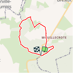
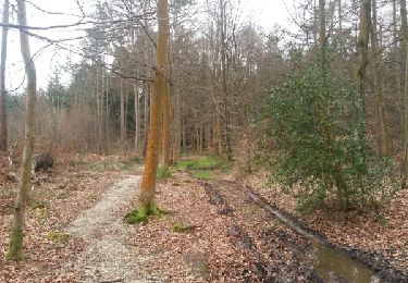
Ruta Senderismo de 5,9 km a descubrir en Normandía, Eure, Brestot. Esta ruta ha sido propuesta por dominiquelouis.
Descripción
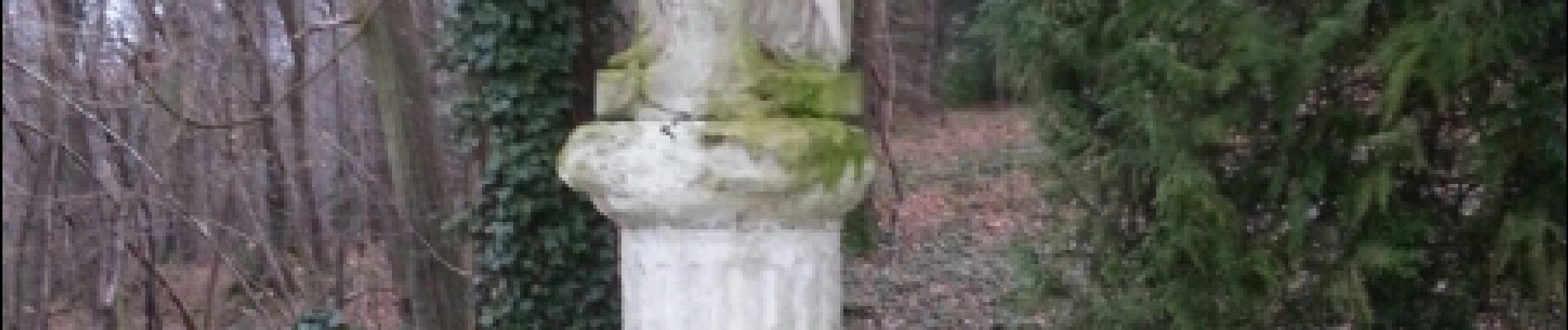
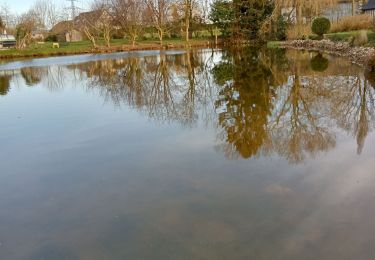
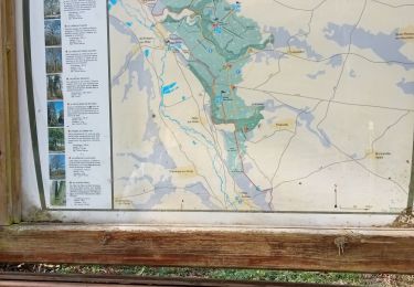
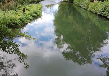
Au départ de l'aire d'accueil du Val Dallet: balade pédestre de 6 km en forêt domaniale de Montfort et dans le vallon du Val Dallet, en passant par le château et la Vierge de Brumare
Localización
País:
France
Región :
Normandía
Departamento/provincia :
Eure
Municipio :
Brestot
Localidad:
Unknown
Salida:(Dec)
Salida:(UTM)
330822 ; 5466756 (31U) N.
Comentarios
Excursiones cerca
![Excursión Senderismo Illeville-sur-Montfort - Illeville sur Montfort - Le circuit des Jacinthes - La Ferme de Fourges - Photo](https://media.geolcdn.com/t/375/260/3f49af04-1319-456c-9456-ec8bbc5a3b82.jpg&format=jpg&maxdim=2)
![Senderismo Senderismo](https://static1.geolcdn.com/sitytour/trail-icons/101.png)
Illeville sur Montfort - Le circuit des Jacinthes - La Ferme de Fourges
Senderismo
Difícil
(1)
Illeville-sur-Montfort,
Normandía,
Eure,
France
![](/images/other/stat-length.png)
12,3 km | 14,4 km-effort
3h 13min
![](https://static1.geolcdn.com/siteimages/upload/files/16400158638029165_repeat_loop_refresh_sync_direction_icon.png)
Sí
![Excursión Senderismo Illeville-sur-Montfort - Illeville-sur-Monfort - Le circuit des Jacinthes - Photo](https://media.geolcdn.com/t/375/260/4ad22c83-41bc-47e4-95e1-447b2054afca.jpg&format=jpg&maxdim=2)
![Senderismo Senderismo](https://static1.geolcdn.com/sitytour/trail-icons/101.png)
Illeville-sur-Monfort - Le circuit des Jacinthes
Senderismo
Difícil
(2)
Illeville-sur-Montfort,
Normandía,
Eure,
France
![](/images/other/stat-length.png)
12,3 km | 14,5 km-effort
3h 8min
![](https://static1.geolcdn.com/siteimages/upload/files/16400158638029165_repeat_loop_refresh_sync_direction_icon.png)
Sí
![Excursión Senderismo Condé-sur-Risle - Circuit des faneuses -Condé sur Risle-St Christophe sur Condé - Photo](https://media.geolcdn.com/t/375/260/3b4a5190-fc9d-4ba2-a272-b6d4b94cd6f5.jpg&format=jpg&maxdim=2)
![Senderismo Senderismo](https://static1.geolcdn.com/sitytour/trail-icons/101.png)
Circuit des faneuses -Condé sur Risle-St Christophe sur Condé
Senderismo
Difícil
Condé-sur-Risle,
Normandía,
Eure,
France
![](/images/other/stat-length.png)
14 km | 16,4 km-effort
4h 8min
![](https://static1.geolcdn.com/siteimages/upload/files/16400158638029165_repeat_loop_refresh_sync_direction_icon.png)
Sí
![Excursión Senderismo Colletot - Colletot à Corneille sur Risle - Photo](https://media.geolcdn.com/t/375/260/85510aa2-db3d-4ccb-b361-44d57952fb06.jpg&format=jpg&maxdim=2)
![Senderismo Senderismo](https://static1.geolcdn.com/sitytour/trail-icons/101.png)
Colletot à Corneille sur Risle
Senderismo
Difícil
(1)
Colletot,
Normandía,
Eure,
France
![](/images/other/stat-length.png)
11,3 km | 13,4 km-effort
2h 50min
![](https://static1.geolcdn.com/siteimages/upload/files/16400158638029165_repeat_loop_refresh_sync_direction_icon.png)
Sí
![Excursión Senderismo Cauverville-en-Roumois - Cauverville en Roumois - Le chemin du chênede la Vierge - Photo](https://media.geolcdn.com/t/375/260/848c1a14-2520-4048-b5ca-f7b5c61c1edf.jpg&format=jpg&maxdim=2)
![Senderismo Senderismo](https://static1.geolcdn.com/sitytour/trail-icons/101.png)
Cauverville en Roumois - Le chemin du chênede la Vierge
Senderismo
Difícil
(1)
Cauverville-en-Roumois,
Normandía,
Eure,
France
![](/images/other/stat-length.png)
11,7 km | 13,9 km-effort
3h 6min
![](https://static1.geolcdn.com/siteimages/upload/files/16400158638029165_repeat_loop_refresh_sync_direction_icon.png)
Sí
![Excursión Senderismo Appeville-Annebault - Appeville Annebault - Photo](https://media.geolcdn.com/t/375/260/1129d546-4635-4e2a-ba5f-33c44de23099.jpg&format=jpg&maxdim=2)
![Senderismo Senderismo](https://static1.geolcdn.com/sitytour/trail-icons/101.png)
Appeville Annebault
Senderismo
Medio
(1)
Appeville-Annebault,
Normandía,
Eure,
France
![](/images/other/stat-length.png)
26 km | 33 km-effort
4h 42min
![](https://static1.geolcdn.com/siteimages/upload/files/16400158638029165_repeat_loop_refresh_sync_direction_icon.png)
Sí
![Excursión Senderismo Montfort-sur-Risle - Montfort-sur-Risle - Photo](https://media.geolcdn.com/t/375/260/14202da2-b278-459f-b37f-9fa97561a5eb.jpg&format=jpg&maxdim=2)
![Senderismo Senderismo](https://static1.geolcdn.com/sitytour/trail-icons/101.png)
Montfort-sur-Risle
Senderismo
Difícil
Montfort-sur-Risle,
Normandía,
Eure,
France
![](/images/other/stat-length.png)
21 km | 26 km-effort
7h 21min
![](https://static1.geolcdn.com/siteimages/upload/files/16400158638029165_repeat_loop_refresh_sync_direction_icon.png)
Sí
![Excursión Senderismo Appeville-Annebault - appeville - Photo](https://media.geolcdn.com/t/375/260/ext.jpg?maxdim=2&url=https%3A%2F%2Fservices.sitytrail.com%2FGeolivesWS%2FDownloadMedia.ashx%3FTrailID%3D1021886%26Media%3Dfix__20180812105811.jpg)
![Senderismo Senderismo](https://static1.geolcdn.com/sitytour/trail-icons/101.png)
appeville
Senderismo
Medio
Appeville-Annebault,
Normandía,
Eure,
France
![](/images/other/stat-length.png)
23 km | 29 km-effort
5h 6min
![](https://static1.geolcdn.com/siteimages/upload/files/16400158638029165_repeat_loop_refresh_sync_direction_icon.png)
Sí
![Excursión Senderismo Illeville-sur-Montfort - chemin des Séquoias - Photo](https://media.geolcdn.com/t/375/260/ext.jpg?maxdim=2&url=https%3A%2F%2Fservices.sitytrail.com%2FGeolivesWS%2FDownloadMedia.ashx%3FTrailID%3D536058%26Media%3Dfix__20160310171813.jpg)
![Senderismo Senderismo](https://static1.geolcdn.com/sitytour/trail-icons/101.png)
chemin des Séquoias
Senderismo
Medio
Illeville-sur-Montfort,
Normandía,
Eure,
France
![](/images/other/stat-length.png)
7,8 km | 9,7 km-effort
2h 56min
![](https://static1.geolcdn.com/siteimages/upload/files/16400158638029165_repeat_loop_refresh_sync_direction_icon.png)
Sí