


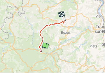

17,7 km | 26 km-effort


Usuario GUIDE


Aplicación GPS de excursión GRATIS
 SityTrail
IGN / Institutos geográficos
SityTrail World
El mundo es suyo
Ruta Paseo ecuestre de 27 km a descubrir en Auvergne-Rhône-Alpes, Ardecha, Désaignes. Esta ruta ha sido propuesta por holtzv.
Désaignes-Le Vergers St Félicien-Domaine du Balayn.
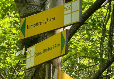
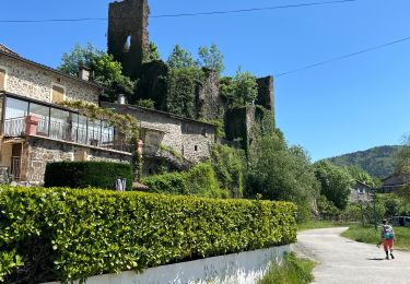
Pique nique au village miniature du col de Buisson. Visite de Paiharès.
Gite chez Camille et Manu Jaubert.

sport
sport

Senderismo

Senderismo

Bici de montaña

Senderismo

Senderismo

Senderismo
Senderismo