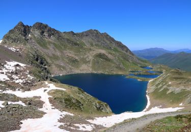
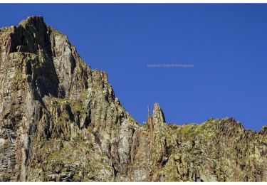
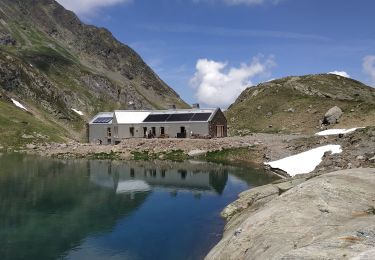
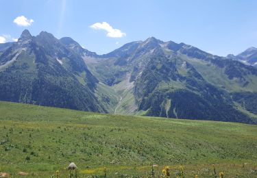
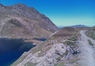
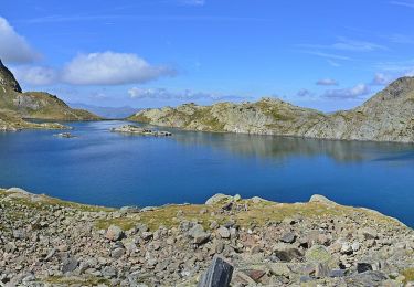
Excursión Senderismo Viella Mitg Arán - Wikiloc - Estanh deth Coth deth Horo - Artiga de Lin - Photo

Wikiloc - Estanh deth Coth deth Horo - Artiga de Lin

 DECHAMPD
DECHAMPD

Usuario

© OpenStreetMap contributors
Longitud
Longitud
6,3 km
Altitud máxima
Altitud máxima
2236 m
Desnivel positivo
Desnivel positivo
769 m
Km-Effort
Km-Effort  
16,6 km
Altitud mínima
Altitud mínima
1463 m
Desnivel negativo
Desnivel negativo
764 m
Boucle
Boucle
Fecha de creación :
2023-06-13 15:10:46.201
Última modificación :
2023-06-13 15:29:32.143

(0 Opinión)

Senderismo
Senderismo
3h45
Dificultad : Difícil

Escanee este código QR para abrir la excursión en la aplicación SityTrail

Aplicación GPS de excursión GRATIS

Logo SityTrail SityTrail

IGN / Institutos geográficos

Descargar SityTrail en App Store Descargar SityTrail en Google Play

Logo SityTrail SityTrail World

El mundo es suyo

Descargar SityTrail en App Store Descargar SityTrail en Google Play Descargar SityTrail en Huawei AppGallery

A propósito

Ruta Senderismo de 6,3 km a descubrir en Cataluña, Lérida, Viella Mitg Arán. Esta ruta ha sido propuesta por DECHAMPD.

Perfil altimétrico

Puntos de interés

Punto de interés Viella Mitg Arán - Panorámica - Photo
DECHAMPD
VIELLA MITG ARÁN 
Punto de interés Viella Mitg Arán - Foto - Photo
DECHAMPD
VIELLA MITG ARÁN 
Punto de interés Viella Mitg Arán - Cadenas sin niebla - Photo
DECHAMPD
VIELLA MITG ARÁN 
Punto de interés Viella Mitg Arán - Vistas Refugio al fondo - Photo
DECHAMPD
VIELLA MITG ARÁN 
Punto de interés Benasque - Panorámica - Photo
DECHAMPD
BENASQUE 
Punto de interés Benasque - Aragón - Photo
DECHAMPD
BENASQUE 
Punto de interés Viella Mitg Arán - Coth deth Horo - Photo
DECHAMPD
VIELLA MITG ARÁN 
Punto de interés Viella Mitg Arán - Foto - Photo
DECHAMPD
VIELLA MITG ARÁN 
Punto de interés Viella Mitg Arán - Foto - Photo
DECHAMPD
VIELLA MITG ARÁN 
Punto de interés Viella Mitg Arán - Vista atrás - Photo
DECHAMPD
VIELLA MITG ARÁN 
Punto de interés Viella Mitg Arán - Foto - Photo
DECHAMPD
VIELLA MITG ARÁN 
Punto de interés Viella Mitg Arán - Cadenas - Photo
DECHAMPD
VIELLA MITG ARÁN 
Punto de interés Viella Mitg Arán - Se va la niebla? - Photo
DECHAMPD
VIELLA MITG ARÁN 
Punto de interés Viella Mitg Arán - Waypoint - Photo
DECHAMPD
VIELLA MITG ARÁN 
Punto de interés Viella Mitg Arán - Paso cadenas - Photo
DECHAMPD
VIELLA MITG ARÁN 
Punto de interés Viella Mitg Arán - Foto - Photo
DECHAMPD
VIELLA MITG ARÁN 
Punto de interés Viella Mitg Arán - Fuerte pendiente - Photo
DECHAMPD
VIELLA MITG ARÁN 
Punto de interés Viella Mitg Arán - Hito - Photo
DECHAMPD
VIELLA MITG ARÁN 
Punto de interés Viella Mitg Arán - Sendero visible - Photo
DECHAMPD
VIELLA MITG ARÁN 
Punto de interés Viella Mitg Arán - Foto - Photo
DECHAMPD
VIELLA MITG ARÁN 
Punto de interés Viella Mitg Arán - Foto - Photo
DECHAMPD
VIELLA MITG ARÁN 
Punto de interés Viella Mitg Arán - Nos acompaña la niebla - Photo
DECHAMPD
VIELLA MITG ARÁN 
Punto de interés Viella Mitg Arán - Hacia Coth deth Horo - Photo
DECHAMPD
VIELLA MITG ARÁN 
Punto de interés Viella Mitg Arán - Foto - Photo
DECHAMPD
VIELLA MITG ARÁN 
Punto de interés Viella Mitg Arán - Panel informativo - Photo
DECHAMPD
VIELLA MITG ARÁN 
Punto de interés Viella Mitg Arán - Inicio Parking Refugio Artiga de Lin - Photo
DECHAMPD

Localización

País:
Spain
Región :
Cataluña
Departamento/provincia :
Lérida
Municipio :
Viella Mitg Arán
Localidad:
Unknown
Salida:(Dec)
Salida:(UTM)
312003 ; 4727662 (31T) N.

Excursiones cerca

Excursión Senderismo Bagnères-de-Luchon - 2022-06-28_22h13m18_chemin_de_l'impératrice_entre_l'hospice_de_france_ - Photo
Senderismo
ego

Senderismo

Medio
(1)
Bagnères-de-Luchon, Occitania, Alto-Garona, France
5,4 km | 8,8 km-effort
2h 0min
No
Excursión A pie Bagnères-de-Luchon - SityTrail - pic de Sauvegarde - Photo
A pie
GUIDE
toutankhcarton

A pie

Difícil
Bagnères-de-Luchon, Occitania, Alto-Garona, France
8,5 km | 22 km-effort
8h 0min
No
Excursión Senderismo Viella Mitg Arán - Boucle du Col des Aranais par le Trou du Toro - Photo
Senderismo
Forcanada

Senderismo

Medio
(1)
Viella Mitg Arán, Cataluña, Lérida, Spain
14,1 km | 31 km-effort
7h 30min
Excursión Senderismo Bagnères-de-Luchon - pic de Sauvegarde - Photo
Senderismo
dawed311

Senderismo

Medio
(2)
Bagnères-de-Luchon, Occitania, Alto-Garona, France
9,7 km | 25 km-effort
3h 9min
No
Excursión Senderismo Bagnères-de-Luchon - Pic de Pouylané - Entecade - Hospice de France - Photo
Senderismo
tracegps

Senderismo

Difícil
(1)
Bagnères-de-Luchon, Occitania, Alto-Garona, France
10,6 km | 24 km-effort
5h 39min
Excursión Senderismo Bagnères-de-Luchon - boums du Port de Venasque - Photo
Senderismo
chrisgps

Senderismo

Muy difícil
Bagnères-de-Luchon, Occitania, Alto-Garona, France
10,7 km | 23 km-effort
5h 6min
Excursión Senderismo Bagnères-de-Luchon - l'Entecade en boucle depuis l'hospice de France  - Photo
Senderismo
GUIDE
lhomme.ph

Senderismo

Medio
Bagnères-de-Luchon, Occitania, Alto-Garona, France
12,2 km | 26 km-effort
6h 36min
No
Excursión A pie Bagnères-de-Luchon - Refuge et Port de Vénasque - Photo
A pie
GUIDE+

A pie

Fácil
Bagnères-de-Luchon, Occitania, Alto-Garona, France
6,3 km | 16,9 km-effort
3h 50min
No
Excursión A pie Bagnères-de-Luchon - Pic de la Sauvegarde - Photo
A pie
GUIDE+

A pie

Medio
Bagnères-de-Luchon, Occitania, Alto-Garona, France
7,7 km | 21 km-effort
4h 50min
No


Cerrar
Mis suscripciones