![](/images/other/stat-length.png)
![Excursión Senderismo Préfailles - Boucle en pointe de Saint Gildas - Photo](https://media.geolcdn.com/t/1900/400/ext.pjpeg?maxdim=2&url=https%3A%2F%2Fmedia.geolcdn.com%2Ff%2F38fd5f4a-0ffa-466a-8e18-2f488e284f1b.jpg)
Boucle en pointe de Saint Gildas
choubaka77
Usuario
![Longitud](/images/other/stat-length.png)
Longitud
16 km
![Altitud máxima](https://static1.geolcdn.com/siteimages/upload/files/1508320355ic_sort_altitude_max_24dp.png)
Altitud máxima
36 m
![Desnivel positivo](https://static1.geolcdn.com/siteimages/upload/files/1508320355ic_sort_den_pos_24dp.png)
Desnivel positivo
98 m
![Km-Effort](/images/other/stat-length.png)
Km-Effort
17,3 km
![Altitud mínima](https://static1.geolcdn.com/siteimages/upload/files/1508320355ic_sort_altitude_min_24dp.png)
Altitud mínima
-1 m
![Desnivel negativo](https://static1.geolcdn.com/siteimages/upload/files/1508320355ic_sort_den_neg_24dp.png)
Desnivel negativo
98 m
![Boucle](https://static1.geolcdn.com/siteimages/upload/files/16400158638029165_repeat_loop_refresh_sync_direction_icon.png)
Boucle
Sí
Fecha de creación :
2023-05-13 08:35:35.0
Última modificación :
2023-05-13 14:40:51.062
![Senderismo](https://static1.geolcdn.com/sitytour/trail-icons/101.png)
4h10
Dificultad : Muy fácil
![Escanee este código QR para abrir la excursión en la aplicación SityTrail](https://capi.geolives.com/qq0zvz2zws4bq2lad0pu/sitytour/trails/3657930/qr.png?size=200)
Aplicación GPS de excursión GRATIS
A propósito
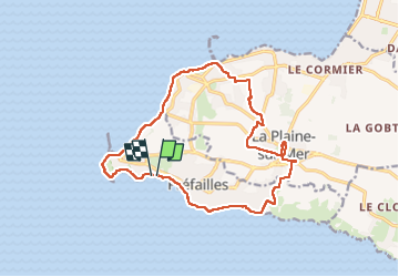
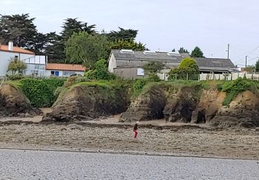
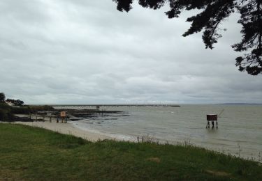
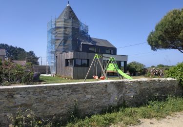
Ruta Senderismo de 16 km a descubrir en Países del Loira, Loira-Atlántico, Préfailles. Esta ruta ha sido propuesta por choubaka77.
Descripción
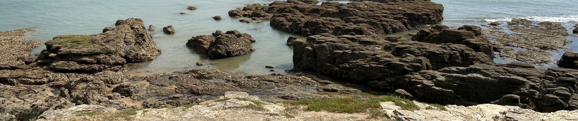
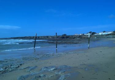
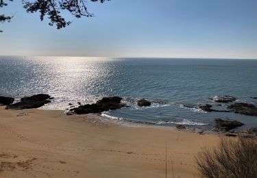
Très belle balade qui fait découvrir toutes les facettes de la partie sud de l’estuaire de la Loire au niveau de la pointe Saint Gildas.
Localización
País:
France
Región :
Países del Loira
Departamento/provincia :
Loira-Atlántico
Municipio :
Préfailles
Localidad:
Unknown
Salida:(Dec)
Salida:(UTM)
558324 ; 5220078 (30T) N.
Comentarios
Excursiones cerca
![Excursión A pie Préfailles - Pointe Saint-Gildas - Photo](https://media.geolcdn.com/t/375/260/ext.jpg?maxdim=2&url=https%3A%2F%2Fmedia.geolcdn.com%2Ff%2Fd0c5c2f6-34d6-4bc5-b58c-e9e0785cf5f0.jpeg)
![A pie A pie](https://static1.geolcdn.com/sitytour/trail-icons/100.png)
Pointe Saint-Gildas
A pie
Fácil
Préfailles,
Países del Loira,
Loira-Atlántico,
France
![](/images/other/stat-length.png)
7,3 km | 8 km-effort
1h 49min
![](https://static1.geolcdn.com/siteimages/upload/files/16400158638029165_repeat_loop_refresh_sync_direction_icon.png)
Sí
![Excursión Senderismo La Plaine-sur-Mer - La plaine sur Mer - Pornic - Photo](https://media.geolcdn.com/t/375/260/ext.jpg?maxdim=2&url=https%3A%2F%2Fmedia.geolcdn.com%2Ff%2F3e6d4e01-0318-4670-946f-5a06ee1210d0.jpg)
![Senderismo Senderismo](https://static1.geolcdn.com/sitytour/trail-icons/101.png)
La plaine sur Mer - Pornic
Senderismo
Medio
La Plaine-sur-Mer,
Países del Loira,
Loira-Atlántico,
France
![](/images/other/stat-length.png)
20 km | 22 km-effort
3h 59min
![](https://static1.geolcdn.com/siteimages/upload/files/16400158638029165_repeat_loop_refresh_sync_direction_icon.png)
No
![Excursión Senderismo Préfailles - Pointe de St Gildas - Photo](https://media.geolcdn.com/t/375/260/ext.jpg?maxdim=2&url=https%3A%2F%2Fmedia.geolcdn.com%2Ff%2F676edf4a-b6e7-4a74-8e49-d68639926018.jpg)
![Senderismo Senderismo](https://static1.geolcdn.com/sitytour/trail-icons/101.png)
Pointe de St Gildas
Senderismo
Muy fácil
Préfailles,
Países del Loira,
Loira-Atlántico,
France
![](/images/other/stat-length.png)
9,5 km | 10,5 km-effort
3h 7min
![](https://static1.geolcdn.com/siteimages/upload/files/16400158638029165_repeat_loop_refresh_sync_direction_icon.png)
Sí
![Excursión Senderismo La Plaine-sur-Mer - pornichet - Photo](https://media.geolcdn.com/t/375/260/ext.jpg?maxdim=2&url=https%3A%2F%2Fmedia.geolcdn.com%2Ff%2Fa6e703b2-84bf-42ae-ac9b-cf1d1769c179.jpg)
![Senderismo Senderismo](https://static1.geolcdn.com/sitytour/trail-icons/101.png)
pornichet
Senderismo
Muy fácil
La Plaine-sur-Mer,
Países del Loira,
Loira-Atlántico,
France
![](/images/other/stat-length.png)
58 km | 63 km-effort
4h 26min
![](https://static1.geolcdn.com/siteimages/upload/files/16400158638029165_repeat_loop_refresh_sync_direction_icon.png)
No
![Excursión Otra actividad La Plaine-sur-Mer - côte des moutons - Photo](https://media.geolcdn.com/t/375/260/ext.jpg?maxdim=2&url=https%3A%2F%2Fservices.sitytrail.com%2FGeolivesWS%2FDownloadMedia.ashx%3FTrailID%3D558942%26Media%3D20160425170255.jpg)
![Otra actividad Otra actividad](https://static1.geolcdn.com/sitytour/trail-icons/900.png)
côte des moutons
Otra actividad
Fácil
La Plaine-sur-Mer,
Países del Loira,
Loira-Atlántico,
France
![](/images/other/stat-length.png)
13 km | 14 km-effort
3h 32min
![](https://static1.geolcdn.com/siteimages/upload/files/16400158638029165_repeat_loop_refresh_sync_direction_icon.png)
Sí
![Excursión Bici de montaña La Plaine-sur-Mer - La Plaine Eric 3 - Photo](https://media.geolcdn.com/t/375/260/ext.jpg?maxdim=2&url=https%3A%2F%2Fstatic1.geolcdn.com%2Fsiteimages%2Fupload%2Ffiles%2F1524743154velo.jpg)
![Bici de montaña Bici de montaña](https://static1.geolcdn.com/sitytour/trail-icons/202.png)
La Plaine Eric 3
Bici de montaña
Medio
La Plaine-sur-Mer,
Países del Loira,
Loira-Atlántico,
France
![](/images/other/stat-length.png)
31 km | 35 km-effort
2h 7min
![](https://static1.geolcdn.com/siteimages/upload/files/16400158638029165_repeat_loop_refresh_sync_direction_icon.png)
Sí
![Excursión Senderismo Saint-Michel-Chef-Chef - 2023-06-03 st Michel chef chef circuit littoral et moulins - Photo](https://media.geolcdn.com/t/375/260/ext.jpg?maxdim=2&url=https%3A%2F%2Fmedia.geolcdn.com%2Ff%2Fb5dec514-b985-4f83-b732-11df6eab5f8a.jpg)
![Senderismo Senderismo](https://static1.geolcdn.com/sitytour/trail-icons/101.png)
2023-06-03 st Michel chef chef circuit littoral et moulins
Senderismo
Difícil
Saint-Michel-Chef-Chef,
Países del Loira,
Loira-Atlántico,
France
![](/images/other/stat-length.png)
15,7 km | 17,2 km-effort
3h 20min
![](https://static1.geolcdn.com/siteimages/upload/files/16400158638029165_repeat_loop_refresh_sync_direction_icon.png)
No
![Excursión Bici de montaña La Plaine-sur-Mer - Claude La Plaine Prefailles - Photo](https://media.geolcdn.com/t/375/260/ext.jpg?maxdim=2&url=https%3A%2F%2Fstatic1.geolcdn.com%2Fsiteimages%2Fupload%2Ffiles%2F1524743154velo.jpg)
![Bici de montaña Bici de montaña](https://static1.geolcdn.com/sitytour/trail-icons/202.png)
Claude La Plaine Prefailles
Bici de montaña
Fácil
La Plaine-sur-Mer,
Países del Loira,
Loira-Atlántico,
France
![](/images/other/stat-length.png)
34 km | 37 km-effort
2h 28min
![](https://static1.geolcdn.com/siteimages/upload/files/16400158638029165_repeat_loop_refresh_sync_direction_icon.png)
No
![Excursión Bici eléctrica Préfailles - prefailles la barre de Monts - Photo](https://media.geolcdn.com/t/375/260/ext.jpg?maxdim=2&url=https%3A%2F%2Fmedia.geolcdn.com%2Ff%2Fe71c9c61-e204-4b69-8995-0cde4b7af8e8.jpg)
![Bici eléctrica Bici eléctrica](https://static1.geolcdn.com/sitytour/trail-icons/205.png)
prefailles la barre de Monts
Bici eléctrica
Muy fácil
Préfailles,
Países del Loira,
Loira-Atlántico,
France
![](/images/other/stat-length.png)
69 km | 0 m-effort
6h 1min
![](https://static1.geolcdn.com/siteimages/upload/files/16400158638029165_repeat_loop_refresh_sync_direction_icon.png)
No