


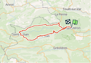

24 km | 46 km-effort


Usuario


Aplicación GPS de excursión GRATIS
 SityTrail
IGN / Institutos geográficos
SityTrail World
El mundo es suyo
Ruta Bici eléctrica de 68 km a descubrir en Provenza-Alpes-Costa Azul, Alpes Marítimos, Roquestéron. Esta ruta ha sido propuesta por franquen.
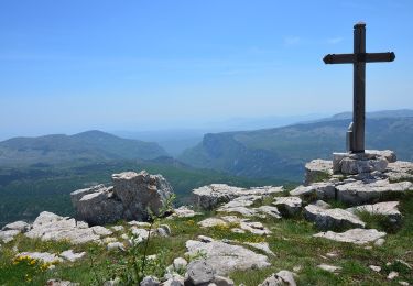
Très beau circuit permettant d'admirer la clue d'Aiglun, la clue de St Auban et la clue de Riolan. Il est conseillé de faire la boucle comme indiqué car dans l'autre sens la montée Coullongues est interminable
A pie

A pie

Senderismo

Senderismo
Senderismo
Senderismo
Senderismo
Senderismo
Senderismo