![](/images/other/stat-length.png)
![Excursión Senderismo Falicon - Pyramide de Nice Falicon - Photo](https://media.geolcdn.com/t/1900/400/415c79b7-5c03-4a3d-bd21-10474bc4f68a.jpg&format=pjpeg&maxdim=2)
Pyramide de Nice Falicon
jll7513
Usuario
![Longitud](/images/other/stat-length.png)
Longitud
4 km
![Altitud máxima](https://static1.geolcdn.com/siteimages/upload/files/1508320355ic_sort_altitude_max_24dp.png)
Altitud máxima
497 m
![Desnivel positivo](https://static1.geolcdn.com/siteimages/upload/files/1508320355ic_sort_den_pos_24dp.png)
Desnivel positivo
145 m
![Km-Effort](/images/other/stat-length.png)
Km-Effort
6 km
![Altitud mínima](https://static1.geolcdn.com/siteimages/upload/files/1508320355ic_sort_altitude_min_24dp.png)
Altitud mínima
350 m
![Desnivel negativo](https://static1.geolcdn.com/siteimages/upload/files/1508320355ic_sort_den_neg_24dp.png)
Desnivel negativo
154 m
![Boucle](https://static1.geolcdn.com/siteimages/upload/files/16400158638029165_repeat_loop_refresh_sync_direction_icon.png)
Boucle
Sí
Fecha de creación :
2023-04-08 06:09:28.0
Última modificación :
2023-04-09 16:48:16.615
![Senderismo](https://static1.geolcdn.com/sitytour/trail-icons/101.png)
1h07
Dificultad : Fácil
![Escanee este código QR para abrir la excursión en la aplicación SityTrail](https://capi.geolives.com/qq0zvz2zws4bq2lad0pu/sitytour/trails/3613226/qr.png?size=200)
Aplicación GPS de excursión GRATIS
A propósito
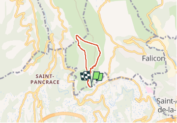
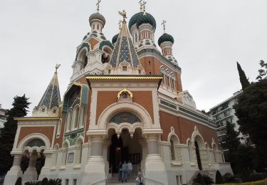
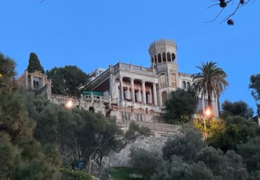
Ruta Senderismo de 4 km a descubrir en Provenza-Alpes-Costa Azul, Alpes Marítimos, Falicon. Esta ruta ha sido propuesta por jll7513.
Descripción
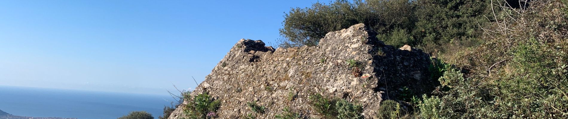
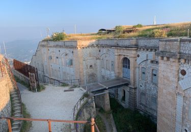
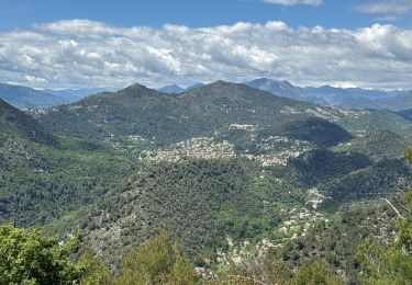
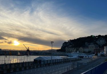
Petite rando bien sympathique. En arrivant de bonne heure , on peut se garer sur la route d´accès. Beaux points de vue sur la ville et sur la mer. Le début du retour se fait sur la route du gaz. .
Localización
País:
France
Región :
Provenza-Alpes-Costa Azul
Departamento/provincia :
Alpes Marítimos
Municipio :
Falicon
Localidad:
Unknown
Salida:(Dec)
Salida:(UTM)
359682 ; 4844682 (32T) N.
Comentarios
Excursiones cerca
![Excursión Senderismo Aspremont - Aspremont tour du Mont Chauve, montée au fort. - Photo](https://media.geolcdn.com/t/375/260/16e89ccd-b354-4ef1-b144-0fc157d8768e.jpg&format=jpg&maxdim=2)
![Senderismo Senderismo](https://static1.geolcdn.com/sitytour/trail-icons/101.png)
Aspremont tour du Mont Chauve, montée au fort.
Senderismo
Difícil
(1)
Aspremont,
Provenza-Alpes-Costa Azul,
Alpes Marítimos,
France
![](/images/other/stat-length.png)
7,5 km | 12 km-effort
2h 44min
![](https://static1.geolcdn.com/siteimages/upload/files/16400158638029165_repeat_loop_refresh_sync_direction_icon.png)
Sí
![Excursión Senderismo Niza - Ballade chemin des douaniers Nice-Villefranche - Photo](https://media.geolcdn.com/t/375/260/c2d5ab1c-da60-4999-9c1c-1e8798e5ba02.jpg&format=jpg&maxdim=2)
![Senderismo Senderismo](https://static1.geolcdn.com/sitytour/trail-icons/101.png)
Ballade chemin des douaniers Nice-Villefranche
Senderismo
Muy fácil
(1)
Niza,
Provenza-Alpes-Costa Azul,
Alpes Marítimos,
France
![](/images/other/stat-length.png)
7,9 km | 10,3 km-effort
2h 13min
![](https://static1.geolcdn.com/siteimages/upload/files/16400158638029165_repeat_loop_refresh_sync_direction_icon.png)
No
![Excursión Senderismo Aspremont - Vallon OBSCUR aux portes de Nice - Photo](https://media.geolcdn.com/t/375/260/16c0b49c-5599-47d7-b53d-8d16968f7369.jpg&format=jpg&maxdim=2)
![Senderismo Senderismo](https://static1.geolcdn.com/sitytour/trail-icons/101.png)
Vallon OBSCUR aux portes de Nice
Senderismo
Medio
(1)
Aspremont,
Provenza-Alpes-Costa Azul,
Alpes Marítimos,
France
![](/images/other/stat-length.png)
5,4 km | 8,5 km-effort
3h 20min
![](https://static1.geolcdn.com/siteimages/upload/files/16400158638029165_repeat_loop_refresh_sync_direction_icon.png)
Sí
![Excursión Senderismo Cantaron - Cantaron : Monts Macaron et Ubac par Levens Tourette réelle - Photo](https://media.geolcdn.com/t/375/260/60da6868-ad90-4803-993b-f92b5b64ec1d.jpg&format=jpg&maxdim=2)
![Senderismo Senderismo](https://static1.geolcdn.com/sitytour/trail-icons/101.png)
Cantaron : Monts Macaron et Ubac par Levens Tourette réelle
Senderismo
Muy difícil
Cantaron,
Provenza-Alpes-Costa Azul,
Alpes Marítimos,
France
![](/images/other/stat-length.png)
19,7 km | 35 km-effort
7h 57min
![](https://static1.geolcdn.com/siteimages/upload/files/16400158638029165_repeat_loop_refresh_sync_direction_icon.png)
Sí
![Excursión Carrera Aspremont - Tour des Monts d'Aspremont 2007 - Photo](https://media.geolcdn.com/t/375/260/ext.jpg?maxdim=2&url=https%3A%2F%2Fstatic1.geolcdn.com%2Fsiteimages%2Fupload%2Ffiles%2F1524743154running.jpg)
![Carrera Carrera](https://static1.geolcdn.com/sitytour/trail-icons/103.png)
Tour des Monts d'Aspremont 2007
Carrera
Muy difícil
(2)
Aspremont,
Provenza-Alpes-Costa Azul,
Alpes Marítimos,
France
![](/images/other/stat-length.png)
21 km | 33 km-effort
3h 0min
![](https://static1.geolcdn.com/siteimages/upload/files/16400158638029165_repeat_loop_refresh_sync_direction_icon.png)
Sí
![Excursión Senderismo Niza - Nice cathédrale Russe - Photo](https://media.geolcdn.com/t/375/260/a2805ec0-0633-4ac1-93e3-767707679f1d.jpg&format=jpg&maxdim=2)
![Senderismo Senderismo](https://static1.geolcdn.com/sitytour/trail-icons/101.png)
Nice cathédrale Russe
Senderismo
Muy fácil
Niza,
Provenza-Alpes-Costa Azul,
Alpes Marítimos,
France
![](/images/other/stat-length.png)
6,9 km | 7,8 km-effort
2h 10min
![](https://static1.geolcdn.com/siteimages/upload/files/16400158638029165_repeat_loop_refresh_sync_direction_icon.png)
Sí
![Excursión Senderismo Cantaron - Cantaron : Monts Macaron et Ubac - Photo](https://media.geolcdn.com/t/375/260/0c099172-d426-4bc6-b370-544c7fbae01b.jpg&format=jpg&maxdim=2)
![Senderismo Senderismo](https://static1.geolcdn.com/sitytour/trail-icons/101.png)
Cantaron : Monts Macaron et Ubac
Senderismo
Medio
Cantaron,
Provenza-Alpes-Costa Azul,
Alpes Marítimos,
France
![](/images/other/stat-length.png)
19 km | 34 km-effort
7h 47min
![](https://static1.geolcdn.com/siteimages/upload/files/16400158638029165_repeat_loop_refresh_sync_direction_icon.png)
Sí
![Excursión Senderismo Niza - Nice - Tour du Mont Boron - Photo](https://media.geolcdn.com/t/375/260/bd67743c-530f-4072-b544-a2d6a051157c.jpg&format=jpg&maxdim=2)
![Senderismo Senderismo](https://static1.geolcdn.com/sitytour/trail-icons/101.png)
Nice - Tour du Mont Boron
Senderismo
Fácil
(1)
Niza,
Provenza-Alpes-Costa Azul,
Alpes Marítimos,
France
![](/images/other/stat-length.png)
7,3 km | 10,5 km-effort
2h 48min
![](https://static1.geolcdn.com/siteimages/upload/files/16400158638029165_repeat_loop_refresh_sync_direction_icon.png)
Sí
![Excursión Senderismo Niza - Balade Niçoise : Centre-Ville, Vieux-Nice, Le Port - Photo](https://media.geolcdn.com/t/375/260/5be08919-2063-4c5c-846d-f0957257afa5.jpg&format=jpg&maxdim=2)
![Senderismo Senderismo](https://static1.geolcdn.com/sitytour/trail-icons/101.png)
Balade Niçoise : Centre-Ville, Vieux-Nice, Le Port
Senderismo
Muy fácil
Niza,
Provenza-Alpes-Costa Azul,
Alpes Marítimos,
France
![](/images/other/stat-length.png)
5,4 km | 7,2 km-effort
2h 30min
![](https://static1.geolcdn.com/siteimages/upload/files/16400158638029165_repeat_loop_refresh_sync_direction_icon.png)
Sí