![](/images/other/stat-length.png)
![Excursión Senderismo Bonnelles - 2023-03-29 Rando Bullion - Photo](https://media.geolcdn.com/t/1900/400/ext.pjpeg?maxdim=2&url=https%3A%2F%2Fstatic1.geolcdn.com%2Fsiteimages%2Fupload%2Ffiles%2F1553511878bg_sport_marche.png)
2023-03-29 Rando Bullion
jchezlemas
Usuario
![Longitud](/images/other/stat-length.png)
Longitud
12,3 km
![Altitud máxima](https://static1.geolcdn.com/siteimages/upload/files/1508320355ic_sort_altitude_max_24dp.png)
Altitud máxima
176 m
![Desnivel positivo](https://static1.geolcdn.com/siteimages/upload/files/1508320355ic_sort_den_pos_24dp.png)
Desnivel positivo
165 m
![Km-Effort](/images/other/stat-length.png)
Km-Effort
14,5 km
![Altitud mínima](https://static1.geolcdn.com/siteimages/upload/files/1508320355ic_sort_altitude_min_24dp.png)
Altitud mínima
106 m
![Desnivel negativo](https://static1.geolcdn.com/siteimages/upload/files/1508320355ic_sort_den_neg_24dp.png)
Desnivel negativo
164 m
![Boucle](https://static1.geolcdn.com/siteimages/upload/files/16400158638029165_repeat_loop_refresh_sync_direction_icon.png)
Boucle
Sí
Fecha de creación :
2023-03-29 07:16:04.071
Última modificación :
2023-03-29 17:16:24.459
![Senderismo](https://static1.geolcdn.com/sitytour/trail-icons/101.png)
2h43
Dificultad : Muy fácil
![Escanee este código QR para abrir la excursión en la aplicación SityTrail](https://capi.geolives.com/qq0zvz2zws4bq2lad0pu/sitytour/trails/3601618/qr.png?size=200)
Aplicación GPS de excursión GRATIS
A propósito
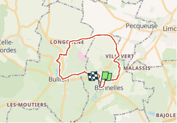
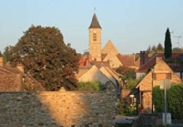
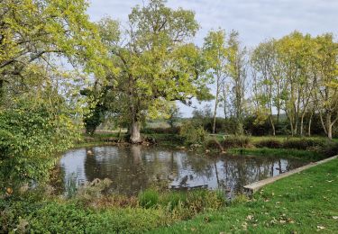
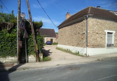
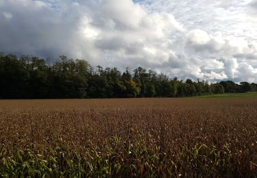
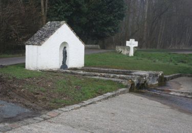
Ruta Senderismo de 12,3 km a descubrir en Isla de Francia, Yvelines, Bonnelles. Esta ruta ha sido propuesta por jchezlemas.
Descripción
Rando de Martine et Alain Gauthier
Office de Tourisme de l'Arpajonnais
https://www.ot-coeuressonne.fr/
Localización
País:
France
Región :
Isla de Francia
Departamento/provincia :
Yvelines
Municipio :
Bonnelles
Localidad:
Unknown
Salida:(Dec)
Salida:(UTM)
428032 ; 5385491 (31U) N.
Comentarios
Excursiones cerca
![Excursión Senderismo Bonnelles - _Le rallye de Bonnelles à Rochefort - Photo](https://media.geolcdn.com/t/375/260/ext.jpg?maxdim=2&url=https%3A%2F%2Fservices.sitytrail.com%2FGeolivesWS%2FDownloadMedia.ashx%3FTrailID%3D172070%26Media%3De98fa123-dbbb-4948-ab08-19666b29bb58.jpg)
![Senderismo Senderismo](https://static1.geolcdn.com/sitytour/trail-icons/101.png)
_Le rallye de Bonnelles à Rochefort
Senderismo
Medio
(10)
Bonnelles,
Isla de Francia,
Yvelines,
France
![](/images/other/stat-length.png)
14,1 km | 16,4 km-effort
3h 30min
![](https://static1.geolcdn.com/siteimages/upload/files/16400158638029165_repeat_loop_refresh_sync_direction_icon.png)
Sí
![Excursión Senderismo Longvilliers - _Les Moulins de la Rémarde - Photo](https://media.geolcdn.com/t/375/260/ext.jpg?maxdim=2&url=https%3A%2F%2Fservices.sitytrail.com%2FGeolivesWS%2FDownloadMedia.ashx%3FTrailID%3D172068%26Media%3Db1cdb090-96c0-44bf-89a1-996bab033954.jpg)
![Senderismo Senderismo](https://static1.geolcdn.com/sitytour/trail-icons/101.png)
_Les Moulins de la Rémarde
Senderismo
Fácil
(8)
Longvilliers,
Isla de Francia,
Yvelines,
France
![](/images/other/stat-length.png)
9,3 km | 10,4 km-effort
2h 0min
![](https://static1.geolcdn.com/siteimages/upload/files/16400158638029165_repeat_loop_refresh_sync_direction_icon.png)
Sí
![Excursión Senderismo Bullion - _Bullion, village vivant ! - Photo](https://media.geolcdn.com/t/375/260/ext.jpg?maxdim=2&url=https%3A%2F%2Fservices.sitytrail.com%2FGeolivesWS%2FDownloadMedia.ashx%3FTrailID%3D172071%26Media%3D4b3b53c0-a03c-424c-96bf-4753188fab20.jpg)
![Senderismo Senderismo](https://static1.geolcdn.com/sitytour/trail-icons/101.png)
_Bullion, village vivant !
Senderismo
Muy fácil
(5)
Bullion,
Isla de Francia,
Yvelines,
France
![](/images/other/stat-length.png)
7,1 km | 8,5 km-effort
1h 52min
![](https://static1.geolcdn.com/siteimages/upload/files/16400158638029165_repeat_loop_refresh_sync_direction_icon.png)
Sí
![Excursión Senderismo Limours - Essonne_Tour_des_Fermes_de_la_Prédecelle - Photo](https://media.geolcdn.com/t/375/260/2a39169f-a228-484c-b261-d2ccff03535e.jpg&format=jpg&maxdim=2)
![Senderismo Senderismo](https://static1.geolcdn.com/sitytour/trail-icons/101.png)
Essonne_Tour_des_Fermes_de_la_Prédecelle
Senderismo
Muy fácil
(1)
Limours,
Isla de Francia,
Essonne,
France
![](/images/other/stat-length.png)
12,9 km | 14,3 km-effort
3h 43min
![](https://static1.geolcdn.com/siteimages/upload/files/16400158638029165_repeat_loop_refresh_sync_direction_icon.png)
Sí
![Excursión Senderismo Bullion - _Le bois d''Haumont - Photo](https://media.geolcdn.com/t/375/260/ext.jpg?maxdim=2&url=https%3A%2F%2Fservices.sitytrail.com%2FGeolivesWS%2FDownloadMedia.ashx%3FTrailID%3D172072%26Media%3D9dbe9f7c-fb0a-44be-ab73-8dc5727df278.JPG)
![Senderismo Senderismo](https://static1.geolcdn.com/sitytour/trail-icons/101.png)
_Le bois d''Haumont
Senderismo
Fácil
(4)
Bullion,
Isla de Francia,
Yvelines,
France
![](/images/other/stat-length.png)
5,8 km | 7,1 km-effort
1h 30min
![](https://static1.geolcdn.com/siteimages/upload/files/16400158638029165_repeat_loop_refresh_sync_direction_icon.png)
Sí
![Excursión Senderismo Limours - Essonne_RD_Limours=>Viaduc=>Prédecelle=>Chaumusson - Photo](https://media.geolcdn.com/t/375/260/c60124a9-cca7-4dae-90e5-561e58250ffa.jpg&format=jpg&maxdim=2)
![Senderismo Senderismo](https://static1.geolcdn.com/sitytour/trail-icons/101.png)
Essonne_RD_Limours=>Viaduc=>Prédecelle=>Chaumusson
Senderismo
Fácil
(1)
Limours,
Isla de Francia,
Essonne,
France
![](/images/other/stat-length.png)
7,4 km | 8,4 km-effort
2h 30min
![](https://static1.geolcdn.com/siteimages/upload/files/16400158638029165_repeat_loop_refresh_sync_direction_icon.png)
Sí
![Excursión Senderismo Limours - 20210319_Limours_Viaduc_Prédecelle_Amont - Photo](https://media.geolcdn.com/t/375/260/c60124a9-cca7-4dae-90e5-561e58250ffa.jpg&format=jpg&maxdim=2)
![Senderismo Senderismo](https://static1.geolcdn.com/sitytour/trail-icons/101.png)
20210319_Limours_Viaduc_Prédecelle_Amont
Senderismo
Fácil
(1)
Limours,
Isla de Francia,
Essonne,
France
![](/images/other/stat-length.png)
8,7 km | 9,9 km-effort
2h 30min
![](https://static1.geolcdn.com/siteimages/upload/files/16400158638029165_repeat_loop_refresh_sync_direction_icon.png)
Sí
![Excursión Senderismo Pecqueuse - 20191019_Tour_des_Fermes_réalisé - Photo](https://media.geolcdn.com/t/375/260/3b6cb32e-1ca9-460c-8665-52898ea68512.jpg&format=jpg&maxdim=2)
![Senderismo Senderismo](https://static1.geolcdn.com/sitytour/trail-icons/101.png)
20191019_Tour_des_Fermes_réalisé
Senderismo
Muy fácil
(1)
Pecqueuse,
Isla de Francia,
Essonne,
France
![](/images/other/stat-length.png)
13,8 km | 15,2 km-effort
3h 43min
![](https://static1.geolcdn.com/siteimages/upload/files/16400158638029165_repeat_loop_refresh_sync_direction_icon.png)
Sí
![Excursión Senderismo Bullion - Autour de Bullion - Photo](https://media.geolcdn.com/t/375/260/ext.jpg?maxdim=2&url=https%3A%2F%2Fservices.sitytrail.com%2FGeolivesWS%2FDownloadMedia.ashx%3FTrailID%3D102194%26Media%3D2593_2.jpg)
![Senderismo Senderismo](https://static1.geolcdn.com/sitytour/trail-icons/101.png)
Autour de Bullion
Senderismo
Difícil
(1)
Bullion,
Isla de Francia,
Yvelines,
France
![](/images/other/stat-length.png)
22 km | 26 km-effort
4h 30min
![](https://static1.geolcdn.com/siteimages/upload/files/16400158638029165_repeat_loop_refresh_sync_direction_icon.png)
Sí