![](/images/other/stat-length.png)
![Excursión Senderismo Saint-Georges-de-Commiers - Boucle autour de Saint Georges de Commiers - Photo](https://media.geolcdn.com/t/1900/400/0bfddc52-e2d2-4332-a925-7e71f6c56a54.jpg&format=pjpeg&maxdim=2)
Boucle autour de Saint Georges de Commiers
permanent 31
Usuario
![Longitud](/images/other/stat-length.png)
![Altitud máxima](https://static1.geolcdn.com/siteimages/upload/files/1508320355ic_sort_altitude_max_24dp.png)
![Desnivel positivo](https://static1.geolcdn.com/siteimages/upload/files/1508320355ic_sort_den_pos_24dp.png)
![Km-Effort](/images/other/stat-length.png)
![Altitud mínima](https://static1.geolcdn.com/siteimages/upload/files/1508320355ic_sort_altitude_min_24dp.png)
![Desnivel negativo](https://static1.geolcdn.com/siteimages/upload/files/1508320355ic_sort_den_neg_24dp.png)
![Boucle](https://static1.geolcdn.com/siteimages/upload/files/16400158638029165_repeat_loop_refresh_sync_direction_icon.png)
![Senderismo](https://static1.geolcdn.com/sitytour/trail-icons/101.png)
2h26
Dificultad : Difícil
![Escanee este código QR para abrir la excursión en la aplicación SityTrail](https://capi.geolives.com/qq0zvz2zws4bq2lad0pu/sitytour/trails/3588314/qr.png?size=200)
Aplicación GPS de excursión GRATIS
A propósito
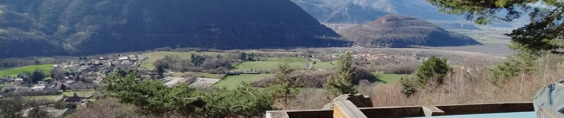
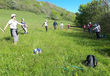
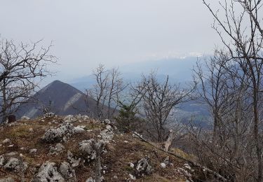
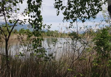
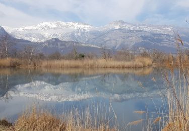
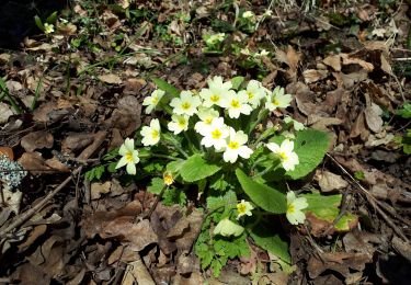
Ruta Senderismo de 8,2 km a descubrir en Auvergne-Rhône-Alpes, Isère, Saint-Georges-de-Commiers. Esta ruta ha sido propuesta por permanent 31.
Descripción
En surplomb de la vallée du Drac en longeant les voies du petit train de La Mure jusqu’à Notre Dame de Commiers. Retour par chemins au dessus de St Pierre//St Georges de Commiers sur les contreforts du Conest.
Beaucoup de charme
Localización
Comentarios
Excursiones cerca
![Excursión Senderismo Champ-sur-Drac - 38 Couvent St Michel Champ / drac - Photo](https://media.geolcdn.com/t/375/260/2541c209-e2b9-4fc5-ac0c-29659bf67ee5.jpg&format=jpg&maxdim=2)
![Senderismo Senderismo](https://static1.geolcdn.com/sitytour/trail-icons/101.png)
Senderismo
![](/images/other/stat-length.png)
![](https://static1.geolcdn.com/siteimages/upload/files/16400158638029165_repeat_loop_refresh_sync_direction_icon.png)
![Excursión Senderismo Varces-Allières-et-Risset - Les Etangs de Reymure réaménagés en 2023. - Photo](https://media.geolcdn.com/t/375/260/a9036917-cc32-4324-8d0a-4d872f501612.jpg&format=jpg&maxdim=2)
![Senderismo Senderismo](https://static1.geolcdn.com/sitytour/trail-icons/101.png)
Senderismo
![](/images/other/stat-length.png)
![](https://static1.geolcdn.com/siteimages/upload/files/16400158638029165_repeat_loop_refresh_sync_direction_icon.png)
![Excursión Senderismo Vif - la ferme oriol en circuit - Photo](https://media.geolcdn.com/t/375/260/40456475-f1df-45a6-819a-93e9ddb16412.jpg&format=jpg&maxdim=2)
![Senderismo Senderismo](https://static1.geolcdn.com/sitytour/trail-icons/101.png)
Senderismo
![](/images/other/stat-length.png)
![](https://static1.geolcdn.com/siteimages/upload/files/16400158638029165_repeat_loop_refresh_sync_direction_icon.png)
![Excursión Senderismo Saint-Jean-de-Vaulx - Beauregard - Photo](https://media.geolcdn.com/t/375/260/8654abbb-ac45-4c31-9816-ec7c55c81e78.jpg&format=jpg&maxdim=2)
![Senderismo Senderismo](https://static1.geolcdn.com/sitytour/trail-icons/101.png)
Senderismo
![](/images/other/stat-length.png)
![](https://static1.geolcdn.com/siteimages/upload/files/16400158638029165_repeat_loop_refresh_sync_direction_icon.png)
![Excursión Marcha nórdica Saint-Jean-de-Vaulx - Alpage du Conest en traversée - Photo](https://media.geolcdn.com/t/375/260/3b20f2c5-846f-479a-a83a-77deaede7ec9.jpg&format=jpg&maxdim=2)
![Marcha nórdica Marcha nórdica](https://static1.geolcdn.com/sitytour/trail-icons/102.png)
Marcha nórdica
![](/images/other/stat-length.png)
![](https://static1.geolcdn.com/siteimages/upload/files/16400158638029165_repeat_loop_refresh_sync_direction_icon.png)
![Excursión Senderismo Le Gua - Un tour de L'Eperrimont par le sommet ! - Photo](https://media.geolcdn.com/t/375/260/86c123e6-6997-4f93-970a-703604abf85f.jpg&format=jpg&maxdim=2)
![Senderismo Senderismo](https://static1.geolcdn.com/sitytour/trail-icons/101.png)
Senderismo
![](/images/other/stat-length.png)
![](https://static1.geolcdn.com/siteimages/upload/files/16400158638029165_repeat_loop_refresh_sync_direction_icon.png)
![Excursión Marcha nórdica Vif - Les Etangs de la Plaine de Reymure - Photo](https://media.geolcdn.com/t/375/260/1d6be850-f5d4-4e8e-a42b-a881c0492ad2.jpg&format=jpg&maxdim=2)
![Marcha nórdica Marcha nórdica](https://static1.geolcdn.com/sitytour/trail-icons/102.png)
Marcha nórdica
![](/images/other/stat-length.png)
![](https://static1.geolcdn.com/siteimages/upload/files/16400158638029165_repeat_loop_refresh_sync_direction_icon.png)
![Excursión Marcha nórdica Varces-Allières-et-Risset - De la plaine de Reymure au canal de Malissolles - Photo](https://media.geolcdn.com/t/375/260/3d91b17d-7f71-4e45-96ae-37747dd4929a.jpg&format=jpg&maxdim=2)
![Marcha nórdica Marcha nórdica](https://static1.geolcdn.com/sitytour/trail-icons/102.png)
Marcha nórdica
![](/images/other/stat-length.png)
![](https://static1.geolcdn.com/siteimages/upload/files/16400158638029165_repeat_loop_refresh_sync_direction_icon.png)
![Excursión Senderismo Vif - Circuit entre Vif et les sources de l'Echaillon par la cabane d'Uriol avec retour par Champrond - Photo](https://media.geolcdn.com/t/375/260/064ad078-4d4b-4439-8dbb-d18d7e525498.jpg&format=jpg&maxdim=2)
![Senderismo Senderismo](https://static1.geolcdn.com/sitytour/trail-icons/101.png)
Senderismo
![](/images/other/stat-length.png)
![](https://static1.geolcdn.com/siteimages/upload/files/16400158638029165_repeat_loop_refresh_sync_direction_icon.png)