![](/images/other/stat-length.png)
![Excursión Senderismo Anzegem - Anzegem - Photo](https://media.geolcdn.com/t/1900/400/ext.pjpeg?maxdim=2&url=https%3A%2F%2Fstatic1.geolcdn.com%2Fsiteimages%2Fupload%2Ffiles%2F1553511878bg_sport_marche.png)
Anzegem
Greg813
Usuario
![Longitud](/images/other/stat-length.png)
Longitud
18,6 km
![Altitud máxima](https://static1.geolcdn.com/siteimages/upload/files/1508320355ic_sort_altitude_max_24dp.png)
Altitud máxima
82 m
![Desnivel positivo](https://static1.geolcdn.com/siteimages/upload/files/1508320355ic_sort_den_pos_24dp.png)
Desnivel positivo
211 m
![Km-Effort](/images/other/stat-length.png)
Km-Effort
21 km
![Altitud mínima](https://static1.geolcdn.com/siteimages/upload/files/1508320355ic_sort_altitude_min_24dp.png)
Altitud mínima
17 m
![Desnivel negativo](https://static1.geolcdn.com/siteimages/upload/files/1508320355ic_sort_den_neg_24dp.png)
Desnivel negativo
212 m
![Boucle](https://static1.geolcdn.com/siteimages/upload/files/16400158638029165_repeat_loop_refresh_sync_direction_icon.png)
Boucle
Sí
Fecha de creación :
2023-03-12 08:40:10.771
Última modificación :
2023-03-13 13:49:24.046
![Senderismo](https://static1.geolcdn.com/sitytour/trail-icons/101.png)
4h04
Dificultad : Medio
![Escanee este código QR para abrir la excursión en la aplicación SityTrail](https://capi.geolives.com/qq0zvz2zws4bq2lad0pu/sitytour/trails/3582610/qr.png?size=200)
Aplicación GPS de excursión GRATIS
A propósito
Ruta Senderismo de 18,6 km a descubrir en Flandes, Flandes Occidental, Anzegem. Esta ruta ha sido propuesta por Greg813.
Descripción
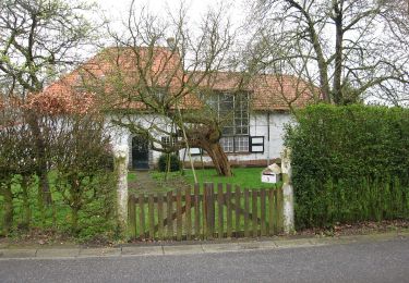
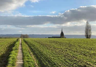
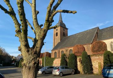
Randonnée avec Mettons le Monde en Marche en Flandres belges autour d'Anzegem.
Pour d'autres photos, voir le site de l'association :
https://mmm-rando.org/anzegem-2023/
Localización
País:
Belgium
Región :
Flandes
Departamento/provincia :
Flandes Occidental
Municipio :
Anzegem
Localidad:
Anzegem
Salida:(Dec)
Salida:(UTM)
533752 ; 5631680 (31U) N.
Comentarios
Excursiones cerca
![Excursión A pie Anzegem - Kleine Kluis wandelroute - Photo](https://media.geolcdn.com/t/375/260/c9bce239-b59f-41ee-919d-92c5b1fb521a.jpeg&format=jpg&maxdim=2)
![A pie A pie](https://static1.geolcdn.com/sitytour/trail-icons/100.png)
Kleine Kluis wandelroute
A pie
Fácil
Anzegem,
Flandes,
Flandes Occidental,
Belgium
![](/images/other/stat-length.png)
7,7 km | 9 km-effort
2h 2min
![](https://static1.geolcdn.com/siteimages/upload/files/16400158638029165_repeat_loop_refresh_sync_direction_icon.png)
Sí
![Excursión A pie Anzegem - Streuvels wandelroute - Photo](https://media.geolcdn.com/t/375/260/06f94339-110f-4e54-94ef-e0eea7d6de9e.jpeg&format=jpg&maxdim=2)
![A pie A pie](https://static1.geolcdn.com/sitytour/trail-icons/100.png)
Streuvels wandelroute
A pie
Fácil
Anzegem,
Flandes,
Flandes Occidental,
Belgium
![](/images/other/stat-length.png)
6,5 km | 7,8 km-effort
1h 46min
![](https://static1.geolcdn.com/siteimages/upload/files/16400158638029165_repeat_loop_refresh_sync_direction_icon.png)
Sí
![Excursión Senderismo Wortegem-Petegem - Wortegem 12,7 km - Photo](https://media.geolcdn.com/t/375/260/9ff34f99-a6b3-41ce-a23a-9793b47fa9ba.jpg&format=jpg&maxdim=2)
![Senderismo Senderismo](https://static1.geolcdn.com/sitytour/trail-icons/101.png)
Wortegem 12,7 km
Senderismo
Fácil
Wortegem-Petegem,
Flandes,
Provincia de Flandes Oriental,
Belgium
![](/images/other/stat-length.png)
12,7 km | 14,6 km-effort
3h 21min
![](https://static1.geolcdn.com/siteimages/upload/files/16400158638029165_repeat_loop_refresh_sync_direction_icon.png)
Sí
![Excursión Senderismo Anzegem - Kaster 19 km - Photo](https://media.geolcdn.com/t/375/260/cd087088-349b-46ac-914e-e2974ea749d3.jpg&format=jpg&maxdim=2)
![Senderismo Senderismo](https://static1.geolcdn.com/sitytour/trail-icons/101.png)
Kaster 19 km
Senderismo
Medio
Anzegem,
Flandes,
Flandes Occidental,
Belgium
![](/images/other/stat-length.png)
18,9 km | 22 km-effort
5h 7min
![](https://static1.geolcdn.com/siteimages/upload/files/16400158638029165_repeat_loop_refresh_sync_direction_icon.png)
Sí
![Excursión Senderismo Anzegem - Kaster 16,5 km - Photo](https://media.geolcdn.com/t/375/260/521238e5-89f9-4b18-bd04-3fe12dcb2800.jpg&format=jpg&maxdim=2)
![Senderismo Senderismo](https://static1.geolcdn.com/sitytour/trail-icons/101.png)
Kaster 16,5 km
Senderismo
Fácil
Anzegem,
Flandes,
Flandes Occidental,
Belgium
![](/images/other/stat-length.png)
16,5 km | 18,8 km-effort
4h 3min
![](https://static1.geolcdn.com/siteimages/upload/files/16400158638029165_repeat_loop_refresh_sync_direction_icon.png)
Sí
![Excursión Otra actividad Wortegem-Petegem - eerste ritje - Photo](https://media.geolcdn.com/t/375/260/ext.jpg?maxdim=2&url=https%3A%2F%2Fservices.sitytrail.com%2FGeolivesWS%2FDownloadMedia.ashx%3FTrailID%3D48984%26Media%3Dimage1.jpg)
![Otra actividad Otra actividad](https://static1.geolcdn.com/sitytour/trail-icons/900.png)
eerste ritje
Otra actividad
Muy fácil
Wortegem-Petegem,
Flandes,
Provincia de Flandes Oriental,
Belgium
![](/images/other/stat-length.png)
25 km | 28 km-effort
Desconocido
![](https://static1.geolcdn.com/siteimages/upload/files/16400158638029165_repeat_loop_refresh_sync_direction_icon.png)
No
![Excursión Senderismo Wortegem-Petegem - wortegem 13,5 km - Photo](https://media.geolcdn.com/t/375/260/ext.jpg?maxdim=2&url=https%3A%2F%2Fstatic1.geolcdn.com%2Fsiteimages%2Fupload%2Ffiles%2F1553511878bg_sport_marche.png)
![Senderismo Senderismo](https://static1.geolcdn.com/sitytour/trail-icons/101.png)
wortegem 13,5 km
Senderismo
Muy fácil
Wortegem-Petegem,
Flandes,
Provincia de Flandes Oriental,
Belgium
![](/images/other/stat-length.png)
14,1 km | 16,2 km-effort
3h 32min
![](https://static1.geolcdn.com/siteimages/upload/files/16400158638029165_repeat_loop_refresh_sync_direction_icon.png)
Sí
![Excursión Senderismo Waregem - Nokere Waregem Flanders Field naar Nokere - 16 km RT - Photo](https://media.geolcdn.com/t/375/260/ext.jpg?maxdim=2&url=https%3A%2F%2Fstatic1.geolcdn.com%2Fsiteimages%2Fupload%2Ffiles%2F1553511878bg_sport_marche.png)
![Senderismo Senderismo](https://static1.geolcdn.com/sitytour/trail-icons/101.png)
Nokere Waregem Flanders Field naar Nokere - 16 km RT
Senderismo
Muy fácil
Waregem,
Flandes,
Flandes Occidental,
Belgium
![](/images/other/stat-length.png)
15,6 km | 18 km-effort
Desconocido
![](https://static1.geolcdn.com/siteimages/upload/files/16400158638029165_repeat_loop_refresh_sync_direction_icon.png)
Sí
![Excursión Senderismo Anzegem - Kaster Juliaan Clearhout Pad - 7 km RT - Photo](https://media.geolcdn.com/t/375/260/ext.jpg?maxdim=2&url=https%3A%2F%2Fstatic1.geolcdn.com%2Fsiteimages%2Fupload%2Ffiles%2F1553511878bg_sport_marche.png)
![Senderismo Senderismo](https://static1.geolcdn.com/sitytour/trail-icons/101.png)
Kaster Juliaan Clearhout Pad - 7 km RT
Senderismo
Muy fácil
(1)
Anzegem,
Flandes,
Flandes Occidental,
Belgium
![](/images/other/stat-length.png)
7 km | 7,8 km-effort
Desconocido
![](https://static1.geolcdn.com/siteimages/upload/files/16400158638029165_repeat_loop_refresh_sync_direction_icon.png)
Sí