![](/images/other/stat-length.png)
![Excursión Senderismo Rendeux - Cheoux Rendeux Chroix - Photo](https://media.geolcdn.com/t/1900/400/01c4f992-903a-4926-9029-561f1ee753c6.jpg&format=pjpeg&maxdim=2)
Cheoux Rendeux Chroix
Thierry Deppe
Usuario
![Longitud](/images/other/stat-length.png)
Longitud
20 km
![Altitud máxima](https://static1.geolcdn.com/siteimages/upload/files/1508320355ic_sort_altitude_max_24dp.png)
Altitud máxima
436 m
![Desnivel positivo](https://static1.geolcdn.com/siteimages/upload/files/1508320355ic_sort_den_pos_24dp.png)
Desnivel positivo
538 m
![Km-Effort](/images/other/stat-length.png)
Km-Effort
27 km
![Altitud mínima](https://static1.geolcdn.com/siteimages/upload/files/1508320355ic_sort_altitude_min_24dp.png)
Altitud mínima
261 m
![Desnivel negativo](https://static1.geolcdn.com/siteimages/upload/files/1508320355ic_sort_den_neg_24dp.png)
Desnivel negativo
537 m
![Boucle](https://static1.geolcdn.com/siteimages/upload/files/16400158638029165_repeat_loop_refresh_sync_direction_icon.png)
Boucle
Sí
Fecha de creación :
2023-03-04 11:19:22.0
Última modificación :
2023-03-04 15:48:35.856
![Senderismo](https://static1.geolcdn.com/sitytour/trail-icons/101.png)
4h28
Dificultad : Difícil
![Escanee este código QR para abrir la excursión en la aplicación SityTrail](https://capi.geolives.com/qq0zvz2zws4bq2lad0pu/sitytour/trails/3573126/qr.png?size=200)
Aplicación GPS de excursión GRATIS
A propósito
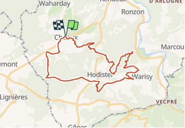
Ruta Senderismo de 20 km a descubrir en Valonia, Luxemburgo, Rendeux. Esta ruta ha sido propuesta por Thierry Deppe.
Descripción
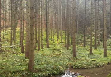
Superbe points de vues de la vallée de l’Ourthe
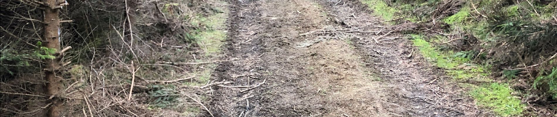
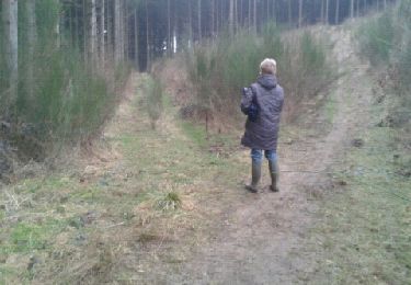
Un peu de hors piste
Début assez difficile, cote avec ronces…
Attention chaussures étanches conseillées
Localización
País:
Belgium
Región :
Valonia
Departamento/provincia :
Luxemburgo
Municipio :
Rendeux
Localidad:
Unknown
Salida:(Dec)
Salida:(UTM)
676396 ; 5565668 (31U) N.
Comentarios
Excursiones cerca
![Excursión Senderismo Hotton - RB-LUX-04 - En Famenne - Photo](https://media.geolcdn.com/t/375/260/ext.jpg?maxdim=2&url=https%3A%2F%2Fservices.sitytrail.com%2FGeolivesWS%2FDownloadMedia.ashx%3FTrailID%3D179613%26Media%3Dc1eccb03-838f-4466-b103-ba3011ffaee0.jpg)
![Senderismo Senderismo](https://static1.geolcdn.com/sitytour/trail-icons/101.png)
RB-LUX-04 - En Famenne
Senderismo
Medio
(13)
Hotton,
Valonia,
Luxemburgo,
Belgium
![](/images/other/stat-length.png)
18,4 km | 24 km-effort
5h 6min
![](https://static1.geolcdn.com/siteimages/upload/files/16400158638029165_repeat_loop_refresh_sync_direction_icon.png)
Sí
![Excursión Senderismo Rendeux - Arboretum et Ourthe - Photo](https://media.geolcdn.com/t/375/260/114fab54-a809-4035-a129-83d982caf499.jpg&format=jpg&maxdim=2)
![Senderismo Senderismo](https://static1.geolcdn.com/sitytour/trail-icons/101.png)
Arboretum et Ourthe
Senderismo
Medio
(4)
Rendeux,
Valonia,
Luxemburgo,
Belgium
![](/images/other/stat-length.png)
9 km | 12 km-effort
3h 15min
![](https://static1.geolcdn.com/siteimages/upload/files/16400158638029165_repeat_loop_refresh_sync_direction_icon.png)
Sí
![Excursión Senderismo Rendeux - hodister - Photo](https://media.geolcdn.com/t/375/260/e73fbed5-6ae2-4bd7-8844-cc4756518ef2.jpg&format=jpg&maxdim=2)
![Senderismo Senderismo](https://static1.geolcdn.com/sitytour/trail-icons/101.png)
hodister
Senderismo
Fácil
(1)
Rendeux,
Valonia,
Luxemburgo,
Belgium
![](/images/other/stat-length.png)
8,8 km | 11,5 km-effort
3h 39min
![](https://static1.geolcdn.com/siteimages/upload/files/16400158638029165_repeat_loop_refresh_sync_direction_icon.png)
Sí
![Excursión Senderismo Marche-en-Famenne - Grimbiémont-Lignières- boucle - Photo](https://media.geolcdn.com/t/375/260/ext.jpg?maxdim=2&url=https%3A%2F%2Fservices.sitytrail.com%2FGeolivesWS%2FDownloadMedia.ashx%3FTrailID%3D116546%26Media%3D492a6278-1252-4756-987d-ad86fac6f5d1.jpg)
![Senderismo Senderismo](https://static1.geolcdn.com/sitytour/trail-icons/101.png)
Grimbiémont-Lignières- boucle
Senderismo
Fácil
(3)
Marche-en-Famenne,
Valonia,
Luxemburgo,
Belgium
![](/images/other/stat-length.png)
8,6 km | 11,6 km-effort
1h 59min
![](https://static1.geolcdn.com/siteimages/upload/files/16400158638029165_repeat_loop_refresh_sync_direction_icon.png)
Sí
![Excursión Senderismo Rendeux - promenade de lourthe - Photo](https://media.geolcdn.com/t/375/260/ext.jpg?maxdim=2&url=https%3A%2F%2Fservices.sitytrail.com%2FGeolivesWS%2FDownloadMedia.ashx%3FTrailID%3D338833%26Media%3Dfix__20140824184151.jpg)
![Senderismo Senderismo](https://static1.geolcdn.com/sitytour/trail-icons/101.png)
promenade de lourthe
Senderismo
Difícil
(3)
Rendeux,
Valonia,
Luxemburgo,
Belgium
![](/images/other/stat-length.png)
8,1 km | 11 km-effort
2h 35min
![](https://static1.geolcdn.com/siteimages/upload/files/16400158638029165_repeat_loop_refresh_sync_direction_icon.png)
Sí
![Excursión Senderismo Rendeux - Montaigu - Photo](https://media.geolcdn.com/t/375/260/ext.jpg?maxdim=2&url=https%3A%2F%2Fservices.sitytrail.com%2FGeolivesWS%2FDownloadMedia.ashx%3FTrailID%3D264121%26Media%3De6783db9-1bdf-46f4-876d-878e9e4b81fa.jpg)
![Senderismo Senderismo](https://static1.geolcdn.com/sitytour/trail-icons/101.png)
Montaigu
Senderismo
Fácil
(2)
Rendeux,
Valonia,
Luxemburgo,
Belgium
![](/images/other/stat-length.png)
5,5 km | 8 km-effort
Desconocido
![](https://static1.geolcdn.com/siteimages/upload/files/16400158638029165_repeat_loop_refresh_sync_direction_icon.png)
Sí
![Excursión Senderismo Hotton - De werpin a werpin via Trinal - Photo](https://media.geolcdn.com/t/375/260/ext.jpg?maxdim=2&url=https%3A%2F%2Fservices.sitytrail.com%2FGeolivesWS%2FDownloadMedia.ashx%3FTrailID%3D225931%26Media%3Dfix__20131007161453.jpg)
![Senderismo Senderismo](https://static1.geolcdn.com/sitytour/trail-icons/101.png)
De werpin a werpin via Trinal
Senderismo
Fácil
(1)
Hotton,
Valonia,
Luxemburgo,
Belgium
![](/images/other/stat-length.png)
9,3 km | 12,4 km-effort
2h 38min
![](https://static1.geolcdn.com/siteimages/upload/files/16400158638029165_repeat_loop_refresh_sync_direction_icon.png)
Sí
![Excursión Senderismo Marche-en-Famenne - Randoguide - Photo](https://media.geolcdn.com/t/375/260/ext.jpg?maxdim=2&url=https%3A%2F%2Fservices.sitytrail.com%2FGeolivesWS%2FDownloadMedia.ashx%3FTrailID%3D116543%26Media%3D20120310173342.jpeg)
![Senderismo Senderismo](https://static1.geolcdn.com/sitytour/trail-icons/101.png)
Randoguide
Senderismo
Fácil
(1)
Marche-en-Famenne,
Valonia,
Luxemburgo,
Belgium
![](/images/other/stat-length.png)
5,2 km | 6,5 km-effort
1h 16min
![](https://static1.geolcdn.com/siteimages/upload/files/16400158638029165_repeat_loop_refresh_sync_direction_icon.png)
Sí
![Excursión Senderismo Marche-en-Famenne - Griembiemont - Photo](https://media.geolcdn.com/t/375/260/bed5409d-d7f9-4d54-a4de-97aba440bdbe.jpg&format=jpg&maxdim=2)
![Senderismo Senderismo](https://static1.geolcdn.com/sitytour/trail-icons/101.png)
Griembiemont
Senderismo
Difícil
Marche-en-Famenne,
Valonia,
Luxemburgo,
Belgium
![](/images/other/stat-length.png)
12,4 km | 16,8 km-effort
2h 22min
![](https://static1.geolcdn.com/siteimages/upload/files/16400158638029165_repeat_loop_refresh_sync_direction_icon.png)
Sí