![](/images/other/stat-length.png)
Les vallons de Valcros
affinetataille
Usuario GUIDE
![Longitud](/images/other/stat-length.png)
![Altitud máxima](https://static1.geolcdn.com/siteimages/upload/files/1508320355ic_sort_altitude_max_24dp.png)
![Desnivel positivo](https://static1.geolcdn.com/siteimages/upload/files/1508320355ic_sort_den_pos_24dp.png)
![Km-Effort](/images/other/stat-length.png)
![Altitud mínima](https://static1.geolcdn.com/siteimages/upload/files/1508320355ic_sort_altitude_min_24dp.png)
![Desnivel negativo](https://static1.geolcdn.com/siteimages/upload/files/1508320355ic_sort_den_neg_24dp.png)
![Boucle](https://static1.geolcdn.com/siteimages/upload/files/16400158638029165_repeat_loop_refresh_sync_direction_icon.png)
![Senderismo](https://static1.geolcdn.com/sitytour/trail-icons/101.png)
6h00
Dificultad : Difícil
![Escanee este código QR para abrir la excursión en la aplicación SityTrail](https://capi.geolives.com/qq0zvz2zws4bq2lad0pu/sitytour/trails/3562321/qr.png?size=200)
Aplicación GPS de excursión GRATIS
A propósito
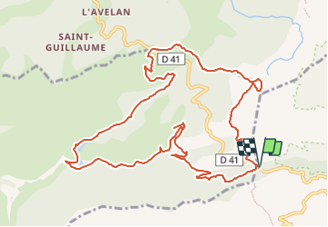
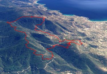
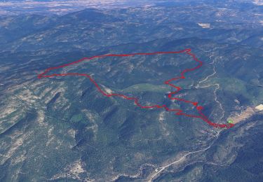
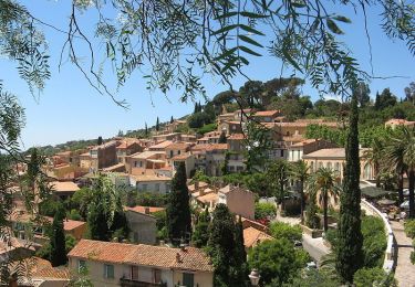
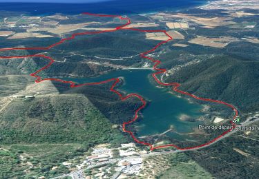
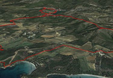
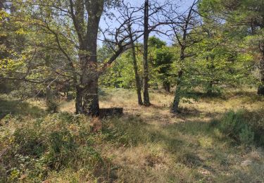
Ruta Senderismo de 14 km a descubrir en Provenza-Alpes-Costa Azul, Var, Bormes-les-Mimosas. Esta ruta ha sido propuesta por affinetataille.
Descripción
Malgré son apparence aujourd'hui déserte la forêt du massif des Maures recèle de nombreux vestiges d'une occupation ancienne et laborieuse : fermes et bergeries, séchoirs à châtaignes, puits et citernes, charbonnières ... et vieux chemins. C'est sur l'un d'entre eux, que nous conduit cette balade. Voir :
[url]http://les-randos-du-grand.eklablog.com/les-vallons-de-valcros-a213181973[/url]
Localización
Comentarios
Excursiones cerca
![Excursión Senderismo Bormes-les-Mimosas - SityTrail - Bormes les Mimosas - ND de Constance - Cols de Gratteloup et Landon - Photo](https://media.geolcdn.com/t/375/260/c3cd69d2-66a0-450a-95c5-e8005107dd21.jpg&format=jpg&maxdim=2)
![Senderismo Senderismo](https://static1.geolcdn.com/sitytour/trail-icons/101.png)
Senderismo
![](/images/other/stat-length.png)
![](https://static1.geolcdn.com/siteimages/upload/files/16400158638029165_repeat_loop_refresh_sync_direction_icon.png)
![Excursión Senderismo Bormes-les-Mimosas - SityTrail - 3043274 - bargeanxchartreuse-verne - Photo](https://media.geolcdn.com/t/375/260/3db88ff5-5d2e-4949-8a29-14c430fd8c8f.jpg&format=jpg&maxdim=2)
![Senderismo Senderismo](https://static1.geolcdn.com/sitytour/trail-icons/101.png)
Senderismo
![](/images/other/stat-length.png)
![](https://static1.geolcdn.com/siteimages/upload/files/16400158638029165_repeat_loop_refresh_sync_direction_icon.png)
![Excursión Senderismo Bormes-les-Mimosas - Chartreuse de la Verne - Photo](https://media.geolcdn.com/t/375/260/ext.jpg?maxdim=2&url=https%3A%2F%2Fservices.sitytrail.com%2FGeolivesWS%2FDownloadMedia.ashx%3FTrailID%3D898630%26Media%3Dfix__20170215102107.jpg)
![Senderismo Senderismo](https://static1.geolcdn.com/sitytour/trail-icons/101.png)
Senderismo
![](/images/other/stat-length.png)
![](https://static1.geolcdn.com/siteimages/upload/files/16400158638029165_repeat_loop_refresh_sync_direction_icon.png)
![Excursión Senderismo Bormes-les-Mimosas - Bormes les Mimosas et la Forêt des Maures - Photo](https://media.geolcdn.com/t/375/260/ext.jpg?maxdim=2&url=https%3A%2F%2Fservices.sitytrail.com%2FGeolivesWS%2FDownloadMedia.ashx%3FTrailID%3D103786%26Media%3D6556_2.jpg)
![Senderismo Senderismo](https://static1.geolcdn.com/sitytour/trail-icons/101.png)
Senderismo
![](/images/other/stat-length.png)
![](https://static1.geolcdn.com/siteimages/upload/files/16400158638029165_repeat_loop_refresh_sync_direction_icon.png)
![Excursión Senderismo Bormes-les-Mimosas - SityTrail - Barrage du Trapan - Estagnol - Pellegrin - Photo](https://media.geolcdn.com/t/375/260/ebe11e5b-c00f-4172-b479-00c30bf032ed.jpg&format=jpg&maxdim=2)
![Senderismo Senderismo](https://static1.geolcdn.com/sitytour/trail-icons/101.png)
Senderismo
![](/images/other/stat-length.png)
![](https://static1.geolcdn.com/siteimages/upload/files/16400158638029165_repeat_loop_refresh_sync_direction_icon.png)
![Excursión Senderismo Bormes-les-Mimosas - Bormes les Mimosas Les 3 Cols - Photo](https://media.geolcdn.com/t/375/260/23bdb278-92e8-4d98-83cb-eb5b5435fc48.jpg&format=jpg&maxdim=2)
![Senderismo Senderismo](https://static1.geolcdn.com/sitytour/trail-icons/101.png)
Senderismo
![](/images/other/stat-length.png)
![](https://static1.geolcdn.com/siteimages/upload/files/16400158638029165_repeat_loop_refresh_sync_direction_icon.png)
![Excursión Senderismo Bormes-les-Mimosas - SityTrail - Bormes les Mimosas - Cap Léoube - Photo](https://media.geolcdn.com/t/375/260/313e00c8-6453-4b42-83e0-fd33fc6b49b0.jpg&format=jpg&maxdim=2)
![Senderismo Senderismo](https://static1.geolcdn.com/sitytour/trail-icons/101.png)
Senderismo
![](/images/other/stat-length.png)
![](https://static1.geolcdn.com/siteimages/upload/files/16400158638029165_repeat_loop_refresh_sync_direction_icon.png)
![Excursión Senderismo Bormes-les-Mimosas - Col du Gratteloup - Piste domaniale Sud - Cols de Labade et Landon - Pierre d'Avenon - GR51/90 - Photo](https://media.geolcdn.com/t/375/260/a68a068d-d9c5-4471-8f2a-bbfabcb93eed.jpg&format=jpg&maxdim=2)
![Senderismo Senderismo](https://static1.geolcdn.com/sitytour/trail-icons/101.png)
Senderismo
![](/images/other/stat-length.png)
![](https://static1.geolcdn.com/siteimages/upload/files/16400158638029165_repeat_loop_refresh_sync_direction_icon.png)
![Excursión Senderismo Bormes-les-Mimosas - Boucle : Pont des Caunes - Piste de l'Amandier - Piste de la Gourre - Piste Lambert - Col de la Citadelle - Pont des Caunes. - Photo](https://media.geolcdn.com/t/375/260/93e7f835-4806-4284-8793-c12d2410b0fc.jpg&format=jpg&maxdim=2)
![Senderismo Senderismo](https://static1.geolcdn.com/sitytour/trail-icons/101.png)
Senderismo
![](/images/other/stat-length.png)
![](https://static1.geolcdn.com/siteimages/upload/files/16400158638029165_repeat_loop_refresh_sync_direction_icon.png)