![](/images/other/stat-length.png)
![Excursión Senderismo Oudenaarde - audenarde et ses montagnes - Photo](https://media.geolcdn.com/t/1900/400/ext.pjpeg?maxdim=2&url=https%3A%2F%2Fstatic1.geolcdn.com%2Fsiteimages%2Fupload%2Ffiles%2F1553511878bg_sport_marche.png)
audenarde et ses montagnes
Charles Lemaire
Usuario GUIDE
![Longitud](/images/other/stat-length.png)
![Altitud máxima](https://static1.geolcdn.com/siteimages/upload/files/1508320355ic_sort_altitude_max_24dp.png)
![Desnivel positivo](https://static1.geolcdn.com/siteimages/upload/files/1508320355ic_sort_den_pos_24dp.png)
![Km-Effort](/images/other/stat-length.png)
![Altitud mínima](https://static1.geolcdn.com/siteimages/upload/files/1508320355ic_sort_altitude_min_24dp.png)
![Desnivel negativo](https://static1.geolcdn.com/siteimages/upload/files/1508320355ic_sort_den_neg_24dp.png)
![Boucle](https://static1.geolcdn.com/siteimages/upload/files/16400158638029165_repeat_loop_refresh_sync_direction_icon.png)
![Senderismo](https://static1.geolcdn.com/sitytour/trail-icons/101.png)
4h52
Dificultad : Difícil
![Escanee este código QR para abrir la excursión en la aplicación SityTrail](https://capi.geolives.com/qq0zvz2zws4bq2lad0pu/sitytour/trails/3561903/qr.png?size=200)
Aplicación GPS de excursión GRATIS
A propósito
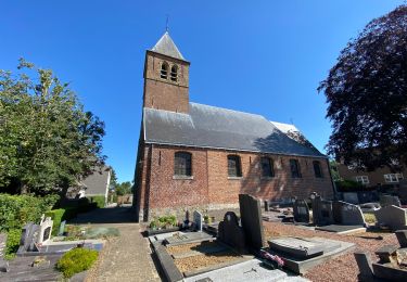
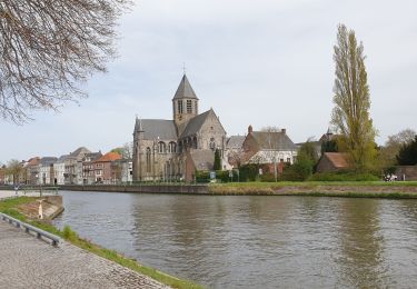
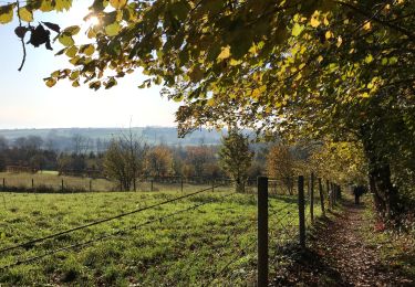
Ruta Senderismo de 19,7 km a descubrir en Flandes, Provincia de Flandes Oriental, Oudenaarde. Esta ruta ha sido propuesta por Charles Lemaire.
Descripción
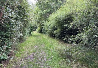
Une jolie promenade, très forestière et très vallonnée (300m de dénivelé positif pour une promenade de 20km), en boucle à partir de l'église de Leupegem.
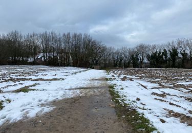
Du côté des difficultés: l'escalade du Koppenberg (d'où la mention des montagnes dans le titre) et quelques passages sur du gravier non dammé dans les derniers kilomètres vers Leupegem.
Localización
Comentarios
Excursiones cerca
![Excursión Senderismo Kluisbergen - Zulzeke 15,8 km - Photo](https://media.geolcdn.com/t/375/260/2d20912f-6269-44c4-8fd6-afa867e882c3.jpg&format=jpg&maxdim=2)
![Senderismo Senderismo](https://static1.geolcdn.com/sitytour/trail-icons/101.png)
Senderismo
![](/images/other/stat-length.png)
![](https://static1.geolcdn.com/siteimages/upload/files/16400158638029165_repeat_loop_refresh_sync_direction_icon.png)
![Excursión Senderismo Oudenaarde - Audenarde Oudenaarde 11,6 km - Photo](https://media.geolcdn.com/t/375/260/a67c7aa9-660e-4a0f-8875-b5238bc48372.jpg&format=jpg&maxdim=2)
![Senderismo Senderismo](https://static1.geolcdn.com/sitytour/trail-icons/101.png)
Senderismo
![](/images/other/stat-length.png)
![](https://static1.geolcdn.com/siteimages/upload/files/16400158638029165_repeat_loop_refresh_sync_direction_icon.png)
![Excursión Senderismo Oudenaarde - Ename 13,5 km - Photo](https://media.geolcdn.com/t/375/260/7a8ce4f2-9472-418d-8d4d-b1ad03c191eb.jpg&format=jpg&maxdim=2)
![Senderismo Senderismo](https://static1.geolcdn.com/sitytour/trail-icons/101.png)
Senderismo
![](/images/other/stat-length.png)
![](https://static1.geolcdn.com/siteimages/upload/files/16400158638029165_repeat_loop_refresh_sync_direction_icon.png)
![Excursión Senderismo Oudenaarde - Audenarde 14,7 km - Photo](https://media.geolcdn.com/t/375/260/5d96080c-beb7-4079-85eb-2d79d693da57.jpg&format=jpg&maxdim=2)
![Senderismo Senderismo](https://static1.geolcdn.com/sitytour/trail-icons/101.png)
Senderismo
![](/images/other/stat-length.png)
![](https://static1.geolcdn.com/siteimages/upload/files/16400158638029165_repeat_loop_refresh_sync_direction_icon.png)
![Excursión Bici eléctrica Oudenaarde - audenarde parc Lieds - Photo](https://media.geolcdn.com/t/375/260/aff480f0-3c26-4265-87ac-95242c49e7f9.jpg&format=jpg&maxdim=2)
![Bici eléctrica Bici eléctrica](https://static1.geolcdn.com/sitytour/trail-icons/205.png)
Bici eléctrica
![](/images/other/stat-length.png)
![](https://static1.geolcdn.com/siteimages/upload/files/16400158638029165_repeat_loop_refresh_sync_direction_icon.png)
![Excursión Senderismo Oudenaarde - Edelare 18,8 km - Photo](https://media.geolcdn.com/t/375/260/8cf81e11-aa64-46bb-a89f-c1a383a458e1.jpg&format=jpg&maxdim=2)
![Senderismo Senderismo](https://static1.geolcdn.com/sitytour/trail-icons/101.png)
Senderismo
![](/images/other/stat-length.png)
![](https://static1.geolcdn.com/siteimages/upload/files/16400158638029165_repeat_loop_refresh_sync_direction_icon.png)
![Excursión Senderismo Kluisbergen - Zulzeke 10 km - Photo](https://media.geolcdn.com/t/375/260/b867d382-658d-4055-9c73-3aad2fea1196.jpg&format=jpg&maxdim=2)
![Senderismo Senderismo](https://static1.geolcdn.com/sitytour/trail-icons/101.png)
Senderismo
![](/images/other/stat-length.png)
![](https://static1.geolcdn.com/siteimages/upload/files/16400158638029165_repeat_loop_refresh_sync_direction_icon.png)
![Excursión Senderismo Oudenaarde - Audenarde 5 km - Photo](https://media.geolcdn.com/t/375/260/f47abf0b-7c90-4247-a9fc-faaf251750c3.jpg&format=jpg&maxdim=2)
![Senderismo Senderismo](https://static1.geolcdn.com/sitytour/trail-icons/101.png)
Senderismo
![](/images/other/stat-length.png)
![](https://static1.geolcdn.com/siteimages/upload/files/16400158638029165_repeat_loop_refresh_sync_direction_icon.png)
![Excursión Senderismo Maarkedal - Maarkedal 17 km - Photo](https://media.geolcdn.com/t/375/260/5720cbd8-611b-46c0-978a-2c3a80274bb0.jpg&format=jpg&maxdim=2)
![Senderismo Senderismo](https://static1.geolcdn.com/sitytour/trail-icons/101.png)
Senderismo
![](/images/other/stat-length.png)
![](https://static1.geolcdn.com/siteimages/upload/files/16400158638029165_repeat_loop_refresh_sync_direction_icon.png)