![](/images/other/stat-length.png)
![Excursión Senderismo Thiers - Thiers_Couteliere_3 - Photo](https://media.geolcdn.com/t/1900/400/dcb28280-70fa-4637-9a62-befd9280dc1e.jpg&format=pjpeg&maxdim=2)
Thiers_Couteliere_3
jagarnier
Usuario GUIDE
![Longitud](/images/other/stat-length.png)
![Altitud máxima](https://static1.geolcdn.com/siteimages/upload/files/1508320355ic_sort_altitude_max_24dp.png)
![Desnivel positivo](https://static1.geolcdn.com/siteimages/upload/files/1508320355ic_sort_den_pos_24dp.png)
![Km-Effort](/images/other/stat-length.png)
![Altitud mínima](https://static1.geolcdn.com/siteimages/upload/files/1508320355ic_sort_altitude_min_24dp.png)
![Desnivel negativo](https://static1.geolcdn.com/siteimages/upload/files/1508320355ic_sort_den_neg_24dp.png)
![Boucle](https://static1.geolcdn.com/siteimages/upload/files/16400158638029165_repeat_loop_refresh_sync_direction_icon.png)
![Senderismo](https://static1.geolcdn.com/sitytour/trail-icons/101.png)
7h00
Dificultad : Difícil
![Escanee este código QR para abrir la excursión en la aplicación SityTrail](https://capi.geolives.com/qq0zvz2zws4bq2lad0pu/sitytour/trails/3554056/qr.png?size=200)
Aplicación GPS de excursión GRATIS
A propósito
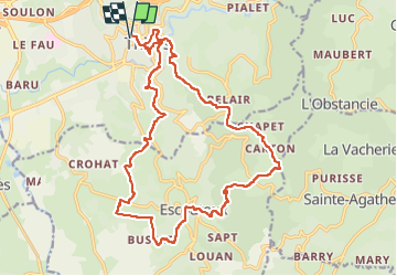
Ruta Senderismo de 21 km a descubrir en Auvergne-Rhône-Alpes, Puy-de-Dôme, Thiers. Esta ruta ha sido propuesta por jagarnier.
Descripción
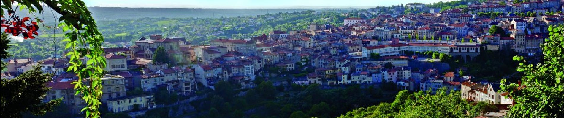
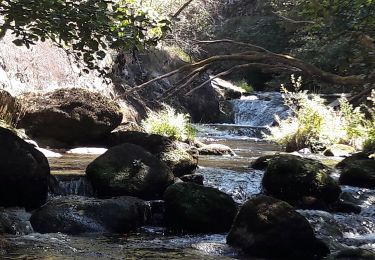
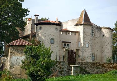
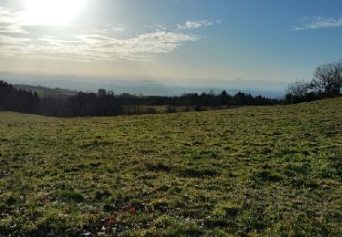
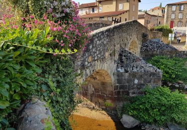
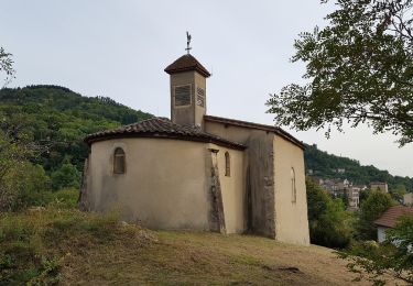
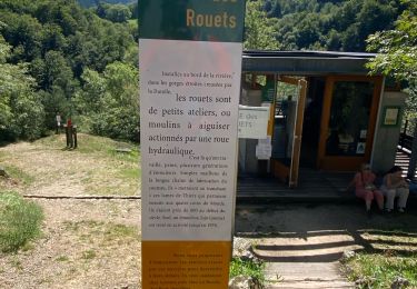
Thiers, depuis 6 siècles, a été marqué par ses couteliers, le GMIT (Groupe des Marcheurs Indépendants de Thiers) leur dédie une randonnée avec un parcours recentré sur la région thiernoise, la Vallée des rouets, la Durolle, la cité médiévale, les paysages du Livradois Forez et du val de DORE, ...
Localización
Comentarios
Excursiones cerca
![Excursión Senderismo Thiers - Thiers_Enfer_Rouets - Photo](https://media.geolcdn.com/t/375/260/d30f62f6-c2be-42d4-8327-b960a8e7ad10.jpg&format=jpg&maxdim=2)
![Senderismo Senderismo](https://static1.geolcdn.com/sitytour/trail-icons/101.png)
Senderismo
![](/images/other/stat-length.png)
![](https://static1.geolcdn.com/siteimages/upload/files/16400158638029165_repeat_loop_refresh_sync_direction_icon.png)
![Excursión Senderismo Thiers - Thiers_Horts - Photo](https://media.geolcdn.com/t/375/260/a517b9ce-72b2-4eb8-b533-599543dd0dbf.jpg&format=jpg&maxdim=2)
![Senderismo Senderismo](https://static1.geolcdn.com/sitytour/trail-icons/101.png)
Senderismo
![](/images/other/stat-length.png)
![](https://static1.geolcdn.com/siteimages/upload/files/16400158638029165_repeat_loop_refresh_sync_direction_icon.png)
![Excursión Senderismo Saint-Rémy-sur-Durolle - 2016-1-26- Chabrol - Photo](https://media.geolcdn.com/t/375/260/ext.jpg?maxdim=2&url=https%3A%2F%2Fservices.sitytrail.com%2FGeolivesWS%2FDownloadMedia.ashx%3FTrailID%3D517769%26Media%3Dfix__20160126160133.jpg)
![Senderismo Senderismo](https://static1.geolcdn.com/sitytour/trail-icons/101.png)
Senderismo
![](/images/other/stat-length.png)
![](https://static1.geolcdn.com/siteimages/upload/files/16400158638029165_repeat_loop_refresh_sync_direction_icon.png)
![Excursión A pie Thiers - Thiers - Château de Vaulx - Photo](https://media.geolcdn.com/t/375/260/d9376438-b0f9-4c05-849e-307a520c5889.jpeg&format=jpg&maxdim=2)
![A pie A pie](https://static1.geolcdn.com/sitytour/trail-icons/100.png)
A pie
![](/images/other/stat-length.png)
![](https://static1.geolcdn.com/siteimages/upload/files/16400158638029165_repeat_loop_refresh_sync_direction_icon.png)
![Excursión A pie Thiers - Château de Vaulx - Thiers - Photo](https://media.geolcdn.com/t/375/260/a3f04348-13bb-4f13-9b8b-5e876d0aa9b1.jpeg&format=jpg&maxdim=2)
![A pie A pie](https://static1.geolcdn.com/sitytour/trail-icons/100.png)
A pie
![](/images/other/stat-length.png)
![](https://static1.geolcdn.com/siteimages/upload/files/16400158638029165_repeat_loop_refresh_sync_direction_icon.png)
![Excursión A pie Dorat - Le sentier de Néron - Photo](https://media.geolcdn.com/t/375/260/c929225b-d926-40dd-9fd6-d6dd547a4945.jpeg&format=jpg&maxdim=2)
![A pie A pie](https://static1.geolcdn.com/sitytour/trail-icons/100.png)
A pie
![](/images/other/stat-length.png)
![](https://static1.geolcdn.com/siteimages/upload/files/16400158638029165_repeat_loop_refresh_sync_direction_icon.png)
![Excursión A pie Thiers - De l'Enfer aux Rouets - Photo](https://media.geolcdn.com/t/375/260/929c0432-0df8-4b9b-9f47-7f14e14b443e.jpeg&format=jpg&maxdim=2)
![A pie A pie](https://static1.geolcdn.com/sitytour/trail-icons/100.png)
A pie
![](/images/other/stat-length.png)
![](https://static1.geolcdn.com/siteimages/upload/files/16400158638029165_repeat_loop_refresh_sync_direction_icon.png)
![Excursión A pie Escoutoux - Les Terrasses de la Dore - Photo](https://media.geolcdn.com/t/375/260/35672727-a85c-4fd8-ae6f-8544d7faa0f5.jpeg&format=jpg&maxdim=2)
![A pie A pie](https://static1.geolcdn.com/sitytour/trail-icons/100.png)
A pie
![](/images/other/stat-length.png)
![](https://static1.geolcdn.com/siteimages/upload/files/16400158638029165_repeat_loop_refresh_sync_direction_icon.png)
![Excursión Senderismo Thiers - Ballet des rouets - Photo](https://media.geolcdn.com/t/375/260/810cc98b-159f-4c9b-8e0c-49a79d616f43.jpg&format=jpg&maxdim=2)
![Senderismo Senderismo](https://static1.geolcdn.com/sitytour/trail-icons/101.png)
Senderismo
![](/images/other/stat-length.png)
![](https://static1.geolcdn.com/siteimages/upload/files/16400158638029165_repeat_loop_refresh_sync_direction_icon.png)