![](/images/other/stat-length.png)
![Excursión Senderismo La Plaine-sur-Mer - La plaine sur Mer - Pornic - Photo](https://media.geolcdn.com/t/1900/400/3e6d4e01-0318-4670-946f-5a06ee1210d0.jpg&format=pjpeg&maxdim=2)
La plaine sur Mer - Pornic
Lobin
Usuario
![Longitud](/images/other/stat-length.png)
Longitud
20 km
![Altitud máxima](https://static1.geolcdn.com/siteimages/upload/files/1508320355ic_sort_altitude_max_24dp.png)
Altitud máxima
28 m
![Desnivel positivo](https://static1.geolcdn.com/siteimages/upload/files/1508320355ic_sort_den_pos_24dp.png)
Desnivel positivo
148 m
![Km-Effort](/images/other/stat-length.png)
Km-Effort
22 km
![Altitud mínima](https://static1.geolcdn.com/siteimages/upload/files/1508320355ic_sort_altitude_min_24dp.png)
Altitud mínima
0 m
![Desnivel negativo](https://static1.geolcdn.com/siteimages/upload/files/1508320355ic_sort_den_neg_24dp.png)
Desnivel negativo
165 m
![Boucle](https://static1.geolcdn.com/siteimages/upload/files/16400158638029165_repeat_loop_refresh_sync_direction_icon.png)
Boucle
No
Fecha de creación :
2023-02-11 09:22:05.0
Última modificación :
2023-02-11 21:40:49.461
![Senderismo](https://static1.geolcdn.com/sitytour/trail-icons/101.png)
3h59
Dificultad : Medio
![Escanee este código QR para abrir la excursión en la aplicación SityTrail](https://capi.geolives.com/qq0zvz2zws4bq2lad0pu/sitytour/trails/3548517/qr.png?size=200)
Aplicación GPS de excursión GRATIS
A propósito
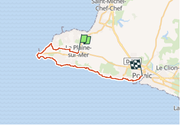
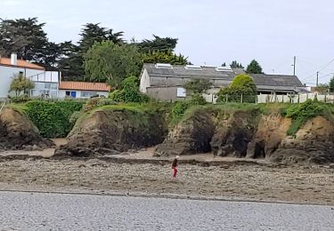
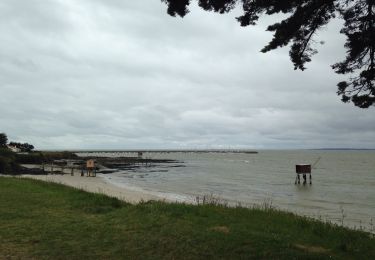
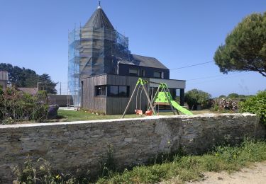
Ruta Senderismo de 20 km a descubrir en Países del Loira, Loira-Atlántico, La Plaine-sur-Mer. Esta ruta ha sido propuesta por Lobin.
Descripción
Départ de Pornic.
Prendre le bus 315 à destination de la plaine sur Mer Centre.
Puis retour à Pornic à pied
Localización
País:
France
Región :
Países del Loira
Departamento/provincia :
Loira-Atlántico
Municipio :
La Plaine-sur-Mer
Localidad:
Unknown
Salida:(Dec)
Salida:(UTM)
561351 ; 5220857 (30T) N.
Comentarios
Excursiones cerca
![Excursión Senderismo Saint-Michel-Chef-Chef - St Michel chef chef st Brevin les pins - Photo](https://media.geolcdn.com/t/375/260/c61c664a-852e-412f-9c74-0d8191a78cd6.jpg&format=jpg&maxdim=2)
![Senderismo Senderismo](https://static1.geolcdn.com/sitytour/trail-icons/101.png)
St Michel chef chef st Brevin les pins
Senderismo
Medio
Saint-Michel-Chef-Chef,
Países del Loira,
Loira-Atlántico,
France
![](/images/other/stat-length.png)
7 km | 7,8 km-effort
1h 52min
![](https://static1.geolcdn.com/siteimages/upload/files/16400158638029165_repeat_loop_refresh_sync_direction_icon.png)
Sí
![Excursión Senderismo Préfailles - Boucle en pointe de Saint Gildas - Photo](https://media.geolcdn.com/t/375/260/38fd5f4a-0ffa-466a-8e18-2f488e284f1b.jpg&format=jpg&maxdim=2)
![Senderismo Senderismo](https://static1.geolcdn.com/sitytour/trail-icons/101.png)
Boucle en pointe de Saint Gildas
Senderismo
Muy fácil
Préfailles,
Países del Loira,
Loira-Atlántico,
France
![](/images/other/stat-length.png)
16 km | 17,3 km-effort
4h 10min
![](https://static1.geolcdn.com/siteimages/upload/files/16400158638029165_repeat_loop_refresh_sync_direction_icon.png)
Sí
![Excursión A pie Préfailles - Pointe Saint-Gildas - Photo](https://media.geolcdn.com/t/375/260/d0c5c2f6-34d6-4bc5-b58c-e9e0785cf5f0.jpeg&format=jpg&maxdim=2)
![A pie A pie](https://static1.geolcdn.com/sitytour/trail-icons/100.png)
Pointe Saint-Gildas
A pie
Fácil
Préfailles,
Países del Loira,
Loira-Atlántico,
France
![](/images/other/stat-length.png)
7,3 km | 8 km-effort
1h 49min
![](https://static1.geolcdn.com/siteimages/upload/files/16400158638029165_repeat_loop_refresh_sync_direction_icon.png)
Sí
![Excursión Senderismo Préfailles - Pointe de St Gildas - Photo](https://media.geolcdn.com/t/375/260/676edf4a-b6e7-4a74-8e49-d68639926018.jpg&format=jpg&maxdim=2)
![Senderismo Senderismo](https://static1.geolcdn.com/sitytour/trail-icons/101.png)
Pointe de St Gildas
Senderismo
Muy fácil
Préfailles,
Países del Loira,
Loira-Atlántico,
France
![](/images/other/stat-length.png)
9,5 km | 10,5 km-effort
3h 7min
![](https://static1.geolcdn.com/siteimages/upload/files/16400158638029165_repeat_loop_refresh_sync_direction_icon.png)
Sí
![Excursión Senderismo La Plaine-sur-Mer - pornichet - Photo](https://media.geolcdn.com/t/375/260/a6e703b2-84bf-42ae-ac9b-cf1d1769c179.jpg&format=jpg&maxdim=2)
![Senderismo Senderismo](https://static1.geolcdn.com/sitytour/trail-icons/101.png)
pornichet
Senderismo
Muy fácil
La Plaine-sur-Mer,
Países del Loira,
Loira-Atlántico,
France
![](/images/other/stat-length.png)
58 km | 63 km-effort
4h 26min
![](https://static1.geolcdn.com/siteimages/upload/files/16400158638029165_repeat_loop_refresh_sync_direction_icon.png)
No
![Excursión Otra actividad La Plaine-sur-Mer - côte des moutons - Photo](https://media.geolcdn.com/t/375/260/ext.jpg?maxdim=2&url=https%3A%2F%2Fservices.sitytrail.com%2FGeolivesWS%2FDownloadMedia.ashx%3FTrailID%3D558942%26Media%3D20160425170255.jpg)
![Otra actividad Otra actividad](https://static1.geolcdn.com/sitytour/trail-icons/900.png)
côte des moutons
Otra actividad
Fácil
La Plaine-sur-Mer,
Países del Loira,
Loira-Atlántico,
France
![](/images/other/stat-length.png)
13 km | 14 km-effort
3h 32min
![](https://static1.geolcdn.com/siteimages/upload/files/16400158638029165_repeat_loop_refresh_sync_direction_icon.png)
Sí
![Excursión Bici de montaña La Plaine-sur-Mer - La Plaine Eric 3 - Photo](https://media.geolcdn.com/t/375/260/ext.jpg?maxdim=2&url=https%3A%2F%2Fstatic1.geolcdn.com%2Fsiteimages%2Fupload%2Ffiles%2F1524743154velo.jpg)
![Bici de montaña Bici de montaña](https://static1.geolcdn.com/sitytour/trail-icons/202.png)
La Plaine Eric 3
Bici de montaña
Medio
La Plaine-sur-Mer,
Países del Loira,
Loira-Atlántico,
France
![](/images/other/stat-length.png)
31 km | 35 km-effort
2h 7min
![](https://static1.geolcdn.com/siteimages/upload/files/16400158638029165_repeat_loop_refresh_sync_direction_icon.png)
Sí
![Excursión Senderismo Saint-Michel-Chef-Chef - 2023-06-03 st Michel chef chef circuit littoral et moulins - Photo](https://media.geolcdn.com/t/375/260/b5dec514-b985-4f83-b732-11df6eab5f8a.jpg&format=jpg&maxdim=2)
![Senderismo Senderismo](https://static1.geolcdn.com/sitytour/trail-icons/101.png)
2023-06-03 st Michel chef chef circuit littoral et moulins
Senderismo
Difícil
Saint-Michel-Chef-Chef,
Países del Loira,
Loira-Atlántico,
France
![](/images/other/stat-length.png)
15,7 km | 17,2 km-effort
3h 20min
![](https://static1.geolcdn.com/siteimages/upload/files/16400158638029165_repeat_loop_refresh_sync_direction_icon.png)
No
![Excursión Senderismo Saint-Michel-Chef-Chef - Saint-Michel-Chef-Chef Randonnée - Photo](https://media.geolcdn.com/t/375/260/ext.jpg?maxdim=2&url=https%3A%2F%2Fstatic1.geolcdn.com%2Fsiteimages%2Fupload%2Ffiles%2F1553511878bg_sport_marche.png)
![Senderismo Senderismo](https://static1.geolcdn.com/sitytour/trail-icons/101.png)
Saint-Michel-Chef-Chef Randonnée
Senderismo
Difícil
Saint-Michel-Chef-Chef,
Países del Loira,
Loira-Atlántico,
France
![](/images/other/stat-length.png)
11,2 km | 12,7 km-effort
2h 53min
![](https://static1.geolcdn.com/siteimages/upload/files/16400158638029165_repeat_loop_refresh_sync_direction_icon.png)
Sí