![](/images/other/stat-length.png)
![Excursión Senderismo Vaunaveys-la-Rochette - Vaunaveys Crest Vaunaveys - Photo](https://media.geolcdn.com/t/1900/400/ext.pjpeg?maxdim=2&url=https%3A%2F%2Fstatic1.geolcdn.com%2Fsiteimages%2Fupload%2Ffiles%2F1553511878bg_sport_marche.png)
Vaunaveys Crest Vaunaveys
LydiaMich
Usuario
![Longitud](/images/other/stat-length.png)
Longitud
13,4 km
![Altitud máxima](https://static1.geolcdn.com/siteimages/upload/files/1508320355ic_sort_altitude_max_24dp.png)
Altitud máxima
412 m
![Desnivel positivo](https://static1.geolcdn.com/siteimages/upload/files/1508320355ic_sort_den_pos_24dp.png)
Desnivel positivo
437 m
![Km-Effort](/images/other/stat-length.png)
Km-Effort
19,2 km
![Altitud mínima](https://static1.geolcdn.com/siteimages/upload/files/1508320355ic_sort_altitude_min_24dp.png)
Altitud mínima
193 m
![Desnivel negativo](https://static1.geolcdn.com/siteimages/upload/files/1508320355ic_sort_den_neg_24dp.png)
Desnivel negativo
438 m
![Boucle](https://static1.geolcdn.com/siteimages/upload/files/16400158638029165_repeat_loop_refresh_sync_direction_icon.png)
Boucle
Sí
Fecha de creación :
2023-02-09 09:33:18.964
Última modificación :
2023-02-10 09:21:04.795
![Senderismo](https://static1.geolcdn.com/sitytour/trail-icons/101.png)
3h37
Dificultad : Fácil
![Escanee este código QR para abrir la excursión en la aplicación SityTrail](https://capi.geolives.com/qq0zvz2zws4bq2lad0pu/sitytour/trails/3545970/qr.png?size=200)
Aplicación GPS de excursión GRATIS
A propósito
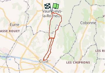
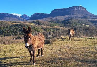
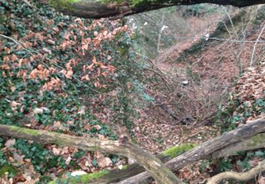
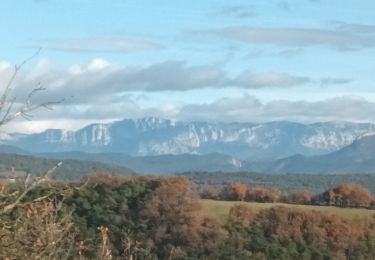
Ruta Senderismo de 13,4 km a descubrir en Auvergne-Rhône-Alpes, Drôme, Vaunaveys-la-Rochette. Esta ruta ha sido propuesta por LydiaMich .
Descripción
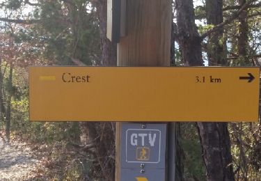
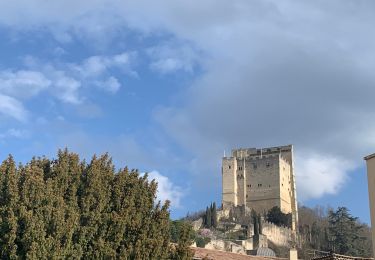
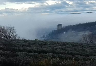
Randonnée entre Vaunaveys et Crest en boucle bien sympathique. On peut en profiter pour une petite visite du vieux Crest au passage avant de monter à sa tour.
Localización
País:
France
Región :
Auvergne-Rhône-Alpes
Departamento/provincia :
Drôme
Municipio :
Vaunaveys-la-Rochette
Localidad:
Unknown
Salida:(Dec)
Salida:(UTM)
660882 ; 4959309 (31T) N.
Comentarios
Excursiones cerca
![Excursión Senderismo Crest - Crest / Col de Bessot - Photo](https://media.geolcdn.com/t/375/260/ext.jpg?maxdim=2&url=https%3A%2F%2Fservices.sitytrail.com%2FGeolivesWS%2FDownloadMedia.ashx%3FTrailID%3D497687%26Media%3Dfix__20151127133911.jpg)
![Senderismo Senderismo](https://static1.geolcdn.com/sitytour/trail-icons/101.png)
Crest / Col de Bessot
Senderismo
Medio
(2)
Crest,
Auvergne-Rhône-Alpes,
Drôme,
France
![](/images/other/stat-length.png)
19,5 km | 28 km-effort
5h 52min
![](https://static1.geolcdn.com/siteimages/upload/files/16400158638029165_repeat_loop_refresh_sync_direction_icon.png)
Sí
![Excursión sport Ourches - Ourches Cobonne col croix Bezot - Photo](https://media.geolcdn.com/t/375/260/c1f74f9b-903b-45f4-9039-e55a97ca2dd5.jpg&format=jpg&maxdim=2)
Ourches Cobonne col croix Bezot
sport
Muy fácil
Ourches,
Auvergne-Rhône-Alpes,
Drôme,
France
![](/images/other/stat-length.png)
18,8 km | 32 km-effort
Desconocido
![](https://static1.geolcdn.com/siteimages/upload/files/16400158638029165_repeat_loop_refresh_sync_direction_icon.png)
Sí
![Excursión Senderismo Crest - Crest à VAUNAVEY - Photo](https://media.geolcdn.com/t/375/260/286137c0-d121-4814-8720-e6aa22e27ac9.jpg&format=jpg&maxdim=2)
![Senderismo Senderismo](https://static1.geolcdn.com/sitytour/trail-icons/101.png)
Crest à VAUNAVEY
Senderismo
Muy fácil
Crest,
Auvergne-Rhône-Alpes,
Drôme,
France
![](/images/other/stat-length.png)
9,2 km | 11,5 km-effort
1h 58min
![](https://static1.geolcdn.com/siteimages/upload/files/16400158638029165_repeat_loop_refresh_sync_direction_icon.png)
No
![Excursión Bici de carretera Crest - j3 Crest limouche vauna vaunaveys 01.07.23 - Photo](https://media.geolcdn.com/t/375/260/f1e7664d-d94c-4a24-8662-9bd9acc5deea.jpg&format=jpg&maxdim=2)
![Bici de carretera Bici de carretera](https://static1.geolcdn.com/sitytour/trail-icons/201.png)
j3 Crest limouche vauna vaunaveys 01.07.23
Bici de carretera
Medio
Crest,
Auvergne-Rhône-Alpes,
Drôme,
France
![](/images/other/stat-length.png)
66 km | 85 km-effort
5h 58min
![](https://static1.geolcdn.com/siteimages/upload/files/16400158638029165_repeat_loop_refresh_sync_direction_icon.png)
No
![Excursión Senderismo Crest - Crest les crêtes - Photo](https://media.geolcdn.com/t/375/260/d13859cb-c499-4b0f-86ce-a9a52bdb88e9.jpg&format=jpg&maxdim=2)
![Senderismo Senderismo](https://static1.geolcdn.com/sitytour/trail-icons/101.png)
Crest les crêtes
Senderismo
Fácil
Crest,
Auvergne-Rhône-Alpes,
Drôme,
France
![](/images/other/stat-length.png)
7,4 km | 10,7 km-effort
2h 0min
![](https://static1.geolcdn.com/siteimages/upload/files/16400158638029165_repeat_loop_refresh_sync_direction_icon.png)
Sí
![Excursión Senderismo Crest - Crest - Photo](https://media.geolcdn.com/t/375/260/e9e06745-c5f4-4002-b953-5ca3b3c4882f.jpg&format=jpg&maxdim=2)
![Senderismo Senderismo](https://static1.geolcdn.com/sitytour/trail-icons/101.png)
Crest
Senderismo
Medio
Crest,
Auvergne-Rhône-Alpes,
Drôme,
France
![](/images/other/stat-length.png)
17,4 km | 25 km-effort
4h 18min
![](https://static1.geolcdn.com/siteimages/upload/files/16400158638029165_repeat_loop_refresh_sync_direction_icon.png)
Sí
![Excursión Senderismo Crest - crest divajeu - Photo](https://media.geolcdn.com/t/375/260/cf010178-53b5-4440-b31b-9f59a793c8ce.jpg&format=jpg&maxdim=2)
![Senderismo Senderismo](https://static1.geolcdn.com/sitytour/trail-icons/101.png)
crest divajeu
Senderismo
Fácil
Crest,
Auvergne-Rhône-Alpes,
Drôme,
France
![](/images/other/stat-length.png)
13,6 km | 18,4 km-effort
4h 6min
![](https://static1.geolcdn.com/siteimages/upload/files/16400158638029165_repeat_loop_refresh_sync_direction_icon.png)
Sí
![Excursión Senderismo Upie - 26 UPIE zel 10.01.25 - Photo](https://media.geolcdn.com/t/375/260/2b767135-d0f6-4245-a21c-bbb031bd60c2.jpg&format=jpg&maxdim=2)
![Senderismo Senderismo](https://static1.geolcdn.com/sitytour/trail-icons/101.png)
26 UPIE zel 10.01.25
Senderismo
Fácil
Upie,
Auvergne-Rhône-Alpes,
Drôme,
France
![](/images/other/stat-length.png)
13,9 km | 20 km-effort
5h 16min
![](https://static1.geolcdn.com/siteimages/upload/files/16400158638029165_repeat_loop_refresh_sync_direction_icon.png)
Sí
![Excursión Senderismo Ourches - ourches - Photo](https://media.geolcdn.com/t/375/260/a90379ff-a76c-4a66-986a-310e3f19e0fa.jpg&format=jpg&maxdim=2)
![Senderismo Senderismo](https://static1.geolcdn.com/sitytour/trail-icons/101.png)
ourches
Senderismo
Muy difícil
Ourches,
Auvergne-Rhône-Alpes,
Drôme,
France
![](/images/other/stat-length.png)
15,5 km | 22 km-effort
6h 28min
![](https://static1.geolcdn.com/siteimages/upload/files/16400158638029165_repeat_loop_refresh_sync_direction_icon.png)
No