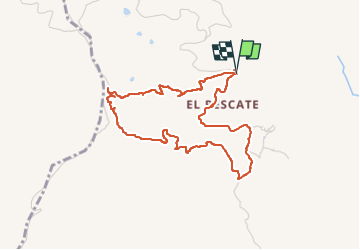
![](/images/other/stat-length.png)
![Excursión Senderismo Almuñécar - Rescate au dessus - Photo](https://media.geolcdn.com/t/1900/400/ec5fb466-62dd-4930-bc43-4267f1602454.jpg&format=pjpeg&maxdim=2)
Rescate au dessus
jpipacific
Usuario
![Longitud](/images/other/stat-length.png)
![Altitud máxima](https://static1.geolcdn.com/siteimages/upload/files/1508320355ic_sort_altitude_max_24dp.png)
![Desnivel positivo](https://static1.geolcdn.com/siteimages/upload/files/1508320355ic_sort_den_pos_24dp.png)
![Km-Effort](/images/other/stat-length.png)
![Altitud mínima](https://static1.geolcdn.com/siteimages/upload/files/1508320355ic_sort_altitude_min_24dp.png)
![Desnivel negativo](https://static1.geolcdn.com/siteimages/upload/files/1508320355ic_sort_den_neg_24dp.png)
![Boucle](https://static1.geolcdn.com/siteimages/upload/files/16400158638029165_repeat_loop_refresh_sync_direction_icon.png)
![Senderismo](https://static1.geolcdn.com/sitytour/trail-icons/101.png)
2h10
Dificultad : Medio
![Escanee este código QR para abrir la excursión en la aplicación SityTrail](https://capi.geolives.com/qq0zvz2zws4bq2lad0pu/sitytour/trails/3524108/qr.png?size=200)
Aplicación GPS de excursión GRATIS
A propósito
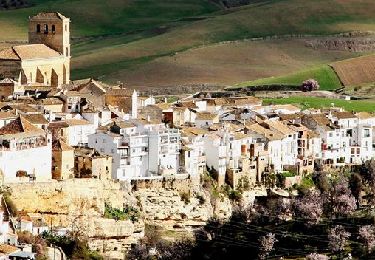
Ruta Senderismo de 5,1 km a descubrir en Andalucía, Granada, Almuñécar. Esta ruta ha sido propuesta por jpipacific.
Descripción
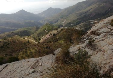
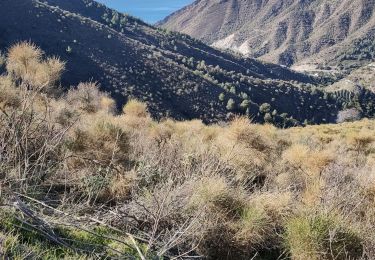
La première partie en montée n'est pas facile dans un chemin quasiment disparu. Ca grimpe dur au milieu des broussailles sans pause. Pas très agréable.
Le départ du retour est a chercher dans la plantation d'olivier puis le chemin devient très facile à suivre, en descente jusqu'à l'arrivée.
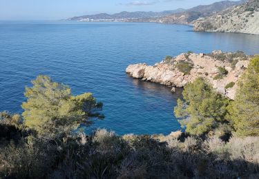
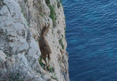
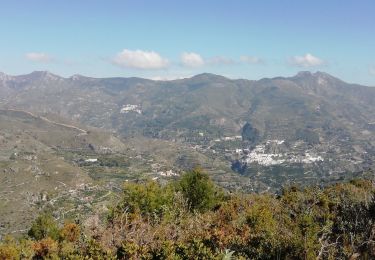
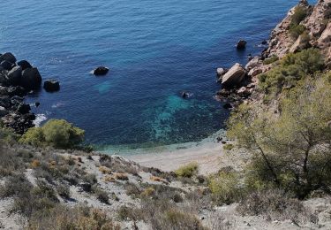
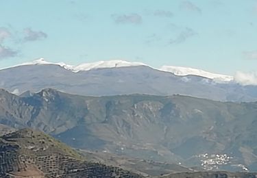
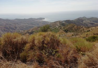
Points de vue magnifiques sur les montagnes environnantes, la Sierra Nevada enneigée au loin et la vue sur la mer de Motril à Velez Malaga
Localización
Comentarios
Excursiones cerca
![Excursión Senderismo Nerja - Montes Cerro Caleta - Photo](https://media.geolcdn.com/t/375/260/42a3f5e5-5c24-48a4-92ae-1b1aa382f506.jpg&format=jpg&maxdim=2)
![Senderismo Senderismo](https://static1.geolcdn.com/sitytour/trail-icons/101.png)
Senderismo
![](/images/other/stat-length.png)
![](https://static1.geolcdn.com/siteimages/upload/files/16400158638029165_repeat_loop_refresh_sync_direction_icon.png)
![Excursión Senderismo Nerja - Parking Cañada real - Peñón del Fraile- Playa Cañuelos - Photo](https://media.geolcdn.com/t/375/260/6549f82a-23a4-427e-9f22-49e56ce7a56a.jpg&format=jpg&maxdim=2)
![Senderismo Senderismo](https://static1.geolcdn.com/sitytour/trail-icons/101.png)
Senderismo
![](/images/other/stat-length.png)
![](https://static1.geolcdn.com/siteimages/upload/files/16400158638029165_repeat_loop_refresh_sync_direction_icon.png)
![Excursión Senderismo Otívar - OTIVAR Castillo Moscaril - Photo](https://media.geolcdn.com/t/375/260/0f691502-7702-4e97-b4a7-20ff68f93bf9.jpg&format=jpg&maxdim=2)
![Senderismo Senderismo](https://static1.geolcdn.com/sitytour/trail-icons/101.png)
Senderismo
![](/images/other/stat-length.png)
![](https://static1.geolcdn.com/siteimages/upload/files/16400158638029165_repeat_loop_refresh_sync_direction_icon.png)
![Excursión Senderismo Nerja - Los Cañuelos - Photo](https://media.geolcdn.com/t/375/260/a698f154-2ceb-4e23-a29f-8ee99a4e5034.jpg&format=jpg&maxdim=2)
![Senderismo Senderismo](https://static1.geolcdn.com/sitytour/trail-icons/101.png)
![Excursión Senderismo Nerja - Rio de la miel Hoya Quintana - Photo](https://media.geolcdn.com/t/375/260/7515d86c-bd23-4f7c-8916-266655eb9043.jpg&format=jpg&maxdim=2)
![Senderismo Senderismo](https://static1.geolcdn.com/sitytour/trail-icons/101.png)
Senderismo
![](/images/other/stat-length.png)
![](https://static1.geolcdn.com/siteimages/upload/files/16400158638029165_repeat_loop_refresh_sync_direction_icon.png)
![Excursión Motocross Almuñécar - Balade en passant par Alhama de Granada - Photo](https://media.geolcdn.com/t/375/260/65eca8fc-d181-48b0-8100-93108ba26b18.jpg&format=jpg&maxdim=2)
![Motocross Motocross](https://static1.geolcdn.com/sitytour/trail-icons/406.png)
Motocross
![](/images/other/stat-length.png)
![](https://static1.geolcdn.com/siteimages/upload/files/16400158638029165_repeat_loop_refresh_sync_direction_icon.png)
![Excursión Senderismo Nerja - Loma del Puesto Long - Photo](https://media.geolcdn.com/t/375/260/89487078-dcc3-4468-bbda-492f06a82232.jpg&format=jpg&maxdim=2)
![Senderismo Senderismo](https://static1.geolcdn.com/sitytour/trail-icons/101.png)
Senderismo
![](/images/other/stat-length.png)
![](https://static1.geolcdn.com/siteimages/upload/files/16400158638029165_repeat_loop_refresh_sync_direction_icon.png)
![Excursión Senderismo Almuñécar - Au dessus de EL CERVAL - Photo](https://media.geolcdn.com/t/375/260/8cdb8405-48e9-44ea-a73a-31deabc2a61b.jpg&format=jpg&maxdim=2)
![Senderismo Senderismo](https://static1.geolcdn.com/sitytour/trail-icons/101.png)
Senderismo
![](/images/other/stat-length.png)
![](https://static1.geolcdn.com/siteimages/upload/files/16400158638029165_repeat_loop_refresh_sync_direction_icon.png)
![Excursión Senderismo Nerja - el-rescate - Photo](https://media.geolcdn.com/t/375/260/f4f104b4-9256-490d-ac86-6b5b14f79a1e.jpg&format=jpg&maxdim=2)
![Senderismo Senderismo](https://static1.geolcdn.com/sitytour/trail-icons/101.png)