


7,6 km | 12,7 km-effort


Usuario


Aplicación GPS de excursión GRATIS
 SityTrail
IGN / Institutos geográficos
SityTrail World
El mundo es suyo
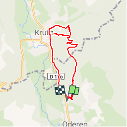
Ruta Senderismo de 7,5 km a descubrir en Gran Este, Alto Rin, Oderen. Esta ruta ha sido propuesta por patrickbeyrath.
Sentier en partie Club Vosgien et une partie avec sigle S'trass Hiesel et une partie sans sigle
le tracé est à peu près

Senderismo

Senderismo
Senderismo

Senderismo

Bici de montaña
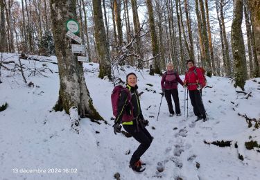
Senderismo

Senderismo

Senderismo

Senderismo