![](/images/other/stat-length.png)
![Excursión Senderismo Val-d'Arc - tour du haut de Randens - Photo](https://media.geolcdn.com/t/1900/400/aa8a7963-0ce0-4bad-bb6f-4b975d8a3b5b.jpg&format=pjpeg&maxdim=2)
tour du haut de Randens
jibebouvier
Usuario
![Longitud](/images/other/stat-length.png)
![Altitud máxima](https://static1.geolcdn.com/siteimages/upload/files/1508320355ic_sort_altitude_max_24dp.png)
![Desnivel positivo](https://static1.geolcdn.com/siteimages/upload/files/1508320355ic_sort_den_pos_24dp.png)
![Km-Effort](/images/other/stat-length.png)
![Altitud mínima](https://static1.geolcdn.com/siteimages/upload/files/1508320355ic_sort_altitude_min_24dp.png)
![Desnivel negativo](https://static1.geolcdn.com/siteimages/upload/files/1508320355ic_sort_den_neg_24dp.png)
![Boucle](https://static1.geolcdn.com/siteimages/upload/files/16400158638029165_repeat_loop_refresh_sync_direction_icon.png)
![Senderismo](https://static1.geolcdn.com/sitytour/trail-icons/101.png)
2h48
Dificultad : Medio
![Escanee este código QR para abrir la excursión en la aplicación SityTrail](https://capi.geolives.com/qq0zvz2zws4bq2lad0pu/sitytour/trails/3505046/qr.png?size=200)
Aplicación GPS de excursión GRATIS
A propósito
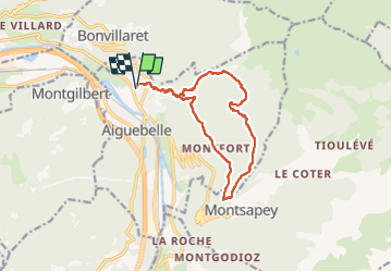
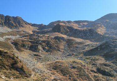
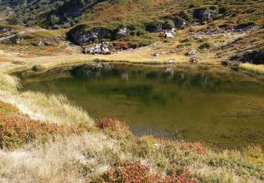
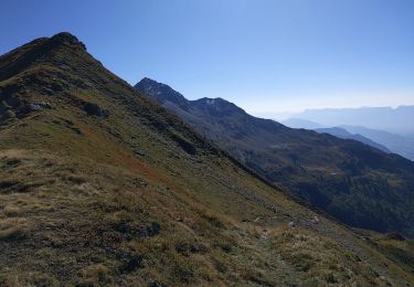
Ruta Senderismo de 13 km a descubrir en Auvergne-Rhône-Alpes, Saboya, Val-d'Arc. Esta ruta ha sido propuesta por jibebouvier.
Descripción
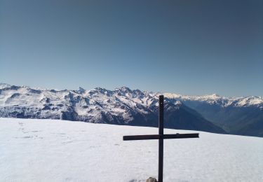
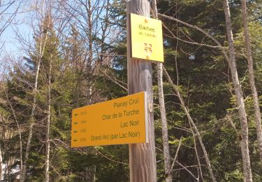
en passant par Coisse, Montfort, la chapelle de Montsapey, et prendre direction la place des dépôts de bois juste en dessous le trou du loup.
Là, longue traversée quasi à plat jusqu'en dessous des Mauilles, puis retour tout dré dans le pentu ;-)
15,8km 3D et 1300 m dénivelé.
bonne balade
Localización
Comentarios
Excursiones cerca
![Excursión Senderismo Montsapey - Lac Clartan et plus - Photo](https://media.geolcdn.com/t/375/260/a3945484-2742-42e9-b6c0-fb5c4b25df2b.jpg&format=jpg&maxdim=2)
![Senderismo Senderismo](https://static1.geolcdn.com/sitytour/trail-icons/101.png)
Senderismo
![](/images/other/stat-length.png)
![](https://static1.geolcdn.com/siteimages/upload/files/16400158638029165_repeat_loop_refresh_sync_direction_icon.png)
![Excursión Esquí de fondo Montsapey - pas de Freydon - Photo](https://media.geolcdn.com/t/375/260/878ecc25-aa9c-40b4-b58b-a735c66cffef.jpg&format=jpg&maxdim=2)
![Esquí de fondo Esquí de fondo](https://static1.geolcdn.com/sitytour/trail-icons/503.png)
Esquí de fondo
![](/images/other/stat-length.png)
![](https://static1.geolcdn.com/siteimages/upload/files/16400158638029165_repeat_loop_refresh_sync_direction_icon.png)
![Excursión Senderismo Val-d'Arc - Grand Arc - Photo](https://media.geolcdn.com/t/375/260/ext.jpg?maxdim=2&url=https%3A%2F%2Fstatic1.geolcdn.com%2Fsiteimages%2Fupload%2Ffiles%2F1553511878bg_sport_marche.png)
![Senderismo Senderismo](https://static1.geolcdn.com/sitytour/trail-icons/101.png)
Senderismo
![](/images/other/stat-length.png)
![](https://static1.geolcdn.com/siteimages/upload/files/16400158638029165_repeat_loop_refresh_sync_direction_icon.png)
![Excursión Senderismo Montsapey - portes de Montmélian par le col des fretes - Photo](https://media.geolcdn.com/t/375/260/90286a5c-8381-4fdf-9211-0d4b99111163.jpg&format=jpg&maxdim=2)
![Senderismo Senderismo](https://static1.geolcdn.com/sitytour/trail-icons/101.png)
Senderismo
![](/images/other/stat-length.png)
![](https://static1.geolcdn.com/siteimages/upload/files/16400158638029165_repeat_loop_refresh_sync_direction_icon.png)
![Excursión Senderismo Montgilbert - les batteries par Montgilbert - Photo](https://media.geolcdn.com/t/375/260/f104cb28-96a4-49e7-af5f-60f831324464.jpg&format=jpg&maxdim=2)
![Senderismo Senderismo](https://static1.geolcdn.com/sitytour/trail-icons/101.png)
Senderismo
![](/images/other/stat-length.png)
![](https://static1.geolcdn.com/siteimages/upload/files/16400158638029165_repeat_loop_refresh_sync_direction_icon.png)
![Excursión Senderismo Sainte-Hélène-sur-Isère - 27 09 23 le Grand Arc - Photo](https://media.geolcdn.com/t/375/260/06827bae-7a14-40e2-996f-75ece7e1ce9b.jpg&format=jpg&maxdim=2)
![Senderismo Senderismo](https://static1.geolcdn.com/sitytour/trail-icons/101.png)
Senderismo
![](/images/other/stat-length.png)
![](https://static1.geolcdn.com/siteimages/upload/files/16400158638029165_repeat_loop_refresh_sync_direction_icon.png)
![Excursión Senderismo Sainte-Hélène-sur-Isère - 26 09 23 la dent du corbeau par la grande lanche - Photo](https://media.geolcdn.com/t/375/260/87de882e-a65f-4159-b9ac-8bc46446cbc4.jpg&format=jpg&maxdim=2)
![Senderismo Senderismo](https://static1.geolcdn.com/sitytour/trail-icons/101.png)
Senderismo
![](/images/other/stat-length.png)
![](https://static1.geolcdn.com/siteimages/upload/files/16400158638029165_repeat_loop_refresh_sync_direction_icon.png)
![Excursión Senderismo Montsapey - petit arc par bataille dessus printemps - Photo](https://media.geolcdn.com/t/375/260/3bc7f631-fc7c-488f-b081-67d83a0e2dae.jpg&format=jpg&maxdim=2)
![Senderismo Senderismo](https://static1.geolcdn.com/sitytour/trail-icons/101.png)
Senderismo
![](/images/other/stat-length.png)
![](https://static1.geolcdn.com/siteimages/upload/files/16400158638029165_repeat_loop_refresh_sync_direction_icon.png)
![Excursión Senderismo Montsapey - la chapelle de montsap' lac noir - Photo](https://media.geolcdn.com/t/375/260/d1b6e184-6050-487d-bf66-654bd3da97db.jpg&format=jpg&maxdim=2)
![Senderismo Senderismo](https://static1.geolcdn.com/sitytour/trail-icons/101.png)
Senderismo
![](/images/other/stat-length.png)
![](https://static1.geolcdn.com/siteimages/upload/files/16400158638029165_repeat_loop_refresh_sync_direction_icon.png)