![](/images/other/stat-length.png)
![Excursión Senderismo Plan-d'Aups-Sainte-Baume - Sainte baume + gr9 (Plan d'Aups...) - Photo](https://media.geolcdn.com/t/1900/400/ext.pjpeg?maxdim=2&url=https%3A%2F%2Fstatic1.geolcdn.com%2Fsiteimages%2Fupload%2Ffiles%2F1553511878bg_sport_marche.png)
Sainte baume + gr9 (Plan d'Aups...)
Frayssinet
Usuario
![Longitud](/images/other/stat-length.png)
Longitud
14,7 km
![Altitud máxima](https://static1.geolcdn.com/siteimages/upload/files/1508320355ic_sort_altitude_max_24dp.png)
Altitud máxima
1140 m
![Desnivel positivo](https://static1.geolcdn.com/siteimages/upload/files/1508320355ic_sort_den_pos_24dp.png)
Desnivel positivo
615 m
![Km-Effort](/images/other/stat-length.png)
Km-Effort
23 km
![Altitud mínima](https://static1.geolcdn.com/siteimages/upload/files/1508320355ic_sort_altitude_min_24dp.png)
Altitud mínima
671 m
![Desnivel negativo](https://static1.geolcdn.com/siteimages/upload/files/1508320355ic_sort_den_neg_24dp.png)
Desnivel negativo
615 m
![Boucle](https://static1.geolcdn.com/siteimages/upload/files/16400158638029165_repeat_loop_refresh_sync_direction_icon.png)
Boucle
Sí
Fecha de creación :
2022-12-29 08:30:15.801
Última modificación :
2023-01-01 13:28:33.703
![Senderismo](https://static1.geolcdn.com/sitytour/trail-icons/101.png)
5h45
Dificultad : Medio
![Escanee este código QR para abrir la excursión en la aplicación SityTrail](https://capi.geolives.com/qq0zvz2zws4bq2lad0pu/sitytour/trails/3497082/qr.png?size=200)
Aplicación GPS de excursión GRATIS
A propósito
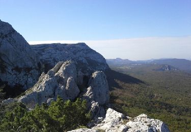
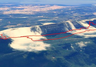
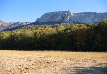
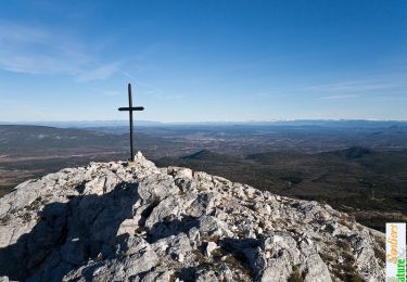
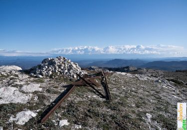
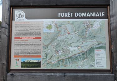
Ruta Senderismo de 14,7 km a descubrir en Provenza-Alpes-Costa Azul, Var, Plan-d'Aups-Sainte-Baume. Esta ruta ha sido propuesta por Frayssinet.
Descripción
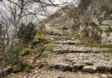
visite de la grotte Sainte Marie Madeleine
corniche avec le gr9.
retour par la vallée.
Attention quand les roches sont humides. Prenez des bâtons.
Localización
País:
France
Región :
Provenza-Alpes-Costa Azul
Departamento/provincia :
Var
Municipio :
Plan-d'Aups-Sainte-Baume
Localidad:
Unknown
Salida:(Dec)
Salida:(UTM)
723660 ; 4801773 (31T) N.
Comentarios
Excursiones cerca
![Excursión Senderismo Plan-d'Aups-Sainte-Baume - Sainte Baume 8,5 km - Photo](https://media.geolcdn.com/t/375/260/02bfd54c-87ac-472a-9dd7-603e289d99c6.jpeg&format=jpg&maxdim=2)
![Senderismo Senderismo](https://static1.geolcdn.com/sitytour/trail-icons/101.png)
Sainte Baume 8,5 km
Senderismo
Medio
(1)
Plan-d'Aups-Sainte-Baume,
Provenza-Alpes-Costa Azul,
Var,
France
![](/images/other/stat-length.png)
8,4 km | 15,5 km-effort
4h 38min
![](https://static1.geolcdn.com/siteimages/upload/files/16400158638029165_repeat_loop_refresh_sync_direction_icon.png)
Sí
![Excursión Senderismo Nans-les-Pins - Le baou des glacières - Photo](https://media.geolcdn.com/t/375/260/ext.jpg?maxdim=2&url=https%3A%2F%2Fservices.sitytrail.com%2FGeolivesWS%2FDownloadMedia.ashx%3FTrailID%3D356935%26Media%3Dfix__20141025130409.jpg)
![Senderismo Senderismo](https://static1.geolcdn.com/sitytour/trail-icons/101.png)
Le baou des glacières
Senderismo
Medio
(1)
Nans-les-Pins,
Provenza-Alpes-Costa Azul,
Var,
France
![](/images/other/stat-length.png)
7,6 km | 12,2 km-effort
4h 27min
![](https://static1.geolcdn.com/siteimages/upload/files/16400158638029165_repeat_loop_refresh_sync_direction_icon.png)
Sí
![Excursión Senderismo Plan-d'Aups-Sainte-Baume - SityTrail - Sentier merveilleux - La Ste baume - Le Plan d'aups - Photo](https://media.geolcdn.com/t/375/260/e69b33b5-1427-482e-bef6-59e868e7cd87.jpg&format=jpg&maxdim=2)
![Senderismo Senderismo](https://static1.geolcdn.com/sitytour/trail-icons/101.png)
SityTrail - Sentier merveilleux - La Ste baume - Le Plan d'aups
Senderismo
Medio
(1)
Plan-d'Aups-Sainte-Baume,
Provenza-Alpes-Costa Azul,
Var,
France
![](/images/other/stat-length.png)
15 km | 23 km-effort
6h 0min
![](https://static1.geolcdn.com/siteimages/upload/files/16400158638029165_repeat_loop_refresh_sync_direction_icon.png)
Sí
![Excursión Senderismo Plan-d'Aups-Sainte-Baume - Crêts de la Ste Baume - Photo](https://media.geolcdn.com/t/375/260/ext.jpg?maxdim=2&url=https%3A%2F%2Fservices.sitytrail.com%2FGeolivesWS%2FDownloadMedia.ashx%3FTrailID%3D214866%26Media%3D15409_2.jpg)
![Senderismo Senderismo](https://static1.geolcdn.com/sitytour/trail-icons/101.png)
Crêts de la Ste Baume
Senderismo
Medio
(2)
Plan-d'Aups-Sainte-Baume,
Provenza-Alpes-Costa Azul,
Var,
France
![](/images/other/stat-length.png)
15,4 km | 23 km-effort
5h 0min
![](https://static1.geolcdn.com/siteimages/upload/files/16400158638029165_repeat_loop_refresh_sync_direction_icon.png)
Sí
![Excursión Senderismo Nans-les-Pins - La Croix des Glacières, Sainte-Baume - Photo](https://media.geolcdn.com/t/375/260/ext.jpg?maxdim=2&url=https%3A%2F%2Fservices.sitytrail.com%2FGeolivesWS%2FDownloadMedia.ashx%3FTrailID%3D107654%26Media%3D12647_1.jpg)
![Senderismo Senderismo](https://static1.geolcdn.com/sitytour/trail-icons/101.png)
La Croix des Glacières, Sainte-Baume
Senderismo
Medio
(1)
Nans-les-Pins,
Provenza-Alpes-Costa Azul,
Var,
France
![](/images/other/stat-length.png)
7,2 km | 12 km-effort
3h 19min
![](https://static1.geolcdn.com/siteimages/upload/files/16400158638029165_repeat_loop_refresh_sync_direction_icon.png)
Sí
![Excursión Senderismo Plan-d'Aups-Sainte-Baume - Du Col du Saint-Pilon au Pas de l'Aï, Sainte Baume - Photo](https://media.geolcdn.com/t/375/260/ext.jpg?maxdim=2&url=https%3A%2F%2Fservices.sitytrail.com%2FGeolivesWS%2FDownloadMedia.ashx%3FTrailID%3D107608%26Media%3D12576_1.jpg)
![Senderismo Senderismo](https://static1.geolcdn.com/sitytour/trail-icons/101.png)
Du Col du Saint-Pilon au Pas de l'Aï, Sainte Baume
Senderismo
Medio
(1)
Plan-d'Aups-Sainte-Baume,
Provenza-Alpes-Costa Azul,
Var,
France
![](/images/other/stat-length.png)
13,1 km | 20 km-effort
5h 15min
![](https://static1.geolcdn.com/siteimages/upload/files/16400158638029165_repeat_loop_refresh_sync_direction_icon.png)
Sí
![Excursión Senderismo Riboux - Riboux - Forêt de Malaucène - Photo](https://media.geolcdn.com/t/375/260/ext.jpg?maxdim=2&url=https%3A%2F%2Fservices.sitytrail.com%2FGeolivesWS%2FDownloadMedia.ashx%3FTrailID%3D103921%26Media%3D6772_2.jpg)
![Senderismo Senderismo](https://static1.geolcdn.com/sitytour/trail-icons/101.png)
Riboux - Forêt de Malaucène
Senderismo
Medio
(4)
Riboux,
Provenza-Alpes-Costa Azul,
Var,
France
![](/images/other/stat-length.png)
12,2 km | 15,2 km-effort
2h 40min
![](https://static1.geolcdn.com/siteimages/upload/files/16400158638029165_repeat_loop_refresh_sync_direction_icon.png)
Sí
![Excursión Senderismo Plan-d'Aups-Sainte-Baume - La Grotte aux oiseaux - Plan d'Aups - Photo](https://media.geolcdn.com/t/375/260/ext.jpg?maxdim=2&url=https%3A%2F%2Fservices.sitytrail.com%2FGeolivesWS%2FDownloadMedia.ashx%3FTrailID%3D103826%26Media%3D6600_1.jpg)
![Senderismo Senderismo](https://static1.geolcdn.com/sitytour/trail-icons/101.png)
La Grotte aux oiseaux - Plan d'Aups
Senderismo
Medio
(1)
Plan-d'Aups-Sainte-Baume,
Provenza-Alpes-Costa Azul,
Var,
France
![](/images/other/stat-length.png)
8,8 km | 12,5 km-effort
2h 30min
![](https://static1.geolcdn.com/siteimages/upload/files/16400158638029165_repeat_loop_refresh_sync_direction_icon.png)
Sí
![Excursión Senderismo Saint-Zacharie - Sources des Nayes - Photo](https://media.geolcdn.com/t/375/260/f10876bf-7b9c-4295-a050-83953c85f7a8.jpg&format=jpg&maxdim=2)
![Senderismo Senderismo](https://static1.geolcdn.com/sitytour/trail-icons/101.png)
Sources des Nayes
Senderismo
Medio
Saint-Zacharie,
Provenza-Alpes-Costa Azul,
Var,
France
![](/images/other/stat-length.png)
7,6 km | 9,6 km-effort
1h 47min
![](https://static1.geolcdn.com/siteimages/upload/files/16400158638029165_repeat_loop_refresh_sync_direction_icon.png)
Sí