![](/images/other/stat-length.png)
![Excursión Senderismo Overijse - #221024 - Jesus-Eik, Arboretum, Kapucijnenbos - Photo](https://media.geolcdn.com/t/1900/400/23166059-8f62-4748-a8b6-ece68949b182.jpg&format=pjpeg&maxdim=2)
#221024 - Jesus-Eik, Arboretum, Kapucijnenbos
Randos Ouvertes
Usuario
![Longitud](/images/other/stat-length.png)
Longitud
7,9 km
![Altitud máxima](https://static1.geolcdn.com/siteimages/upload/files/1508320355ic_sort_altitude_max_24dp.png)
Altitud máxima
140 m
![Desnivel positivo](https://static1.geolcdn.com/siteimages/upload/files/1508320355ic_sort_den_pos_24dp.png)
Desnivel positivo
108 m
![Km-Effort](/images/other/stat-length.png)
Km-Effort
9,3 km
![Altitud mínima](https://static1.geolcdn.com/siteimages/upload/files/1508320355ic_sort_altitude_min_24dp.png)
Altitud mínima
93 m
![Desnivel negativo](https://static1.geolcdn.com/siteimages/upload/files/1508320355ic_sort_den_neg_24dp.png)
Desnivel negativo
108 m
![Boucle](https://static1.geolcdn.com/siteimages/upload/files/16400158638029165_repeat_loop_refresh_sync_direction_icon.png)
Boucle
Sí
Fecha de creación :
2022-10-18 07:49:53.695
Última modificación :
2022-10-26 19:57:31.79
![Senderismo](https://static1.geolcdn.com/sitytour/trail-icons/101.png)
2h07
Dificultad : Medio
![Escanee este código QR para abrir la excursión en la aplicación SityTrail](https://capi.geolives.com/qq0zvz2zws4bq2lad0pu/sitytour/trails/3427492/qr.png?size=200)
Aplicación GPS de excursión GRATIS
A propósito
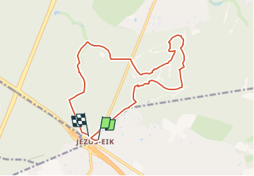
Ruta Senderismo de 7,9 km a descubrir en Flandes, Brabante Flamenco, Overijse. Esta ruta ha sido propuesta por Randos Ouvertes.
Descripción
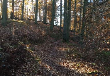
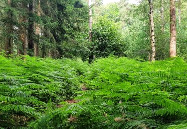
Un must absolu, navigation ludique nécessitant un peu d'attention. Voir photos du 24/10/2022 dont le crédit revient à Sophie Vermote. Merci à elle.
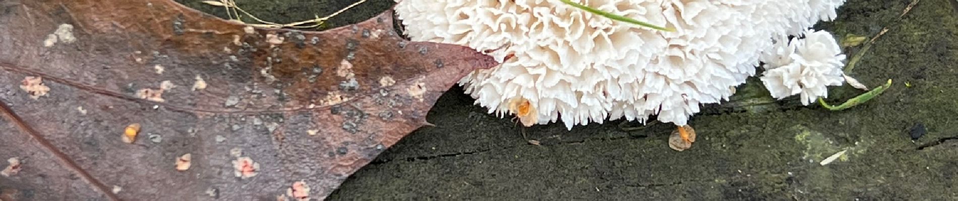
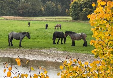
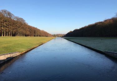
Localización
País:
Belgium
Región :
Flandes
Departamento/provincia :
Brabante Flamenco
Municipio :
Overijse
Localidad:
Unknown
Salida:(Dec)
Salida:(UTM)
604651 ; 5627923 (31U) N.
Comentarios
Excursiones cerca
![Excursión Senderismo Hoeilaart - GG-Bw-04_Hoeilaart - Genval - Photo](https://media.geolcdn.com/t/375/260/364592d0-bbf8-45ce-9ea9-708b8ca7581f.jpg&format=jpg&maxdim=2)
![Senderismo Senderismo](https://static1.geolcdn.com/sitytour/trail-icons/101.png)
GG-Bw-04_Hoeilaart - Genval
Senderismo
Muy difícil
(6)
Hoeilaart,
Flandes,
Brabante Flamenco,
Belgium
![](/images/other/stat-length.png)
23 km | 28 km-effort
5h 54min
![](https://static1.geolcdn.com/siteimages/upload/files/16400158638029165_repeat_loop_refresh_sync_direction_icon.png)
No
![Excursión Senderismo Auderghem - Oudergem - RB-Br-09 Raccourci 2 - Photo](https://media.geolcdn.com/t/375/260/ext.jpg?maxdim=2&url=https%3A%2F%2Fservices.sitytrail.com%2FGeolivesWS%2FDownloadMedia.ashx%3FTrailID%3D247903%26Media%3D4f2f6ef8-5647-4df5-b72e-d8a55c5e5b6f.jpg)
![Senderismo Senderismo](https://static1.geolcdn.com/sitytour/trail-icons/101.png)
RB-Br-09 Raccourci 2
Senderismo
Fácil
(9)
Auderghem - Oudergem,
Région de Bruxelles-Capitale - Brussels Hoofdstedelijk Gewest,
Desconocido,
Belgium
![](/images/other/stat-length.png)
15,3 km | 18 km-effort
4h 5min
![](https://static1.geolcdn.com/siteimages/upload/files/16400158638029165_repeat_loop_refresh_sync_direction_icon.png)
Sí
![Excursión Senderismo Auderghem - Oudergem - RB-Br-09 - Photo](https://media.geolcdn.com/t/375/260/ext.jpg?maxdim=2&url=https%3A%2F%2Fservices.sitytrail.com%2FGeolivesWS%2FDownloadMedia.ashx%3FTrailID%3D247899%26Media%3D7b6d3a4f-3999-4d35-8f7d-f23163489b77.jpg)
![Senderismo Senderismo](https://static1.geolcdn.com/sitytour/trail-icons/101.png)
RB-Br-09
Senderismo
Medio
(8)
Auderghem - Oudergem,
Région de Bruxelles-Capitale - Brussels Hoofdstedelijk Gewest,
Desconocido,
Belgium
![](/images/other/stat-length.png)
20 km | 25 km-effort
5h 34min
![](https://static1.geolcdn.com/siteimages/upload/files/16400158638029165_repeat_loop_refresh_sync_direction_icon.png)
Sí
![Excursión Senderismo Auderghem - Oudergem - RB-Br-09 Raccourci 1 - Photo](https://media.geolcdn.com/t/375/260/ext.jpg?maxdim=2&url=https%3A%2F%2Fservices.sitytrail.com%2FGeolivesWS%2FDownloadMedia.ashx%3FTrailID%3D247901%26Media%3D4f2f6ef8-5647-4df5-b72e-d8a55c5e5b6f.jpg)
![Senderismo Senderismo](https://static1.geolcdn.com/sitytour/trail-icons/101.png)
RB-Br-09 Raccourci 1
Senderismo
Fácil
(4)
Auderghem - Oudergem,
Région de Bruxelles-Capitale - Brussels Hoofdstedelijk Gewest,
Desconocido,
Belgium
![](/images/other/stat-length.png)
16 km | 19,1 km-effort
4h 20min
![](https://static1.geolcdn.com/siteimages/upload/files/16400158638029165_repeat_loop_refresh_sync_direction_icon.png)
Sí
![Excursión Senderismo Tervuren - #221017 - Duisburg, Wolfkensberg, Raffelberg - Photo](https://media.geolcdn.com/t/375/260/eb11e242-b355-4cb6-a158-313432558930.jpg&format=jpg&maxdim=2)
![Senderismo Senderismo](https://static1.geolcdn.com/sitytour/trail-icons/101.png)
#221017 - Duisburg, Wolfkensberg, Raffelberg
Senderismo
Medio
(2)
Tervuren,
Flandes,
Brabante Flamenco,
Belgium
![](/images/other/stat-length.png)
8,3 km | 9,5 km-effort
2h 10min
![](https://static1.geolcdn.com/siteimages/upload/files/16400158638029165_repeat_loop_refresh_sync_direction_icon.png)
Sí
![Excursión Senderismo Tervuren - Tervuren Leefdaal 22 km - Photo](https://media.geolcdn.com/t/375/260/ext.jpg?maxdim=2&url=https%3A%2F%2Fservices.sitytrail.com%2FGeolivesWS%2FDownloadMedia.ashx%3FTrailID%3D1084200%26Media%3D20181213150951.jpg)
![Senderismo Senderismo](https://static1.geolcdn.com/sitytour/trail-icons/101.png)
Tervuren Leefdaal 22 km
Senderismo
Fácil
(1)
Tervuren,
Flandes,
Brabante Flamenco,
Belgium
![](/images/other/stat-length.png)
23 km | 27 km-effort
5h 24min
![](https://static1.geolcdn.com/siteimages/upload/files/16400158638029165_repeat_loop_refresh_sync_direction_icon.png)
Sí
![Excursión Senderismo Hoeilaart - grœnendael forêt de Soigne. 14 - Photo](https://media.geolcdn.com/t/375/260/ext.jpg?maxdim=2&url=https%3A%2F%2Fservices.sitytrail.com%2FGeolivesWS%2FDownloadMedia.ashx%3FTrailID%3D1072419%26Media%3D20181115132109.jpg)
![Senderismo Senderismo](https://static1.geolcdn.com/sitytour/trail-icons/101.png)
grœnendael forêt de Soigne. 14
Senderismo
Muy fácil
(2)
Hoeilaart,
Flandes,
Brabante Flamenco,
Belgium
![](/images/other/stat-length.png)
14 km | 16,9 km-effort
4h 23min
![](https://static1.geolcdn.com/siteimages/upload/files/16400158638029165_repeat_loop_refresh_sync_direction_icon.png)
Sí
![Excursión Senderismo Hoeilaart - Soignes-Hulpe South - Photo](https://media.geolcdn.com/t/375/260/ext.jpg?maxdim=2&url=https%3A%2F%2Fservices.sitytrail.com%2FGeolivesWS%2FDownloadMedia.ashx%3FTrailID%3D551510%26Media%3D20160410104135.jpg)
![Senderismo Senderismo](https://static1.geolcdn.com/sitytour/trail-icons/101.png)
Soignes-Hulpe South
Senderismo
Fácil
(3)
Hoeilaart,
Flandes,
Brabante Flamenco,
Belgium
![](/images/other/stat-length.png)
13,9 km | 16,9 km-effort
3h 46min
![](https://static1.geolcdn.com/siteimages/upload/files/16400158638029165_repeat_loop_refresh_sync_direction_icon.png)
Sí
![Excursión Senderismo Tervuren - Arboretum - Kapucijnenbos - Photo](https://media.geolcdn.com/t/375/260/b9913596-de24-4332-b79b-b09410acdfbd.jpg&format=jpg&maxdim=2)
![Senderismo Senderismo](https://static1.geolcdn.com/sitytour/trail-icons/101.png)
Arboretum - Kapucijnenbos
Senderismo
Difícil
(1)
Tervuren,
Flandes,
Brabante Flamenco,
Belgium
![](/images/other/stat-length.png)
13,7 km | 16,3 km-effort
3h 41min
![](https://static1.geolcdn.com/siteimages/upload/files/16400158638029165_repeat_loop_refresh_sync_direction_icon.png)
Sí