![](/images/other/stat-length.png)
![Excursión Senderismo Merlas - Merlas boucle par le lac de St Sixt et étang des chartreux - Photo](https://media.geolcdn.com/t/1900/400/89c53a81-49aa-496f-a3ef-ba0fc42f890a.jpg&format=pjpeg&maxdim=2)
Merlas boucle par le lac de St Sixt et étang des chartreux
gmtrando
Usuario
![Longitud](/images/other/stat-length.png)
Longitud
16,6 km
![Altitud máxima](https://static1.geolcdn.com/siteimages/upload/files/1508320355ic_sort_altitude_max_24dp.png)
Altitud máxima
917 m
![Desnivel positivo](https://static1.geolcdn.com/siteimages/upload/files/1508320355ic_sort_den_pos_24dp.png)
Desnivel positivo
499 m
![Km-Effort](/images/other/stat-length.png)
Km-Effort
23 km
![Altitud mínima](https://static1.geolcdn.com/siteimages/upload/files/1508320355ic_sort_altitude_min_24dp.png)
Altitud mínima
618 m
![Desnivel negativo](https://static1.geolcdn.com/siteimages/upload/files/1508320355ic_sort_den_neg_24dp.png)
Desnivel negativo
497 m
![Boucle](https://static1.geolcdn.com/siteimages/upload/files/16400158638029165_repeat_loop_refresh_sync_direction_icon.png)
Boucle
Sí
Fecha de creación :
2022-10-02 07:45:23.943
Última modificación :
2022-10-02 20:18:45.65
![Senderismo](https://static1.geolcdn.com/sitytour/trail-icons/101.png)
4h30
Dificultad : Fácil
![Escanee este código QR para abrir la excursión en la aplicación SityTrail](https://capi.geolives.com/qq0zvz2zws4bq2lad0pu/sitytour/trails/3410995/qr.png?size=200)
Aplicación GPS de excursión GRATIS
A propósito
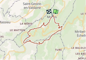
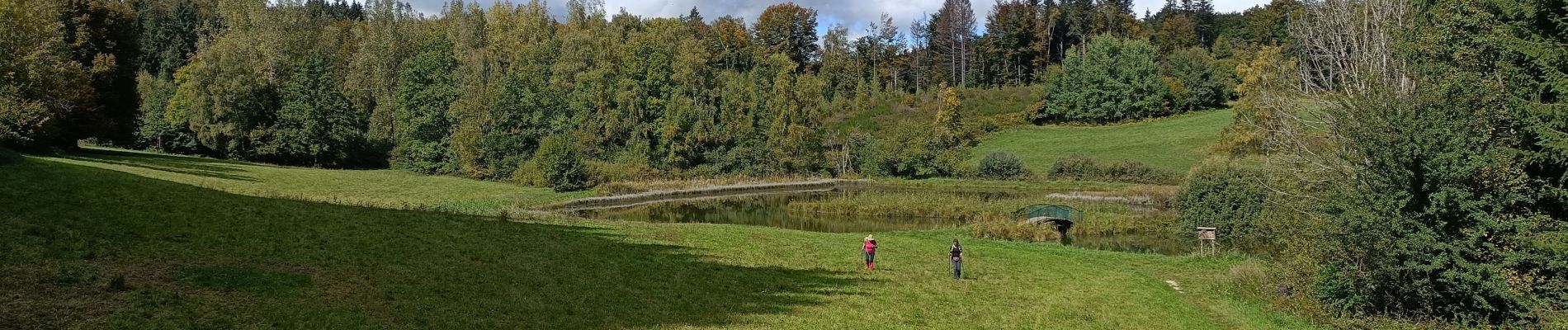
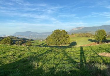
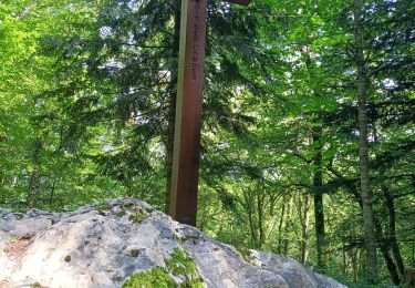
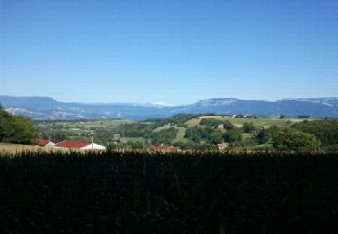
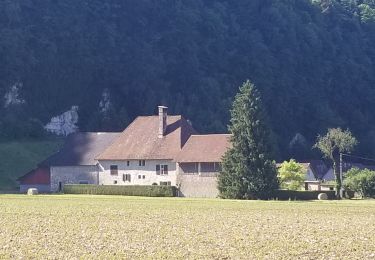
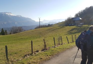
Ruta Senderismo de 16,6 km a descubrir en Auvergne-Rhône-Alpes, Isère, Merlas. Esta ruta ha sido propuesta por gmtrando.
Descripción
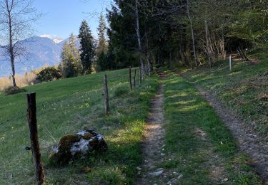
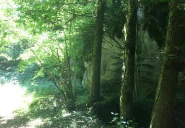
jolie petite randonnée beaucoup en sous bois. Tracé = passage dans des propriétés privées. peut être à rectifier.
Localización
País:
France
Región :
Auvergne-Rhône-Alpes
Departamento/provincia :
Isère
Municipio :
Merlas
Localidad:
Unknown
Salida:(Dec)
Salida:(UTM)
708386 ; 5035836 (31T) N.
Comentarios
Excursiones cerca
![Excursión Senderismo Velanne - Boucle autour de sauge - Photo](https://media.geolcdn.com/t/375/260/804bbea8-b5ac-447b-b9b3-5a79a27bbb0f.jpg&format=jpg&maxdim=2)
![Senderismo Senderismo](https://static1.geolcdn.com/sitytour/trail-icons/101.png)
Boucle autour de sauge
Senderismo
Muy fácil
Velanne,
Auvergne-Rhône-Alpes,
Isère,
France
![](/images/other/stat-length.png)
5,7 km | 7,2 km-effort
1h 33min
![](https://static1.geolcdn.com/siteimages/upload/files/16400158638029165_repeat_loop_refresh_sync_direction_icon.png)
Sí
![Excursión Senderismo Miribel-les-Échelles - mir - Photo](https://media.geolcdn.com/t/375/260/4a726117-d683-49cd-b31a-68e783ca1ce2.jpg&format=jpg&maxdim=2)
![Senderismo Senderismo](https://static1.geolcdn.com/sitytour/trail-icons/101.png)
mir
Senderismo
Difícil
Miribel-les-Échelles,
Auvergne-Rhône-Alpes,
Isère,
France
![](/images/other/stat-length.png)
12,7 km | 18 km-effort
7h 23min
![](https://static1.geolcdn.com/siteimages/upload/files/16400158638029165_repeat_loop_refresh_sync_direction_icon.png)
Sí
![Excursión Senderismo Miribel-les-Échelles - Circuit panoramique au départ de Miribelle - Photo](https://media.geolcdn.com/t/375/260/b11436e7-f00f-45a9-8670-74fc9f964837.jpg&format=jpg&maxdim=2)
![Senderismo Senderismo](https://static1.geolcdn.com/sitytour/trail-icons/101.png)
Circuit panoramique au départ de Miribelle
Senderismo
Fácil
(1)
Miribel-les-Échelles,
Auvergne-Rhône-Alpes,
Isère,
France
![](/images/other/stat-length.png)
9,5 km | 13,4 km-effort
2h 57min
![](https://static1.geolcdn.com/siteimages/upload/files/16400158638029165_repeat_loop_refresh_sync_direction_icon.png)
Sí
![Excursión Carrera Miribel-les-Échelles - Autour de Miribel-les-echelles - Photo](https://media.geolcdn.com/t/375/260/3c005446-1f23-4fe5-a1eb-5449d2562515.jpg&format=jpg&maxdim=2)
![Carrera Carrera](https://static1.geolcdn.com/sitytour/trail-icons/103.png)
Autour de Miribel-les-echelles
Carrera
Fácil
Miribel-les-Échelles,
Auvergne-Rhône-Alpes,
Isère,
France
![](/images/other/stat-length.png)
7,2 km | 11,5 km-effort
57min
![](https://static1.geolcdn.com/siteimages/upload/files/16400158638029165_repeat_loop_refresh_sync_direction_icon.png)
Sí
![Excursión Senderismo Saint-Sulpice-des-Rivoires - st sulpice mt blanc - Photo](https://media.geolcdn.com/t/375/260/ext.jpg?maxdim=2&url=https%3A%2F%2Fservices.sitytrail.com%2FGeolivesWS%2FDownloadMedia.ashx%3FTrailID%3D465895%26Media%3Dfix__20150826141129.jpg)
![Senderismo Senderismo](https://static1.geolcdn.com/sitytour/trail-icons/101.png)
st sulpice mt blanc
Senderismo
Fácil
Saint-Sulpice-des-Rivoires,
Auvergne-Rhône-Alpes,
Isère,
France
![](/images/other/stat-length.png)
9,7 km | 12,6 km-effort
2h 46min
![](https://static1.geolcdn.com/siteimages/upload/files/16400158638029165_repeat_loop_refresh_sync_direction_icon.png)
Sí
![Excursión Bicicleta híbrida Miribel-les-Échelles - Miribel - Les Echelles - St Christophe la Grotte - St Laurent - Miribel - Photo](https://media.geolcdn.com/t/375/260/cafa1724-1527-4e65-97cb-50120870953f.jpg&format=jpg&maxdim=2)
![Bicicleta híbrida Bicicleta híbrida](https://static1.geolcdn.com/sitytour/trail-icons/203.png)
Miribel - Les Echelles - St Christophe la Grotte - St Laurent - Miribel
Bicicleta híbrida
Muy fácil
Miribel-les-Échelles,
Auvergne-Rhône-Alpes,
Isère,
France
![](/images/other/stat-length.png)
31 km | 38 km-effort
2h 6min
![](https://static1.geolcdn.com/siteimages/upload/files/16400158638029165_repeat_loop_refresh_sync_direction_icon.png)
Sí
![Excursión Senderismo Miribel-les-Échelles - Av Pascal - Photo](https://media.geolcdn.com/t/375/260/133d33bc-3f8f-4d65-acb4-d0b19f07c4ac.jpg&format=jpg&maxdim=2)
![Senderismo Senderismo](https://static1.geolcdn.com/sitytour/trail-icons/101.png)
Av Pascal
Senderismo
Miribel-les-Échelles,
Auvergne-Rhône-Alpes,
Isère,
France
![](/images/other/stat-length.png)
5,3 km | 7,3 km-effort
1h 46min
![](https://static1.geolcdn.com/siteimages/upload/files/16400158638029165_repeat_loop_refresh_sync_direction_icon.png)
Sí
![Excursión Senderismo Miribel-les-Échelles - Col des mille martyrs - Photo](https://media.geolcdn.com/t/375/260/211017fc-24a5-4c2b-9aba-047b51cc3de6.jpg&format=jpg&maxdim=2)
![Senderismo Senderismo](https://static1.geolcdn.com/sitytour/trail-icons/101.png)
Col des mille martyrs
Senderismo
Muy fácil
(1)
Miribel-les-Échelles,
Auvergne-Rhône-Alpes,
Isère,
France
![](/images/other/stat-length.png)
5,9 km | 8,2 km-effort
2h 42min
![](https://static1.geolcdn.com/siteimages/upload/files/16400158638029165_repeat_loop_refresh_sync_direction_icon.png)
No
![Excursión Senderismo Miribel-les-Échelles - pierre a mata - Photo](https://media.geolcdn.com/t/375/260/34162138-d0b2-44c8-b748-df347e204590.jpg&format=jpg&maxdim=2)
![Senderismo Senderismo](https://static1.geolcdn.com/sitytour/trail-icons/101.png)
pierre a mata
Senderismo
Muy fácil
Miribel-les-Échelles,
Auvergne-Rhône-Alpes,
Isère,
France
![](/images/other/stat-length.png)
12,6 km | 17,8 km-effort
4h 58min
![](https://static1.geolcdn.com/siteimages/upload/files/16400158638029165_repeat_loop_refresh_sync_direction_icon.png)
Sí