![](/images/other/stat-length.png)
Reco Bargème-Châteauvieux
Sugg
Usuario
![Longitud](/images/other/stat-length.png)
![Altitud máxima](https://static1.geolcdn.com/siteimages/upload/files/1508320355ic_sort_altitude_max_24dp.png)
![Desnivel positivo](https://static1.geolcdn.com/siteimages/upload/files/1508320355ic_sort_den_pos_24dp.png)
![Km-Effort](/images/other/stat-length.png)
![Altitud mínima](https://static1.geolcdn.com/siteimages/upload/files/1508320355ic_sort_altitude_min_24dp.png)
![Desnivel negativo](https://static1.geolcdn.com/siteimages/upload/files/1508320355ic_sort_den_neg_24dp.png)
![Boucle](https://static1.geolcdn.com/siteimages/upload/files/16400158638029165_repeat_loop_refresh_sync_direction_icon.png)
![Senderismo](https://static1.geolcdn.com/sitytour/trail-icons/101.png)
5h49
Dificultad : Medio
![Escanee este código QR para abrir la excursión en la aplicación SityTrail](https://capi.geolives.com/qq0zvz2zws4bq2lad0pu/sitytour/trails/340287/qr.png?size=200)
Aplicación GPS de excursión GRATIS
A propósito
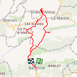
Ruta Senderismo de 19,3 km a descubrir en Provenza-Alpes-Costa Azul, Var, Bargème. Esta ruta ha sido propuesta por Sugg.
Descripción
Reco future rando RF
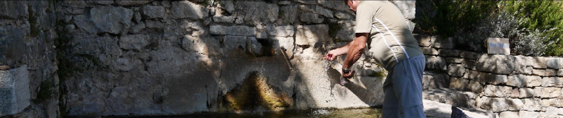
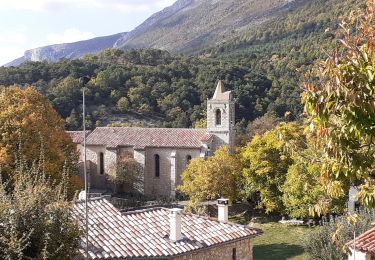
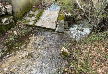
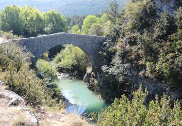
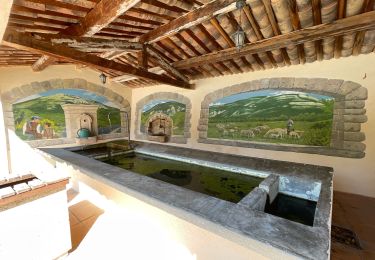
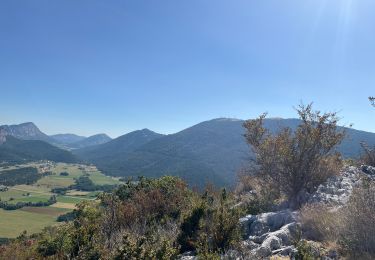
Avec Pierre,le gué cote 915 ( Les Gabres ) avec pas mal d'eau, à vérifier pour le jour J, le plan d'Anelle, les Davids et Château Rima ( prendre la route des Davids, car propriété privée ) visite Châteauvieux et petite bière au restaurant La Gruppi, puis Vallon Font Freye, Pont Madame, " Romain du 17ème LOL " et
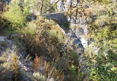
le gué et le début des gorges de l'Artuby( praticable sur 1 km d'après un pécheur ) retour par la piste pricipale qui passe sous la grotte de l'aigle, on ne prend pas la piste de Pra Guillen qui rejoint le GR49.
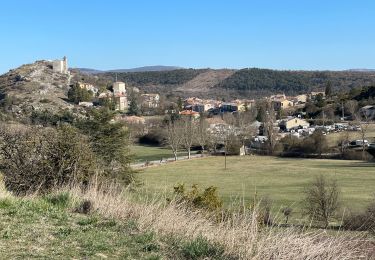
Visite de Bargème, toujours aussi beau village avec entre autres les ruines du Château.
La durée comprend comme d'hab les arrêts et recherche.
Super balade a venir pour nos randonneurs de Restons en Forme de Draguignan.
Localización
Comentarios
Excursiones cerca
![Excursión Senderismo Bargème - Montagne de Brouis. Bargeme - Photo](https://media.geolcdn.com/t/375/260/12ed21c8-92a7-48a8-a5a0-b4198ffe950d.jpg&format=jpg&maxdim=2)
![Senderismo Senderismo](https://static1.geolcdn.com/sitytour/trail-icons/101.png)
Senderismo
![](/images/other/stat-length.png)
![](https://static1.geolcdn.com/siteimages/upload/files/16400158638029165_repeat_loop_refresh_sync_direction_icon.png)
![Excursión Senderismo Bargème - bargeme pierre - Photo](https://media.geolcdn.com/t/375/260/12a20404-1c8f-4d32-b367-b86448c5a645.jpg&format=jpg&maxdim=2)
![Senderismo Senderismo](https://static1.geolcdn.com/sitytour/trail-icons/101.png)
Senderismo
![](/images/other/stat-length.png)
![](https://static1.geolcdn.com/siteimages/upload/files/16400158638029165_repeat_loop_refresh_sync_direction_icon.png)
![Excursión Senderismo La Bastide - Lachens le tour trace réelle - Photo](https://media.geolcdn.com/t/375/260/2bcc9855-0aa8-43b5-8275-4dbc1ebfe660.jpg&format=jpg&maxdim=2)
![Senderismo Senderismo](https://static1.geolcdn.com/sitytour/trail-icons/101.png)
Senderismo
![](/images/other/stat-length.png)
![](https://static1.geolcdn.com/siteimages/upload/files/16400158638029165_repeat_loop_refresh_sync_direction_icon.png)
![Excursión Senderismo La Bastide - Mont Lachens depuis La Bastide - Photo](https://media.geolcdn.com/t/375/260/56f0544f-2b76-496c-a00e-0afd7a0a58b8.jpg&format=jpg&maxdim=2)
![Senderismo Senderismo](https://static1.geolcdn.com/sitytour/trail-icons/101.png)
Senderismo
![](/images/other/stat-length.png)
![](https://static1.geolcdn.com/siteimages/upload/files/16400158638029165_repeat_loop_refresh_sync_direction_icon.png)
![Excursión Senderismo La Bastide - Le Lachens 2024 - Photo](https://media.geolcdn.com/t/375/260/913959e8-b638-421e-a577-0b933e0f73a7.jpg&format=jpg&maxdim=2)
![Senderismo Senderismo](https://static1.geolcdn.com/sitytour/trail-icons/101.png)
Senderismo
![](/images/other/stat-length.png)
![](https://static1.geolcdn.com/siteimages/upload/files/16400158638029165_repeat_loop_refresh_sync_direction_icon.png)
![Senderismo Senderismo](https://static1.geolcdn.com/sitytour/trail-icons/101.png)
Senderismo
![](/images/other/stat-length.png)
![](https://static1.geolcdn.com/siteimages/upload/files/16400158638029165_repeat_loop_refresh_sync_direction_icon.png)
![Excursión Senderismo Bargème - Bargème ; Tour du Brouis - Photo](https://media.geolcdn.com/t/375/260/bdd4129f-db89-4282-b7d9-c24fd3a1e82a.jpg&format=jpg&maxdim=2)
![Senderismo Senderismo](https://static1.geolcdn.com/sitytour/trail-icons/101.png)
Senderismo
![](/images/other/stat-length.png)
![](https://static1.geolcdn.com/siteimages/upload/files/16400158638029165_repeat_loop_refresh_sync_direction_icon.png)
![Excursión sport Bargème - Bargeme pont de madame brouis la bastide - Photo](https://media.geolcdn.com/t/375/260/24bf6eb2-8c8d-4ef9-bab8-4ca50644e049.jpg&format=jpg&maxdim=2)
sport
![](/images/other/stat-length.png)
![](https://static1.geolcdn.com/siteimages/upload/files/16400158638029165_repeat_loop_refresh_sync_direction_icon.png)
![Excursión Senderismo Comps-sur-Artuby - Comps - Bargème - Jabron - Photo](https://media.geolcdn.com/t/375/260/4bd3e454-b69f-45b2-8b30-9c9620cfd23e.jpg&format=jpg&maxdim=2)
![Senderismo Senderismo](https://static1.geolcdn.com/sitytour/trail-icons/101.png)
Senderismo
![](/images/other/stat-length.png)
![](https://static1.geolcdn.com/siteimages/upload/files/16400158638029165_repeat_loop_refresh_sync_direction_icon.png)
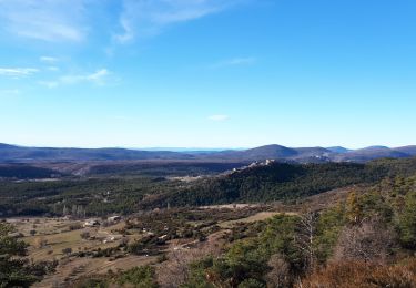
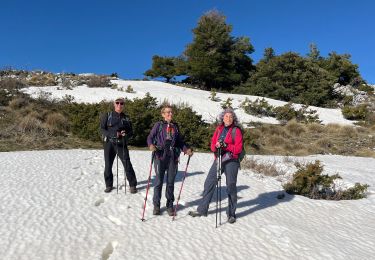
superbe randonnée.avec château vieux plan d Anaëlle et un temps d hiver très beau