![](/images/other/stat-length.png)
![Excursión Senderismo Eysines - GR Bordeaux Métropole. EYSINES MAGUDAS. - Photo](https://media.geolcdn.com/t/1900/400/91b4e53c-8028-4e29-8bf2-0ff221a4fcc2.jpeg&format=pjpeg&maxdim=2)
GR Bordeaux Métropole. EYSINES MAGUDAS.
piba2
Usuario
![Longitud](/images/other/stat-length.png)
![Altitud máxima](https://static1.geolcdn.com/siteimages/upload/files/1508320355ic_sort_altitude_max_24dp.png)
![Desnivel positivo](https://static1.geolcdn.com/siteimages/upload/files/1508320355ic_sort_den_pos_24dp.png)
![Km-Effort](/images/other/stat-length.png)
![Altitud mínima](https://static1.geolcdn.com/siteimages/upload/files/1508320355ic_sort_altitude_min_24dp.png)
![Desnivel negativo](https://static1.geolcdn.com/siteimages/upload/files/1508320355ic_sort_den_neg_24dp.png)
![Boucle](https://static1.geolcdn.com/siteimages/upload/files/16400158638029165_repeat_loop_refresh_sync_direction_icon.png)
![Senderismo](https://static1.geolcdn.com/sitytour/trail-icons/101.png)
3h37
Dificultad : Muy fácil
![Escanee este código QR para abrir la excursión en la aplicación SityTrail](https://capi.geolives.com/qq0zvz2zws4bq2lad0pu/sitytour/trails/3387122/qr.png?size=200)
Aplicación GPS de excursión GRATIS
A propósito
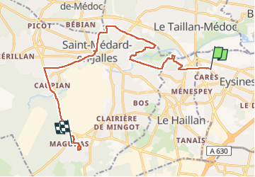
Ruta Senderismo de 16,1 km a descubrir en Nueva Aquitania, Gironda, Eysines. Esta ruta ha sido propuesta por piba2.
Descripción
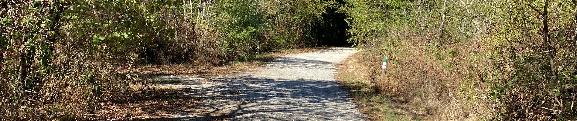
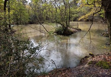
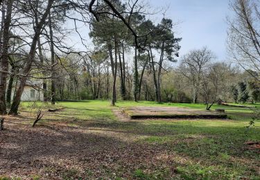
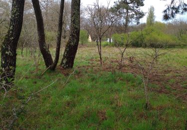
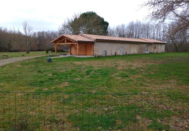
Marche souvent à l'ombre des arbres, en forêt, en sous-bois, sauf le dernier tiers, en zone périurbaine, mais qui reste agréable.
On arrive par le tram D, Les Sources.
On repart vers Bordeaux par le bus 71, Village de Magudas. Le dimanche, un bus toutes les heures seulement.
Localización
Comentarios
Excursiones cerca
![Excursión Senderismo Blanquefort - Pnl Tanais - Photo](https://media.geolcdn.com/t/375/260/d5d98c98-c615-4cb3-9bf4-916690b17932.jpg&format=jpg&maxdim=2)
![Senderismo Senderismo](https://static1.geolcdn.com/sitytour/trail-icons/101.png)
Senderismo
![](/images/other/stat-length.png)
![](https://static1.geolcdn.com/siteimages/upload/files/16400158638029165_repeat_loop_refresh_sync_direction_icon.png)
![Excursión Senderismo Blanquefort - Circuit autour de Blanquefort - Photo](https://media.geolcdn.com/t/375/260/e929d0b7-3df3-414f-8052-5790c33dbb56.jpg&format=jpg&maxdim=2)
![Senderismo Senderismo](https://static1.geolcdn.com/sitytour/trail-icons/101.png)
Senderismo
![](/images/other/stat-length.png)
![](https://static1.geolcdn.com/siteimages/upload/files/16400158638029165_repeat_loop_refresh_sync_direction_icon.png)
![Excursión Senderismo Blanquefort - Blanquefort/ Le Pian-Medoc - Photo](https://media.geolcdn.com/t/375/260/661631f6-1335-49e9-a8c6-69d8a45a6939.jpg&format=jpg&maxdim=2)
![Senderismo Senderismo](https://static1.geolcdn.com/sitytour/trail-icons/101.png)
Senderismo
![](/images/other/stat-length.png)
![](https://static1.geolcdn.com/siteimages/upload/files/16400158638029165_repeat_loop_refresh_sync_direction_icon.png)
![Excursión Senderismo Blanquefort - Tanais finalisé - Photo](https://media.geolcdn.com/t/375/260/65129eed-45b3-4fa6-9c6a-476d886a3a2f.jpg&format=jpg&maxdim=2)
![Senderismo Senderismo](https://static1.geolcdn.com/sitytour/trail-icons/101.png)
Senderismo
![](/images/other/stat-length.png)
![](https://static1.geolcdn.com/siteimages/upload/files/16400158638029165_repeat_loop_refresh_sync_direction_icon.png)
![Excursión Senderismo Bruges - JFT YB ETAPE 15 13-5-2014 - Photo](https://media.geolcdn.com/t/375/260/ext.jpg?maxdim=2&url=https%3A%2F%2Fservices.sitytrail.com%2FGeolivesWS%2FDownloadMedia.ashx%3FTrailID%3D301267%26Media%3Dfix__20140513144815.jpg)
![Senderismo Senderismo](https://static1.geolcdn.com/sitytour/trail-icons/101.png)
Senderismo
![](/images/other/stat-length.png)
![](https://static1.geolcdn.com/siteimages/upload/files/16400158638029165_repeat_loop_refresh_sync_direction_icon.png)
![Excursión Motor Bruges - Escapade en Charente 2012 - Photo](https://media.geolcdn.com/t/375/260/ext.jpg?maxdim=2&url=https%3A%2F%2Fservices.sitytrail.com%2FGeolivesWS%2FDownloadMedia.ashx%3FTrailID%3D141858%26Media%3D52823fb7-1ddd-4b13-b35d-27ae7b597f4d.jpg)
![Motor Motor](https://static1.geolcdn.com/sitytour/trail-icons/400.png)
Motor
![](/images/other/stat-length.png)
![](https://static1.geolcdn.com/siteimages/upload/files/16400158638029165_repeat_loop_refresh_sync_direction_icon.png)
![Excursión Senderismo Le Taillan-Médoc - 2010-09-02 - 19h41m27 - Photo](https://media.geolcdn.com/t/375/260/ext.jpg?maxdim=2&url=https%3A%2F%2Fservices.sitytrail.com%2FGeolivesWS%2FDownloadMedia.ashx%3FTrailID%3D45181%26Media%3Dimage2.jpg)
![Senderismo Senderismo](https://static1.geolcdn.com/sitytour/trail-icons/101.png)
Senderismo
![](/images/other/stat-length.png)
![](https://static1.geolcdn.com/siteimages/upload/files/16400158638029165_repeat_loop_refresh_sync_direction_icon.png)
![Excursión Senderismo Saint-Médard-en-Jalles - Dehes - Photo](https://media.geolcdn.com/t/375/260/e1c74e07-5af3-4c24-b4d0-3b4d9bd8c189.jpg&format=jpg&maxdim=2)
![Senderismo Senderismo](https://static1.geolcdn.com/sitytour/trail-icons/101.png)
Senderismo
![](/images/other/stat-length.png)
![](https://static1.geolcdn.com/siteimages/upload/files/16400158638029165_repeat_loop_refresh_sync_direction_icon.png)
![Excursión Senderismo Le Taillan-Médoc - le Taillan - Photo](https://media.geolcdn.com/t/375/260/77418fbb-a3e1-4c2e-919b-dd8588ff5855.jpg&format=jpg&maxdim=2)
![Senderismo Senderismo](https://static1.geolcdn.com/sitytour/trail-icons/101.png)
Senderismo
![](/images/other/stat-length.png)
![](https://static1.geolcdn.com/siteimages/upload/files/16400158638029165_repeat_loop_refresh_sync_direction_icon.png)