![](/images/other/stat-length.png)
![Excursión Senderismo Saint-Étienne-de-Tinée - Mont Rougnous - Photo](https://media.geolcdn.com/t/1900/400/59ffaeaa-80b4-4da6-aa4e-a96199cdd14c.jpg&format=pjpeg&maxdim=2)
Mont Rougnous
bozo1970
Usuario
![Longitud](/images/other/stat-length.png)
![Altitud máxima](https://static1.geolcdn.com/siteimages/upload/files/1508320355ic_sort_altitude_max_24dp.png)
![Desnivel positivo](https://static1.geolcdn.com/siteimages/upload/files/1508320355ic_sort_den_pos_24dp.png)
![Km-Effort](/images/other/stat-length.png)
![Altitud mínima](https://static1.geolcdn.com/siteimages/upload/files/1508320355ic_sort_altitude_min_24dp.png)
![Desnivel negativo](https://static1.geolcdn.com/siteimages/upload/files/1508320355ic_sort_den_neg_24dp.png)
![Boucle](https://static1.geolcdn.com/siteimages/upload/files/16400158638029165_repeat_loop_refresh_sync_direction_icon.png)
![Senderismo](https://static1.geolcdn.com/sitytour/trail-icons/101.png)
6h40
Dificultad : Muy difícil
![Escanee este código QR para abrir la excursión en la aplicación SityTrail](https://capi.geolives.com/qq0zvz2zws4bq2lad0pu/sitytour/trails/3375425/qr.png?size=200)
Aplicación GPS de excursión GRATIS
A propósito
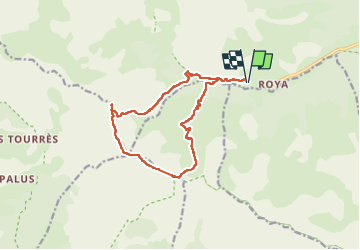
Ruta Senderismo de 14,5 km a descubrir en Provenza-Alpes-Costa Azul, Alpes Marítimos, Saint-Étienne-de-Tinée. Esta ruta ha sido propuesta por bozo1970.
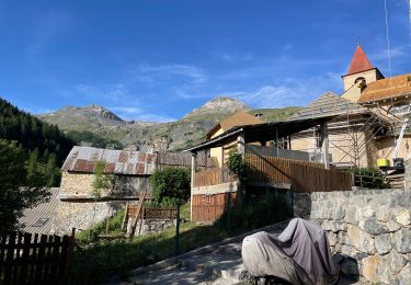
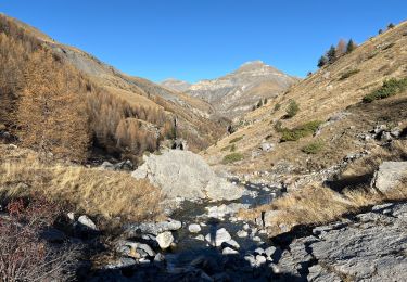
Descripción
Départ Roya
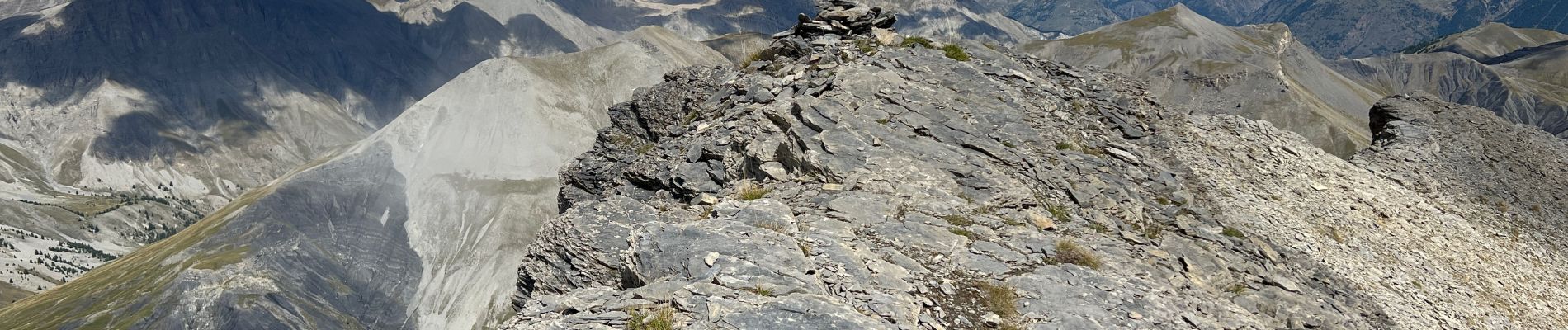
Montée hors sentier par sa face sud est
Nouvelle voie décrite
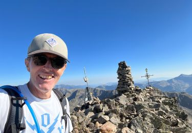
Sommet en 3h20’ pour un D de 1100m et 6km
Retour par le col de Crous en suivant la crête
Retour par le sentier du vallon de l’Alp
6h40’ en tout
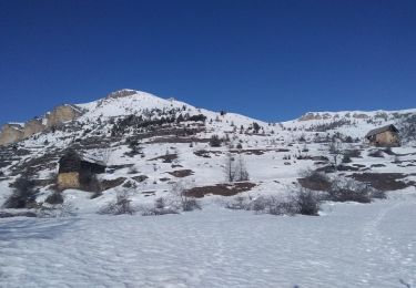
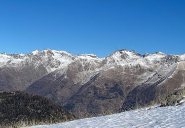
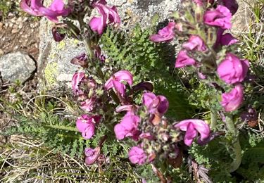
Randonnée très sauvage et agre
Localización
Comentarios
Excursiones cerca
![Excursión Senderismo Saint-Étienne-de-Tinée - Réel Roya Col de Crousette Stèle Valette Petit Mounier et Mounier - Photo](https://media.geolcdn.com/t/375/260/b5c86927-6c55-4c7f-afae-58ada10c53b3.jpg&format=jpg&maxdim=2)
![Senderismo Senderismo](https://static1.geolcdn.com/sitytour/trail-icons/101.png)
Senderismo
![](/images/other/stat-length.png)
![](https://static1.geolcdn.com/siteimages/upload/files/16400158638029165_repeat_loop_refresh_sync_direction_icon.png)
![Excursión A pie Saint-Étienne-de-Tinée - Cime de la Bercha - Photo](https://media.geolcdn.com/t/375/260/06e4d46f-e317-406d-bd2c-01041e541c38.jpeg&format=jpg&maxdim=2)
![A pie A pie](https://static1.geolcdn.com/sitytour/trail-icons/100.png)
A pie
![](/images/other/stat-length.png)
![](https://static1.geolcdn.com/siteimages/upload/files/16400158638029165_repeat_loop_refresh_sync_direction_icon.png)
![Excursión Esquí de fondo Saint-Étienne-de-Tinée - Mont Triboulet et Mont Rion - Photo](https://media.geolcdn.com/t/375/260/628b9303-05b3-4c82-bf08-aa61a07e7015.jpg&format=jpg&maxdim=2)
![Esquí de fondo Esquí de fondo](https://static1.geolcdn.com/sitytour/trail-icons/503.png)
Esquí de fondo
![](/images/other/stat-length.png)
![](https://static1.geolcdn.com/siteimages/upload/files/16400158638029165_repeat_loop_refresh_sync_direction_icon.png)
![Excursión Esquí de fondo Saint-Étienne-de-Tinée - Las Donnas et baisse du Colombier - Photo](https://media.geolcdn.com/t/375/260/0cedeff1-332d-460c-af06-a42d22a26fa2.jpg&format=jpg&maxdim=2)
![Esquí de fondo Esquí de fondo](https://static1.geolcdn.com/sitytour/trail-icons/503.png)
Esquí de fondo
![](/images/other/stat-length.png)
![](https://static1.geolcdn.com/siteimages/upload/files/16400158638029165_repeat_loop_refresh_sync_direction_icon.png)
![Excursión Raquetas de nieve Saint-Étienne-de-Tinée - Cabane Vieille - Photo](https://media.geolcdn.com/t/375/260/d08ad509-8448-4a00-bc95-11334e53fd24.jpg&format=jpg&maxdim=2)
![Raquetas de nieve Raquetas de nieve](https://static1.geolcdn.com/sitytour/trail-icons/504.png)
Raquetas de nieve
![](/images/other/stat-length.png)
![](https://static1.geolcdn.com/siteimages/upload/files/16400158638029165_repeat_loop_refresh_sync_direction_icon.png)
![Excursión Senderismo Saint-Étienne-de-Tinée - Le Mounier - Photo](https://media.geolcdn.com/t/375/260/6d3039c6-e5bd-4a5c-b5ca-417ffa1a190a.jpg&format=jpg&maxdim=2)
![Senderismo Senderismo](https://static1.geolcdn.com/sitytour/trail-icons/101.png)
Senderismo
![](/images/other/stat-length.png)
![](https://static1.geolcdn.com/siteimages/upload/files/16400158638029165_repeat_loop_refresh_sync_direction_icon.png)
![Excursión Senderismo Saint-Étienne-de-Tinée - Le Corborant - Photo](https://media.geolcdn.com/t/375/260/4e6a72e4-8dfa-499a-bed5-882b283528e3.jpeg&format=jpg&maxdim=2)
![Senderismo Senderismo](https://static1.geolcdn.com/sitytour/trail-icons/101.png)
Senderismo
![](/images/other/stat-length.png)
![](https://static1.geolcdn.com/siteimages/upload/files/16400158638029165_repeat_loop_refresh_sync_direction_icon.png)
![Excursión Senderismo Saint-Étienne-de-Tinée - De Roya au Col de Blainon, baisse herisson - Photo](https://media.geolcdn.com/t/375/260/f3ff390a-3102-4c2f-baae-0abdbac6b210.jpg&format=jpg&maxdim=2)
![Senderismo Senderismo](https://static1.geolcdn.com/sitytour/trail-icons/101.png)
Senderismo
![](/images/other/stat-length.png)
![](https://static1.geolcdn.com/siteimages/upload/files/16400158638029165_repeat_loop_refresh_sync_direction_icon.png)
![Excursión sport Saint-Étienne-de-Tinée - Tête de l autaret Lagos colla longa - Photo](https://media.geolcdn.com/t/375/260/0f54380f-0cc0-41e9-83d3-976012bf1985.jpg&format=jpg&maxdim=2)
sport
![](/images/other/stat-length.png)
![](https://static1.geolcdn.com/siteimages/upload/files/16400158638029165_repeat_loop_refresh_sync_direction_icon.png)