![](/images/other/stat-length.png)
![Excursión Senderismo Waremme - La promenade du Wachnet à Waremme - Photo](https://media.geolcdn.com/t/1900/400/268bcfb1-bebe-41f7-9369-4099f3cd380c.jpeg&format=pjpeg&maxdim=2)
La promenade du Wachnet à Waremme
Benjamin27
Usuario GUIDE
![Longitud](/images/other/stat-length.png)
![Altitud máxima](https://static1.geolcdn.com/siteimages/upload/files/1508320355ic_sort_altitude_max_24dp.png)
![Desnivel positivo](https://static1.geolcdn.com/siteimages/upload/files/1508320355ic_sort_den_pos_24dp.png)
![Km-Effort](/images/other/stat-length.png)
![Altitud mínima](https://static1.geolcdn.com/siteimages/upload/files/1508320355ic_sort_altitude_min_24dp.png)
![Desnivel negativo](https://static1.geolcdn.com/siteimages/upload/files/1508320355ic_sort_den_neg_24dp.png)
![Boucle](https://static1.geolcdn.com/siteimages/upload/files/16400158638029165_repeat_loop_refresh_sync_direction_icon.png)
![Senderismo](https://static1.geolcdn.com/sitytour/trail-icons/101.png)
37m
Dificultad : Fácil
![Escanee este código QR para abrir la excursión en la aplicación SityTrail](https://capi.geolives.com/qq0zvz2zws4bq2lad0pu/sitytour/trails/3369601/qr.png?size=200)
Aplicación GPS de excursión GRATIS
A propósito
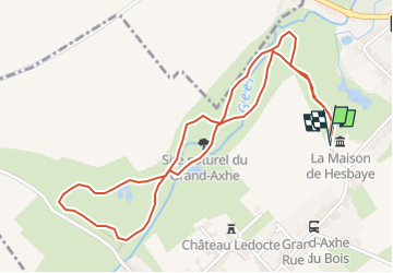
Ruta Senderismo de 2,6 km a descubrir en Valonia, Lieja, Waremme. Esta ruta ha sido propuesta por Benjamin27.
Descripción
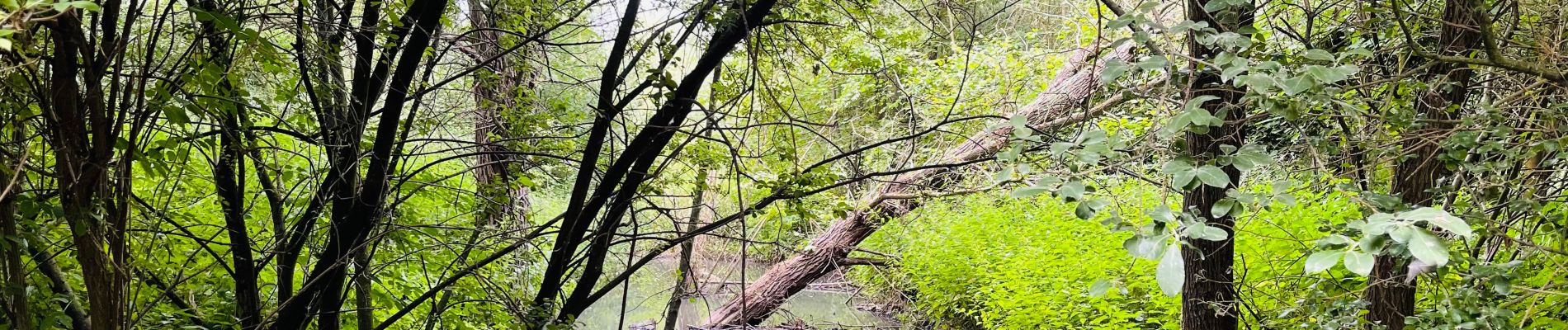
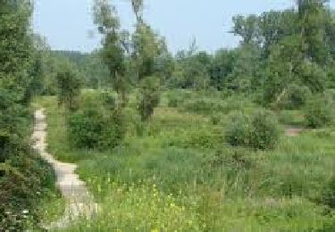
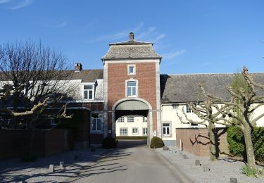
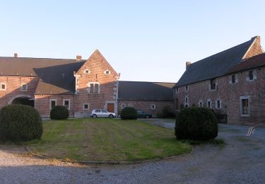
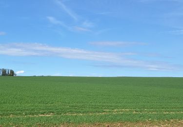
Au cœur de la Hesbaye et du bassin du Geer, entre champs et cours d’eau, le bois du Wachnet à Waremme regorge d’une nature luxuriante et diversifiée. Courte promenade ressourçante et très calme.
👣 Distance : 2,5km - non balisé.
📍Départ : maison de Hesbaye, rue de Petit-Axhe 45 - 4300 Waremme.
🚂🚍 Aller à la gare de Waremme et prendre le bus TEC 128 ou 145 jusqu’à l’arrêt « Waremme - Petit Axhe ».
Localización
Comentarios
Excursiones cerca
![Excursión Senderismo Geer - Promenade le long du Geer et réserve - Photo](https://media.geolcdn.com/t/375/260/4fc37dda-e21b-43f8-a27a-3af14e8a0d8e.jpg&format=jpg&maxdim=2)
![Senderismo Senderismo](https://static1.geolcdn.com/sitytour/trail-icons/101.png)
Senderismo
![](/images/other/stat-length.png)
![](https://static1.geolcdn.com/siteimages/upload/files/16400158638029165_repeat_loop_refresh_sync_direction_icon.png)
![Excursión Senderismo Waremme - WACHNET WAREMME - Photo](https://media.geolcdn.com/t/375/260/9402a055-337f-4143-8a11-4cda7b0783be.png&format=jpg&maxdim=2)
![Senderismo Senderismo](https://static1.geolcdn.com/sitytour/trail-icons/101.png)
Senderismo
![](/images/other/stat-length.png)
![](https://static1.geolcdn.com/siteimages/upload/files/16400158638029165_repeat_loop_refresh_sync_direction_icon.png)
![Excursión Senderismo Waremme - Cirkwi-Waremme_-_Autour_de_la_Vallée_du_Geer_-_7,1km - Photo](https://media.geolcdn.com/t/375/260/ext.jpg?maxdim=2&url=https%3A%2F%2Fstatic1.geolcdn.com%2Fsiteimages%2Fupload%2Ffiles%2F1553511878bg_sport_marche.png)
![Senderismo Senderismo](https://static1.geolcdn.com/sitytour/trail-icons/101.png)
Senderismo
![](/images/other/stat-length.png)
![](https://static1.geolcdn.com/siteimages/upload/files/16400158638029165_repeat_loop_refresh_sync_direction_icon.png)
![Excursión A pie Geer - Promenade des Peupliers - Photo](https://media.geolcdn.com/t/375/260/f68fd01a-6493-4bfb-8eb0-00aa4284b467.jpeg&format=jpg&maxdim=2)
![A pie A pie](https://static1.geolcdn.com/sitytour/trail-icons/100.png)
A pie
![](/images/other/stat-length.png)
![](https://static1.geolcdn.com/siteimages/upload/files/16400158638029165_repeat_loop_refresh_sync_direction_icon.png)
![Excursión A pie Geer - Promenade du Geer - Photo](https://media.geolcdn.com/t/375/260/b73edfb0-f782-4f6f-af6c-98fa8486e229.jpeg&format=jpg&maxdim=2)
![A pie A pie](https://static1.geolcdn.com/sitytour/trail-icons/100.png)
![Excursión Cicloturismo Waremme - 2024-05-13_13h13m22_24 05 06 39 Km W-HsG-L-V-W-Fal-Av-L St R-Om-W - Photo](https://media.geolcdn.com/t/375/260/ext.jpg?maxdim=2&url=https%3A%2F%2Fstatic1.geolcdn.com%2Fsiteimages%2Fupload%2Ffiles%2F1524743154velo.jpg)
![Cicloturismo Cicloturismo](https://static1.geolcdn.com/sitytour/trail-icons/204.png)
Cicloturismo
![](/images/other/stat-length.png)
![](https://static1.geolcdn.com/siteimages/upload/files/16400158638029165_repeat_loop_refresh_sync_direction_icon.png)
![Excursión Senderismo Waremme - Waremme ( autour de la vallée du Geer) - Photo](https://media.geolcdn.com/t/375/260/e56e87e8-dda3-4c10-9253-9701ae5a37ab.jpg&format=jpg&maxdim=2)
![Senderismo Senderismo](https://static1.geolcdn.com/sitytour/trail-icons/101.png)
Senderismo
![](/images/other/stat-length.png)
![](https://static1.geolcdn.com/siteimages/upload/files/16400158638029165_repeat_loop_refresh_sync_direction_icon.png)
![Excursión Senderismo Waremme - Oleye - bous de Horne - Photo](https://media.geolcdn.com/t/375/260/1a016a95-1857-49e8-88fe-ed16c9189e3e.jpg&format=jpg&maxdim=2)
![Senderismo Senderismo](https://static1.geolcdn.com/sitytour/trail-icons/101.png)
Senderismo
![](/images/other/stat-length.png)
![](https://static1.geolcdn.com/siteimages/upload/files/16400158638029165_repeat_loop_refresh_sync_direction_icon.png)
![Excursión Senderismo Waremme - WAREMME _ Marche Fédérale _ LG _ 29/04/2023 - Photo](https://media.geolcdn.com/t/375/260/5f155266-fac2-4ae1-b976-114cbadef2b5.jpg&format=jpg&maxdim=2)
![Senderismo Senderismo](https://static1.geolcdn.com/sitytour/trail-icons/101.png)
Senderismo
![](/images/other/stat-length.png)
![](https://static1.geolcdn.com/siteimages/upload/files/16400158638029165_repeat_loop_refresh_sync_direction_icon.png)