![](/images/other/stat-length.png)
![Excursión Senderismo Lummen - La digue du lac de Schulen - Photo](https://media.geolcdn.com/t/1900/400/54678e9b-45f5-40fb-ba6f-4e678ffbf33b.jpeg&format=pjpeg&maxdim=2)
La digue du lac de Schulen
Benjamin27
Usuario GUIDE
![Longitud](/images/other/stat-length.png)
![Altitud máxima](https://static1.geolcdn.com/siteimages/upload/files/1508320355ic_sort_altitude_max_24dp.png)
![Desnivel positivo](https://static1.geolcdn.com/siteimages/upload/files/1508320355ic_sort_den_pos_24dp.png)
![Km-Effort](/images/other/stat-length.png)
![Altitud mínima](https://static1.geolcdn.com/siteimages/upload/files/1508320355ic_sort_altitude_min_24dp.png)
![Desnivel negativo](https://static1.geolcdn.com/siteimages/upload/files/1508320355ic_sort_den_neg_24dp.png)
![Boucle](https://static1.geolcdn.com/siteimages/upload/files/16400158638029165_repeat_loop_refresh_sync_direction_icon.png)
![Senderismo](https://static1.geolcdn.com/sitytour/trail-icons/101.png)
32m
Dificultad : Fácil
![Escanee este código QR para abrir la excursión en la aplicación SityTrail](https://capi.geolives.com/qq0zvz2zws4bq2lad0pu/sitytour/trails/3350280/qr.png?size=200)
Aplicación GPS de excursión GRATIS
A propósito
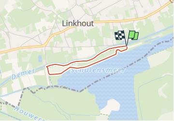
Ruta Senderismo de 2,3 km a descubrir en Flandes, Limburgo, Lummen. Esta ruta ha sido propuesta por Benjamin27.
Descripción
Photo de profil de lesbaladesdebenja
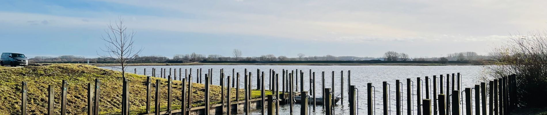
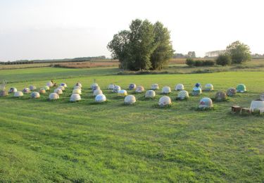
La digue du lac de Schulen.
Vous longerez le magnifique lac de Schulen pour rejoindre ensuite les abords de la rivière « Démer ». C’est un très chouette endroit pour déconnecter et se ressourcer.
👣 Distance : 2km - balisage rectangle vert.
📍Départ : parking prévu au fond de la Demerstraat - 3560 Linkhout (Lummen).
🚂🚍 Aller à la gare de Diest et prendre le bus DE LIJN 35c ou 92 jusqu’à l’arrêt « Linkhout - Schansstraat » et marcher 7 minutes jusqu’au point de départ.
Localización
Comentarios
Excursiones cerca
![Excursión A pie Lummen - Lummensbroek rode driehoek - Photo](https://media.geolcdn.com/t/375/260/da9a5d6a-8877-4c5a-bca2-fdd50203b419.jpeg&format=jpg&maxdim=2)
![A pie A pie](https://static1.geolcdn.com/sitytour/trail-icons/100.png)
A pie
![](/images/other/stat-length.png)
![](https://static1.geolcdn.com/siteimages/upload/files/16400158638029165_repeat_loop_refresh_sync_direction_icon.png)
![Excursión A pie Lummen - Lummense Parels Blauwe ruit - Photo](https://media.geolcdn.com/t/375/260/3f6dc320-e729-4d4d-9db7-571f5c09e396.jpeg&format=jpg&maxdim=2)
![A pie A pie](https://static1.geolcdn.com/sitytour/trail-icons/100.png)
A pie
![](/images/other/stat-length.png)
![](https://static1.geolcdn.com/siteimages/upload/files/16400158638029165_repeat_loop_refresh_sync_direction_icon.png)
![Excursión A pie Halen - Zilveren Helmenwandeling - Photo](https://media.geolcdn.com/t/375/260/5671e5b0-70b4-4d41-9e57-848b60eb02ae.jpeg&format=jpg&maxdim=2)
![A pie A pie](https://static1.geolcdn.com/sitytour/trail-icons/100.png)
A pie
![](/images/other/stat-length.png)
![](https://static1.geolcdn.com/siteimages/upload/files/16400158638029165_repeat_loop_refresh_sync_direction_icon.png)
![Excursión A pie Halen - Zelk Oranje bol - Photo](https://media.geolcdn.com/t/375/260/54f67bfb-93a4-4273-8a07-b47b83b202cf.jpeg&format=jpg&maxdim=2)
![A pie A pie](https://static1.geolcdn.com/sitytour/trail-icons/100.png)
![Excursión A pie Halen - Kartuizerspatiamentum Oranje bol - Photo](https://media.geolcdn.com/t/375/260/9bcbcf4b-6db4-4abd-8824-a8ed4639b90d.jpeg&format=jpg&maxdim=2)
![A pie A pie](https://static1.geolcdn.com/sitytour/trail-icons/100.png)
A pie
![](/images/other/stat-length.png)
![](https://static1.geolcdn.com/siteimages/upload/files/16400158638029165_repeat_loop_refresh_sync_direction_icon.png)
![Excursión A pie Lummen - Venusberg Oranje bol - Photo](https://media.geolcdn.com/t/375/260/e018a3b8-b1ce-46da-9114-cd30959fdec5.jpeg&format=jpg&maxdim=2)
![A pie A pie](https://static1.geolcdn.com/sitytour/trail-icons/100.png)
A pie
![](/images/other/stat-length.png)
![](https://static1.geolcdn.com/siteimages/upload/files/16400158638029165_repeat_loop_refresh_sync_direction_icon.png)
![Excursión A pie Diest - Kelbergenwandeling - Photo](https://media.geolcdn.com/t/375/260/1996b687-8a6d-4199-83b2-a87c4a3538b0.jpeg&format=jpg&maxdim=2)
![A pie A pie](https://static1.geolcdn.com/sitytour/trail-icons/100.png)
A pie
![](/images/other/stat-length.png)
![](https://static1.geolcdn.com/siteimages/upload/files/16400158638029165_repeat_loop_refresh_sync_direction_icon.png)
![Excursión A pie Lummen - Lummense Parels Groene rechthoek - Photo](https://media.geolcdn.com/t/375/260/da9a5d6a-8877-4c5a-bca2-fdd50203b419.jpeg&format=jpg&maxdim=2)
![A pie A pie](https://static1.geolcdn.com/sitytour/trail-icons/100.png)
A pie
![](/images/other/stat-length.png)
![](https://static1.geolcdn.com/siteimages/upload/files/16400158638029165_repeat_loop_refresh_sync_direction_icon.png)
![Excursión A pie Herk-de-Stad - Schulensmeer Blauwe ruit - Photo](https://media.geolcdn.com/t/375/260/f4488938-1fcd-43c9-a4d1-6a2825bf5bb5.jpeg&format=jpg&maxdim=2)
![A pie A pie](https://static1.geolcdn.com/sitytour/trail-icons/100.png)
A pie
![](/images/other/stat-length.png)
![](https://static1.geolcdn.com/siteimages/upload/files/16400158638029165_repeat_loop_refresh_sync_direction_icon.png)