![](/images/other/stat-length.png)
![Excursión Senderismo Val-Cenis - Col d'Etache - gros Peyron - Bec d'Etache - Photo](https://media.geolcdn.com/t/1900/400/5aeb25f3-8e0d-4d55-9235-334883bccd5e.jpg&format=pjpeg&maxdim=2)
Col d'Etache - gros Peyron - Bec d'Etache
yves12
Usuario
![Longitud](/images/other/stat-length.png)
![Altitud máxima](https://static1.geolcdn.com/siteimages/upload/files/1508320355ic_sort_altitude_max_24dp.png)
![Desnivel positivo](https://static1.geolcdn.com/siteimages/upload/files/1508320355ic_sort_den_pos_24dp.png)
![Km-Effort](/images/other/stat-length.png)
![Altitud mínima](https://static1.geolcdn.com/siteimages/upload/files/1508320355ic_sort_altitude_min_24dp.png)
![Desnivel negativo](https://static1.geolcdn.com/siteimages/upload/files/1508320355ic_sort_den_neg_24dp.png)
![Boucle](https://static1.geolcdn.com/siteimages/upload/files/16400158638029165_repeat_loop_refresh_sync_direction_icon.png)
![Senderismo](https://static1.geolcdn.com/sitytour/trail-icons/101.png)
8h20
Dificultad : Difícil
![Escanee este código QR para abrir la excursión en la aplicación SityTrail](https://capi.geolives.com/qq0zvz2zws4bq2lad0pu/sitytour/trails/3344769/qr.png?size=200)
Aplicación GPS de excursión GRATIS
A propósito
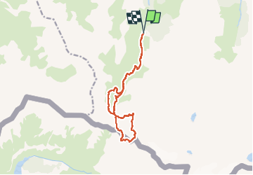
Ruta Senderismo de 14,8 km a descubrir en Auvergne-Rhône-Alpes, Saboya, Val-Cenis. Esta ruta ha sido propuesta por yves12.
Descripción
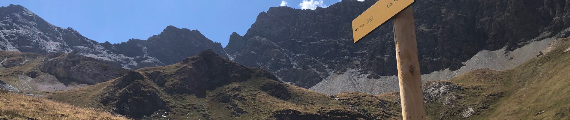
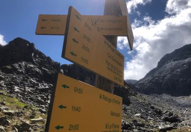
Départ du Parking d'Etache direction le Col d'Etache puis direction le Gros Peyron - puis le Bec d'Etache.
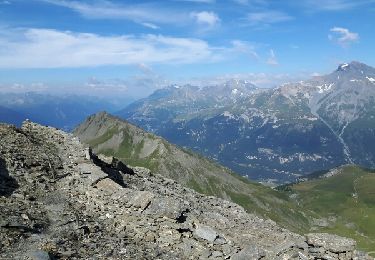
Attention au Bec d'Etache nous sommes descendu par un pierrier que nous ne conseillons pas si vous n'avez pas le pied sûr ! Il y a des " petits pas d'escalade".
Le mieux pour ne pas prendre de risque est de rebrousser chemin pour redescendre du Bec dEtache !
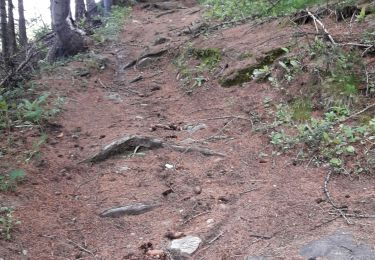
Localización
Comentarios
Excursiones cerca
![Excursión Senderismo Val-Cenis - signal du Petit Mont-Cenis Cenis - Photo](https://media.geolcdn.com/t/375/260/ext.jpg?maxdim=2&url=https%3A%2F%2Fservices.sitytrail.com%2FGeolivesWS%2FDownloadMedia.ashx%3FTrailID%3D615956%26Media%3Dfix__20160817102723.jpg)
![Senderismo Senderismo](https://static1.geolcdn.com/sitytour/trail-icons/101.png)
Senderismo
![](/images/other/stat-length.png)
![](https://static1.geolcdn.com/siteimages/upload/files/16400158638029165_repeat_loop_refresh_sync_direction_icon.png)
![Excursión Senderismo Val-Cenis - Lac de Savinne - Photo](https://media.geolcdn.com/t/375/260/ext.jpg?maxdim=2&url=https%3A%2F%2Fstatic1.geolcdn.com%2Fsiteimages%2Fupload%2Ffiles%2F1553511878bg_sport_marche.png)
![Senderismo Senderismo](https://static1.geolcdn.com/sitytour/trail-icons/101.png)
Senderismo
![](/images/other/stat-length.png)
![](https://static1.geolcdn.com/siteimages/upload/files/16400158638029165_repeat_loop_refresh_sync_direction_icon.png)
![Excursión Senderismo Val-Cenis - Savoie_Bramans-LePlanay=>Alpages_de_Montbas - Photo](https://media.geolcdn.com/t/375/260/e2fc6e3f-d7d3-4a11-84a0-df6a02af42c8.jpg&format=jpg&maxdim=2)
![Senderismo Senderismo](https://static1.geolcdn.com/sitytour/trail-icons/101.png)
Senderismo
![](/images/other/stat-length.png)
![](https://static1.geolcdn.com/siteimages/upload/files/16400158638029165_repeat_loop_refresh_sync_direction_icon.png)
![Excursión Senderismo Val-Cenis - Refuge du petit Mont-Cenis - Col de Bellecombe - Photo](https://media.geolcdn.com/t/375/260/6ef1a6b7-2407-4d68-aa00-60607ba7429d.jpg&format=jpg&maxdim=2)
![Senderismo Senderismo](https://static1.geolcdn.com/sitytour/trail-icons/101.png)
Senderismo
![](/images/other/stat-length.png)
![](https://static1.geolcdn.com/siteimages/upload/files/16400158638029165_repeat_loop_refresh_sync_direction_icon.png)
![Excursión Senderismo Val-Cenis - Col agnel puis Lac d'Ambin Bramans - Photo](https://media.geolcdn.com/t/375/260/1745d82d-7eda-48ff-b6de-c3bab13e3684.jpg&format=jpg&maxdim=2)
![Senderismo Senderismo](https://static1.geolcdn.com/sitytour/trail-icons/101.png)
Senderismo
![](/images/other/stat-length.png)
![](https://static1.geolcdn.com/siteimages/upload/files/16400158638029165_repeat_loop_refresh_sync_direction_icon.png)
![Excursión Senderismo Val-Cenis - Parking Etache - Pas de la Coche Bramans - Photo](https://media.geolcdn.com/t/375/260/0946d2b3-7a1a-44f3-90e2-4cbe032d6378.jpg&format=jpg&maxdim=2)
![Senderismo Senderismo](https://static1.geolcdn.com/sitytour/trail-icons/101.png)
Senderismo
![](/images/other/stat-length.png)
![](https://static1.geolcdn.com/siteimages/upload/files/16400158638029165_repeat_loop_refresh_sync_direction_icon.png)
![Excursión Senderismo Val-Cenis - Val Cenis - boucle par les crêtes de Montiolit - Photo](https://media.geolcdn.com/t/375/260/373b5ffc-ed0a-4aeb-b6a6-6c753469bddc.jpg&format=jpg&maxdim=2)
![Senderismo Senderismo](https://static1.geolcdn.com/sitytour/trail-icons/101.png)
Senderismo
![](/images/other/stat-length.png)
![](https://static1.geolcdn.com/siteimages/upload/files/16400158638029165_repeat_loop_refresh_sync_direction_icon.png)
![Excursión Senderismo Val-Cenis - BRAMANS - 73 - Photo](https://media.geolcdn.com/t/375/260/c671f643-1828-4d5b-84a6-28d52fabe947.jpg&format=jpg&maxdim=2)
![Senderismo Senderismo](https://static1.geolcdn.com/sitytour/trail-icons/101.png)
Senderismo
![](/images/other/stat-length.png)
![](https://static1.geolcdn.com/siteimages/upload/files/16400158638029165_repeat_loop_refresh_sync_direction_icon.png)
![Excursión Senderismo Val-Cenis - Saint-Pierre d'Extravache Bramanette - Photo](https://media.geolcdn.com/t/375/260/86f4d05b-1d05-4724-9198-b23a6425c340.jpg&format=jpg&maxdim=2)
![Senderismo Senderismo](https://static1.geolcdn.com/sitytour/trail-icons/101.png)
Senderismo
![](/images/other/stat-length.png)
![](https://static1.geolcdn.com/siteimages/upload/files/16400158638029165_repeat_loop_refresh_sync_direction_icon.png)