![](/images/other/stat-length.png)
![Excursión Senderismo Gemeinde Angerberg - La Voie de l’Aigle : J2 - Photo](https://media.geolcdn.com/t/1900/400/c8d164bd-5090-4d74-8c3c-e4a1f6bcdc99.jpg&format=pjpeg&maxdim=2)
La Voie de l’Aigle : J2
Greg813
Usuario
![Longitud](/images/other/stat-length.png)
Longitud
18,3 km
![Altitud máxima](https://static1.geolcdn.com/siteimages/upload/files/1508320355ic_sort_altitude_max_24dp.png)
Altitud máxima
1333 m
![Desnivel positivo](https://static1.geolcdn.com/siteimages/upload/files/1508320355ic_sort_den_pos_24dp.png)
Desnivel positivo
330 m
![Km-Effort](/images/other/stat-length.png)
Km-Effort
25 km
![Altitud mínima](https://static1.geolcdn.com/siteimages/upload/files/1508320355ic_sort_altitude_min_24dp.png)
Altitud mínima
708 m
![Desnivel negativo](https://static1.geolcdn.com/siteimages/upload/files/1508320355ic_sort_den_neg_24dp.png)
Desnivel negativo
942 m
![Boucle](https://static1.geolcdn.com/siteimages/upload/files/16400158638029165_repeat_loop_refresh_sync_direction_icon.png)
Boucle
No
Fecha de creación :
2022-07-30 06:22:42.029
Última modificación :
2024-09-15 07:26:19.059
![Senderismo](https://static1.geolcdn.com/sitytour/trail-icons/101.png)
4h06
Dificultad : Medio
![Escanee este código QR para abrir la excursión en la aplicación SityTrail](https://capi.geolives.com/qq0zvz2zws4bq2lad0pu/sitytour/trails/3335510/qr.png?size=200)
Aplicación GPS de excursión GRATIS
A propósito
Ruta Senderismo de 18,3 km a descubrir en Tirol, Bezirk Kufstein, Gemeinde Angerberg. Esta ruta ha sido propuesta por Greg813.
Descripción
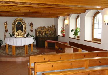
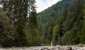
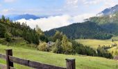
Trek de 8 jours dans le Tyrol autrichien avec Mettons le Monde en Marche. Parcours de la voie de l'Aigle de Langkampfen à Innsbrück avec nuits en refuge.
Etape 2 : Buchacker – Pinegg
Pour d'autres photos, voir le site de l'association :
https://mmm-rando.org/trek-la-voix-de-laigle-autriche-2022/
Localización
País:
Austria
Región :
Tirol
Departamento/provincia :
Bezirk Kufstein
Municipio :
Gemeinde Angerberg
Localidad:
Unknown
Salida:(Dec)
Salida:(UTM)
275624 ; 5268723 (33T) N.
Comentarios
Excursiones cerca
![Excursión A pie Gemeinde Langkampfen - Niederbreitenbach-Höhlenstein - Photo](https://media.geolcdn.com/t/375/260/b0ed7c18-f3e2-4ee3-b16a-f331369063e3.jpeg&format=jpg&maxdim=2)
![A pie A pie](https://static1.geolcdn.com/sitytour/trail-icons/100.png)
Niederbreitenbach-Höhlenstein
A pie
Fácil
Gemeinde Langkampfen,
Tirol,
Bezirk Kufstein,
Austria
![](/images/other/stat-length.png)
3,9 km | 11 km-effort
2h 30min
![](https://static1.geolcdn.com/siteimages/upload/files/16400158638029165_repeat_loop_refresh_sync_direction_icon.png)
No
![Excursión A pie Stadt Wörgl - Buchackeraufstieg - Photo](https://media.geolcdn.com/t/375/260/33651029-364f-428e-826b-95db25b7358f.jpeg&format=jpg&maxdim=2)
![A pie A pie](https://static1.geolcdn.com/sitytour/trail-icons/100.png)
Buchackeraufstieg
A pie
Fácil
Stadt Wörgl,
Tirol,
Bezirk Kufstein,
Austria
![](/images/other/stat-length.png)
5,9 km | 8,9 km-effort
2h 1min
![](https://static1.geolcdn.com/siteimages/upload/files/16400158638029165_repeat_loop_refresh_sync_direction_icon.png)
No
![Excursión A pie Gemeinde Thiersee - Wäschkogelrunde - Photo](https://media.geolcdn.com/t/375/260/ext.jpg?maxdim=2&url=https%3A%2F%2Fstatic1.geolcdn.com%2Fsiteimages%2Fupload%2Ffiles%2F1545311037marcheuse_200dpi.jpg)
![A pie A pie](https://static1.geolcdn.com/sitytour/trail-icons/100.png)
Wäschkogelrunde
A pie
Fácil
Gemeinde Thiersee,
Tirol,
Bezirk Kufstein,
Austria
![](/images/other/stat-length.png)
3,7 km | 5,3 km-effort
1h 11min
![](https://static1.geolcdn.com/siteimages/upload/files/16400158638029165_repeat_loop_refresh_sync_direction_icon.png)
No
![Excursión A pie Gemeinde Langkampfen - Gasthof Alpenhof Runde](https://media.geolcdn.com/t/375/260/ext.jpg?maxdim=2&url=https%3A%2F%2Fstatic1.geolcdn.com%2Fsiteimages%2Fupload%2Ffiles%2F1545311037marcheuse_200dpi.jpg)
![A pie A pie](https://static1.geolcdn.com/sitytour/trail-icons/100.png)
Gasthof Alpenhof Runde "Adlerrunde"
A pie
Fácil
Gemeinde Langkampfen,
Tirol,
Bezirk Kufstein,
Austria
![](/images/other/stat-length.png)
7,1 km | 13,4 km-effort
3h 2min
![](https://static1.geolcdn.com/siteimages/upload/files/16400158638029165_repeat_loop_refresh_sync_direction_icon.png)
No
![Excursión A pie Gemeinde Angerberg - Hundalm Eishöhle - Photo](https://media.geolcdn.com/t/375/260/ext.jpg?maxdim=2&url=https%3A%2F%2Fstatic1.geolcdn.com%2Fsiteimages%2Fupload%2Ffiles%2F1545311037marcheuse_200dpi.jpg)
![A pie A pie](https://static1.geolcdn.com/sitytour/trail-icons/100.png)
Hundalm Eishöhle
A pie
Fácil
Gemeinde Angerberg,
Tirol,
Bezirk Kufstein,
Austria
![](/images/other/stat-length.png)
6,9 km | 16,3 km-effort
3h 42min
![](https://static1.geolcdn.com/siteimages/upload/files/16400158638029165_repeat_loop_refresh_sync_direction_icon.png)
No