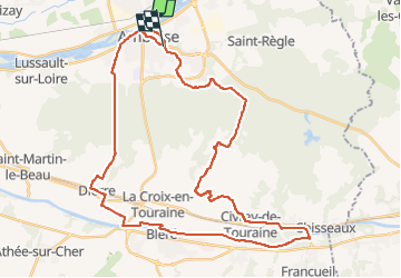
![](/images/other/stat-length.png)
![Excursión Bici de carretera Amboise - Activity - Photo](https://media.geolcdn.com/t/1900/400/9c97a7b9-c38f-41da-b025-552f580b37d8.jpg&format=pjpeg&maxdim=2)
Activity
verpoorten
Usuario
![Longitud](/images/other/stat-length.png)
![Altitud máxima](https://static1.geolcdn.com/siteimages/upload/files/1508320355ic_sort_altitude_max_24dp.png)
![Desnivel positivo](https://static1.geolcdn.com/siteimages/upload/files/1508320355ic_sort_den_pos_24dp.png)
![Km-Effort](/images/other/stat-length.png)
![Altitud mínima](https://static1.geolcdn.com/siteimages/upload/files/1508320355ic_sort_altitude_min_24dp.png)
![Desnivel negativo](https://static1.geolcdn.com/siteimages/upload/files/1508320355ic_sort_den_neg_24dp.png)
![Boucle](https://static1.geolcdn.com/siteimages/upload/files/16400158638029165_repeat_loop_refresh_sync_direction_icon.png)
![Bici de carretera](https://static1.geolcdn.com/sitytour/trail-icons/201.png)
2h54
Dificultad : Muy difícil
![Escanee este código QR para abrir la excursión en la aplicación SityTrail](https://capi.geolives.com/qq0zvz2zws4bq2lad0pu/sitytour/trails/3329983/qr.png?size=200)
Aplicación GPS de excursión GRATIS
A propósito
Ruta Bici de carretera de 43 km a descubrir en Centro, Indre y Loira, Amboise. Esta ruta ha sido propuesta por verpoorten.
Descripción
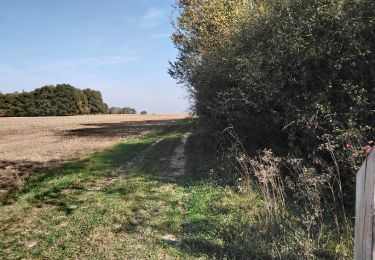
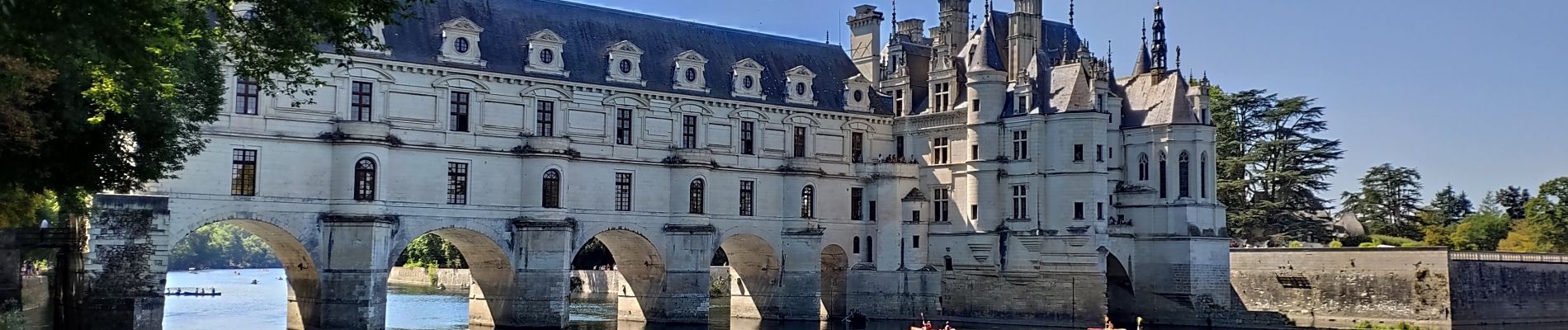
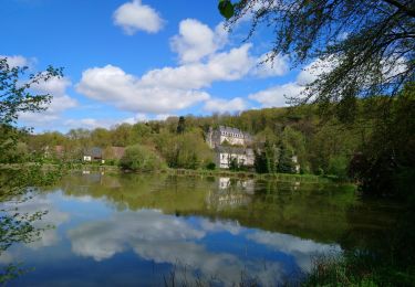
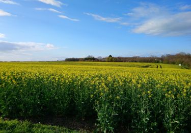
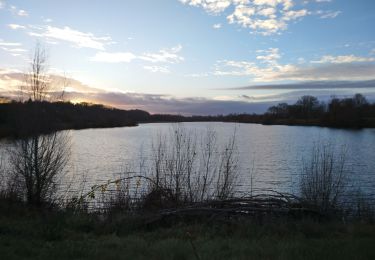
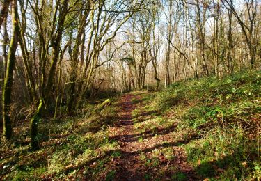
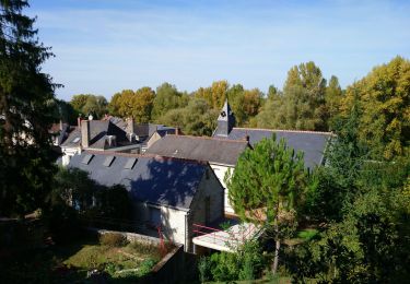
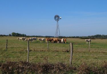
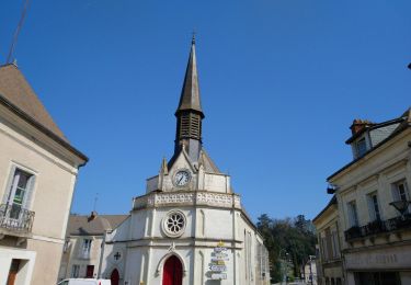
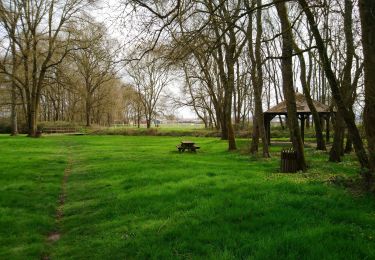
Le top départ de cette boucle à vélo se fait à Amboise, ville marquée par Charles VIII, François 1er, mais aussi… un certain Léonard de Vinci. Cette longue balade vous fera ensuite traverser la grande forêt d’Amboise en direction du château de Chenonceau, indissociable de la reine Catherine de Médicis. Et si l’histoire est au rendez-vous, les paysages le sont également, notamment le long du Cher.
Boucle balisée avec des panneaux verts et blancs numéro de la boucle n°47
Localización
Comentarios
Excursiones cerca
![Excursión Senderismo Pocé-sur-Cisse - Pocé-sur-Cisse - Saint-Ouen-les-Vignes - 17km 305m 3h45 (35mn) - 2024 04 10 - Photo](https://media.geolcdn.com/t/375/260/40530b85-1831-4d54-bee3-88999e7b680f.jpg&format=jpg&maxdim=2)
![Senderismo Senderismo](https://static1.geolcdn.com/sitytour/trail-icons/101.png)
Senderismo
![](/images/other/stat-length.png)
![](https://static1.geolcdn.com/siteimages/upload/files/16400158638029165_repeat_loop_refresh_sync_direction_icon.png)
![Excursión Senderismo Nazelles-Négron - Nazelles-Négron - Zig zag autour de Nazelles et de Pocé-sur-Cisse - 18.1km 340m 4h05 - 2024 03 24 - Photo](https://media.geolcdn.com/t/375/260/b4c80bca-e974-478d-aff9-0771f417e572.jpg&format=jpg&maxdim=2)
![Senderismo Senderismo](https://static1.geolcdn.com/sitytour/trail-icons/101.png)
Senderismo
![](/images/other/stat-length.png)
![](https://static1.geolcdn.com/siteimages/upload/files/16400158638029165_repeat_loop_refresh_sync_direction_icon.png)
![Excursión Senderismo Amboise - Amboise - variante PR Hors des sentiers battus - 13.2km 125m 2h45 - 2023 12 20 - Photo](https://media.geolcdn.com/t/375/260/eaedd70a-7314-4305-8a66-377c6d47d376.jpg&format=jpg&maxdim=2)
![Senderismo Senderismo](https://static1.geolcdn.com/sitytour/trail-icons/101.png)
Senderismo
![](/images/other/stat-length.png)
![](https://static1.geolcdn.com/siteimages/upload/files/16400158638029165_repeat_loop_refresh_sync_direction_icon.png)
![Excursión Senderismo Nazelles-Négron - Nazelles-Négron - variante PR Circuit Val Plateau - 10.6km 125m 2h25 (40mn) - 2023 12 20 - Photo](https://media.geolcdn.com/t/375/260/db197c9d-ca81-4840-908b-9a2fe7566a1d.jpg&format=jpg&maxdim=2)
![Senderismo Senderismo](https://static1.geolcdn.com/sitytour/trail-icons/101.png)
Senderismo
![](/images/other/stat-length.png)
![](https://static1.geolcdn.com/siteimages/upload/files/16400158638029165_repeat_loop_refresh_sync_direction_icon.png)
![Excursión Senderismo Lussault-sur-Loire - Lussault-sur-Loire - Grille Dorée Pagode de Chanteloup - 15.1km 160m 3h15 - 2023 10 11 - Photo](https://media.geolcdn.com/t/375/260/49886bf8-2556-4f8b-ac9a-489bf75e23bb.jpg&format=jpg&maxdim=2)
![Senderismo Senderismo](https://static1.geolcdn.com/sitytour/trail-icons/101.png)
Senderismo
![](/images/other/stat-length.png)
![](https://static1.geolcdn.com/siteimages/upload/files/16400158638029165_repeat_loop_refresh_sync_direction_icon.png)
![Excursión Senderismo Nazelles-Négron - Nazelles-Négron - variante PR Circuit Val Village de Négron - 8.3km 40m 1h50 (40mn) - 2023 10 11 - Photo](https://media.geolcdn.com/t/375/260/a8cef7b4-e79b-4337-9586-e14374732695.jpg&format=jpg&maxdim=2)
![Senderismo Senderismo](https://static1.geolcdn.com/sitytour/trail-icons/101.png)
Senderismo
![](/images/other/stat-length.png)
![](https://static1.geolcdn.com/siteimages/upload/files/16400158638029165_repeat_loop_refresh_sync_direction_icon.png)
![Senderismo Senderismo](https://static1.geolcdn.com/sitytour/trail-icons/101.png)
Senderismo
![](/images/other/stat-length.png)
![](https://static1.geolcdn.com/siteimages/upload/files/16400158638029165_repeat_loop_refresh_sync_direction_icon.png)
![Excursión Senderismo Nazelles-Négron - Nazelles-Négron - Circuit Val Vallées avec variantes - 16.2km 215m 3h35 - 2022 03 20 - Photo](https://media.geolcdn.com/t/375/260/d7269374-9ddb-4ef6-b612-9579ef8c2ac3.jpg&format=jpg&maxdim=2)
![Senderismo Senderismo](https://static1.geolcdn.com/sitytour/trail-icons/101.png)
Senderismo
![](/images/other/stat-length.png)
![](https://static1.geolcdn.com/siteimages/upload/files/16400158638029165_repeat_loop_refresh_sync_direction_icon.png)
![Excursión Senderismo Amboise - 0 Amboise - Photo](https://media.geolcdn.com/t/375/260/382cc57d-fded-47ca-b4cc-b7cc299cb89d.jpg&format=jpg&maxdim=2)
![Senderismo Senderismo](https://static1.geolcdn.com/sitytour/trail-icons/101.png)