![](/images/other/stat-length.png)
![Excursión Senderismo Conches-en-Ouche - Conches en Ouche, Chanteloup, Collandres,vieux Conches 24 kms - Photo](https://media.geolcdn.com/t/1900/400/ext.pjpeg?maxdim=2&url=https%3A%2F%2Fstatic1.geolcdn.com%2Fsiteimages%2Fupload%2Ffiles%2F1553511878bg_sport_marche.png)
Conches en Ouche, Chanteloup, Collandres,vieux Conches 24 kms
Marie-Claire-mcp
Usuario
![Longitud](/images/other/stat-length.png)
Longitud
24 km
![Altitud máxima](https://static1.geolcdn.com/siteimages/upload/files/1508320355ic_sort_altitude_max_24dp.png)
Altitud máxima
166 m
![Desnivel positivo](https://static1.geolcdn.com/siteimages/upload/files/1508320355ic_sort_den_pos_24dp.png)
Desnivel positivo
251 m
![Km-Effort](/images/other/stat-length.png)
Km-Effort
27 km
![Altitud mínima](https://static1.geolcdn.com/siteimages/upload/files/1508320355ic_sort_altitude_min_24dp.png)
Altitud mínima
108 m
![Desnivel negativo](https://static1.geolcdn.com/siteimages/upload/files/1508320355ic_sort_den_neg_24dp.png)
Desnivel negativo
252 m
![Boucle](https://static1.geolcdn.com/siteimages/upload/files/16400158638029165_repeat_loop_refresh_sync_direction_icon.png)
Boucle
Sí
Fecha de creación :
2022-07-23 12:45:46.021
Última modificación :
2022-07-23 12:48:14.068
![Senderismo](https://static1.geolcdn.com/sitytour/trail-icons/101.png)
6h07
Dificultad : Muy difícil
![Escanee este código QR para abrir la excursión en la aplicación SityTrail](https://capi.geolives.com/qq0zvz2zws4bq2lad0pu/sitytour/trails/3326239/qr.png?size=200)
Aplicación GPS de excursión GRATIS
A propósito
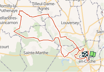
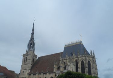
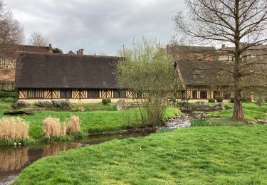
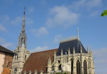
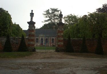
Ruta Senderismo de 24 km a descubrir en Normandía, Eure, Conches-en-Ouche. Esta ruta ha sido propuesta por Marie-Claire-mcp.
Descripción
Départ de la Place Aristide Briand, passer devant le Donjon, puis la Mairie et à droite GRP.....
Localización
País:
France
Región :
Normandía
Departamento/provincia :
Eure
Municipio :
Conches-en-Ouche
Localidad:
Unknown
Salida:(Dec)
Salida:(UTM)
349439 ; 5425142 (31U) N.
Comentarios
Excursiones cerca
![Senderismo Senderismo](https://static1.geolcdn.com/sitytour/trail-icons/101.png)
20220609-Conches en Ouches
Senderismo
Medio
Conches-en-Ouche,
Normandía,
Eure,
France
![](/images/other/stat-length.png)
21 km | 24 km-effort
5h 35min
![](https://static1.geolcdn.com/siteimages/upload/files/16400158638029165_repeat_loop_refresh_sync_direction_icon.png)
Sí
![Excursión Senderismo Nagel-Séez-Mesnil - 2020_02_21_Circuit de Nagel - Photo](https://media.geolcdn.com/t/375/260/ext.jpg?maxdim=2&url=https%3A%2F%2Fstatic1.geolcdn.com%2Fsiteimages%2Fupload%2Ffiles%2F1553511878bg_sport_marche.png)
![Senderismo Senderismo](https://static1.geolcdn.com/sitytour/trail-icons/101.png)
2020_02_21_Circuit de Nagel
Senderismo
Fácil
(1)
Nagel-Séez-Mesnil,
Normandía,
Eure,
France
![](/images/other/stat-length.png)
11 km | 12,4 km-effort
2h 20min
![](https://static1.geolcdn.com/siteimages/upload/files/16400158638029165_repeat_loop_refresh_sync_direction_icon.png)
Sí
![Excursión Senderismo Conches-en-Ouche - conches - Photo](https://media.geolcdn.com/t/375/260/ext.jpg?maxdim=2&url=https%3A%2F%2Fstatic1.geolcdn.com%2Fsiteimages%2Fupload%2Ffiles%2F1553511878bg_sport_marche.png)
![Senderismo Senderismo](https://static1.geolcdn.com/sitytour/trail-icons/101.png)
conches
Senderismo
Muy fácil
(1)
Conches-en-Ouche,
Normandía,
Eure,
France
![](/images/other/stat-length.png)
13,9 km | 16,6 km-effort
Desconocido
![](https://static1.geolcdn.com/siteimages/upload/files/16400158638029165_repeat_loop_refresh_sync_direction_icon.png)
Sí
![Excursión Senderismo Conches-en-Ouche - La vallée de rouloir - Photo](https://media.geolcdn.com/t/375/260/7422122c-1187-488a-911c-d4dca591b9d9.jpg&format=jpg&maxdim=2)
![Senderismo Senderismo](https://static1.geolcdn.com/sitytour/trail-icons/101.png)
La vallée de rouloir
Senderismo
Fácil
Conches-en-Ouche,
Normandía,
Eure,
France
![](/images/other/stat-length.png)
11,6 km | 13,8 km-effort
3h 23min
![](https://static1.geolcdn.com/siteimages/upload/files/16400158638029165_repeat_loop_refresh_sync_direction_icon.png)
Sí
![A pie A pie](https://static1.geolcdn.com/sitytour/trail-icons/100.png)
Conches en Ouche
A pie
Fácil
Conches-en-Ouche,
Normandía,
Eure,
France
![](/images/other/stat-length.png)
21 km | 25 km-effort
Desconocido
![](https://static1.geolcdn.com/siteimages/upload/files/16400158638029165_repeat_loop_refresh_sync_direction_icon.png)
Sí
![Excursión Bici de montaña Conches-en-Ouche - conches-ferrière sur risles - Photo](https://media.geolcdn.com/t/375/260/ext.jpg?maxdim=2&url=https%3A%2F%2Fservices.sitytrail.com%2FGeolivesWS%2FDownloadMedia.ashx%3FTrailID%3D448884%26Media%3Dfix__20140511115030.jpg)
![Bici de montaña Bici de montaña](https://static1.geolcdn.com/sitytour/trail-icons/202.png)
conches-ferrière sur risles
Bici de montaña
Fácil
Conches-en-Ouche,
Normandía,
Eure,
France
![](/images/other/stat-length.png)
47 km | 53 km-effort
3h 26min
![](https://static1.geolcdn.com/siteimages/upload/files/16400158638029165_repeat_loop_refresh_sync_direction_icon.png)
Sí
![Excursión Bici de montaña Conches-en-Ouche - conches-ferrière sur risles - Photo](https://media.geolcdn.com/t/375/260/ext.jpg?maxdim=2&url=https%3A%2F%2Fservices.sitytrail.com%2FGeolivesWS%2FDownloadMedia.ashx%3FTrailID%3D285571%26Media%3Dfix__20140511115030.jpg)
![Bici de montaña Bici de montaña](https://static1.geolcdn.com/sitytour/trail-icons/202.png)
conches-ferrière sur risles
Bici de montaña
Fácil
Conches-en-Ouche,
Normandía,
Eure,
France
![](/images/other/stat-length.png)
47 km | 53 km-effort
3h 26min
![](https://static1.geolcdn.com/siteimages/upload/files/16400158638029165_repeat_loop_refresh_sync_direction_icon.png)
Sí
![Excursión Caballo La Croisille - les boscherons - Photo](https://media.geolcdn.com/t/375/260/ext.jpg?maxdim=2&url=https%3A%2F%2Fservices.sitytrail.com%2FGeolivesWS%2FDownloadMedia.ashx%3FTrailID%3D238492%26Media%3Dfix__20131222113833.jpg)
![Caballo Caballo](https://static1.geolcdn.com/sitytour/trail-icons/300.png)
![Excursión Senderismo Conches-en-Ouche - Sur la route de Compostelle autour de Conches 11 kms - Photo](https://media.geolcdn.com/t/375/260/ext.jpg?maxdim=2&url=https%3A%2F%2Fstatic1.geolcdn.com%2Fsiteimages%2Fupload%2Ffiles%2F1553511878bg_sport_marche.png)
![Senderismo Senderismo](https://static1.geolcdn.com/sitytour/trail-icons/101.png)
Sur la route de Compostelle autour de Conches 11 kms
Senderismo
Difícil
Conches-en-Ouche,
Normandía,
Eure,
France
![](/images/other/stat-length.png)
10,7 km | 12,8 km-effort
2h 55min
![](https://static1.geolcdn.com/siteimages/upload/files/16400158638029165_repeat_loop_refresh_sync_direction_icon.png)
Sí