![](/images/other/stat-length.png)
![Excursión Senderismo La Rochebeaucourt-et-Argentine - Randonnée du 15 août 2022 Les gardiens du Patrimoine - Photo](https://media.geolcdn.com/t/1900/400/621c97c7-1f63-4395-9b54-b39175723b89.jpg&format=pjpeg&maxdim=2)
Randonnée du 15 août 2022 Les gardiens du Patrimoine
alainjoseph6
Usuario
![Longitud](/images/other/stat-length.png)
![Altitud máxima](https://static1.geolcdn.com/siteimages/upload/files/1508320355ic_sort_altitude_max_24dp.png)
![Desnivel positivo](https://static1.geolcdn.com/siteimages/upload/files/1508320355ic_sort_den_pos_24dp.png)
![Km-Effort](/images/other/stat-length.png)
![Altitud mínima](https://static1.geolcdn.com/siteimages/upload/files/1508320355ic_sort_altitude_min_24dp.png)
![Desnivel negativo](https://static1.geolcdn.com/siteimages/upload/files/1508320355ic_sort_den_neg_24dp.png)
![Boucle](https://static1.geolcdn.com/siteimages/upload/files/16400158638029165_repeat_loop_refresh_sync_direction_icon.png)
![Senderismo](https://static1.geolcdn.com/sitytour/trail-icons/101.png)
2h52
Dificultad : Medio
![Escanee este código QR para abrir la excursión en la aplicación SityTrail](https://capi.geolives.com/qq0zvz2zws4bq2lad0pu/sitytour/trails/3314419/qr.png?size=200)
Aplicación GPS de excursión GRATIS
A propósito
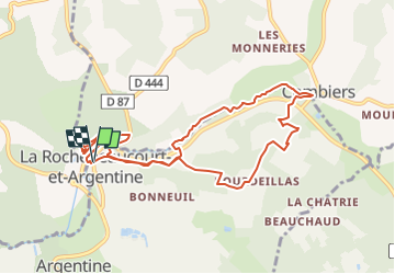
Ruta Senderismo de 10 km a descubrir en Nueva Aquitania, Dordogne, La Rochebeaucourt-et-Argentine. Esta ruta ha sido propuesta por alainjoseph6.
Descripción
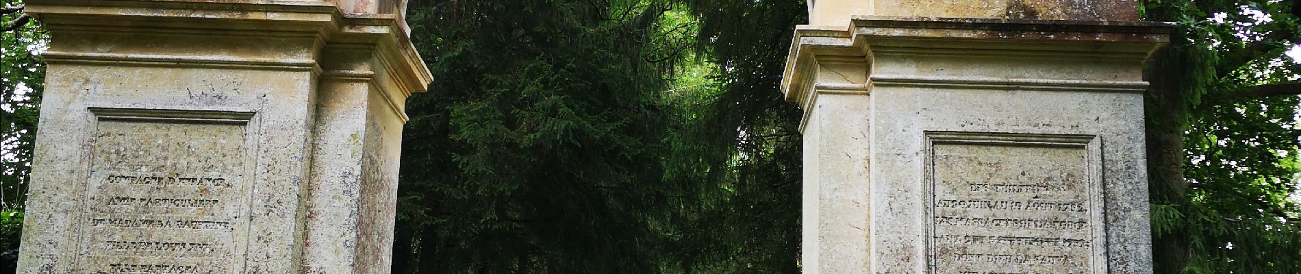
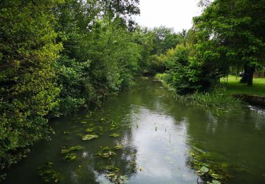
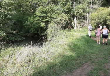
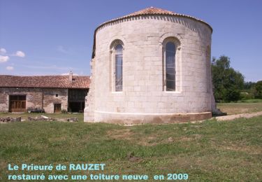
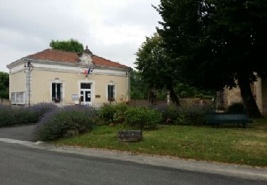
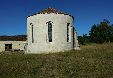
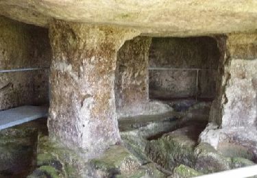
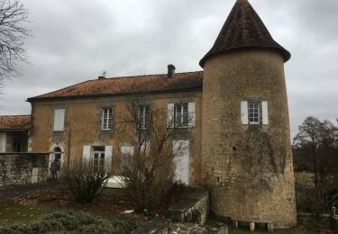
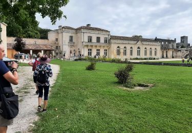
Au départ de la place de l'église de Larochebeaucourt en passant par la fontaine de Bonneuil puis vers Bourdeillas , le Chatenet , Lasteyrie et descente vers Combiers pour emprunter le sentier de découverte de La Nizonne . Retour par le parc du Château et l'arche de La Vertue.
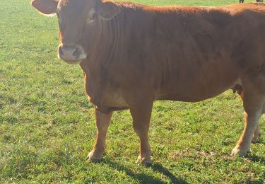
Localización
Comentarios
Excursiones cerca
![Excursión Senderismo Combiers - La randonnée de Marchapack - Photo](https://media.geolcdn.com/t/375/260/ea8563e2-4ba2-481a-9ee5-82f48b60f3c1.jpg&format=jpg&maxdim=2)
![Senderismo Senderismo](https://static1.geolcdn.com/sitytour/trail-icons/101.png)
Senderismo
![](/images/other/stat-length.png)
![](https://static1.geolcdn.com/siteimages/upload/files/16400158638029165_repeat_loop_refresh_sync_direction_icon.png)
![Excursión Senderismo Combiers - Rando de Combiers à Larochebeaucourt par chez Maurice - Photo](https://media.geolcdn.com/t/375/260/c6dc3ea3-705e-4acf-bc25-96c5897cc725.jpg&format=jpg&maxdim=2)
![Senderismo Senderismo](https://static1.geolcdn.com/sitytour/trail-icons/101.png)
Senderismo
![](/images/other/stat-length.png)
![](https://static1.geolcdn.com/siteimages/upload/files/16400158638029165_repeat_loop_refresh_sync_direction_icon.png)
![Excursión Senderismo Combiers - Nouveau circuit de randonnée de COMBIERS - balisé jaune - Photo](https://media.geolcdn.com/t/375/260/378fcde2-24d9-47eb-a8d3-f0f1747efca6.jpg&format=jpg&maxdim=2)
![Senderismo Senderismo](https://static1.geolcdn.com/sitytour/trail-icons/101.png)
Senderismo
![](/images/other/stat-length.png)
![](https://static1.geolcdn.com/siteimages/upload/files/16400158638029165_repeat_loop_refresh_sync_direction_icon.png)
![Excursión Senderismo Combiers - De COMBIERS à la grange de l'ONF et retour par les Bernouillies - Photo](https://media.geolcdn.com/t/375/260/ext.jpg?maxdim=2&url=https%3A%2F%2Fservices.sitytrail.com%2FGeolivesWS%2FDownloadMedia.ashx%3FTrailID%3D796168%26Media%3Dfix__20170725090628.jpg)
![Senderismo Senderismo](https://static1.geolcdn.com/sitytour/trail-icons/101.png)
Senderismo
![](/images/other/stat-length.png)
![](https://static1.geolcdn.com/siteimages/upload/files/16400158638029165_repeat_loop_refresh_sync_direction_icon.png)
![Excursión Senderismo Combiers - Le circuit jaune de COMBIERS - Photo](https://media.geolcdn.com/t/375/260/ext.jpg?maxdim=2&url=https%3A%2F%2Fservices.sitytrail.com%2FGeolivesWS%2FDownloadMedia.ashx%3FTrailID%3D613175%26Media%3Dfix__20160812100856.jpg)
![Senderismo Senderismo](https://static1.geolcdn.com/sitytour/trail-icons/101.png)
Senderismo
![](/images/other/stat-length.png)
![](https://static1.geolcdn.com/siteimages/upload/files/16400158638029165_repeat_loop_refresh_sync_direction_icon.png)
![Excursión Senderismo La Rochebeaucourt-et-Argentine - Argentine (24) découverte de ses trésors - Photo](https://media.geolcdn.com/t/375/260/ext.jpg?maxdim=2&url=https%3A%2F%2Fservices.sitytrail.com%2FGeolivesWS%2FDownloadMedia.ashx%3FTrailID%3D314185%26Media%3Dfix__20140619112911.jpg)
![Senderismo Senderismo](https://static1.geolcdn.com/sitytour/trail-icons/101.png)
Senderismo
![](/images/other/stat-length.png)
![](https://static1.geolcdn.com/siteimages/upload/files/16400158638029165_repeat_loop_refresh_sync_direction_icon.png)
![Excursión Senderismo Combiers - rando combiers - Photo](https://media.geolcdn.com/t/375/260/6bfcb907-a727-4148-a353-c6cd8aafdd66.jpg&format=jpg&maxdim=2)
![Senderismo Senderismo](https://static1.geolcdn.com/sitytour/trail-icons/101.png)
Senderismo
![](/images/other/stat-length.png)
![](https://static1.geolcdn.com/siteimages/upload/files/16400158638029165_repeat_loop_refresh_sync_direction_icon.png)
![Excursión Senderismo Blanzaguet-Saint-Cybard - Blanzaguet-Saint-Cybard - Photo](https://media.geolcdn.com/t/375/260/b9b13559-9191-4d57-b6be-7cb97a87ea8f.jpg&format=jpg&maxdim=2)
![Senderismo Senderismo](https://static1.geolcdn.com/sitytour/trail-icons/101.png)
Senderismo
![](/images/other/stat-length.png)
![](https://static1.geolcdn.com/siteimages/upload/files/16400158638029165_repeat_loop_refresh_sync_direction_icon.png)
![Excursión Senderismo La Rochebeaucourt-et-Argentine - la randonnée de Larochebeaucourt et le parc delà vertue - Photo](https://media.geolcdn.com/t/375/260/fad508f8-4338-4352-a82b-9c4914945e3b.jpg&format=jpg&maxdim=2)
![Senderismo Senderismo](https://static1.geolcdn.com/sitytour/trail-icons/101.png)
Senderismo
![](/images/other/stat-length.png)
![](https://static1.geolcdn.com/siteimages/upload/files/16400158638029165_repeat_loop_refresh_sync_direction_icon.png)