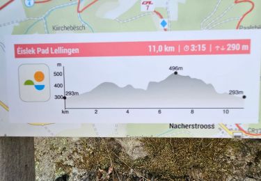
![](/images/other/stat-length.png)
![Excursión Senderismo Parc Hosingen - Escapardenne Lee Trail: Hoscheid - Kautenbach - Photo](https://media.geolcdn.com/t/1900/400/8bf23a72-7eca-4436-91e5-2141dda4e2a9.jpeg&format=pjpeg&maxdim=2)
Escapardenne Lee Trail: Hoscheid - Kautenbach
dauzata
Usuario
![Longitud](/images/other/stat-length.png)
![Altitud máxima](https://static1.geolcdn.com/siteimages/upload/files/1508320355ic_sort_altitude_max_24dp.png)
![Desnivel positivo](https://static1.geolcdn.com/siteimages/upload/files/1508320355ic_sort_den_pos_24dp.png)
![Km-Effort](/images/other/stat-length.png)
![Altitud mínima](https://static1.geolcdn.com/siteimages/upload/files/1508320355ic_sort_altitude_min_24dp.png)
![Desnivel negativo](https://static1.geolcdn.com/siteimages/upload/files/1508320355ic_sort_den_neg_24dp.png)
![Boucle](https://static1.geolcdn.com/siteimages/upload/files/16400158638029165_repeat_loop_refresh_sync_direction_icon.png)
![Senderismo](https://static1.geolcdn.com/sitytour/trail-icons/101.png)
4h25
Dificultad : Medio
![Escanee este código QR para abrir la excursión en la aplicación SityTrail](https://capi.geolives.com/qq0zvz2zws4bq2lad0pu/sitytour/trails/3308970/qr.png?size=200)
Aplicación GPS de excursión GRATIS
A propósito
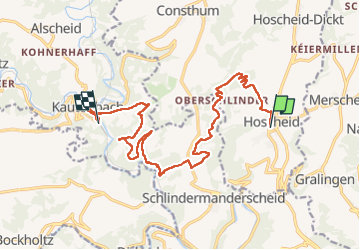
Ruta Senderismo de 15,5 km a descubrir en Desconocido, Canton Clervaux, Parc Hosingen. Esta ruta ha sido propuesta por dauzata.
Descripción
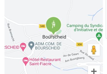
Départ: Hoscheid, route principale (Haaptstross).
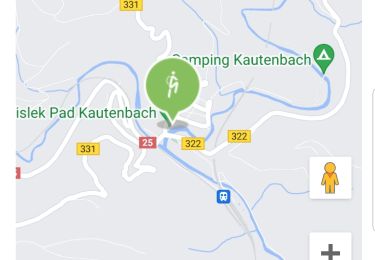
Arrivée: Gare de Kautenbach.
Possibilité d'arriver à Hoscheid depuis Ettelbrück via le bus 137 ou 170, arrêt "Hoscheid, Kräizgaass" ou "Hoscheid, Braaken".
Possibilité de retour vers Ettelbrück ou Clervaux via le train depuis Kautenbach.
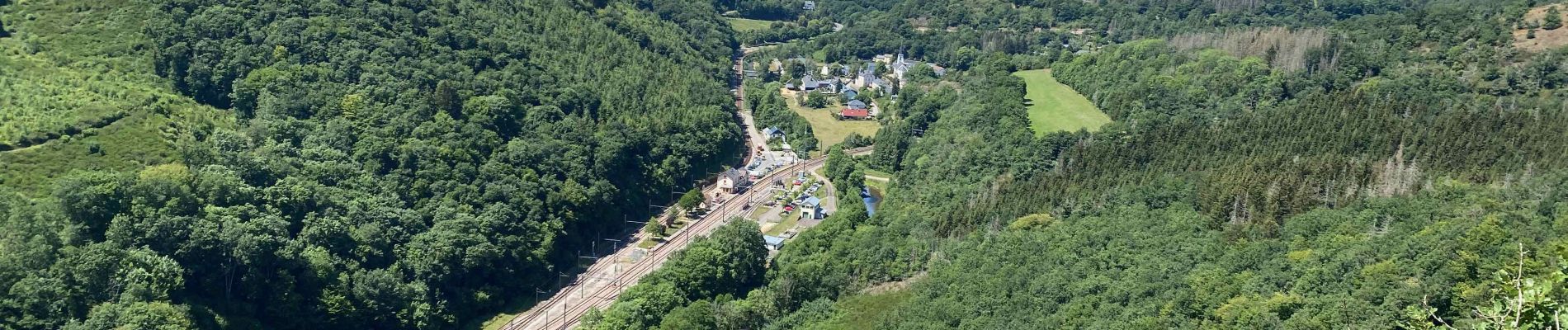
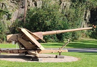
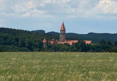
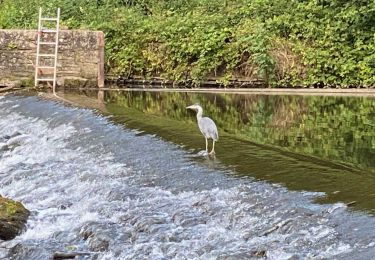
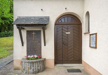
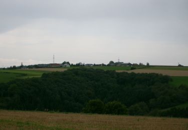
Localización
Comentarios
Excursiones cerca
![Excursión Senderismo Bourscheid - Autopedestres : Bourscheid - Photo](https://media.geolcdn.com/t/375/260/ext.jpg?maxdim=2&url=https%3A%2F%2Fstatic1.geolcdn.com%2Fsiteimages%2Fupload%2Ffiles%2F1553511878bg_sport_marche.png)
![Senderismo Senderismo](https://static1.geolcdn.com/sitytour/trail-icons/101.png)
Senderismo
![](/images/other/stat-length.png)
![](https://static1.geolcdn.com/siteimages/upload/files/16400158638029165_repeat_loop_refresh_sync_direction_icon.png)
![Excursión Senderismo Kiischpelt - eislek trail de Kautenbach à Troisvierges - Photo](https://media.geolcdn.com/t/375/260/fa22f2d8-d5f7-4d5a-bd3c-5a3522af9299.jpg&format=jpg&maxdim=2)
![Senderismo Senderismo](https://static1.geolcdn.com/sitytour/trail-icons/101.png)
Senderismo
![](/images/other/stat-length.png)
![](https://static1.geolcdn.com/siteimages/upload/files/16400158638029165_repeat_loop_refresh_sync_direction_icon.png)
![Excursión Senderismo Kiischpelt - 2023-06-19_15h16m15_eislek-pad-lellingen-1 - Photo](https://media.geolcdn.com/t/375/260/b5d867db-7edb-46bc-9488-bc2835d5be2c.jpg&format=jpg&maxdim=2)
![Senderismo Senderismo](https://static1.geolcdn.com/sitytour/trail-icons/101.png)
Senderismo
![](/images/other/stat-length.png)
![](https://static1.geolcdn.com/siteimages/upload/files/16400158638029165_repeat_loop_refresh_sync_direction_icon.png)
![Excursión Senderismo Kiischpelt - 2022-09-22_13h29m24_t62885235_eislek pad kautenbach (1) - Photo](https://media.geolcdn.com/t/375/260/0c0135b5-3869-4e5e-9de6-2c826fdc4a40.jpg&format=jpg&maxdim=2)
![Senderismo Senderismo](https://static1.geolcdn.com/sitytour/trail-icons/101.png)
Senderismo
![](/images/other/stat-length.png)
![](https://static1.geolcdn.com/siteimages/upload/files/16400158638029165_repeat_loop_refresh_sync_direction_icon.png)
![Excursión Senderismo Bourscheid - 2022-09-22_13h10m58_t62880921_eislek pad bourscheid - Photo](https://media.geolcdn.com/t/375/260/22286de4-94ea-4b92-acbb-a4fc138a2ba8.jpg&format=jpg&maxdim=2)
![Senderismo Senderismo](https://static1.geolcdn.com/sitytour/trail-icons/101.png)
Senderismo
![](/images/other/stat-length.png)
![](https://static1.geolcdn.com/siteimages/upload/files/16400158638029165_repeat_loop_refresh_sync_direction_icon.png)
![Excursión Senderismo Kiischpelt - Escapardenne Eisleck Trail: Kautenbach - Clervaux - Photo](https://media.geolcdn.com/t/375/260/86b391f6-6800-4c48-b33b-03a021b1a218.jpeg&format=jpg&maxdim=2)
![Senderismo Senderismo](https://static1.geolcdn.com/sitytour/trail-icons/101.png)
Senderismo
![](/images/other/stat-length.png)
![](https://static1.geolcdn.com/siteimages/upload/files/16400158638029165_repeat_loop_refresh_sync_direction_icon.png)
![Excursión Senderismo Bourscheid - Escapardenne Lee Trail: Moulin de Bourscheid - Hoscheid - Photo](https://media.geolcdn.com/t/375/260/d49b1826-4b3a-4793-bf5a-6d813972bfaf.jpeg&format=jpg&maxdim=2)
![Senderismo Senderismo](https://static1.geolcdn.com/sitytour/trail-icons/101.png)
Senderismo
![](/images/other/stat-length.png)
![](https://static1.geolcdn.com/siteimages/upload/files/16400158638029165_repeat_loop_refresh_sync_direction_icon.png)
![Excursión A pie Bourscheid - Autopedestre Schlindermanderscheid - Photo](https://media.geolcdn.com/t/375/260/b96de446-0e31-4144-a1e8-49f30dc2459e.jpeg&format=jpg&maxdim=2)
![A pie A pie](https://static1.geolcdn.com/sitytour/trail-icons/100.png)
A pie
![](/images/other/stat-length.png)
![](https://static1.geolcdn.com/siteimages/upload/files/16400158638029165_repeat_loop_refresh_sync_direction_icon.png)
![Excursión A pie Tandel - Autopedestre Brandenbourg - Photo](https://media.geolcdn.com/t/375/260/f773c6ce-1e62-48fa-9c88-bf2c6a499187.jpeg&format=jpg&maxdim=2)
![A pie A pie](https://static1.geolcdn.com/sitytour/trail-icons/100.png)
A pie
![](/images/other/stat-length.png)
![](https://static1.geolcdn.com/siteimages/upload/files/16400158638029165_repeat_loop_refresh_sync_direction_icon.png)