![](/images/other/stat-length.png)
![Excursión Bicicleta Pesmes - Pesmes - Photo](https://media.geolcdn.com/t/1900/400/ext.pjpeg?maxdim=2&url=https%3A%2F%2Fservices.sitytrail.com%2FGeolivesWS%2FDownloadMedia.ashx%3FTrailID%3D329922%26Media%3Dfix__20140801142908.jpg)
Pesmes
albert39
Usuario
![Longitud](/images/other/stat-length.png)
Longitud
102 km
![Altitud máxima](https://static1.geolcdn.com/siteimages/upload/files/1508320355ic_sort_altitude_max_24dp.png)
Altitud máxima
257 m
![Desnivel positivo](https://static1.geolcdn.com/siteimages/upload/files/1508320355ic_sort_den_pos_24dp.png)
Desnivel positivo
1022 m
![Km-Effort](/images/other/stat-length.png)
Km-Effort
116 km
![Altitud mínima](https://static1.geolcdn.com/siteimages/upload/files/1508320355ic_sort_altitude_min_24dp.png)
Altitud mínima
179 m
![Desnivel negativo](https://static1.geolcdn.com/siteimages/upload/files/1508320355ic_sort_den_neg_24dp.png)
Desnivel negativo
1023 m
![Boucle](https://static1.geolcdn.com/siteimages/upload/files/16400158638029165_repeat_loop_refresh_sync_direction_icon.png)
Boucle
Sí
Fecha de creación :
2014-12-10 00:00:00.0
Última modificación :
2014-12-10 00:00:00.0
![Bicicleta](https://static1.geolcdn.com/sitytour/trail-icons/200.png)
5h42
Dificultad : Fácil
![Escanee este código QR para abrir la excursión en la aplicación SityTrail](https://capi.geolives.com/qq0zvz2zws4bq2lad0pu/sitytour/trails/329922/qr.png?size=200)
Aplicación GPS de excursión GRATIS
A propósito
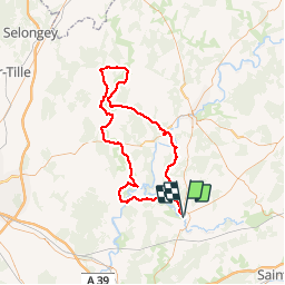
Ruta Bicicleta de 102 km a descubrir en Borgoña-Franco Condado, Alto Saona, Pesmes. Esta ruta ha sido propuesta por albert39.
Descripción
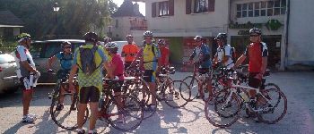
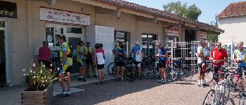
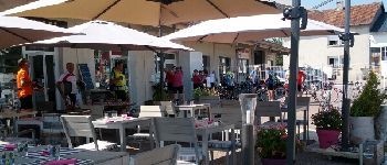
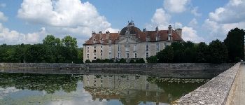
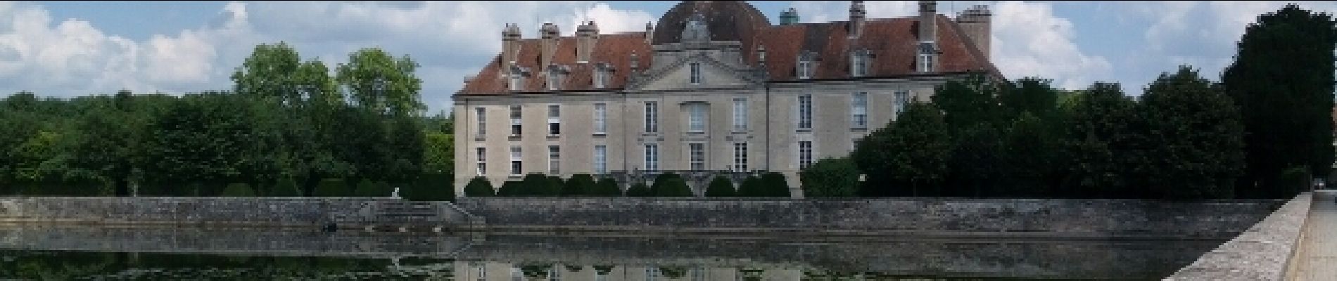
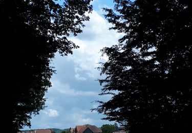
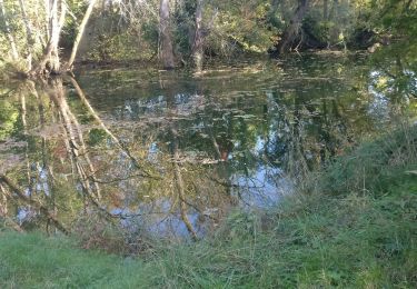
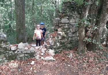
Sortie journée. RdV, Parking de la poste, circuit Vallée de la Vingeanne, déjeuner à Fontaine-Française au resto l'Entre-Pot (excellent), retour par Pontailler et Pesmes.
Localización
País:
France
Región :
Borgoña-Franco Condado
Departamento/provincia :
Alto Saona
Municipio :
Pesmes
Localidad:
Unknown
Salida:(Dec)
Salida:(UTM)
694057 ; 5239390 (31T) N.
Comentarios
Excursiones cerca
![Excursión Senderismo Pesmes - pesmes - Photo](https://media.geolcdn.com/t/375/260/935d3a51-86d4-4011-9ff8-a492cef0cf74.jpg&format=jpg&maxdim=2)
![Senderismo Senderismo](https://static1.geolcdn.com/sitytour/trail-icons/101.png)
pesmes
Senderismo
Muy fácil
Pesmes,
Borgoña-Franco Condado,
Alto Saona,
France
![](/images/other/stat-length.png)
3,5 km | 4,3 km-effort
58min
![](https://static1.geolcdn.com/siteimages/upload/files/16400158638029165_repeat_loop_refresh_sync_direction_icon.png)
Sí
![Excursión Senderismo Thervay - Thervay - Photo](https://media.geolcdn.com/t/375/260/228c0f49-6823-49bc-aed9-2dab58bd8f93.jpg&format=jpg&maxdim=2)
![Senderismo Senderismo](https://static1.geolcdn.com/sitytour/trail-icons/101.png)
Thervay
Senderismo
Fácil
Thervay,
Borgoña-Franco Condado,
Jura,
France
![](/images/other/stat-length.png)
16,1 km | 18,3 km-effort
5h 45min
![](https://static1.geolcdn.com/siteimages/upload/files/16400158638029165_repeat_loop_refresh_sync_direction_icon.png)
No
![Excursión Senderismo Dammartin-Marpain - dammartin - Photo](https://media.geolcdn.com/t/375/260/1603a98c-1196-445d-97c8-ccfd5e2db07b.jpg&format=jpg&maxdim=2)
![Senderismo Senderismo](https://static1.geolcdn.com/sitytour/trail-icons/101.png)
dammartin
Senderismo
Medio
Dammartin-Marpain,
Borgoña-Franco Condado,
Jura,
France
![](/images/other/stat-length.png)
12,3 km | 14,1 km-effort
3h 5min
![](https://static1.geolcdn.com/siteimages/upload/files/16400158638029165_repeat_loop_refresh_sync_direction_icon.png)
Sí
![Excursión Senderismo Pesmes - pesmes 1 - Photo](https://media.geolcdn.com/t/375/260/3a5d7fb0-9900-436b-9361-06e60db4200d.jpg&format=jpg&maxdim=2)
![Senderismo Senderismo](https://static1.geolcdn.com/sitytour/trail-icons/101.png)
pesmes 1
Senderismo
Medio
Pesmes,
Borgoña-Franco Condado,
Alto Saona,
France
![](/images/other/stat-length.png)
7,4 km | 8,2 km-effort
2h 12min
![](https://static1.geolcdn.com/siteimages/upload/files/16400158638029165_repeat_loop_refresh_sync_direction_icon.png)
No
![Excursión Senderismo Pesmes - Pesmes - Photo](https://media.geolcdn.com/t/375/260/ext.jpg?maxdim=2&url=https%3A%2F%2Fstatic1.geolcdn.com%2Fsiteimages%2Fupload%2Ffiles%2F1553511878bg_sport_marche.png)
![Senderismo Senderismo](https://static1.geolcdn.com/sitytour/trail-icons/101.png)
Pesmes
Senderismo
Fácil
Pesmes,
Borgoña-Franco Condado,
Alto Saona,
France
![](/images/other/stat-length.png)
13,2 km | 15,5 km-effort
3h 33min
![](https://static1.geolcdn.com/siteimages/upload/files/16400158638029165_repeat_loop_refresh_sync_direction_icon.png)
Sí
![Excursión Senderismo Malans - Malans Ile Art 20200825 - Photo](https://media.geolcdn.com/t/375/260/8b473933-64a6-465d-8b74-e874d69439b2.jpg&format=jpg&maxdim=2)
![Senderismo Senderismo](https://static1.geolcdn.com/sitytour/trail-icons/101.png)
Malans Ile Art 20200825
Senderismo
Muy fácil
Malans,
Borgoña-Franco Condado,
Alto Saona,
France
![](/images/other/stat-length.png)
4,1 km | 4,7 km-effort
1h 30min
![](https://static1.geolcdn.com/siteimages/upload/files/16400158638029165_repeat_loop_refresh_sync_direction_icon.png)
Sí
![Excursión Senderismo Pesmes - pesmes et autour de pesmes - Photo](https://media.geolcdn.com/t/375/260/ext.jpg?maxdim=2&url=https%3A%2F%2Fstatic1.geolcdn.com%2Fsiteimages%2Fupload%2Ffiles%2F1553511878bg_sport_marche.png)
![Senderismo Senderismo](https://static1.geolcdn.com/sitytour/trail-icons/101.png)
pesmes et autour de pesmes
Senderismo
Muy difícil
Pesmes,
Borgoña-Franco Condado,
Alto Saona,
France
![](/images/other/stat-length.png)
22 km | 24 km-effort
5h 31min
![](https://static1.geolcdn.com/siteimages/upload/files/16400158638029165_repeat_loop_refresh_sync_direction_icon.png)
Sí
![Excursión Bici de carretera Pesmes - 3_1_22 - Photo](https://media.geolcdn.com/t/375/260/ext.jpg?maxdim=2&url=https%3A%2F%2Fstatic1.geolcdn.com%2Fsiteimages%2Fupload%2Ffiles%2F1524743154velo.jpg)
![Bici de carretera Bici de carretera](https://static1.geolcdn.com/sitytour/trail-icons/201.png)
3_1_22
Bici de carretera
Muy difícil
Pesmes,
Borgoña-Franco Condado,
Alto Saona,
France
![](/images/other/stat-length.png)
147 km | 172 km-effort
11h 28min
![](https://static1.geolcdn.com/siteimages/upload/files/16400158638029165_repeat_loop_refresh_sync_direction_icon.png)
Sí
![Excursión sport Thervay - 2019-09-09_08h36m59_thervay - Photo](https://media.geolcdn.com/t/375/260/ext.jpg?maxdim=2&url=https%3A%2F%2Fsecurestorage.geolives.com%2Fsitytour%2Ftrail-bg%2Fdefault.jpg)
2019-09-09_08h36m59_thervay
sport
Muy fácil
Thervay,
Borgoña-Franco Condado,
Jura,
France
![](/images/other/stat-length.png)
21 km | 24 km-effort
Desconocido
![](https://static1.geolcdn.com/siteimages/upload/files/16400158638029165_repeat_loop_refresh_sync_direction_icon.png)
Sí