![](/images/other/stat-length.png)
![Excursión Senderismo Thiviers - boucle de la table d'orientation - Photo](https://media.geolcdn.com/t/1900/400/ext.pjpeg?maxdim=2&url=https%3A%2F%2Fstatic1.geolcdn.com%2Fsiteimages%2Fupload%2Ffiles%2F1553511878bg_sport_marche.png)
boucle de la table d'orientation
Patricew
Usuario
![Longitud](/images/other/stat-length.png)
Longitud
11,6 km
![Altitud máxima](https://static1.geolcdn.com/siteimages/upload/files/1508320355ic_sort_altitude_max_24dp.png)
Altitud máxima
242 m
![Desnivel positivo](https://static1.geolcdn.com/siteimages/upload/files/1508320355ic_sort_den_pos_24dp.png)
Desnivel positivo
205 m
![Km-Effort](/images/other/stat-length.png)
Km-Effort
14,3 km
![Altitud mínima](https://static1.geolcdn.com/siteimages/upload/files/1508320355ic_sort_altitude_min_24dp.png)
Altitud mínima
150 m
![Desnivel negativo](https://static1.geolcdn.com/siteimages/upload/files/1508320355ic_sort_den_neg_24dp.png)
Desnivel negativo
204 m
![Boucle](https://static1.geolcdn.com/siteimages/upload/files/16400158638029165_repeat_loop_refresh_sync_direction_icon.png)
Boucle
Sí
Fecha de creación :
2022-06-28 06:59:45.945
Última modificación :
2022-06-30 17:03:24.842
![Senderismo](https://static1.geolcdn.com/sitytour/trail-icons/101.png)
2h28
Dificultad : Fácil
![Escanee este código QR para abrir la excursión en la aplicación SityTrail](https://capi.geolives.com/qq0zvz2zws4bq2lad0pu/sitytour/trails/3297368/qr.png?size=200)
Aplicación GPS de excursión GRATIS
A propósito
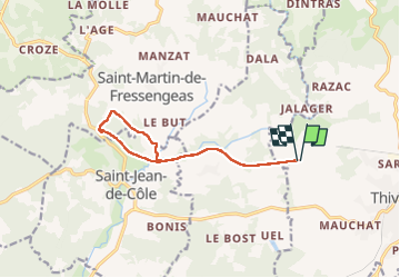
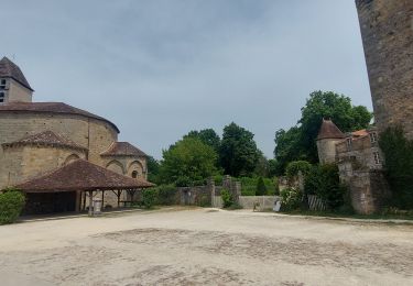
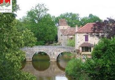
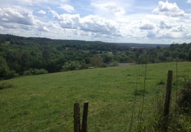
Ruta Senderismo de 11,6 km a descubrir en Nueva Aquitania, Dordogne, Thiviers. Esta ruta ha sido propuesta por Patricew.
Descripción
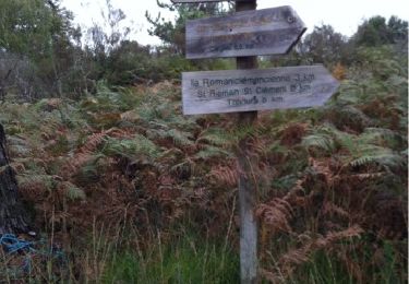
niveau moyen,bien ombragée,jolie
Une grande partie de la randonnée est un aller - retour voie verte, mais la boucle à partir du parking de saint jean est très jolie et ombragée
Localización
País:
France
Región :
Nueva Aquitania
Departamento/provincia :
Dordogne
Municipio :
Thiviers
Localidad:
Unknown
Salida:(Dec)
Salida:(UTM)
334999 ; 5032479 (31T) N.
Comentarios
Excursiones cerca
![Excursión Senderismo Saint-Jean-de-Côle - Saint-Jean de colle la côte 12 km - Photo](https://media.geolcdn.com/t/375/260/b7af3448-8976-4374-bf55-0b6f9de554da.jpg&format=jpg&maxdim=2)
![Senderismo Senderismo](https://static1.geolcdn.com/sitytour/trail-icons/101.png)
Saint-Jean de colle la côte 12 km
Senderismo
Fácil
(1)
Saint-Jean-de-Côle,
Nueva Aquitania,
Dordogne,
France
![](/images/other/stat-length.png)
12 km | 14,4 km-effort
2h 51min
![](https://static1.geolcdn.com/siteimages/upload/files/16400158638029165_repeat_loop_refresh_sync_direction_icon.png)
Sí
![Excursión Bici de montaña Thiviers - Thiviers vtt - Photo](https://media.geolcdn.com/t/375/260/df34d907-768b-4b26-a7b5-5ec7cdc86a99.jpg&format=jpg&maxdim=2)
![Bici de montaña Bici de montaña](https://static1.geolcdn.com/sitytour/trail-icons/202.png)
Thiviers vtt
Bici de montaña
Muy fácil
Thiviers,
Nueva Aquitania,
Dordogne,
France
![](/images/other/stat-length.png)
48 km | 58 km-effort
6h 2min
![](https://static1.geolcdn.com/siteimages/upload/files/16400158638029165_repeat_loop_refresh_sync_direction_icon.png)
Sí
![Excursión Senderismo Saint-Jean-de-Côle - Saint jean de Côle/St Martin - Photo](https://media.geolcdn.com/t/375/260/8665702b-ffe2-48bb-a76f-45247ee7e571.jpg&format=jpg&maxdim=2)
![Senderismo Senderismo](https://static1.geolcdn.com/sitytour/trail-icons/101.png)
Saint jean de Côle/St Martin
Senderismo
Saint-Jean-de-Côle,
Nueva Aquitania,
Dordogne,
France
![](/images/other/stat-length.png)
12 km | 15,3 km-effort
3h 23min
![](https://static1.geolcdn.com/siteimages/upload/files/16400158638029165_repeat_loop_refresh_sync_direction_icon.png)
Sí
![Excursión Senderismo Eyzerac - La Servolle 2 - Photo](https://media.geolcdn.com/t/375/260/ext.jpg?maxdim=2&url=https%3A%2F%2Fservices.sitytrail.com%2FGeolivesWS%2FDownloadMedia.ashx%3FTrailID%3D226050%26Media%3D20131008110344.jpg)
![Senderismo Senderismo](https://static1.geolcdn.com/sitytour/trail-icons/101.png)
La Servolle 2
Senderismo
Fácil
Eyzerac,
Nueva Aquitania,
Dordogne,
France
![](/images/other/stat-length.png)
12,4 km | 14,9 km-effort
3h 16min
![](https://static1.geolcdn.com/siteimages/upload/files/16400158638029165_repeat_loop_refresh_sync_direction_icon.png)
Sí
![Excursión Senderismo Saint-Jean-de-Côle - St-Jean de Côle - St-Martin - Photo](https://media.geolcdn.com/t/375/260/143ff9ac-a165-4b59-9523-935f63a9a082.jpg&format=jpg&maxdim=2)
![Senderismo Senderismo](https://static1.geolcdn.com/sitytour/trail-icons/101.png)
St-Jean de Côle - St-Martin
Senderismo
Medio
Saint-Jean-de-Côle,
Nueva Aquitania,
Dordogne,
France
![](/images/other/stat-length.png)
5,9 km | 7,3 km-effort
1h 29min
![](https://static1.geolcdn.com/siteimages/upload/files/16400158638029165_repeat_loop_refresh_sync_direction_icon.png)
Sí
![Senderismo Senderismo](https://static1.geolcdn.com/sitytour/trail-icons/101.png)
St Martin de Fressengeas
Senderismo
Medio
(1)
Saint-Martin-de-Fressengeas,
Nueva Aquitania,
Dordogne,
France
![](/images/other/stat-length.png)
12,6 km | 16,7 km-effort
4h 46min
![](https://static1.geolcdn.com/siteimages/upload/files/16400158638029165_repeat_loop_refresh_sync_direction_icon.png)
Sí
![Excursión Senderismo Saint-Jean-de-Côle - Saint Jean de Côle - Photo](https://media.geolcdn.com/t/375/260/97f1191d-d6a8-4caf-b34c-213f3218b637.jpg&format=jpg&maxdim=2)
![Senderismo Senderismo](https://static1.geolcdn.com/sitytour/trail-icons/101.png)
Saint Jean de Côle
Senderismo
Difícil
Saint-Jean-de-Côle,
Nueva Aquitania,
Dordogne,
France
![](/images/other/stat-length.png)
13 km | 15,6 km-effort
3h 32min
![](https://static1.geolcdn.com/siteimages/upload/files/16400158638029165_repeat_loop_refresh_sync_direction_icon.png)
Sí
![Excursión Senderismo Saint-Jean-de-Côle - 24 Saint-Jean-de-Côle - Photo](https://media.geolcdn.com/t/375/260/ext.jpg?maxdim=2&url=https%3A%2F%2Fservices.sitytrail.com%2FGeolivesWS%2FDownloadMedia.ashx%3FTrailID%3D752771%26Media%3D20170514153645.jpg)
![Senderismo Senderismo](https://static1.geolcdn.com/sitytour/trail-icons/101.png)
24 Saint-Jean-de-Côle
Senderismo
Fácil
Saint-Jean-de-Côle,
Nueva Aquitania,
Dordogne,
France
![](/images/other/stat-length.png)
16,3 km | 20 km-effort
4h 21min
![](https://static1.geolcdn.com/siteimages/upload/files/16400158638029165_repeat_loop_refresh_sync_direction_icon.png)
No
![Excursión sport Saint-Martin-de-Fressengeas - Ràndo Bernard saint Martin de fressengeas - Photo](https://media.geolcdn.com/t/375/260/ext.jpg?maxdim=2&url=https%3A%2F%2Fsecurestorage.geolives.com%2Fsitytour%2Ftrail-bg%2Fdefault.jpg)
Ràndo Bernard saint Martin de fressengeas
sport
Muy fácil
Saint-Martin-de-Fressengeas,
Nueva Aquitania,
Dordogne,
France
![](/images/other/stat-length.png)
9,1 km | 11,8 km-effort
Desconocido
![](https://static1.geolcdn.com/siteimages/upload/files/16400158638029165_repeat_loop_refresh_sync_direction_icon.png)
Sí