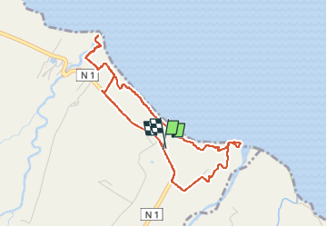
![](/images/other/stat-length.png)
![Excursión Senderismo Basse-Pointe - Boucle de chalvet, Pécoule vers Chalvet. - Photo](https://media.geolcdn.com/t/1900/400/1e4cabaa-63c0-46f7-b111-2c87348cf0ee.jpg&format=pjpeg&maxdim=2)
Boucle de chalvet, Pécoule vers Chalvet.
GabyG
Usuario GUIDE
![Longitud](/images/other/stat-length.png)
![Altitud máxima](https://static1.geolcdn.com/siteimages/upload/files/1508320355ic_sort_altitude_max_24dp.png)
![Desnivel positivo](https://static1.geolcdn.com/siteimages/upload/files/1508320355ic_sort_den_pos_24dp.png)
![Km-Effort](/images/other/stat-length.png)
![Altitud mínima](https://static1.geolcdn.com/siteimages/upload/files/1508320355ic_sort_altitude_min_24dp.png)
![Desnivel negativo](https://static1.geolcdn.com/siteimages/upload/files/1508320355ic_sort_den_neg_24dp.png)
![Boucle](https://static1.geolcdn.com/siteimages/upload/files/16400158638029165_repeat_loop_refresh_sync_direction_icon.png)
![Senderismo](https://static1.geolcdn.com/sitytour/trail-icons/101.png)
3h02
Dificultad : Medio
![Escanee este código QR para abrir la excursión en la aplicación SityTrail](https://capi.geolives.com/qq0zvz2zws4bq2lad0pu/sitytour/trails/3295594/qr.png?size=200)
Aplicación GPS de excursión GRATIS
A propósito
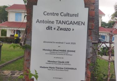
Ruta Senderismo de 6,5 km a descubrir en Martinica, Desconocido, Basse-Pointe. Esta ruta ha sido propuesta por GabyG.
Descripción
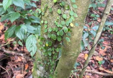
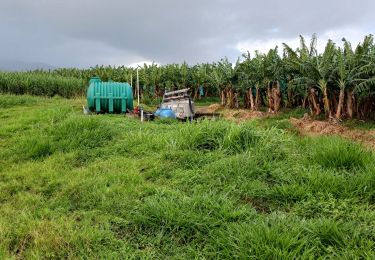
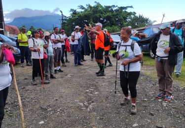
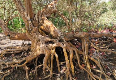
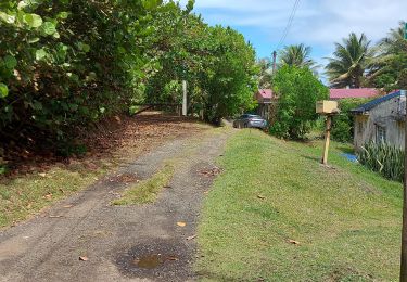
Randonnée de famille, en quittant le parking de Chalvet vers le site de fév. 74 ! faire une petite jonction vers l'embouchure de la rivière Capote, puis revenir vers le site et poursuivre sa randonnée. Arrivé à Pécoule avec un peut de temps devant soi, se rendre vers l'embouchure de la rivière Poquet, puis revenir vers l'Habitation Pécoule pour terminer la randonnée vers Chalvet.
Localización
Comentarios
Excursiones cerca
![Excursión Senderismo Le Lorrain - Boucle Lorrinoise via Morne Wawa - Photo](https://media.geolcdn.com/t/375/260/2260d5fa-b236-443e-94b6-198d12135800.jpg&format=jpg&maxdim=2)
![Senderismo Senderismo](https://static1.geolcdn.com/sitytour/trail-icons/101.png)
Senderismo
![](/images/other/stat-length.png)
![](https://static1.geolcdn.com/siteimages/upload/files/16400158638029165_repeat_loop_refresh_sync_direction_icon.png)
![Excursión Senderismo Le Lorrain - Boucle Morne Capot via La Pirogue - Photo](https://media.geolcdn.com/t/375/260/88d336cd-6544-44b1-ab6c-880c93dcc1a4.jpg&format=jpg&maxdim=2)
![Senderismo Senderismo](https://static1.geolcdn.com/sitytour/trail-icons/101.png)
Senderismo
![](/images/other/stat-length.png)
![](https://static1.geolcdn.com/siteimages/upload/files/16400158638029165_repeat_loop_refresh_sync_direction_icon.png)
![Excursión Senderismo L'Ajoupa-Bouillon - Cascade Dany - Photo](https://media.geolcdn.com/t/375/260/3f4633dd-5480-45ae-9d52-d53ad8f8f6d0.jpg&format=jpg&maxdim=2)
![Senderismo Senderismo](https://static1.geolcdn.com/sitytour/trail-icons/101.png)
Senderismo
![](/images/other/stat-length.png)
![](https://static1.geolcdn.com/siteimages/upload/files/16400158638029165_repeat_loop_refresh_sync_direction_icon.png)
![Senderismo Senderismo](https://static1.geolcdn.com/sitytour/trail-icons/101.png)
Senderismo
![](/images/other/stat-length.png)
![](https://static1.geolcdn.com/siteimages/upload/files/16400158638029165_repeat_loop_refresh_sync_direction_icon.png)
![Excursión Senderismo Basse-Pointe - Exploitations agricoles en boucle N°1 - Photo](https://media.geolcdn.com/t/375/260/25d4e89e-0741-47b9-9c1b-39c4a8472812.jpg&format=jpg&maxdim=2)
![Senderismo Senderismo](https://static1.geolcdn.com/sitytour/trail-icons/101.png)
Senderismo
![](/images/other/stat-length.png)
![](https://static1.geolcdn.com/siteimages/upload/files/16400158638029165_repeat_loop_refresh_sync_direction_icon.png)
![Excursión Senderismo Le Lorrain - Mornes Capot / Lorrain Martinique - Photo](https://media.geolcdn.com/t/375/260/bf3e9288-2731-4804-b2e5-dccb9a2b816e.jpg&format=jpg&maxdim=2)
![Senderismo Senderismo](https://static1.geolcdn.com/sitytour/trail-icons/101.png)
Senderismo
![](/images/other/stat-length.png)
![](https://static1.geolcdn.com/siteimages/upload/files/16400158638029165_repeat_loop_refresh_sync_direction_icon.png)
![Excursión Senderismo Basse-Pointe - Grande Boucle sur Basse pointe. - Photo](https://media.geolcdn.com/t/375/260/08174d61-6359-47a0-ac79-c9191649aa79.jpg&format=jpg&maxdim=2)
![Senderismo Senderismo](https://static1.geolcdn.com/sitytour/trail-icons/101.png)
Senderismo
![](/images/other/stat-length.png)
![](https://static1.geolcdn.com/siteimages/upload/files/16400158638029165_repeat_loop_refresh_sync_direction_icon.png)
![Excursión Senderismo Le Lorrain - trace des Amérindiens - Photo](https://media.geolcdn.com/t/375/260/5dbbcceb-f0b2-4ef7-8df6-def9c209f94d.jpg&format=jpg&maxdim=2)
![Senderismo Senderismo](https://static1.geolcdn.com/sitytour/trail-icons/101.png)
Senderismo
![](/images/other/stat-length.png)
![](https://static1.geolcdn.com/siteimages/upload/files/16400158638029165_repeat_loop_refresh_sync_direction_icon.png)
![Excursión Senderismo Le Lorrain - Boucle La Crabiere - Hbt Assier - Photo](https://media.geolcdn.com/t/375/260/411cf4ff-70b2-4b04-9c7e-524092131d90.jpg&format=jpg&maxdim=2)
![Senderismo Senderismo](https://static1.geolcdn.com/sitytour/trail-icons/101.png)
Senderismo
![](/images/other/stat-length.png)
![](https://static1.geolcdn.com/siteimages/upload/files/16400158638029165_repeat_loop_refresh_sync_direction_icon.png)