![](/images/other/stat-length.png)
![Excursión Bici de carretera Calviac-en-Périgord - VALLÉE DE LA DORDOGNE- PARCOURS OUEST DEPUIS CALVIAC EN PÉRIGORD - Photo](https://media.geolcdn.com/t/1900/400/76580b75-b307-436a-94dd-ef26172667ba.jpg&format=pjpeg&maxdim=2)
VALLÉE DE LA DORDOGNE- PARCOURS OUEST DEPUIS CALVIAC EN PÉRIGORD
jean-marie.parachini
Usuario
![Longitud](/images/other/stat-length.png)
Longitud
69 km
![Altitud máxima](https://static1.geolcdn.com/siteimages/upload/files/1508320355ic_sort_altitude_max_24dp.png)
Altitud máxima
258 m
![Desnivel positivo](https://static1.geolcdn.com/siteimages/upload/files/1508320355ic_sort_den_pos_24dp.png)
Desnivel positivo
1220 m
![Km-Effort](/images/other/stat-length.png)
Km-Effort
85 km
![Altitud mínima](https://static1.geolcdn.com/siteimages/upload/files/1508320355ic_sort_altitude_min_24dp.png)
Altitud mínima
58 m
![Desnivel negativo](https://static1.geolcdn.com/siteimages/upload/files/1508320355ic_sort_den_neg_24dp.png)
Desnivel negativo
1219 m
![Boucle](https://static1.geolcdn.com/siteimages/upload/files/16400158638029165_repeat_loop_refresh_sync_direction_icon.png)
Boucle
Sí
Fecha de creación :
2022-06-20 06:31:30.192
Última modificación :
2022-06-20 16:07:29.553
![Bici de carretera](https://static1.geolcdn.com/sitytour/trail-icons/201.png)
8h24
Dificultad : Difícil
![Escanee este código QR para abrir la excursión en la aplicación SityTrail](https://capi.geolives.com/qq0zvz2zws4bq2lad0pu/sitytour/trails/3289143/qr.png?size=200)
Aplicación GPS de excursión GRATIS
A propósito
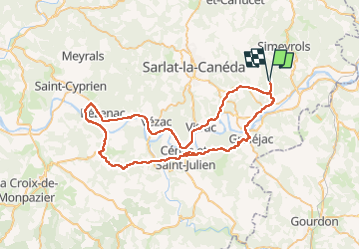
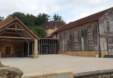
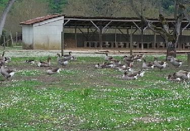
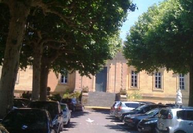
Ruta Bici de carretera de 69 km a descubrir en Nueva Aquitania, Dordogne, Calviac-en-Périgord. Esta ruta ha sido propuesta por jean-marie.parachini.
Descripción
parcours par Carsat-Aillac le village de Domme puis Beynac et Cazenac et La Roque-Gageac.
Retour à Calviac en Périgord.
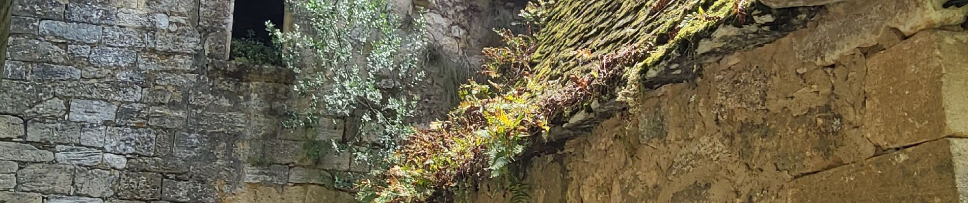
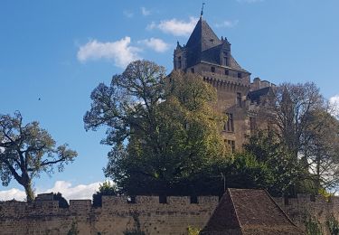
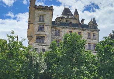
Localización
País:
France
Región :
Nueva Aquitania
Departamento/provincia :
Dordogne
Municipio :
Calviac-en-Périgord
Localidad:
Unknown
Salida:(Dec)
Salida:(UTM)
367313 ; 4970312 (31T) N.
Comentarios
Excursiones cerca
![Excursión Senderismo Saint-Vincent-le-Paluel - Boucle du Paluel - Photo](https://media.geolcdn.com/t/375/260/ext.jpg?maxdim=2&url=https%3A%2F%2Fstatic1.geolcdn.com%2Fsiteimages%2Fupload%2Ffiles%2F1553511878bg_sport_marche.png)
![Senderismo Senderismo](https://static1.geolcdn.com/sitytour/trail-icons/101.png)
Boucle du Paluel
Senderismo
Difícil
(1)
Saint-Vincent-le-Paluel,
Nueva Aquitania,
Dordogne,
France
![](/images/other/stat-length.png)
10,7 km | 13,6 km-effort
3h 5min
![](https://static1.geolcdn.com/siteimages/upload/files/16400158638029165_repeat_loop_refresh_sync_direction_icon.png)
Sí
![Excursión Senderismo Saint-Vincent-le-Paluel - Rando Dordogne jour 1 - Photo](https://media.geolcdn.com/t/375/260/cfec1289-9526-4294-b5f6-f93e54f813ee.jpg&format=jpg&maxdim=2)
![Senderismo Senderismo](https://static1.geolcdn.com/sitytour/trail-icons/101.png)
Rando Dordogne jour 1
Senderismo
Medio
Saint-Vincent-le-Paluel,
Nueva Aquitania,
Dordogne,
France
![](/images/other/stat-length.png)
17,2 km | 22 km-effort
5h 17min
![](https://static1.geolcdn.com/siteimages/upload/files/16400158638029165_repeat_loop_refresh_sync_direction_icon.png)
No
![Excursión Bici de carretera Calviac-en-Périgord - MARTEL - DE CALVIAC EN PASSANT PAR SOUILLAC - Photo](https://media.geolcdn.com/t/375/260/f8797973-83ed-43e5-8480-f17305a157d8.jpg&format=jpg&maxdim=2)
![Bici de carretera Bici de carretera](https://static1.geolcdn.com/sitytour/trail-icons/201.png)
MARTEL - DE CALVIAC EN PASSANT PAR SOUILLAC
Bici de carretera
Medio
Calviac-en-Périgord,
Nueva Aquitania,
Dordogne,
France
![](/images/other/stat-length.png)
74 km | 89 km-effort
7h 4min
![](https://static1.geolcdn.com/siteimages/upload/files/16400158638029165_repeat_loop_refresh_sync_direction_icon.png)
Sí
![Excursión Senderismo Carsac-Aillac - Carsac-Aillac - Photo](https://media.geolcdn.com/t/375/260/f1f9741a-1408-46ce-a6dd-b7b72ca2536b.jpg&format=jpg&maxdim=2)
![Senderismo Senderismo](https://static1.geolcdn.com/sitytour/trail-icons/101.png)
Carsac-Aillac
Senderismo
Fácil
(1)
Carsac-Aillac,
Nueva Aquitania,
Dordogne,
France
![](/images/other/stat-length.png)
13,3 km | 16,5 km-effort
3h 18min
![](https://static1.geolcdn.com/siteimages/upload/files/16400158638029165_repeat_loop_refresh_sync_direction_icon.png)
Sí
![Excursión Senderismo Sainte-Mondane - sarlat_28a - Photo](https://media.geolcdn.com/t/375/260/ext.jpg?maxdim=2&url=https%3A%2F%2Fstatic1.geolcdn.com%2Fsiteimages%2Fupload%2Ffiles%2F1553511878bg_sport_marche.png)
![Senderismo Senderismo](https://static1.geolcdn.com/sitytour/trail-icons/101.png)
sarlat_28a
Senderismo
Fácil
(1)
Sainte-Mondane,
Nueva Aquitania,
Dordogne,
France
![](/images/other/stat-length.png)
6,4 km | 9,3 km-effort
1h 57min
![](https://static1.geolcdn.com/siteimages/upload/files/16400158638029165_repeat_loop_refresh_sync_direction_icon.png)
Sí
![Excursión Senderismo Domme - Cingle de Monfort - Photo](https://media.geolcdn.com/t/375/260/ext.jpg?maxdim=2&url=https%3A%2F%2Fservices.sitytrail.com%2FGeolivesWS%2FDownloadMedia.ashx%3FTrailID%3D272607%26Media%3Dfix__20140501152113.jpg)
![Senderismo Senderismo](https://static1.geolcdn.com/sitytour/trail-icons/101.png)
Cingle de Monfort
Senderismo
Muy fácil
Domme,
Nueva Aquitania,
Dordogne,
France
![](/images/other/stat-length.png)
4,7 km | 5,4 km-effort
1h 12min
![](https://static1.geolcdn.com/siteimages/upload/files/16400158638029165_repeat_loop_refresh_sync_direction_icon.png)
Sí
![Excursión Senderismo Carsac-Aillac - Voie Verte Périgord Quercy - De Aillac à Sarlat la Canéda - Photo](https://media.geolcdn.com/t/375/260/ext.jpg?maxdim=2&url=https%3A%2F%2Fservices.sitytrail.com%2FGeolivesWS%2FDownloadMedia.ashx%3FTrailID%3D106627%26Media%3D11238_5.jpg)
![Senderismo Senderismo](https://static1.geolcdn.com/sitytour/trail-icons/101.png)
Voie Verte Périgord Quercy - De Aillac à Sarlat la Canéda
Senderismo
Medio
Carsac-Aillac,
Nueva Aquitania,
Dordogne,
France
![](/images/other/stat-length.png)
12,3 km | 14,8 km-effort
3h 30min
![](https://static1.geolcdn.com/siteimages/upload/files/16400158638029165_repeat_loop_refresh_sync_direction_icon.png)
No
![Excursión Senderismo Saint-Vincent-le-Paluel - SAINT VINCENT LE PALUEL - Photo](https://media.geolcdn.com/t/375/260/f25f2086-e696-49e6-bd0b-5d7a1841fc48.jpg&format=jpg&maxdim=2)
![Senderismo Senderismo](https://static1.geolcdn.com/sitytour/trail-icons/101.png)
SAINT VINCENT LE PALUEL
Senderismo
Fácil
Saint-Vincent-le-Paluel,
Nueva Aquitania,
Dordogne,
France
![](/images/other/stat-length.png)
11 km | 13,9 km-effort
2h 37min
![](https://static1.geolcdn.com/siteimages/upload/files/16400158638029165_repeat_loop_refresh_sync_direction_icon.png)
Sí
![Excursión Senderismo Calviac-en-Périgord - La ronde des villages J2 : Calviac en périgord - Sainte Mondane - Photo](https://media.geolcdn.com/t/375/260/ext.jpg?maxdim=2&url=https%3A%2F%2Fstatic1.geolcdn.com%2Fsiteimages%2Fupload%2Ffiles%2F1553511878bg_sport_marche.png)
![Senderismo Senderismo](https://static1.geolcdn.com/sitytour/trail-icons/101.png)
La ronde des villages J2 : Calviac en périgord - Sainte Mondane
Senderismo
Muy difícil
Calviac-en-Périgord,
Nueva Aquitania,
Dordogne,
France
![](/images/other/stat-length.png)
30 km | 38 km-effort
6h 14min
![](https://static1.geolcdn.com/siteimages/upload/files/16400158638029165_repeat_loop_refresh_sync_direction_icon.png)
No