![](/images/other/stat-length.png)
activity_8994564839
pascalou73
Usuario GUIDE
![Longitud](/images/other/stat-length.png)
Longitud
48 km
![Altitud máxima](https://static1.geolcdn.com/siteimages/upload/files/1508320355ic_sort_altitude_max_24dp.png)
Altitud máxima
292 m
![Desnivel positivo](https://static1.geolcdn.com/siteimages/upload/files/1508320355ic_sort_den_pos_24dp.png)
Desnivel positivo
817 m
![Km-Effort](/images/other/stat-length.png)
Km-Effort
59 km
![Altitud mínima](https://static1.geolcdn.com/siteimages/upload/files/1508320355ic_sort_altitude_min_24dp.png)
Altitud mínima
165 m
![Desnivel negativo](https://static1.geolcdn.com/siteimages/upload/files/1508320355ic_sort_den_neg_24dp.png)
Desnivel negativo
817 m
![Boucle](https://static1.geolcdn.com/siteimages/upload/files/16400158638029165_repeat_loop_refresh_sync_direction_icon.png)
Boucle
Sí
Fecha de creación :
2022-06-14 10:20:34.333
Última modificación :
2022-06-14 10:22:21.358
![Bici de montaña](https://static1.geolcdn.com/sitytour/trail-icons/202.png)
4h06
Dificultad : Muy difícil
![Escanee este código QR para abrir la excursión en la aplicación SityTrail](https://capi.geolives.com/qq0zvz2zws4bq2lad0pu/sitytour/trails/3281699/qr.png?size=200)
Aplicación GPS de excursión GRATIS
A propósito
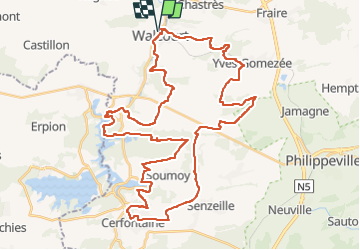
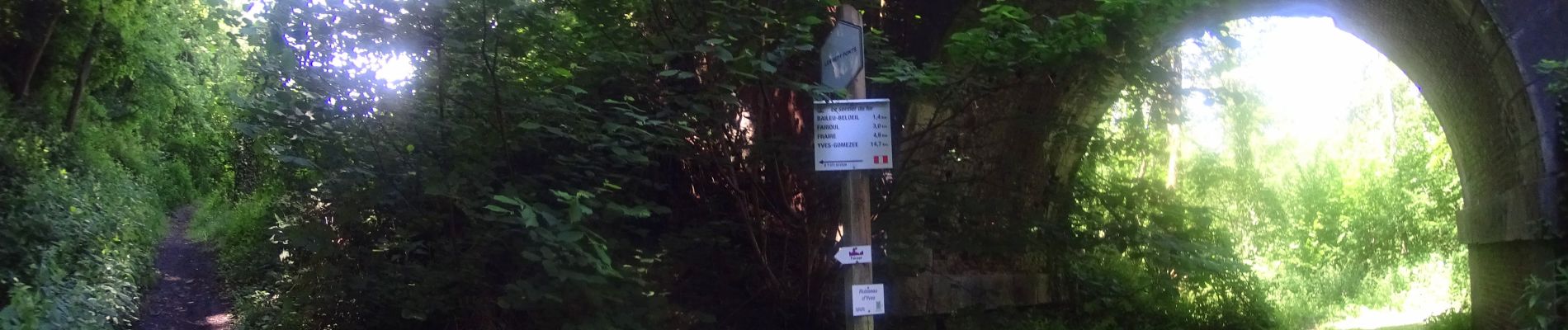
Ruta Bici de montaña de 48 km a descubrir en Valonia, Namur, Walcourt. Esta ruta ha sido propuesta por pascalou73.
Descripción
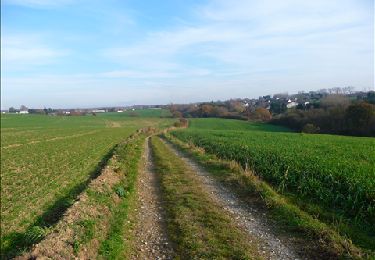
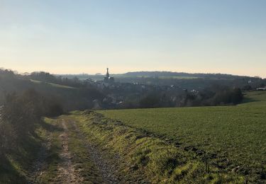
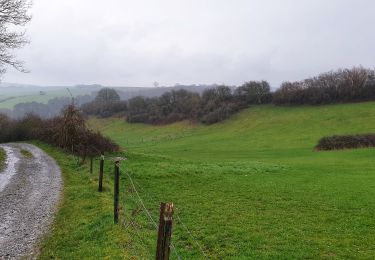
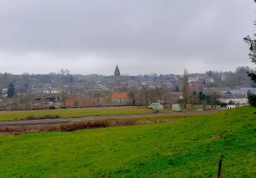
Voilà une belle randonnée VTT au départ du village de Walcourt pour aller chez le fils de sentie et le point de vue sur la région et les barrages au village de Cerfontaine .
Localización
País:
Belgium
Región :
Valonia
Departamento/provincia :
Namur
Municipio :
Walcourt
Localidad:
Unknown
Salida:(Dec)
Salida:(UTM)
601953 ; 5567795 (31U) N.
Comentarios
Excursiones cerca
![Excursión Senderismo Walcourt - GG-Na-17_Walcourt - Philippeville - Photo](https://media.geolcdn.com/t/375/260/0ead20f8-4d85-41da-a61f-64e7e946f31c.jpg&format=jpg&maxdim=2)
![Senderismo Senderismo](https://static1.geolcdn.com/sitytour/trail-icons/101.png)
GG-Na-17_Walcourt - Philippeville
Senderismo
Muy difícil
(2)
Walcourt,
Valonia,
Namur,
Belgium
![](/images/other/stat-length.png)
21 km | 26 km-effort
5h 9min
![](https://static1.geolcdn.com/siteimages/upload/files/16400158638029165_repeat_loop_refresh_sync_direction_icon.png)
No
![Excursión Senderismo Froidchapelle - Du Lac de l'Eau d'Heure au Lac du Ry Jaune - Photo](https://media.geolcdn.com/t/375/260/ext.jpg?maxdim=2&url=https%3A%2F%2Fservices.sitytrail.com%2FGeolivesWS%2FDownloadMedia.ashx%3FTrailID%3D379812%26Media%3Dd36c7a2e-70fd-44ad-a77a-7190af56fd8b.JPG)
![Senderismo Senderismo](https://static1.geolcdn.com/sitytour/trail-icons/101.png)
Du Lac de l'Eau d'Heure au Lac du Ry Jaune
Senderismo
Muy fácil
(3)
Froidchapelle,
Valonia,
Henao,
Belgium
![](/images/other/stat-length.png)
7,5 km | 9,4 km-effort
2h 6min
![](https://static1.geolcdn.com/siteimages/upload/files/16400158638029165_repeat_loop_refresh_sync_direction_icon.png)
Sí
![Excursión Senderismo Froidchapelle - Marche ADEPS à Boussu-lez-Walcourt - Photo](https://media.geolcdn.com/t/375/260/ext.jpg?maxdim=2&url=https%3A%2F%2Fservices.sitytrail.com%2FGeolivesWS%2FDownloadMedia.ashx%3FTrailID%3D251033%26Media%3D06de1a7a-a6bd-4c9d-b2ff-1e6fcd4fa4cd.JPG)
![Senderismo Senderismo](https://static1.geolcdn.com/sitytour/trail-icons/101.png)
Marche ADEPS à Boussu-lez-Walcourt
Senderismo
Fácil
(1)
Froidchapelle,
Valonia,
Henao,
Belgium
![](/images/other/stat-length.png)
10,4 km | 12,8 km-effort
2h 47min
![](https://static1.geolcdn.com/siteimages/upload/files/16400158638029165_repeat_loop_refresh_sync_direction_icon.png)
Sí
![Excursión Senderismo Walcourt - Promenade à Chastrès - Photo](https://media.geolcdn.com/t/375/260/ext.jpg?maxdim=2&url=https%3A%2F%2Fservices.sitytrail.com%2FGeolivesWS%2FDownloadMedia.ashx%3FTrailID%3D117187%26Media%3D3da6a3b3-b81a-4fdc-a255-5d93ffb1cd0b.JPG)
![Senderismo Senderismo](https://static1.geolcdn.com/sitytour/trail-icons/101.png)
Promenade à Chastrès
Senderismo
Muy fácil
(1)
Walcourt,
Valonia,
Namur,
Belgium
![](/images/other/stat-length.png)
4,7 km | 6 km-effort
1h 10min
![](https://static1.geolcdn.com/siteimages/upload/files/16400158638029165_repeat_loop_refresh_sync_direction_icon.png)
Sí
![Excursión Senderismo Walcourt - De Laneffe à Fraire par bois et campagnes - Photo](https://media.geolcdn.com/t/375/260/ext.jpg?maxdim=2&url=https%3A%2F%2Fservices.sitytrail.com%2FGeolivesWS%2FDownloadMedia.ashx%3FTrailID%3D95170%26Media%3Ddbcce443-4e55-417a-979c-b5ffbc4c1513.JPG)
![Senderismo Senderismo](https://static1.geolcdn.com/sitytour/trail-icons/101.png)
De Laneffe à Fraire par bois et campagnes
Senderismo
Fácil
(1)
Walcourt,
Valonia,
Namur,
Belgium
![](/images/other/stat-length.png)
12,9 km | 15,5 km-effort
3h 0min
![](https://static1.geolcdn.com/siteimages/upload/files/16400158638029165_repeat_loop_refresh_sync_direction_icon.png)
Sí
![Excursión Senderismo Walcourt - Randonnée autour de Walcourt - Photo](https://media.geolcdn.com/t/375/260/a37238d0-f00c-4fff-8a56-6d6b6e8a9220.jpg&format=jpg&maxdim=2)
![Senderismo Senderismo](https://static1.geolcdn.com/sitytour/trail-icons/101.png)
Randonnée autour de Walcourt
Senderismo
Medio
(2)
Walcourt,
Valonia,
Namur,
Belgium
![](/images/other/stat-length.png)
16 km | 20 km-effort
3h 43min
![](https://static1.geolcdn.com/siteimages/upload/files/16400158638029165_repeat_loop_refresh_sync_direction_icon.png)
Sí
![Excursión Senderismo Walcourt - Balade à Walcourt - Photo](https://media.geolcdn.com/t/375/260/cc15b3fa-e158-4d51-b096-71bef2cb45f1.jpeg&format=jpg&maxdim=2)
![Senderismo Senderismo](https://static1.geolcdn.com/sitytour/trail-icons/101.png)
Balade à Walcourt
Senderismo
Medio
Walcourt,
Valonia,
Namur,
Belgium
![](/images/other/stat-length.png)
5,9 km | 7,3 km-effort
1h 39min
![](https://static1.geolcdn.com/siteimages/upload/files/16400158638029165_repeat_loop_refresh_sync_direction_icon.png)
Sí
![Excursión Senderismo Walcourt - Balade à Yves-Gomezée - Walcourt - Photo](https://media.geolcdn.com/t/375/260/ce6fe3bc-56a4-4a73-8c7c-fe084ffe21fc.jpg&format=jpg&maxdim=2)
![Senderismo Senderismo](https://static1.geolcdn.com/sitytour/trail-icons/101.png)
Balade à Yves-Gomezée - Walcourt
Senderismo
Difícil
Walcourt,
Valonia,
Namur,
Belgium
![](/images/other/stat-length.png)
10,8 km | 13,2 km-effort
2h 59min
![](https://static1.geolcdn.com/siteimages/upload/files/16400158638029165_repeat_loop_refresh_sync_direction_icon.png)
Sí
![Excursión Senderismo Walcourt - Balade à Berzée - Walcourt - Photo](https://media.geolcdn.com/t/375/260/416ceed2-3b5b-40c8-8a28-534b846e663c.jpeg&format=jpg&maxdim=2)
![Senderismo Senderismo](https://static1.geolcdn.com/sitytour/trail-icons/101.png)
Balade à Berzée - Walcourt
Senderismo
Medio
Walcourt,
Valonia,
Namur,
Belgium
![](/images/other/stat-length.png)
8,4 km | 10,4 km-effort
2h 21min
![](https://static1.geolcdn.com/siteimages/upload/files/16400158638029165_repeat_loop_refresh_sync_direction_icon.png)
Sí