![](/images/other/stat-length.png)
![Excursión Senderismo Myon - Myon - Photo](https://media.geolcdn.com/t/1900/400/e011c131-f78b-4966-a193-682c39bb3a11.jpg&format=pjpeg&maxdim=2)
Myon
eltonnermou
Usuario
![Longitud](/images/other/stat-length.png)
![Altitud máxima](https://static1.geolcdn.com/siteimages/upload/files/1508320355ic_sort_altitude_max_24dp.png)
![Desnivel positivo](https://static1.geolcdn.com/siteimages/upload/files/1508320355ic_sort_den_pos_24dp.png)
![Km-Effort](/images/other/stat-length.png)
![Altitud mínima](https://static1.geolcdn.com/siteimages/upload/files/1508320355ic_sort_altitude_min_24dp.png)
![Desnivel negativo](https://static1.geolcdn.com/siteimages/upload/files/1508320355ic_sort_den_neg_24dp.png)
![Boucle](https://static1.geolcdn.com/siteimages/upload/files/16400158638029165_repeat_loop_refresh_sync_direction_icon.png)
![Senderismo](https://static1.geolcdn.com/sitytour/trail-icons/101.png)
8h32
Dificultad : Fácil
![Escanee este código QR para abrir la excursión en la aplicación SityTrail](https://capi.geolives.com/qq0zvz2zws4bq2lad0pu/sitytour/trails/3272520/qr.png?size=200)
Aplicación GPS de excursión GRATIS
A propósito
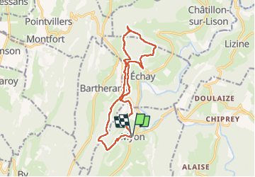
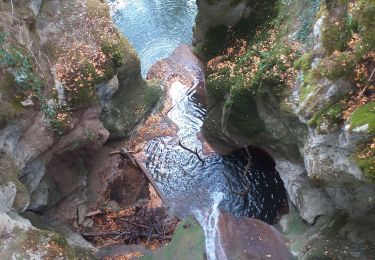
Ruta Senderismo de 14,7 km a descubrir en Borgoña-Franco Condado, Doubs, Myon. Esta ruta ha sido propuesta por eltonnermou.
Descripción
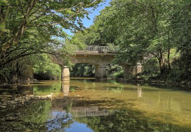
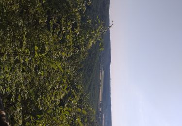
Cette belle randonnée pédestre vous entrainera à travers différents paysages du 1er plateau du haut-doubs.
Cette randonnée peut être couplée avec la rando "Echay et ses belvédères" (distance totale d'environ 19km) et vous fera découvrir des villages avec de belles bâtisses, fontaines et lavoirs.
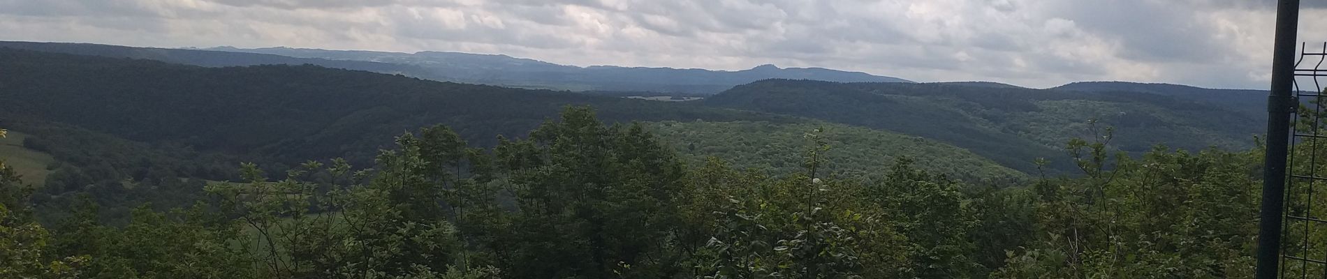
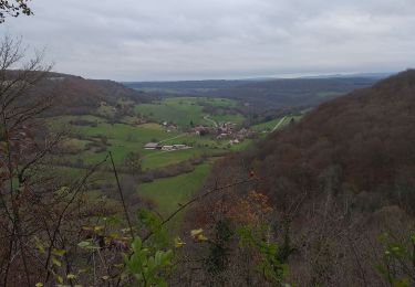
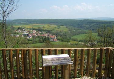
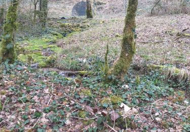
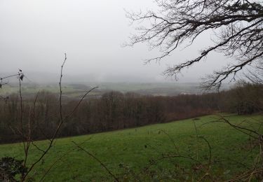
Vous traversez de jolis sous bois avec quelques montées "délicates" (une difficulté à la sortie de Cussey-lison) et plusieurs points de vues et 2 sites propices au pique-nique.
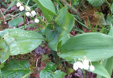
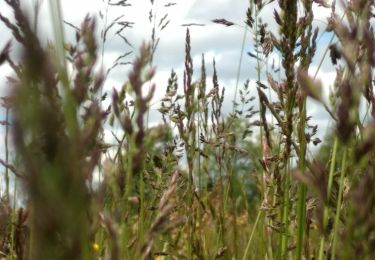
Avec un peu de chance, vous surprendrez des chevreuils ou chamois. Vous pourrez apprécier la diversité de la flore et profiter d'un parcours ombragé et très agréable.
Localización
Comentarios
Excursiones cerca
![Excursión Senderismo Échay - echay et ses belvédères - Photo](https://media.geolcdn.com/t/375/260/e9128b6b-1c37-4aeb-a422-222156e2fff2.jpg&format=jpg&maxdim=2)
![Senderismo Senderismo](https://static1.geolcdn.com/sitytour/trail-icons/101.png)
Senderismo
![](/images/other/stat-length.png)
![](https://static1.geolcdn.com/siteimages/upload/files/16400158638029165_repeat_loop_refresh_sync_direction_icon.png)
![Excursión Senderismo Cussey-sur-Lison - Les Belvédères du Lison - Doubs - Photo](https://media.geolcdn.com/t/375/260/ext.jpg?maxdim=2&url=https%3A%2F%2Fservices.sitytrail.com%2FGeolivesWS%2FDownloadMedia.ashx%3FTrailID%3D108921%26Media%3D2612_1.jpg)
![Senderismo Senderismo](https://static1.geolcdn.com/sitytour/trail-icons/101.png)
Senderismo
![](/images/other/stat-length.png)
![](https://static1.geolcdn.com/siteimages/upload/files/16400158638029165_repeat_loop_refresh_sync_direction_icon.png)
![Excursión A pie Éternoz - Tour du Monniot - Photo](https://media.geolcdn.com/t/375/260/4f40bb2a-64fb-41b5-a821-5ab6a4ea7106.jpeg&format=jpg&maxdim=2)
![A pie A pie](https://static1.geolcdn.com/sitytour/trail-icons/100.png)
A pie
![](/images/other/stat-length.png)
![](https://static1.geolcdn.com/siteimages/upload/files/16400158638029165_repeat_loop_refresh_sync_direction_icon.png)
![Excursión Senderismo Lizine - lizine croix et lison - Photo](https://media.geolcdn.com/t/375/260/89ebaf4b-099d-4372-ae6f-6f2d43eb6248.jpg&format=jpg&maxdim=2)
![Senderismo Senderismo](https://static1.geolcdn.com/sitytour/trail-icons/101.png)
Senderismo
![](/images/other/stat-length.png)
![](https://static1.geolcdn.com/siteimages/upload/files/16400158638029165_repeat_loop_refresh_sync_direction_icon.png)
![Excursión Senderismo Myon - myon les lunettes à Stéphane - Photo](https://media.geolcdn.com/t/375/260/25acafcd-fd37-4522-a9e0-f3895665c873.jpg&format=jpg&maxdim=2)
![Senderismo Senderismo](https://static1.geolcdn.com/sitytour/trail-icons/101.png)
Senderismo
![](/images/other/stat-length.png)
![](https://static1.geolcdn.com/siteimages/upload/files/16400158638029165_repeat_loop_refresh_sync_direction_icon.png)
![Excursión Senderismo Paroy - paroy - Photo](https://media.geolcdn.com/t/375/260/378ec14a-d696-40da-bfca-933f8dfdc99c.jpg&format=jpg&maxdim=2)
![Senderismo Senderismo](https://static1.geolcdn.com/sitytour/trail-icons/101.png)
Senderismo
![](/images/other/stat-length.png)
![](https://static1.geolcdn.com/siteimages/upload/files/16400158638029165_repeat_loop_refresh_sync_direction_icon.png)
![Excursión Senderismo Myon - Myon le gour de conche - Photo](https://media.geolcdn.com/t/375/260/828466b3-4a5a-411c-b191-55f6e34400fe.jpg&format=jpg&maxdim=2)
![Senderismo Senderismo](https://static1.geolcdn.com/sitytour/trail-icons/101.png)
Senderismo
![](/images/other/stat-length.png)
![](https://static1.geolcdn.com/siteimages/upload/files/16400158638029165_repeat_loop_refresh_sync_direction_icon.png)
![Excursión Senderismo Myon - Myon 3 collines - Photo](https://media.geolcdn.com/t/375/260/d4f8bb66-121f-460c-987f-bea11d25d8d0.jpg&format=jpg&maxdim=2)
![Senderismo Senderismo](https://static1.geolcdn.com/sitytour/trail-icons/101.png)
Senderismo
![](/images/other/stat-length.png)
![](https://static1.geolcdn.com/siteimages/upload/files/16400158638029165_repeat_loop_refresh_sync_direction_icon.png)
![Excursión Senderismo Cussey-sur-Lison - Cussey Sur Lison 27 mai 2021 (IBP 69) CAF - Photo](https://media.geolcdn.com/t/375/260/0961a845-d904-4bba-a433-5d2e671655d3.jpg&format=jpg&maxdim=2)
![Senderismo Senderismo](https://static1.geolcdn.com/sitytour/trail-icons/101.png)
Senderismo
![](/images/other/stat-length.png)
![](https://static1.geolcdn.com/siteimages/upload/files/16400158638029165_repeat_loop_refresh_sync_direction_icon.png)