![](/images/other/stat-length.png)
GR341-Lanester Bol d'air-Riantec Locjean-Locmiquelic
AHervé56
Usuario
![Longitud](/images/other/stat-length.png)
![Altitud máxima](https://static1.geolcdn.com/siteimages/upload/files/1508320355ic_sort_altitude_max_24dp.png)
![Desnivel positivo](https://static1.geolcdn.com/siteimages/upload/files/1508320355ic_sort_den_pos_24dp.png)
![Km-Effort](/images/other/stat-length.png)
![Altitud mínima](https://static1.geolcdn.com/siteimages/upload/files/1508320355ic_sort_altitude_min_24dp.png)
![Desnivel negativo](https://static1.geolcdn.com/siteimages/upload/files/1508320355ic_sort_den_neg_24dp.png)
![Boucle](https://static1.geolcdn.com/siteimages/upload/files/16400158638029165_repeat_loop_refresh_sync_direction_icon.png)
![Senderismo](https://static1.geolcdn.com/sitytour/trail-icons/101.png)
5h09
Dificultad : Muy difícil
![Escanee este código QR para abrir la excursión en la aplicación SityTrail](https://capi.geolives.com/qq0zvz2zws4bq2lad0pu/sitytour/trails/3267506/qr.png?size=200)
Aplicación GPS de excursión GRATIS
A propósito
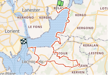
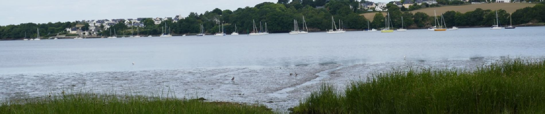
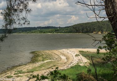
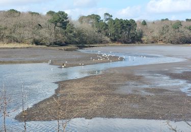
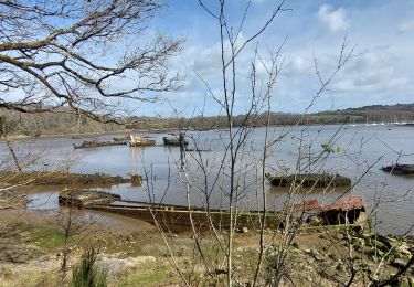
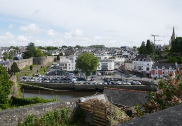
Ruta Senderismo de 20 km a descubrir en Bretaña, Morbihan, Lanester. Esta ruta ha sido propuesta por AHervé56.
Descripción
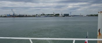
Départ de Lorient par bus T2,T3 ou 14 puis 31 à partir de Quai9 jusqu'à l'arrêt Bol d'air.
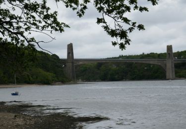
On rejoint le GR34 puis le GR341 au Pont du Bonhomme
Retour à Lorient par l'accès GR34 et le Bateau-bus de Locmiquelic-Pen Mané B1
Juste après le pont du bonhomme, le GR34 a été modifié en chemin côtier avant Talhouet.
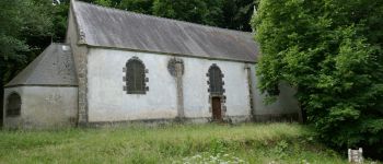
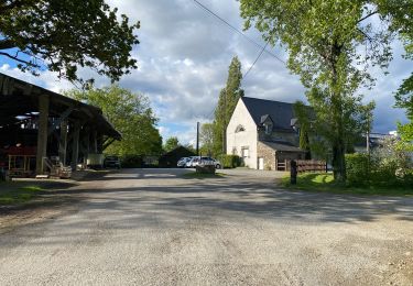
Pour le suivre il faut tourner à droite après Le Lannic, mais cette randonnée vise plutôt à parcourir l'ancien tracé jusqu'à la chapelle de Locjean.
Localización
Comentarios
Excursiones cerca
![Senderismo Senderismo](https://static1.geolcdn.com/sitytour/trail-icons/101.png)
Senderismo
![](/images/other/stat-length.png)
![](https://static1.geolcdn.com/siteimages/upload/files/16400158638029165_repeat_loop_refresh_sync_direction_icon.png)
![Excursión Senderismo Lanester - Le Blabet - Photo](https://media.geolcdn.com/t/375/260/f1cb4a6b-ccc2-4b18-bac5-b89a68b6ae99.jpg&format=jpg&maxdim=2)
![Senderismo Senderismo](https://static1.geolcdn.com/sitytour/trail-icons/101.png)
![Excursión Senderismo Kervignac - Locmiquélic- Pont du Bonhomme en aller-retour - Photo](https://media.geolcdn.com/t/375/260/63a550f3-ddef-4b1f-b9fa-b48ec50655f5.jpg&format=jpg&maxdim=2)
![Senderismo Senderismo](https://static1.geolcdn.com/sitytour/trail-icons/101.png)
Senderismo
![](/images/other/stat-length.png)
![](https://static1.geolcdn.com/siteimages/upload/files/16400158638029165_repeat_loop_refresh_sync_direction_icon.png)
![Excursión Senderismo Locmiquélic - Marais de Pen Mané 3,4 km - Photo](https://media.geolcdn.com/t/375/260/6c49cf6f-c463-494d-9675-6b42e2f5f96c.jpg&format=jpg&maxdim=2)
![Senderismo Senderismo](https://static1.geolcdn.com/sitytour/trail-icons/101.png)
Senderismo
![](/images/other/stat-length.png)
![](https://static1.geolcdn.com/siteimages/upload/files/16400158638029165_repeat_loop_refresh_sync_direction_icon.png)
![Excursión Senderismo Lanester - PR_56_Lanester_BA_02_Circuit1b_Marais-De-La-Goden_20230314 - Photo](https://media.geolcdn.com/t/375/260/aed41ba3-7736-4d16-8d6b-123ef0b8a14f.jpg&format=jpg&maxdim=2)
![Senderismo Senderismo](https://static1.geolcdn.com/sitytour/trail-icons/101.png)
Senderismo
![](/images/other/stat-length.png)
![](https://static1.geolcdn.com/siteimages/upload/files/16400158638029165_repeat_loop_refresh_sync_direction_icon.png)
![Excursión Senderismo Lanester - PR_56_Lanester_AA_01_Circuit1b_Cimetiere-Bateaux-Kerhervy_20230314 - Photo](https://media.geolcdn.com/t/375/260/55788eb3-1fb1-458b-917d-7928a0a8a8f3.jpg&format=jpg&maxdim=2)
![Senderismo Senderismo](https://static1.geolcdn.com/sitytour/trail-icons/101.png)
Senderismo
![](/images/other/stat-length.png)
![](https://static1.geolcdn.com/siteimages/upload/files/16400158638029165_repeat_loop_refresh_sync_direction_icon.png)
![Senderismo Senderismo](https://static1.geolcdn.com/sitytour/trail-icons/101.png)
Senderismo
![](/images/other/stat-length.png)
![](https://static1.geolcdn.com/siteimages/upload/files/16400158638029165_repeat_loop_refresh_sync_direction_icon.png)
![Excursión A pie Hennebont - Circuit du Hingair - Photo](https://media.geolcdn.com/t/375/260/b11697b8-6105-49c9-a404-503ca62238dd.jpeg&format=jpg&maxdim=2)
![A pie A pie](https://static1.geolcdn.com/sitytour/trail-icons/100.png)
A pie
![](/images/other/stat-length.png)
![](https://static1.geolcdn.com/siteimages/upload/files/16400158638029165_repeat_loop_refresh_sync_direction_icon.png)
![Excursión Senderismo Lanester - Lanester cimetière bateaux 14,2 km - Photo](https://media.geolcdn.com/t/375/260/665410bf-b65d-41eb-8afc-98e55b355e55.jpg&format=jpg&maxdim=2)
![Senderismo Senderismo](https://static1.geolcdn.com/sitytour/trail-icons/101.png)
Senderismo
![](/images/other/stat-length.png)
![](https://static1.geolcdn.com/siteimages/upload/files/16400158638029165_repeat_loop_refresh_sync_direction_icon.png)