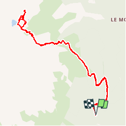
![](/images/other/stat-length.png)
![Excursión Senderismo Allemond - Lac de Belledonne - Photo](https://media.geolcdn.com/t/1900/400/ext.pjpeg?maxdim=2&url=https%3A%2F%2Fservices.sitytrail.com%2FGeolivesWS%2FDownloadMedia.ashx%3FTrailID%3D325958%26Media%3Dfix__20140719114309.jpg)
Lac de Belledonne
Noiraude
Usuario
![Longitud](/images/other/stat-length.png)
![Altitud máxima](https://static1.geolcdn.com/siteimages/upload/files/1508320355ic_sort_altitude_max_24dp.png)
![Desnivel positivo](https://static1.geolcdn.com/siteimages/upload/files/1508320355ic_sort_den_pos_24dp.png)
![Km-Effort](/images/other/stat-length.png)
![Altitud mínima](https://static1.geolcdn.com/siteimages/upload/files/1508320355ic_sort_altitude_min_24dp.png)
![Desnivel negativo](https://static1.geolcdn.com/siteimages/upload/files/1508320355ic_sort_den_neg_24dp.png)
![Boucle](https://static1.geolcdn.com/siteimages/upload/files/16400158638029165_repeat_loop_refresh_sync_direction_icon.png)
![Senderismo](https://static1.geolcdn.com/sitytour/trail-icons/101.png)
6h41
Dificultad : Medio
![Escanee este código QR para abrir la excursión en la aplicación SityTrail](https://capi.geolives.com/qq0zvz2zws4bq2lad0pu/sitytour/trails/325958/qr.png?size=200)
Aplicación GPS de excursión GRATIS
A propósito
Ruta Senderismo de 13,4 km a descubrir en Auvergne-Rhône-Alpes, Isère, Allemond. Esta ruta ha sido propuesta por Noiraude.
Descripción
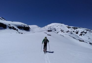
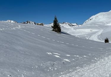
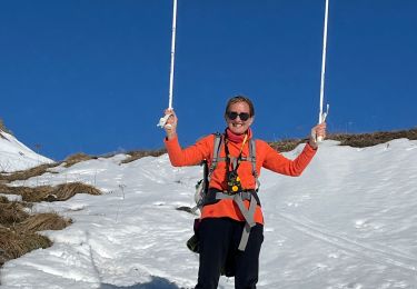
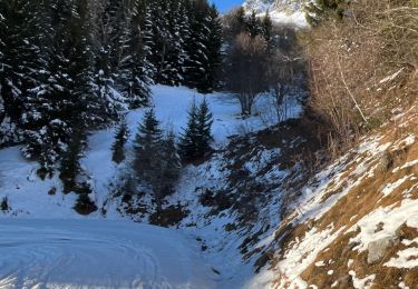
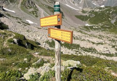
Agréable randonnée au départ d'Allemond sur un versant moins couru de Belledonne.
Sentier agréable qui démarre en forêt (départ un peu raide sur les premiers 500m)pour se poursuivre dans les Rhododendrons et Myrtilles.
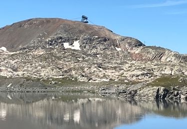
Un dernier effort pour passer le verrou du lac avant de découvrir un joli lac d'un bleu limpide au pied du grand pic de Belledonne.
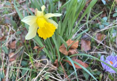
Beaucoup de faune dans le secteur (mouflons, aigles, chamois, bouquetins et marmottes).
Localización
Comentarios
Excursiones cerca
![Excursión Senderismo Allemond - allemond-les chalanches - Photo](https://media.geolcdn.com/t/375/260/ext.jpg?maxdim=2&url=https%3A%2F%2Fservices.sitytrail.com%2FGeolivesWS%2FDownloadMedia.ashx%3FTrailID%3D359050%26Media%3Dfix__20141101111257.jpg)
![Senderismo Senderismo](https://static1.geolcdn.com/sitytour/trail-icons/101.png)
Senderismo
![](/images/other/stat-length.png)
![](https://static1.geolcdn.com/siteimages/upload/files/16400158638029165_repeat_loop_refresh_sync_direction_icon.png)
![Excursión Esquí de fondo Allemond - col PT 2459m près de la gde Lance d'Allemond - Photo](https://media.geolcdn.com/t/375/260/9c8ab575-4333-48a0-9046-13f36910fc12.jpg&format=jpg&maxdim=2)
![Esquí de fondo Esquí de fondo](https://static1.geolcdn.com/sitytour/trail-icons/503.png)
Esquí de fondo
![](/images/other/stat-length.png)
![](https://static1.geolcdn.com/siteimages/upload/files/16400158638029165_repeat_loop_refresh_sync_direction_icon.png)
![Excursión Esquí de fondo Huez - tentative col de la pyramide et tricotage vers les lacs - Photo](https://media.geolcdn.com/t/375/260/1580236e-056d-49cc-9364-57fad8fab5e5.jpg&format=jpg&maxdim=2)
![Esquí de fondo Esquí de fondo](https://static1.geolcdn.com/sitytour/trail-icons/503.png)
Esquí de fondo
![](/images/other/stat-length.png)
![](https://static1.geolcdn.com/siteimages/upload/files/16400158638029165_repeat_loop_refresh_sync_direction_icon.png)
![Excursión sport Vaujany - Randonnée - Photo](https://media.geolcdn.com/t/375/260/031a3bee-458a-4b9a-b2e3-d9cf5829f63e.jpg&format=jpg&maxdim=2)
sport
![](/images/other/stat-length.png)
![](https://static1.geolcdn.com/siteimages/upload/files/16400158638029165_repeat_loop_refresh_sync_direction_icon.png)
![Excursión sport Vaujany - Raquettes dans sabot - Photo](https://media.geolcdn.com/t/375/260/1d7fce42-c97d-4bcb-be58-c648ac018506.jpg&format=jpg&maxdim=2)
sport
![](/images/other/stat-length.png)
![](https://static1.geolcdn.com/siteimages/upload/files/16400158638029165_repeat_loop_refresh_sync_direction_icon.png)
![Excursión sport Vaujany - Orgieres - Photo](https://media.geolcdn.com/t/375/260/3b6ec6ca-b514-4adf-b590-4942c7f4475c.jpg&format=jpg&maxdim=2)
sport
![](/images/other/stat-length.png)
![](https://static1.geolcdn.com/siteimages/upload/files/16400158638029165_repeat_loop_refresh_sync_direction_icon.png)
![Excursión Senderismo Allemond - Lac de Belledonne trace réelle - Photo](https://media.geolcdn.com/t/375/260/3c006e55-5416-422b-8475-727a88b53584.jpg&format=jpg&maxdim=2)
![Senderismo Senderismo](https://static1.geolcdn.com/sitytour/trail-icons/101.png)
Senderismo
![](/images/other/stat-length.png)
![](https://static1.geolcdn.com/siteimages/upload/files/16400158638029165_repeat_loop_refresh_sync_direction_icon.png)
![Excursión Senderismo Vaujany - Sabot Aiguillettes Couard Lac de la Fare 2800 trace réelle - Photo](https://media.geolcdn.com/t/375/260/31a52714-3260-4a16-80d8-ce1486182f6b.jpg&format=jpg&maxdim=2)
![Senderismo Senderismo](https://static1.geolcdn.com/sitytour/trail-icons/101.png)
Senderismo
![](/images/other/stat-length.png)
![](https://static1.geolcdn.com/siteimages/upload/files/16400158638029165_repeat_loop_refresh_sync_direction_icon.png)
![Excursión sport Allemond - Allemond et les hameaux - Photo](https://media.geolcdn.com/t/375/260/9ef2955e-597c-4a93-b262-e89ce8d66961.jpg&format=jpg&maxdim=2)
sport
![](/images/other/stat-length.png)
![](https://static1.geolcdn.com/siteimages/upload/files/16400158638029165_repeat_loop_refresh_sync_direction_icon.png)